Terrain Maps
Studying the terrain map, the mountains and valleys came to life. I could almost feel the rush of the rapids and the crunch of the leaves under my feet. Learn more about Terrain Maps and experience the world in a whole new way.
Studying the terrain map, the mountains and valleys came to life. I could almost feel the rush of the rapids and the crunch of the leaves under my feet. Learn more about Terrain Maps and experience the world in a whole new way.
Learn more about elevation maps and how they are being taken to a whole new level with 3D rendering techniques and a focus on color at different heights. From the snow-capped peaks of the Himalayas to the lush forests of the Amazon, these visually stunning maps offer a deeper understanding of our planet’s geology and natural history.

Examining the elevation map, I was transported to the mountaintops and the depths of the valleys. The colors and contours made the landscape come alive. Learn more about Elevation Maps and elevate your sense of adventure.
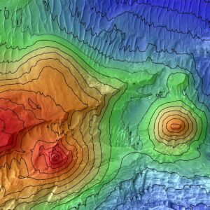
3D Contour Maps. Learn more about 3D Contour maps and how WhiteClouds creates them.
Experience the power of 3D contour maps in movies like The Bridge on the River Kwai, Everest, The Revenant, and The Martian. Learn more about contour maps and how they have been used in various fields to provide crucial information about the landscape and its features.
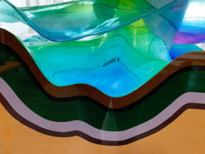
The contour map revealed the secrets of the land, with every hill and valley depicted in stunning detail. I felt like I was flying over the terrain, taking in its beauty from above. Learn more about Contour Maps and discover the art of landscape reading.
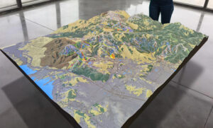
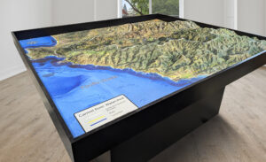
The Park City 3D topographical map is a stunning representation of the local terrain that includes all of the major ski resorts in the area. With its intricate design and detailed features, it’s a valuable resource for anyone interested in winter sports or simply wants to learn more about topographical maps.
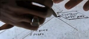
Join the exciting hunt for Red October with 3D topographical maps! Learn more about topographical maps and how they’re used in military intelligence, geology, and environmental management. Follow the thrilling moments of analyzing data and predicting submarine movements in this action-packed movie.
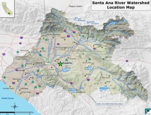
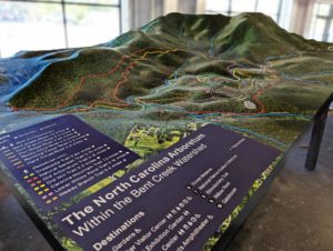
In the iconic movie Erin Brockovich, we saw the power of one person’s fight for justice concerning water contamination. But just as important is understanding 3D watershed maps to protect our planet’s health. Learn more about watershed maps and how human activities can impact our water resources to make a difference today.
The watershed map revealed the intricate network of rivers and streams that nourish the land. It was like witnessing the lifeblood of the earth. Learn more about Watershed Maps and explore the interconnectedness of our planet’s ecosystems.