Sculpting the Tiger Shark Amusement Park Prop for Six Flags New England
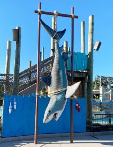
WhiteClouds was commissioned to sculpt a 15 foot long tiger shark for a Six Flags New England amusement park prop. Read about how we did it.
WhiteClouds was commissioned to sculpt a 15 foot long tiger shark for a Six Flags New England amusement park prop. Read about how we did it.
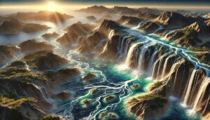
Malta’s watersheds are vital for the island’s agriculture, tourism, and ecosystems. This blog explores their significance, challenges, and how 3D watershed maps help manage water resources, reduce pollution, and support conservation efforts. Learn how mapping technologies help Malta navigate water scarcity, climate change, and resource management challenges for a sustainable future.
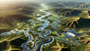
Zimbabwe’s watersheds, including the Zambezi and Limpopo River Basins, are vital for agriculture and ecosystems. Learn how 3D mapping, GIS, and remote sensing technologies help manage these essential water systems. These tools address challenges like water scarcity, pollution, and climate change, ensuring sustainable water use, improving flood management, and safeguarding ecosystems, ultimately supporting the country’s water security for future generations.
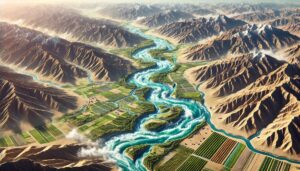
Uzbekistan’s watersheds, including the Amu Darya and Syr Darya Basins, are vital for agriculture and ecosystems. Learn how modern technologies like 3D mapping, GIS, and remote sensing help manage these systems, ensuring sustainable water use and addressing challenges like water scarcity, climate change, and population growth.
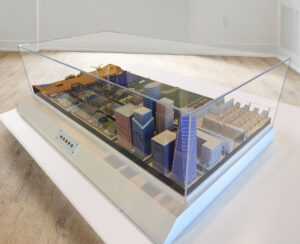
Dive into the captivating world of Architectural Scale Models! Discover how these miniature marvels captivate audiences, revolutionize design, and shape urban planning. Explore the intricate craftsmanship, innovative technologies, and future trends that make these models invaluable in architecture and real estate in our comprehensive, thrilling blog.
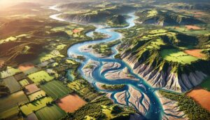
The UK’s watersheds, including the Thames, Severn, and Tyne River Basins, are essential for agriculture and ecosystems. Learn how modern technologies like 3D mapping, GIS, and remote sensing help manage these systems, ensuring sustainable water use and addressing challenges like water scarcity, climate change, and population growth.

Tanzania’s watersheds, including the Rufiji, Pangani, and Wami River Basins, are vital for agriculture and ecosystems. Learn how modern technologies like 3D mapping, GIS, and remote sensing help manage these systems, ensuring sustainable water use and addressing challenges like water scarcity, climate change, and population growth.
Dive into the enchanting world of Giant Skincare Props! Discover how these larger-than-life creations captivate audiences, evoke luxury and nostalgia, and revolutionize beauty marketing and events. From intricate designs to interactive features, explore the endless possibilities and the elegance they bring to any setting in our comprehensive and thrilling blog.
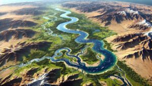
Dive into the heart of Africa with the Nile River Watershed Map, uncovering its vast geography, rich ecosystems, and the cutting-edge technologies shaping water management. Discover how this iconic river sustains millions and how 3D mapping is revolutionizing conservation and flood management efforts. Join us in exploring the lifeblood of northeastern Africa and its vital role in the region’s future.
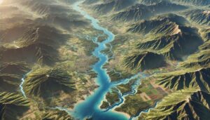
Dominican Republic’s watershed maps are essential for managing river systems, predicting floods, and ensuring sustainable water use. These maps help allocate water for agriculture, industry, and communities while addressing climate change challenges. By monitoring river flow, groundwater levels, and water quality, they support flood prevention, efficient water distribution, and ecosystem protection, ensuring that the country’s water resources are preserved for future generations.