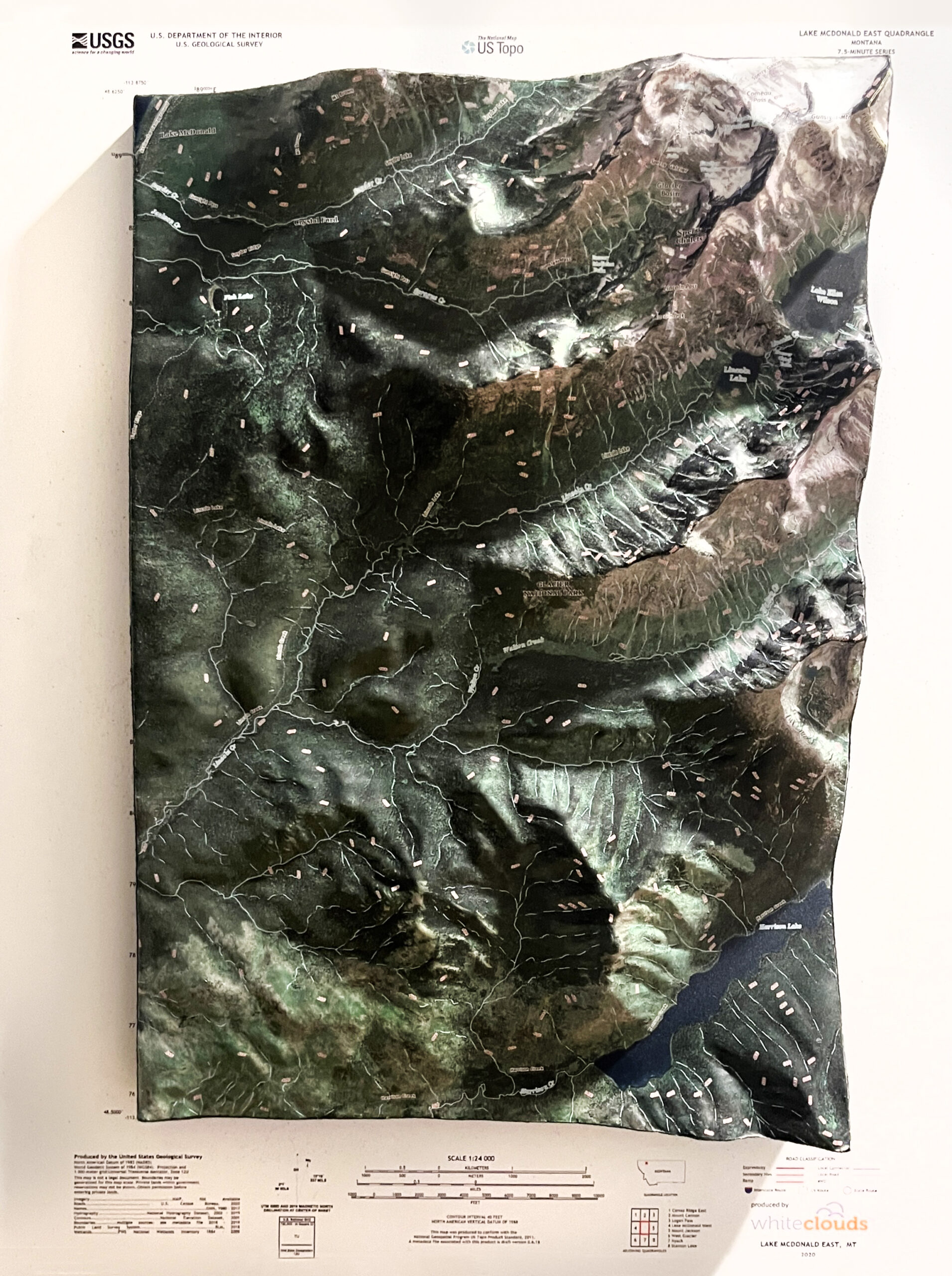
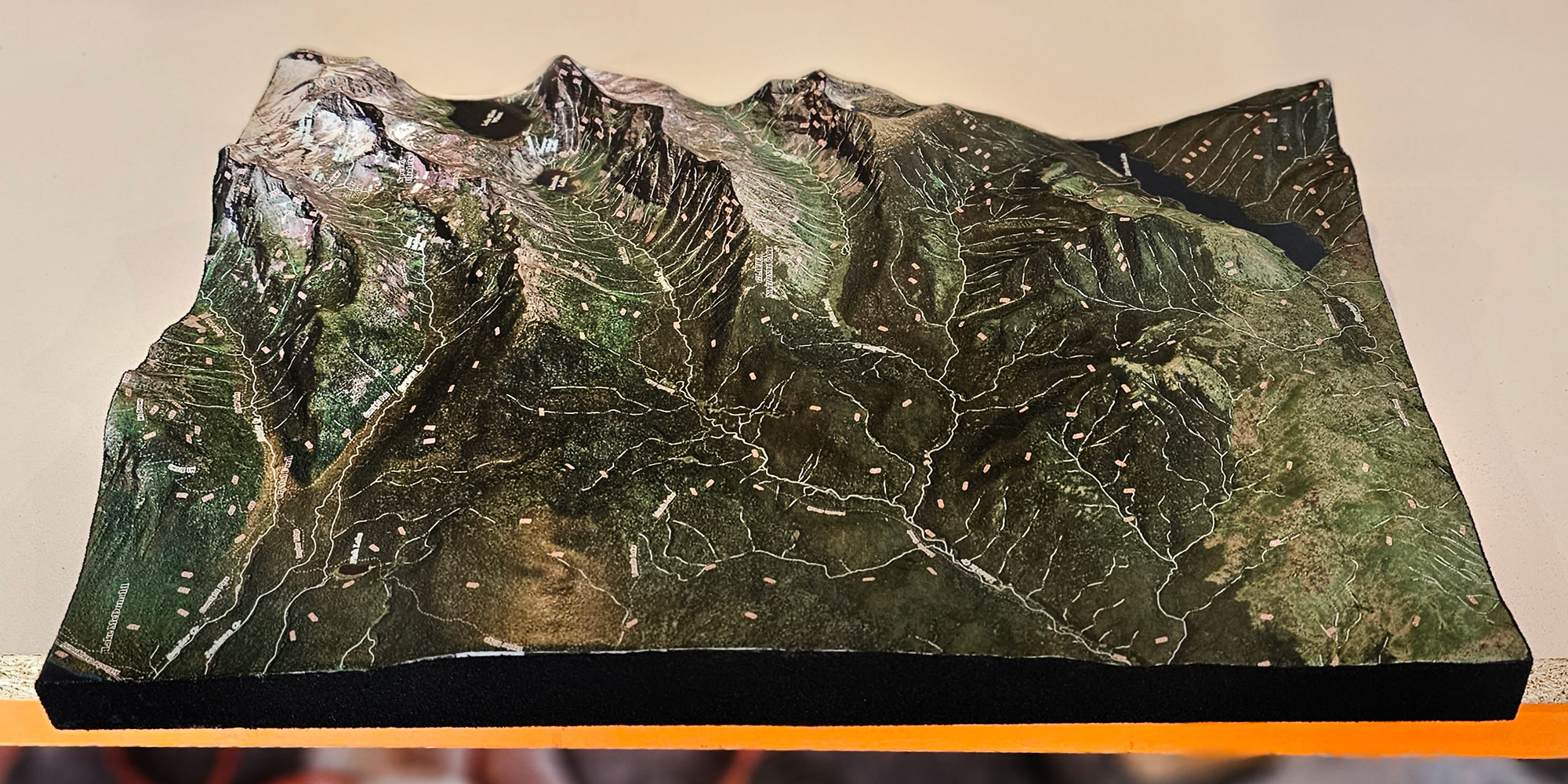
Lake McDonald 3D Topographical Map
Lake McDonald 3D Topographical Map
We Build Custom 3D Raised Relief Maps
Lake McDonald 3D Topographical Map: A Stunning Visualization of Glacier National Park’s Iconic Lake
Located in the heart of Montana’s Glacier National Park, Lake McDonald is one of the most stunning and serene bodies of water in North America. Stretching approximately 10 miles long and over a mile wide, it is the largest lake in the park, drawing visitors from all over the world with its crystal-clear waters, breathtaking mountain backdrop, and vibrant colored rocks that line its shore. However, for those who want to gain a deeper appreciation of the lake’s geographical significance, a Lake McDonald 3D topographical map provides a unique and detailed perspective of the area. By showcasing the natural elevation changes, depths, and surrounding landscape, a 3D topo map offers both a visually stunning and practical tool for exploration and understanding of this natural wonder.
In this blog, we’ll explore the beauty of Lake McDonald and dive into the advantages of using a 3D topographical map to visualize its terrain. We’ll also look at how these maps are used by adventurers, geologists, environmentalists, and outdoor enthusiasts to unlock the secrets of the lake and the surrounding landscape of Glacier National Park.

Understanding Topographical Maps: The Power of 3D Visualization
A topographical map is a two-dimensional representation of three-dimensional terrain, using contour lines to indicate changes in elevation. These maps provide an invaluable resource for hikers, campers, land managers, and anyone interested in understanding the lay of the land. However, while standard topographical maps rely on contour lines to depict elevation, a 3D topographical map takes that representation to the next level, offering a tangible, raised depiction of the landscape.
In the case of Lake McDonald, a 3D topographical map not only showcases the surface features of the lake and surrounding mountains, but it also reveals the underwater contours and depth variations of the lake itself. By adding a third dimension, the map offers a more immersive view of the terrain, allowing users to better understand the steepness of the surrounding peaks, the depth of the lake, and the valleys that feed into it.
For Glacier National Park, where rugged, mountainous terrain meets pristine lakes, rivers, and forests, a 3D map is an ideal tool for capturing the park’s natural beauty and complexity. Lake McDonald, nestled among towering peaks like Stanton Mountain and Mount Brown, is especially well-suited for this kind of visualization. The lake’s positioning within a deep, U-shaped valley carved by ancient glaciers is made even more striking when viewed in three dimensions.
Lake McDonald’s Geological History: How Glaciers Shaped the Landscape
The landscape surrounding Lake McDonald, like much of Glacier National Park, was formed over millions of years by tectonic forces, erosion, and—most notably—glacial activity. Understanding the lake’s geological history provides context for why a 3D topographical map is such a valuable tool in visualizing the area’s unique terrain.
During the last ice age, vast glaciers covered the region, moving slowly over time and carving out the deep valleys and fjords that define Glacier National Park today. Lake McDonald sits in one such valley, a U-shaped glacial trough formed by the movement of ice as it scoured the landscape. As the glaciers receded, they left behind a depression, which filled with meltwater, creating the lake we see today.
A 3D topographical map brings this geological history to life. The elevation changes and sharp contrast between the flat lakebed and the steep mountainsides are strikingly apparent when viewed in 3D. Additionally, the gentle slopes that transition into the lake’s western end, where the valley widens, and the more rugged eastern shorelines are easy to distinguish with the added dimension of depth.
The Features of a Lake McDonald 3D Topographical Map
A 3D topographical map of Lake McDonald highlights several key features that set this lake and its surrounding landscape apart. These features not only help visitors appreciate the area’s natural beauty but also provide important data for activities such as hiking, boating, and scientific research.
Contour and Elevation: The most prominent feature of any 3D topo map is the contour lines that illustrate changes in elevation. In a 3D map of Lake McDonald, these contours are transformed into actual raised surfaces, making it easy to visualize the steep mountain slopes and the flat basin of the lake itself. The steep drop from the surrounding peaks into the lake highlights how Lake McDonald is truly nestled into the valley, emphasizing the sharp rise of the mountains like Stanton Mountain (7,750 feet) and Mount Brown (8,523 feet).
Lake Depth and Underwater Topography: While much of the focus of a topographical map is on above-ground elevation, Lake McDonald’s 3D topo map goes deeper—literally. The lake reaches depths of up to 472 feet, and a 3D map captures these depth changes through bathymetric contours. This allows viewers to see the underwater slopes of the lakebed, including the shallow shelves near the shorelines and the deeper drop-offs in the center of the lake. For anglers, boaters, and environmental researchers, this information is invaluable for understanding the lake’s ecosystem.
Hydrological Features: Lake McDonald is fed by several streams and creeks, which are visible on a 3D topographical map as they flow down from the surrounding mountains and into the lake. McDonald Creek, which flows out of the lake’s southern end, is a key feature that can also be easily traced on the map. Understanding the flow of water is essential for managing water levels, planning recreational activities like kayaking or fishing, and monitoring the health of the aquatic ecosystem.
Trails and Roads: A good 3D topographical map also includes man-made features like hiking trails and roads, making it an excellent planning tool for outdoor enthusiasts. For Lake McDonald, trails such as the famous Avalanche Lake Trail or the Mount Brown Lookout Trail can be clearly seen, showing their ascent into the mountains surrounding the lake. Similarly, the Going-to-the-Sun Road, which runs along the eastern shore of the lake, is another prominent feature.
Forest and Vegetation Zones: Glacier National Park is home to a variety of ecosystems, ranging from alpine meadows to dense forests. A 3D topographical map may use shading or color to represent different vegetation zones, helping viewers understand the distribution of plant life across varying elevations. Around Lake McDonald, the lower elevations near the shore are dominated by cedar-hemlock forests, while higher elevations transition to subalpine fir and spruce trees.

How to Use a 3D Topographical Map of Lake McDonald
A 3D topographical map of Lake McDonald isn’t just a work of art—it’s a highly functional tool for a variety of outdoor activities. Here’s how adventurers, researchers, and even casual visitors can use such a map to enhance their experience in Glacier National Park:
Hiking and Backpacking: Glacier National Park is a hiker’s paradise, with trails ranging from easy lakeside strolls to challenging mountain ascents. A 3D topographical map can help hikers plan their routes by providing a clear sense of the elevation changes and terrain they’ll encounter. For example, if you’re planning to hike the Avalanche Lake Trail, the map shows the steep ascent from Lake McDonald up to the smaller, glacial-fed Avalanche Lake. Knowing the gradient and distance can help you prepare for the physical demands of the hike.
Boating and Fishing: Lake McDonald is a popular destination for boating and fishing, and a 3D topographical map provides crucial information about the lake’s depths and underwater features. Boaters can use the map to avoid shallow areas or locate deeper waters, while anglers can target specific underwater structures where fish are likely to gather. For fly-fishing enthusiasts, the map’s detailed view of tributary streams can also help identify potential fishing hotspots.
Wildlife Observation: Glacier National Park is known for its diverse wildlife, including grizzly bears, mountain goats, moose, and bald eagles. A 3D map helps wildlife enthusiasts identify the best places to observe animals in their natural habitat. For example, the western slopes of the mountains around Lake McDonald are prime spots for spotting mountain goats, while the lush forests near the lake’s shores are home to deer and bears. Understanding the elevation and terrain is essential for knowing where certain species are likely to be found.
Geological Study and Environmental Research: For geologists and environmental scientists, a 3D topographical map of Lake McDonald is a valuable resource for studying the area’s geological history and current environmental conditions. The map provides insight into the glacial processes that shaped the landscape, as well as the hydrological features that influence the lake’s ecosystem. Researchers can use the map to study erosion patterns, water flow, and vegetation changes, helping them monitor the health of the park’s natural resources.
Educational and Interpretive Uses: A 3D topographical map can be a powerful educational tool for visitors to Glacier National Park. By showing the park’s unique geography in a tangible, interactive way, the map helps visitors understand the forces that shaped the landscape and appreciate the park’s natural beauty on a deeper level. Many visitor centers and interpretive displays use 3D maps to engage the public and provide context for the surrounding environment.

The Art and Science of Creating 3D Topographical Maps
Creating a 3D topographical map involves a combination of advanced technology, artistic design, and scientific accuracy. The process begins with gathering topographical data, usually from sources like aerial surveys, satellite imagery, or laser scanning (LiDAR). This data is then processed to create a digital elevation model (DEM) that represents the terrain’s contours in high detail.
Once the digital model is complete, designers use specialized software to convert the data into a 3D map format. This can be done using techniques such as 3D printing, CNC routing, or traditional sculpting, depending on the desired level of detail and the medium in which the map will be produced. The final product can be a physical 3D map, an interactive digital map, or a combination of both.
In the case of Lake McDonald, the goal is to capture not only the lake’s surface and surrounding mountains but also the intricate details of its underwater topography and the valleys carved by glaciers. The combination of scientific data and artistic design creates a map that is both functional and visually stunning, offering a true-to-life representation of the lake and its surroundings.
Conclusion: A Deeper Appreciation of Lake McDonald with 3D Topographical Maps
Lake McDonald is a true gem of Glacier National Park, and a 3D topographical map offers a unique way to explore and understand its natural beauty. From the towering mountains that surround the lake to the depths of its crystal-clear waters, a 3D topo map reveals the intricate details of the landscape that might otherwise go unnoticed.
Whether you’re a hiker planning your next adventure, a boater navigating the lake’s waters, or a scientist studying the park’s geology, a 3D topographical map provides the tools and insights you need to fully appreciate this iconic lake. Combining art, science, and technology, these maps bring the landscape to life, helping us understand the natural processes that shaped Lake McDonald and allowing us to explore its depths and heights with new clarity.
Next time you visit Glacier National Park, take a moment to study a 3D topographical map of Lake McDonald—you’ll gain a deeper connection to the land and a greater appreciation for the natural wonders that make this park such an extraordinary destination.
Check out WhiteClouds’ 3D Maps for more information on 3D maps.
