Mohawk Mountain 3D Maps
Mohawk Mountain 3D Maps
We Build Custom 3D Mohawk Mountain Maps
Mohawk Mountain 3D Maps: Elevating the Ski Experience with Cutting-Edge Terrain Mapping
Mohawk Mountain, nestled in the Litchfield Hills of Connecticut, offers a thrilling and scenic ski experience for winter sports enthusiasts. As one of the oldest and most beloved ski areas in the region, it boasts a diverse range of terrain that caters to everyone from beginners to seasoned skiers. But while the mountain itself offers plenty of adventure, Mohawk Mountain has taken its visitor experience to a new level with the introduction of 3D maps that bring the landscape to life.
These 3D maps offer a groundbreaking way for skiers to engage with the mountain’s unique terrain, providing an immersive view of the slopes and trails. The experience of navigating a ski resort is enhanced when skiers can truly understand the layout and topography of the mountain, and this is where Mohawk Mountain’s 3D maps excel. In this blog, we’ll explore the benefits of Mohawk Mountain 3D maps, the process behind their fabrication, and how they’re used to enhance the skiing experience. We’ll also take a closer look at the major ski runs that make Mohawk Mountain such a beloved destination.
The Power of 3D Mapping in Ski Resorts
Traditionally, ski resorts have relied on flat, two-dimensional paper maps or digital versions to show the layout of their trails and facilities. While functional, these maps are often limited in terms of the information they provide. Skiers can see where trails are located, but they may struggle to understand the intricacies of the terrain, including elevation changes, slope angles, and the true difficulty of a run.
A 3D map, by contrast, brings the mountain to life in a way that flat maps simply can’t. Using advanced technology and topographical data, 3D maps provide a detailed, three-dimensional view of the terrain. Skiers can visualize the height and depth of each run, see how trails weave through the mountain, and get a true sense of the mountain’s scale and features.
At Mohawk Mountain, these 3D maps serve as a powerful tool for skiers of all levels. Beginners can use the map to find gentle slopes that match their skill level, while experienced skiers can seek out steeper runs for more of a challenge. The 3D maps also show important landmarks such as lifts, ski lodges, and trail intersections, making it easier to navigate the mountain with confidence.

How Mohawk Mountain 3D Maps Are Fabricated
The creation of a 3D map requires a blend of precision technology and artistic craftsmanship. The goal is to create a map that not only provides an accurate representation of the terrain but also enhances the skier’s experience through clear, easy-to-read details. Here’s a step-by-step look at how Mohawk Mountain’s 3D maps are fabricated.
Collecting Topographical Data
The foundation of any 3D map is accurate topographical data. For Mohawk Mountain, this data is collected using a combination of advanced surveying techniques, including LiDAR (Light Detection and Ranging) and GPS mapping. LiDAR technology uses laser pulses to measure the distance between the Earth’s surface and the surveying equipment, creating a detailed 3D representation of the landscape. GPS mapping complements this by providing precise location data for key landmarks, such as ski lifts, trails, and buildings.
This data is then processed to create a detailed digital elevation model (DEM) of Mohawk Mountain. The DEM serves as the foundation for the 3D map, capturing every ridge, valley, and slope of the terrain. This process ensures that the map is as accurate as possible, reflecting the real-world contours and elevations of the mountain.
Designing the 3D Map
Once the topographical data is collected, the next step is to design the 3D map. Designers use specialized software to turn the raw elevation data into a usable, visually appealing map. This involves translating the complex terrain into a simplified but informative format that skiers can easily interpret.
The key challenge at this stage is balancing detail with usability. The map must include enough topographical information to give skiers a sense of the terrain, but it shouldn’t be so cluttered that it becomes overwhelming. Designers work carefully to highlight important features like steep slopes, trail intersections, and lifts, while also ensuring that trails are clearly marked and color-coded based on difficulty level (green for beginner, blue for intermediate, and black for advanced).
The map also incorporates shading and contour lines to show elevation changes, which is crucial for helping skiers understand the steepness of different trails. This shading creates a three-dimensional effect that gives the map depth and makes it easier for users to visualize the mountain’s features.
Bringing the Map to Life with Physical Models
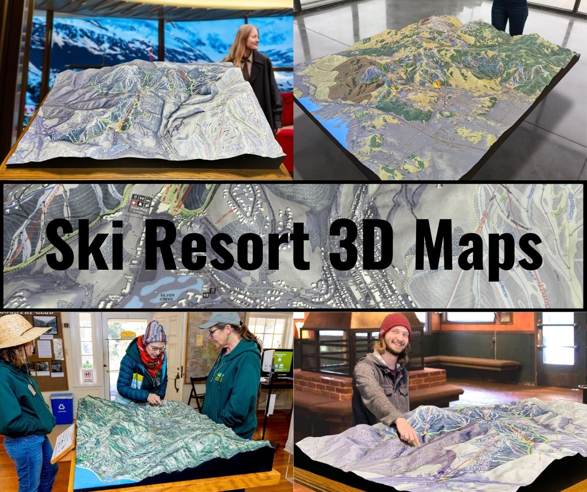
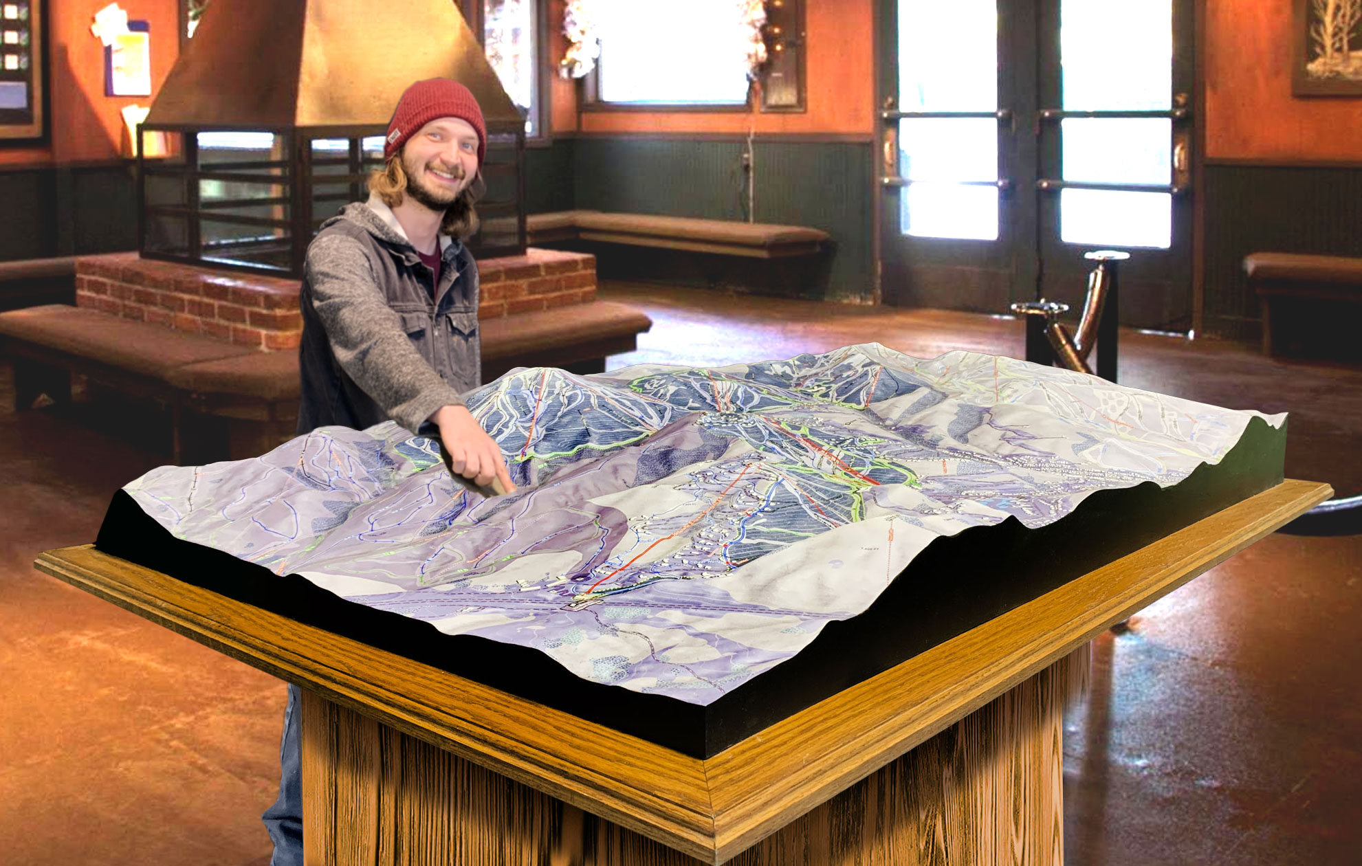
While many 3D maps are used digitally (on websites, apps, or screens at the resort), some ski areas, including Mohawk Mountain, choose to create physical 3D models of their maps to display in the lodge or visitor center. These physical models are made from durable materials such as foam, resin, or acrylic, which are carefully shaped and painted to reflect the topography of the mountain.
The process of building a physical 3D map is similar to creating other raised relief models. The topographical data is used to cut and sculpt the foam or resin into the correct shapes, with every peak and valley replicated in precise detail. Once the model is sculpted, it’s painted to match the real-world colors of the mountain, including the white snow on the slopes, the green forests, and the blue skies.
These physical models are not only informative but also serve as impressive works of art that draw visitors in. Skiers can gather around the model, run their hands over the contours of the mountain, and use it to plan their routes before hitting the slopes.
Adding Digital Interactivity
While physical 3D maps offer a tactile experience, Mohawk Mountain also incorporates digital interactivity into its 3D maps. Digital versions of the map are available on the resort’s website and mobile app, allowing skiers to explore the mountain in real time. These digital maps are interactive, meaning users can zoom in on specific trails, see live updates on conditions, and even view 360-degree panoramas of different parts of the mountain.
The digital maps also integrate with GPS, allowing skiers to track their location on the mountain in real time. This is especially helpful for those who are new to the resort and may need extra guidance navigating the trails.
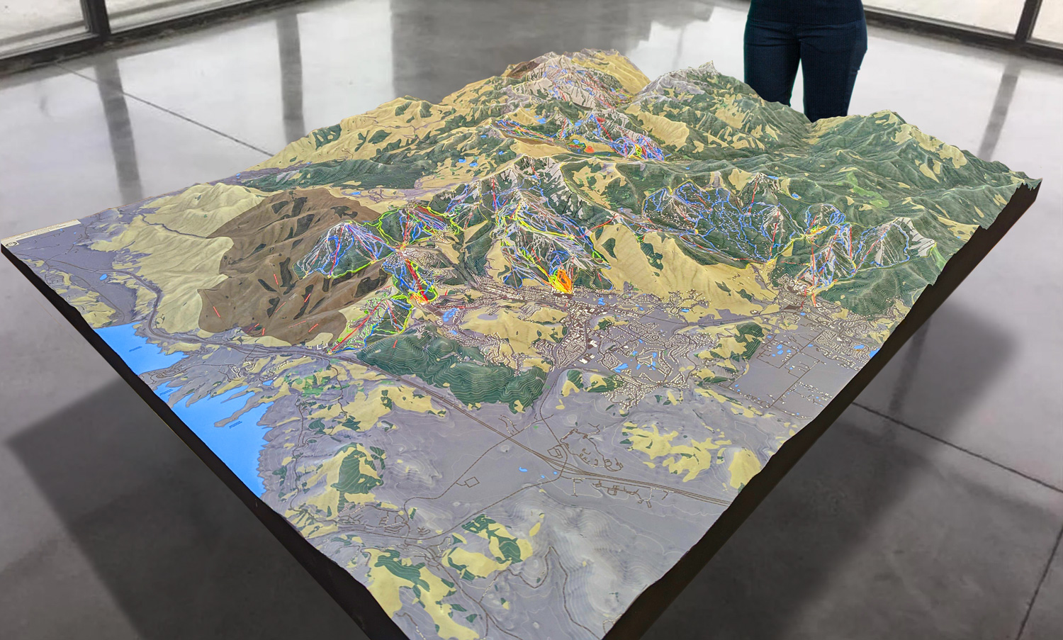
 Park City 3D Raised Relief Map
The Major Ski Runs at Mohawk Mountain
Mohawk Mountain is known for its wide variety of trails, which cater to skiers and snowboarders of all levels. Whether you’re a beginner looking for gentle slopes or an experienced skier seeking a challenge, Mohawk Mountain has something for everyone. Let’s take a closer look at some of the major ski runs that make this mountain a favorite for winter sports enthusiasts.
Deer Run (Beginner)
Deer Run is one of the most popular trails for beginners at Mohawk Mountain. This gentle, green circle trail offers a long, smooth descent, perfect for those who are new to skiing or snowboarding. The wide trail allows beginners to practice their turns and build confidence without feeling crowded or rushed.
The 3D map highlights Deer Run with its gradual slope and even terrain, making it easy for beginners to identify and plan their route. The trail also offers beautiful views of the surrounding Litchfield Hills, giving skiers a scenic introduction to the mountain.
Pine (Intermediate)
For skiers looking to move up from beginner slopes, Pine is an excellent intermediate trail. This blue square trail is slightly steeper than Deer Run but still offers a smooth, controlled descent. It’s a great trail for practicing parallel turns and gaining more confidence on the mountain.
Pine is located near the Nutmeg Triple lift, and the 3D map clearly shows how the trail winds down the mountain, offering multiple points where skiers can exit or continue down to more advanced terrain. The wide, open spaces on Pine make it an enjoyable ride for intermediate skiers who want to challenge themselves without tackling the steepest runs.
Mohawk (Advanced)
For advanced skiers, Mohawk is one of the most exciting black diamond trails on the mountain. This steep, narrow trail offers thrilling descents and tight turns, making it a favorite for those who crave speed and technical difficulty. Mohawk is known for its moguls, which provide an added challenge for skiers looking to test their skills.
The 3D map of Mohawk Mountain highlights the steep incline of the Mohawk trail, giving advanced skiers a clear view of the challenging terrain they’ll face. The trail is located near the summit of the mountain, offering breathtaking views before skiers make their descent.
Arrowhead (Expert)
Arrowhead is another black diamond trail, but it’s reserved for the most experienced skiers. This expert-level run is known for its steep drop and fast-paced terrain, with sharp turns and narrow passages that demand precision and control. Arrowhead is not for the faint of heart, but it’s a must-do for thrill-seekers who want to push their limits.
The 3D map provides a detailed view of Arrowhead’s steep sections and elevation changes, helping expert skiers mentally prepare for the challenges ahead. This trail is often less crowded than some of the intermediate runs, giving advanced skiers the space they need to navigate the terrain safely.
Chute (Advanced/Expert)
Chute is a trail that appeals to both advanced and expert skiers. This black diamond trail offers a mix of steep drops and challenging moguls, making it a dynamic run for those looking to combine speed with technical maneuvers. Chute is located near the top of the mountain and features some of the steepest terrain at Mohawk Mountain.
The 3D map captures the full extent of Chute’s elevation changes, showing how the trail descends rapidly from the summit. Skiers can use the map to get a sense of the trail’s layout and plan their route accordingly.
Nutmeg (Intermediate)
Nutmeg is a long, winding intermediate trail that offers a more leisurely descent compared to some of the steeper advanced runs. It’s a great choice for intermediate skiers who want to take their time and enjoy the scenery while still tackling a few challenging sections.
The 3D map shows how Nutmeg follows the natural contours of the mountain, curving gently around ridges and through wooded areas. This trail is perfect for skiers who enjoy a relaxed pace but still want to test their skills on intermediate terrain.
 Deer Valley 3D Raised Relief Map
Why 3D Maps Matter: Enhancing the Ski Experience
The introduction of 3D maps at Mohawk Mountain has transformed the way skiers interact with the mountain. These maps provide a wealth of benefits, both in terms of safety and enjoyment.
Better Navigation
One of the most obvious advantages of 3D maps is improved navigation. Skiers can see exactly where each trail leads, how it connects to lifts, and what the terrain looks like. This helps skiers plan their routes in advance, reducing the chances of getting lost or ending up on a trail that’s too difficult for their skill level.
Enhanced Safety
Safety is a top priority at any ski resort, and 3D maps contribute to a safer skiing experience. By providing a detailed view of the terrain, 3D maps help skiers avoid areas that may be too steep or challenging. The maps also highlight key safety features, such as ski patrol stations and emergency access points.
Increased Enjoyment
At the end of the day, skiing is about having fun, and 3D maps enhance the overall enjoyment of the experience. Whether you’re a beginner exploring the mountain for the first time or an expert looking for the most challenging runs, 3D maps make it easier to find the trails that match your preferences. The visual appeal of the map also adds to the sense of adventure, giving skiers a clearer understanding of the mountain they’re about to conquer.
Conclusion: The Future of Ski Mapping at Mohawk Mountain
Mohawk Mountain’s 3D maps represent the future of ski mapping, providing a detailed, immersive view of the terrain that enhances the skiing experience. Whether displayed as physical models in the lodge or used as interactive digital tools, these maps help skiers navigate the mountain with ease, stay safe, and make the most of their time on the slopes.
By combining cutting-edge technology with artistic design, Mohawk Mountain has created a tool that not only serves a practical purpose but also adds to the excitement and enjoyment of skiing. As more resorts adopt 3D mapping, we can expect this technology to continue transforming the way we explore and experience the mountains.
Check out WhiteClouds’ 3D Maps for more information on 3D maps of Mohawk Mountain Ski Area.
