Lonesome Pine Trails 3D Maps
Lonesome Pine Trails 3D Maps
We Build Custom 3D Lonesome Pine Trails Maps
The Power of 3D Maps: Elevating the Ski Experience at Lonesome Pine Trails
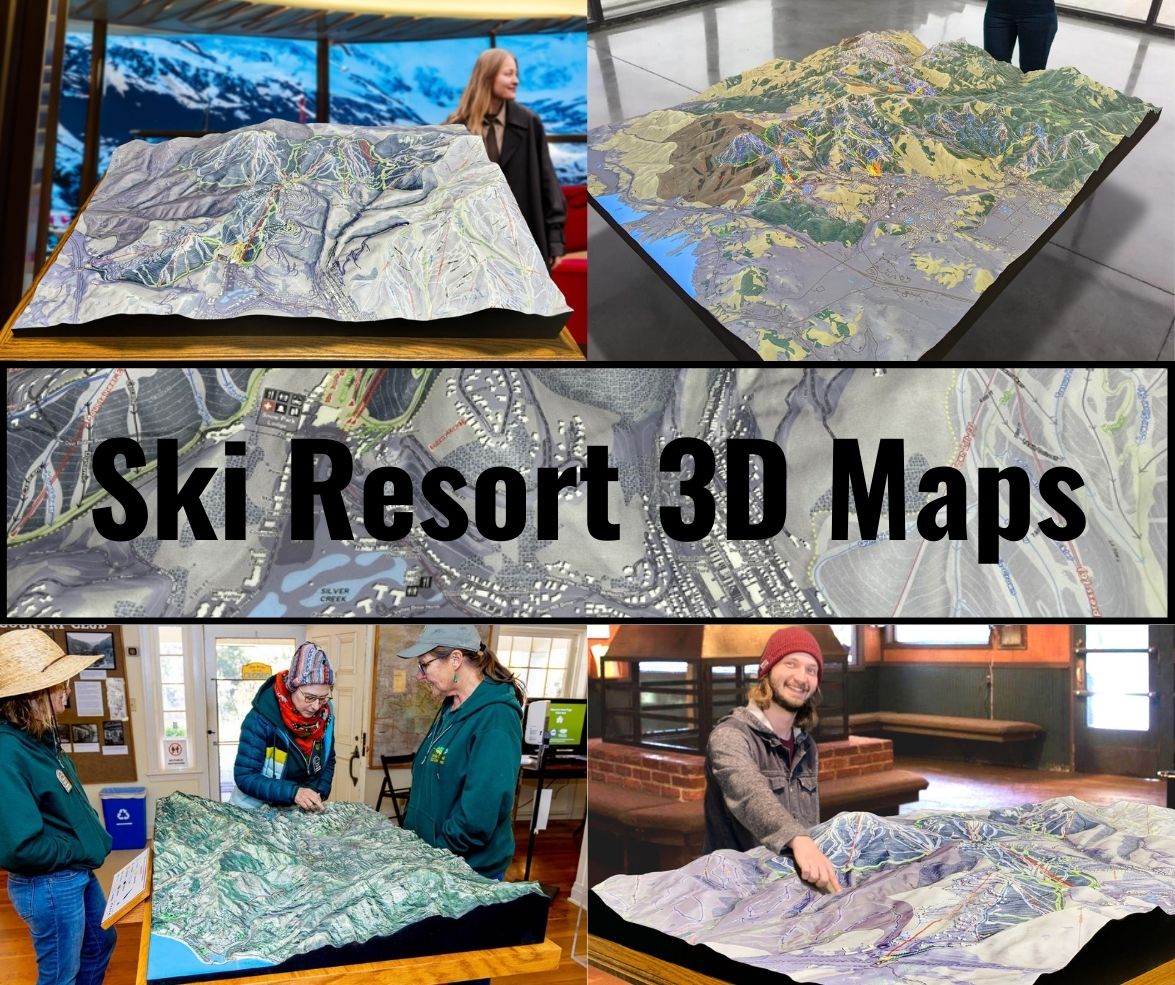
Nestled in Aroostook County, Maine, Lonesome Pine Trails is a cherished ski destination for those seeking a quieter, family-friendly experience with a variety of terrain. For skiers and snowboarders alike, the thrill of the slopes is heightened by understanding the mountain’s terrain and layout. The secret weapon to fully appreciating this hidden gem is the Lonesome Pine Trails 3D map. Unlike traditional flat maps, these topographical masterpieces give skiers an immersive view of the mountain, highlighting every curve, slope, and trail in stunning detail.
3D maps are not just practical navigation tools; they blend function with artistry, offering a deeper connection to the mountain itself. They capture the essence of Lonesome Pine Trails by representing the real-world elevations, paths, and landmarks that make up the ski resort. Whether you’re a beginner learning your first turns or an experienced skier seeking new challenges, Lonesome Pine Trails’ 3D maps offer insights into the terrain, making them essential for planning your next adventure.
The beauty of a 3D map lies in how it transforms raw data into a visual and tactile experience. It allows you to “feel” the mountain, even before setting foot on the snow. Let’s dive into how these maps are created and explore the major ski runs that make Lonesome Pine Trails such a unique place for outdoor enthusiasts.

How Lonesome Pine Trails 3D Maps Are Fabricated: Crafting a Detailed Terrain
Creating a 3D map of Lonesome Pine Trails requires a perfect combination of advanced technology and traditional craftsmanship. The process begins with gathering topographical data, which is usually collected through satellite imagery, aerial surveys, and Geographic Information Systems (GIS). These data points give cartographers an incredibly detailed picture of the mountain’s elevation, slopes, and other physical features. The precision of this data is crucial because even the smallest variation in the landscape can significantly impact a skier’s experience on the slopes.
Once the data is compiled, the next step is translating it into a digital 3D model. Using specialized 3D mapping software, designers create a digital replica of Lonesome Pine Trails. Every aspect of the mountain, from the steepest runs to the gentle bunny hills, is rendered in precise detail. The designers fine-tune the digital model to ensure that it accurately reflects the contours and elevation changes of the mountain.
After the digital model is completed, it’s time to bring the map into the physical world. The most common material used for these maps is high-density foam or a similar lightweight yet durable medium. The foam allows for intricate carving, capturing the mountain’s detailed topography. The digital model is sliced into layers, which are then either carved or 3D printed to recreate the physical shape of Lonesome Pine Trails. Each layer corresponds to a different elevation, and once they are assembled, they form a highly accurate 3D representation of the mountain.
At this stage, the 3D map is just a blank canvas of terrain. It’s the artistry that follows that truly brings it to life. Skilled artists take over, painting the map to resemble the real-world environment of Lonesome Pine Trails. Snow-covered peaks are given a cool, bright finish, while forested areas are painted in shades of green and brown. Trails are carefully color-coded to indicate difficulty levels, making it easy for skiers to navigate the mountain. Chairlifts, lodges, and other key landmarks are added to the map, ensuring it is both functional and visually stunning.
Once the map is fully painted and detailed, it undergoes a protective finishing process. A clear coating is applied to preserve the colors and prevent wear, especially important for maps displayed in high-traffic areas or exposed to the elements. This final touch ensures that the 3D map remains durable and beautiful for years to come.
The result is a map that serves not only as a practical guide for skiers but also as a work of art that showcases the beauty of Lonesome Pine Trails.
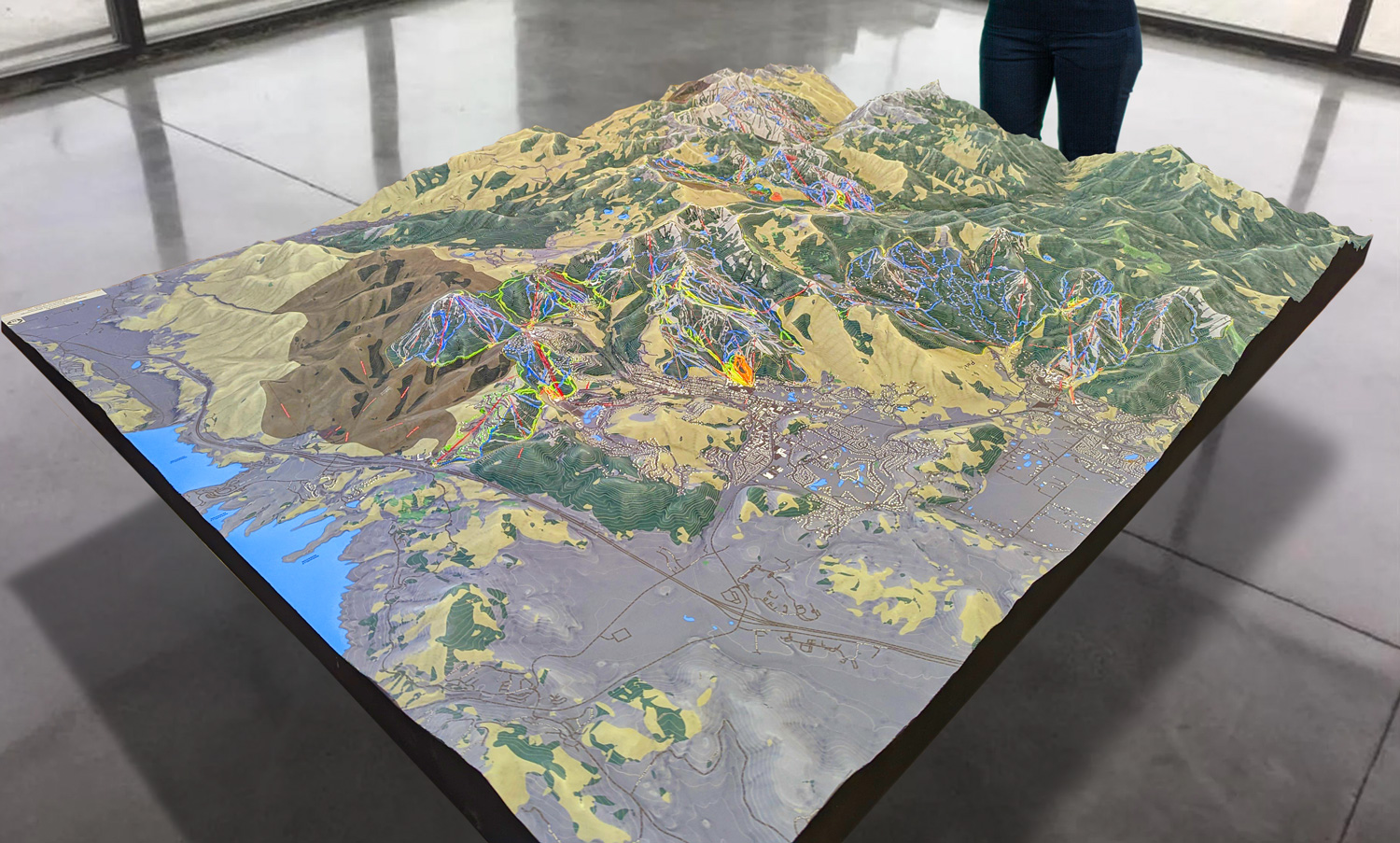
 Park City 3D Raised Relief Map
Navigating Lonesome Pine Trails: A Guide to the Major Ski Runs
Lonesome Pine Trails may not be the largest resort, but it offers a variety of runs that cater to all levels of skiers and snowboarders. From gentle, beginner-friendly slopes to more challenging trails for seasoned skiers, Lonesome Pine Trails provides an experience that is both accessible and exciting. With the help of a 3D map, you can easily plan your routes and explore the best of what the mountain has to offer.
- Ridge Runner (Beginner): For those new to skiing or snowboarding, Ridge Runner is an excellent place to start. This beginner-friendly slope offers a gentle descent with wide, open spaces that allow novices to practice their turns and control. The 3D map of Lonesome Pine Trails clearly shows Ridge Runner’s gentle gradient and smooth curves, making it easy for first-timers to visualize the terrain. It’s also located conveniently near the base lodge, allowing beginners to take breaks and regroup when needed. Ridge Runner is perfect for building confidence before tackling more challenging terrain.
- Pine Glide (Intermediate): Once you’ve mastered the basics, Pine Glide is the next logical step. This intermediate trail offers a slightly steeper incline and more varied terrain than Ridge Runner, providing a fun and exciting challenge for those looking to improve their skills. The 3D map highlights Pine Glide’s path as it winds through the middle of the mountain, offering skiers a scenic route through the trees. With a combination of gentle slopes and moderate turns, Pine Glide strikes a perfect balance between relaxation and challenge.
- Summit Express (Advanced): For more experienced skiers, Summit Express offers the thrills you’re looking for. This advanced trail features steeper inclines, sharper turns, and a faster pace than the beginner and intermediate runs. The 3D map captures Summit Express’ dramatic elevation changes, making it easy for advanced skiers to anticipate the trail’s challenges before they hit the snow. Summit Express is known for its breathtaking views from the top of the mountain, as well as its adrenaline-pumping descent that tests the skills of even the most seasoned skiers.
- The Glades (Expert): For expert skiers seeking an off-piste adventure, The Glades provide an exhilarating challenge. Skiing through the trees requires quick reflexes, precision, and expert control. The 3D map of Lonesome Pine Trails marks The Glades as a densely forested area, offering a clear view of the rugged terrain and natural obstacles. The thrill of navigating between trees and negotiating unpredictable paths makes The Glades a favorite for skiers who want to push their limits. This trail demands respect, but for those who are up to the challenge, it offers an unforgettable experience.
- Sunset Slope (Intermediate/Advanced): One of the most scenic trails at Lonesome Pine Trails, Sunset Slope offers a blend of intermediate and advanced terrain, making it suitable for a wide range of skiers. This trail winds down the western side of the mountain, offering stunning views of the surrounding landscape, especially at dusk when the sun sets over the horizon. The 3D map showcases Sunset Slope’s varied terrain, with sections that cater to both intermediate and advanced skiers. It’s a great choice for those looking for a mix of beautiful scenery and an enjoyable skiing challenge.
How the 3D Map Enhances the Skiing Experience
Lonesome Pine Trails 3D maps are more than just artistic representations of the mountain—they are essential tools that enhance the skiing experience for everyone. By offering a detailed, three-dimensional view of the terrain, these maps help skiers and snowboarders plan their day on the slopes and navigate the mountain with ease.
For beginners, the 3D map provides reassurance by clearly showing the gentle gradients of trails like Ridge Runner. Knowing where the beginner slopes are located makes it easier for newcomers to find their footing and feel comfortable navigating the mountain. The map also helps beginners avoid more challenging runs that may be beyond their skill level, ensuring a safe and enjoyable experience.
Intermediate skiers benefit from the map’s accuracy and detail, which allow them to find trails like Pine Glide or Sunset Slope, where they can practice their turns and enjoy the mountain’s scenic routes. For more advanced skiers, the map’s detailed depiction of trails like Summit Express and The Glades helps them anticipate the terrain and choose runs that suit their skills and preferences.
The map also highlights important features like chairlifts, rest areas, and lodges, making it easy for skiers to plan their day and move between runs. Families and groups can use the 3D map to coordinate meeting points, ensuring that everyone stays connected even if they’re skiing different trails.
Additionally, the map is a valuable tool for planning night skiing adventures. With clear indications of which trails are lit for evening skiing, skiers can extend their day on the slopes and enjoy the thrill of skiing under the stars.
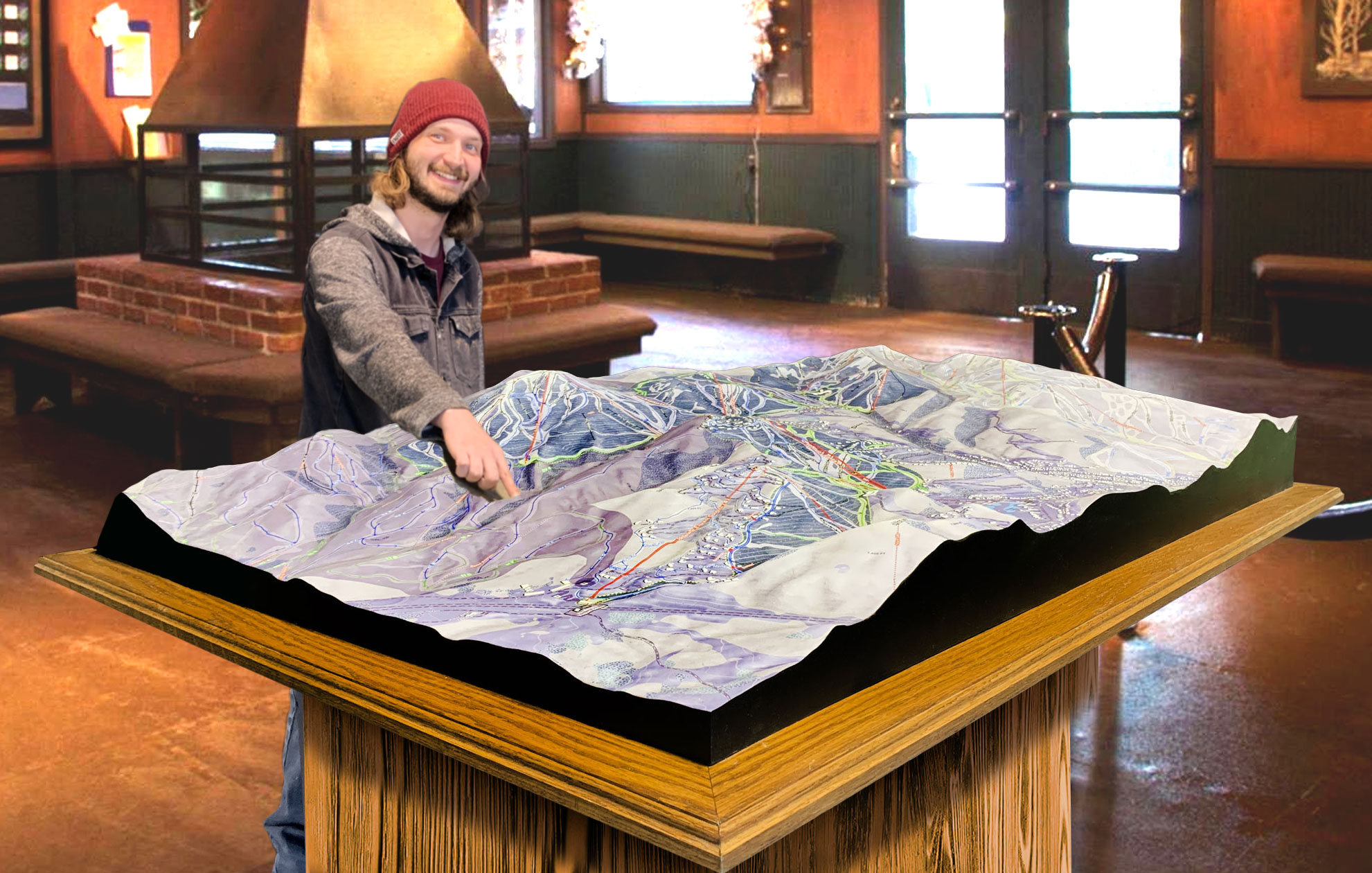
 Deer Valley 3D Raised Relief Map
3D Maps as Keepsakes and Functional Art
Beyond their practical uses, Lonesome Pine Trails 3D maps are also popular keepsakes. Visitors often purchase these maps as souvenirs, taking home a physical reminder of their time on the mountain. The combination of accuracy, detail, and artistry makes these maps a perfect memento, whether you display them on a wall or use them to reminisce about your favorite ski runs.
For collectors and ski enthusiasts, 3D maps are more than just functional tools—they are works of art that capture the essence of the mountain. Whether you’ve tackled Summit Express or enjoyed a leisurely day on Ridge Runner, the 3D map offers a lasting connection to your experience at Lonesome Pine Trails.
Conclusion: The Perfect Blend of Art, Functionality, and Adventure
Lonesome Pine Trails 3D maps are a perfect example of how art, technology, and functionality come together to enhance the skiing experience. These maps are not only practical tools for navigating the mountain but also beautiful works of art that celebrate the natural beauty and adventure of Lonesome Pine Trails. From the intricate fabrication process to the detailed depictions of ski runs, the 3D map offers skiers a deeper connection to the mountain and ensures they can make the most of their time on the slopes.
Whether you’re a beginner navigating your first run or an expert looking for the thrill of The Glades, Lonesome Pine Trails 3D maps provide a unique and essential perspective on the mountain. They serve as a reminder of the adventures shared and the memories made, offering a lasting memento of your time at this special ski destination. So next time you’re at Lonesome Pine Trails, take a moment to study the 3D map—it might just inspire your next great adventure on the slopes.
Check out WhiteClouds’ 3D Maps for more information on 3D maps of Lonesome Pine Trails Ski Resort.
