Delaware Topo Map
Delaware Topo Map
We Build Custom 3D Topo Maps
Delaware’s Unique Landscapes Through Topographic Maps: A Guide to the First State’s Geography
Delaware, though the second smallest state in the U.S., boasts a geography that is rich in diversity and historical significance. From the rolling hills of the Piedmont Plateau in the north to the flat expanses of the Atlantic Coastal Plain in the south, Delaware’s topography reflects a blend of natural beauty and human history. Its waterways, marshes, forests, and farmland create a tapestry of landscapes that come alive through the detailed representation of topographic maps.
Topographic maps provide an in-depth look at Delaware’s subtle elevation changes, intricate waterways, and geographical features. These maps are indispensable for outdoor enthusiasts, land managers, and educators who want to explore and understand the state’s terrain. Both 2D and 3D topographic maps offer a window into Delaware’s landscapes, revealing the hidden contours of this small but fascinating state.
The Piedmont Plateau: Rolling Hills and Rocky Terrain
The northernmost region of Delaware is part of the Piedmont Plateau, a landscape characterized by gently rolling hills, rocky outcrops, and wooded areas. This region includes the state’s highest point, Ebright Azimuth, at 447.85 feet above sea level, and is dotted with historical landmarks and parks.
In 2D topographic maps, the Piedmont Plateau is depicted with contour lines that reveal the gradual elevation changes typical of this region. These maps highlight features such as Brandywine Creek, White Clay Creek, and the rocky ridges that define the area. For hikers and nature enthusiasts, 2D topographic maps provide essential information about trails, elevation changes, and water sources.
3D topographic maps bring the Piedmont Plateau to life by showcasing its rolling hills and rocky features in vivid detail. These maps allow users to visualize the region’s terrain, making them invaluable tools for planning outdoor activities or studying the geological history of Delaware’s northern landscapes.
The Atlantic Coastal Plain: Flatlands, Marshes, and Beaches
The majority of Delaware lies within the Atlantic Coastal Plain, a region defined by its flat terrain, sandy soils, and expansive wetlands. This region includes the state’s famous beaches, such as Rehoboth Beach and Bethany Beach, as well as significant ecological areas like Bombay Hook National Wildlife Refuge.
In 2D topographic maps, the Atlantic Coastal Plain is represented by widely spaced contour lines that reflect its relatively flat terrain. Features such as tidal rivers, salt marshes, and barrier islands are clearly marked, providing a comprehensive view of the region’s topography. These maps are essential for conservationists, land managers, and recreational users who need to understand the nuances of the coastal environment.
3D topographic maps of the Atlantic Coastal Plain enhance the understanding of this region’s terrain by highlighting subtle elevation changes and showcasing the interplay between land and water. For kayakers, birdwatchers, and ecologists, these maps offer a detailed perspective on Delaware’s coastal landscapes, helping to plan activities and conservation efforts.
Delaware’s Waterways: Rivers, Bays, and Wetlands
Delaware is defined by its waterways, which include the Delaware River, the Chesapeake & Delaware Canal, and numerous smaller rivers and streams that crisscross the state. These waterways are not only vital for transportation and commerce but also support diverse ecosystems and recreational activities.
In 2D topographic maps, Delaware’s waterways are prominently displayed, with contour lines indicating the surrounding terrain and the elevation of riverbanks and floodplains. Features such as the Christina River, Mispillion River, and Nanticoke River are clearly marked, along with their tributaries and associated wetlands. These maps are invaluable for managing water resources, planning flood mitigation projects, and protecting aquatic habitats.
3D topographic maps of Delaware’s waterways provide an immersive view of the state’s hydrology, showcasing the depth and breadth of its rivers and the flatness of its floodplains. These maps are particularly useful for planners and engineers working on water management and conservation projects, as well as for anglers and paddlers exploring the state’s rivers and bays.
The Delaware Bay: A Vital Coastal Ecosystem
The Delaware Bay, one of the largest estuaries in the U.S., is a critical feature of the state’s geography. This area is a hub for wildlife, supporting migratory bird populations and marine life, and plays a significant role in Delaware’s economy through fishing, shipping, and tourism.
In 2D topographic maps, the Delaware Bay is represented with contour lines that indicate the surrounding terrain and bathymetric (underwater topography) features. Coastal marshes, tidal creeks, and sandbars are prominently displayed, providing a detailed view of the bay’s complex ecosystem.
3D topographic maps of the Delaware Bay offer a more immersive perspective, showcasing the interplay between the bay’s waters and the adjacent coastal plain. These maps highlight the bay’s depth variations and the elevation changes of the surrounding shoreline, making them valuable for environmental planning, coastal management, and recreational use.
How Delaware Topo Maps Are Fabricated: Precision in Mapping the First State
Creating topographic maps of Delaware requires a blend of advanced technology, precise data collection, and skilled craftsmanship. Despite its small size, Delaware’s diverse landscapes demand accurate and detailed mapping to capture the unique features of each region.
For 2D topographic maps, the process begins with data collection from sources such as satellite imagery, aerial surveys, and LiDAR (Light Detection and Ranging). This data is processed using Geographic Information Systems (GIS) software to create contour lines that represent elevation changes. Given Delaware’s relatively flat terrain, special attention is paid to subtle variations in elevation, ensuring that features like floodplains and ridges are accurately represented. Additional features such as rivers, roads, and urban areas are added to create a comprehensive map.
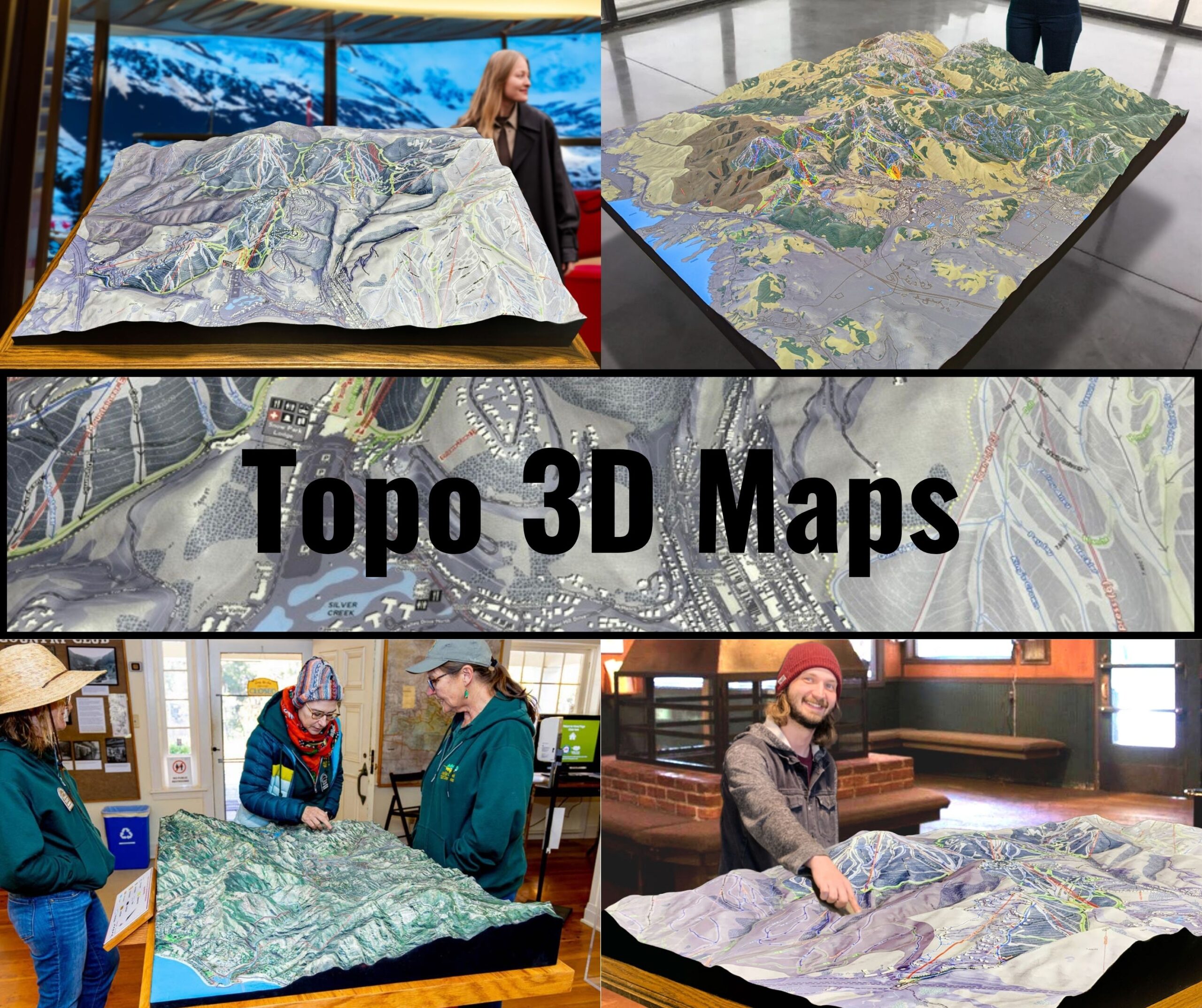
Creating 3D topographic maps involves rendering elevation data into three-dimensional models. Advanced software converts the data into digital 3D representations, which can then be printed using 3D printers or displayed digitally for interactive exploration. For Delaware, particular attention is given to highlighting features such as the marshes of the coastal plain, the rolling hills of the Piedmont Plateau, and the depth of the Delaware Bay.
Once the 3D maps are created, they are often painted and finished to enhance their visual appeal and highlight key features such as elevation changes, vegetation, and water bodies. These maps provide a tactile and immersive way to explore Delaware’s landscapes, making them invaluable for educators, researchers, and outdoor enthusiasts.
Delaware Topo Maps for Conservation and Outdoor Recreation
Topographic maps play a crucial role in conserving Delaware’s natural resources and supporting outdoor recreation. With its blend of forests, waterways, and coastlines, Delaware requires careful management to preserve its natural beauty and biodiversity.
Conservationists use topographic maps to monitor changes in the environment, plan restoration projects, and protect critical habitats. For example, in the Delaware Bay, these maps are used to study the impacts of sea-level rise, erosion, and habitat loss. In the Piedmont Plateau, topographic maps help manage forests and protect water quality in key watersheds.
For outdoor enthusiasts, topographic maps are essential tools for exploring Delaware’s trails, parks, and waterways. Hikers rely on these maps to navigate the trails of White Clay Creek State Park or the Brandywine Valley, while anglers and paddlers use them to find access points and plan routes along the state’s rivers and bays.
Conclusion: Delaware’s Landscapes Through the Lens of Topographic Maps
Delaware’s topographic maps reveal the state’s subtle yet captivating landscapes in remarkable detail. From the rolling hills of the Piedmont Plateau to the flat expanses of the coastal plain and the dynamic Delaware Bay, these maps capture the essence of the First State’s geography.
Whether you’re an adventurer exploring Delaware’s natural beauty, a scientist studying its ecosystems, or an educator teaching geography, topographic maps provide an invaluable tool for understanding and appreciating the state’s terrain. With both 2D and 3D options available, these maps ensure that future generations can continue to explore, protect, and enjoy the landscapes that make Delaware unique.
Check out WhiteClouds’ 3D Maps for more information on Delaware topo maps.

