What Is a Political Map? Understanding Its Purpose and Importance
What Is a Political Map? Understanding Its Purpose and Importance
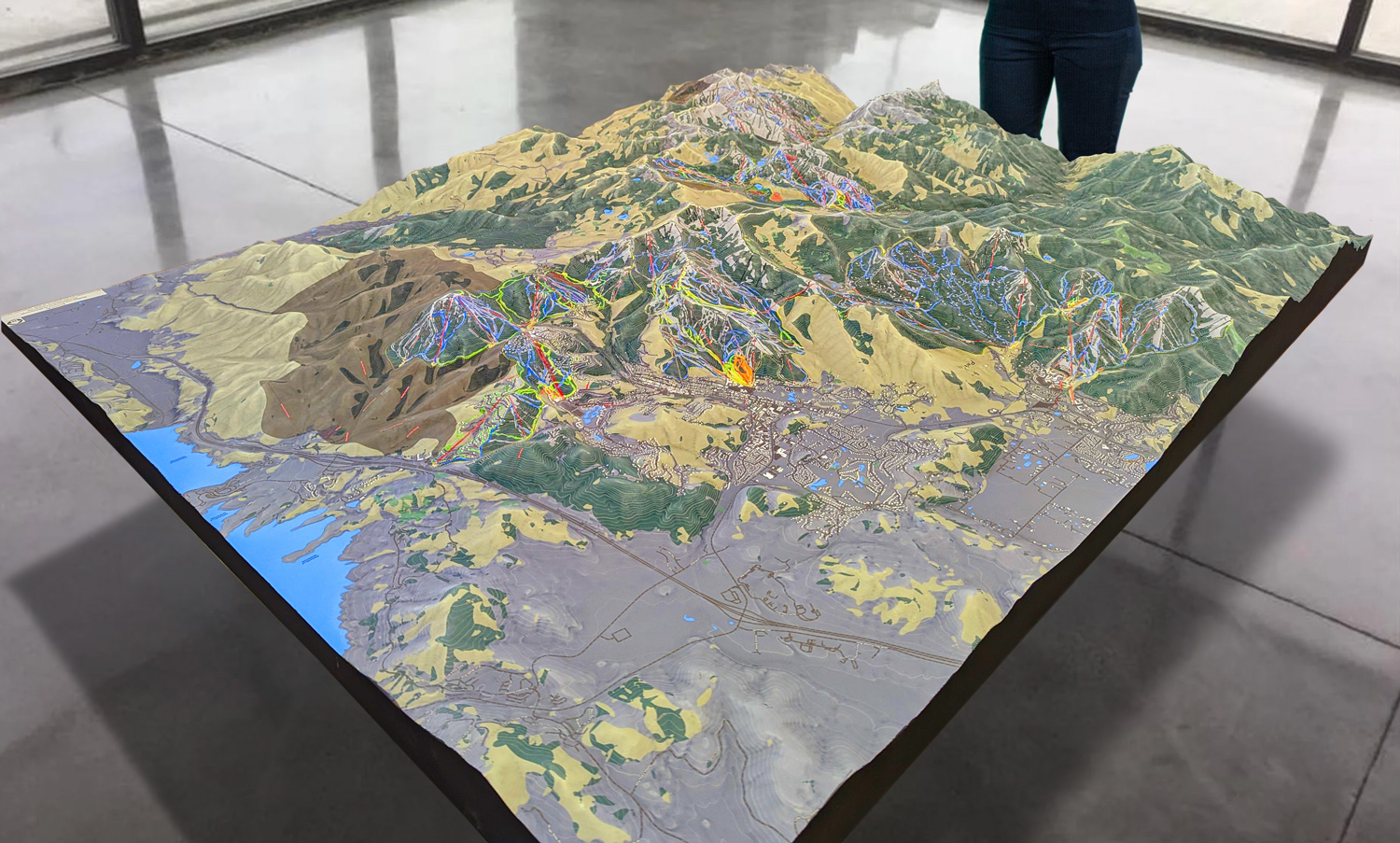
We Build Custom 3D Maps
Did you know we make
custom
3D Raised Relief Maps

Maps are powerful tools that help us make sense of the world, navigate new places, and understand complex information. Among the many types of maps, political maps are some of the most commonly used and widely recognized. These maps are not just tools for geography—they are visual representations of how humans organize the planet into countries, states, and cities. Political maps play a crucial role in education, navigation, politics, and even history, shaping our understanding of the world and its boundaries.
This article explores what political maps are, why they are important, and how they are used in everyday life. We’ll dive into their features, examine their historical development, and highlight how they differ from other types of maps. By the end, you’ll have a deeper appreciation for the value of political maps and the ways they influence how we see the world.
What Is a Political Map?
At its core, a political map is a type of map that shows human-made boundaries and divisions, such as countries, states, provinces, and cities. Unlike physical maps, which focus on natural features like mountains, rivers, and forests, political maps emphasize borders and the names of political entities. They often include major cities, capitals, and sometimes additional features like transportation routes or major water bodies for context.
Political maps are designed to provide a clear and organized view of how people have divided the Earth into territories. They are used for many purposes, from teaching geography in classrooms to helping travelers understand which countries they are entering. Political maps also play an essential role in understanding global issues, such as conflicts, trade, and international relations.

Features of a Political Map
Political maps vary in detail and style, but they typically include the following key elements:
- Borders and Boundaries: The primary purpose of a political map is to show boundaries between countries, states, provinces, and cities. These borders are usually represented by lines, with thicker or colored lines often indicating national borders.
- Labels: Political maps include labels for countries, capitals, major cities, and sometimes regions or territories. These labels are crucial for identifying specific locations and understanding political divisions.
- Capitals and Major Cities: Most political maps highlight capital cities with special symbols, such as stars, to distinguish them from other cities. They may also mark other major urban centers that are important politically or economically.
- Colors: Many political maps use different colors to distinguish between countries or regions. This color-coding helps viewers quickly identify and differentiate areas.
- Legends and Scale: Political maps often include a legend that explains the symbols and colors used, as well as a scale to show distances.
- Contextual Features: While political maps focus on political boundaries, they sometimes include major rivers, lakes, or mountain ranges to provide geographic context.
Why Are Political Maps Important?
Political maps serve a wide range of purposes, from practical applications to shaping global perspectives. Here are some of the key reasons why they are important:
Understanding Borders and Governance
Political maps help us understand how the world is divided and governed. By showing national and state boundaries, these maps provide a visual representation of political territories, helping people grasp the relationships between countries and regions.
For example, a political map of Europe reveals the distinct borders of countries like France, Germany, and Italy, while also showing how these nations are situated relative to each other. This understanding is essential for studying history, politics, and international relations.
Education
Political maps are a cornerstone of geography education. Students use them to learn about countries, capitals, and regions, as well as the organization of states and provinces within their own countries. These maps provide a foundation for understanding global diversity and the complexity of human societies.
Travel and Navigation
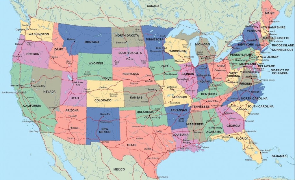
Travelers often rely on political maps to understand the regions they are visiting. For instance, someone traveling across the United States might use a political map to see how states like California, Nevada, and Arizona are connected. Similarly, international travelers can use political maps to understand visa requirements, border crossings, and the political landscape of their destinations.
Conflict and Diplomacy
Political maps play a vital role in understanding international conflicts and diplomacy. By showing disputed borders or contested regions, these maps help people visualize areas of tension. For example, maps of the Middle East often highlight disputed territories like the West Bank or the Golan Heights, providing context for complex geopolitical issues.
Historical Perspective
Political maps also capture the evolution of human societies. Comparing historical political maps with modern ones reveals how borders have changed over time due to wars, treaties, colonization, and independence movements. For example, maps of Africa from the 19th century look vastly different from today, reflecting the impact of European colonization and subsequent decolonization.
The History of Political Maps
Early Political Maps
The earliest political maps date back thousands of years. Ancient civilizations like the Babylonians and Egyptians created maps to represent their territories, cities, and trade routes. These maps were often simple and symbolic, focusing on practical needs rather than detailed geographic accuracy.
The Greeks and Romans advanced political cartography by introducing mathematical principles. Ptolemy, a Greek geographer, created one of the first detailed world maps in the 2nd century, which included political divisions based on the knowledge of his time.
The Middle Ages and Renaissance
During the Middle Ages, mapmaking became more influenced by religion and art. Political maps often depicted the world as seen through a religious lens, with Jerusalem or other holy sites at the center. The Renaissance brought renewed interest in geography and cartography, leading to more accurate political maps that reflected the Age of Exploration.
Modern Political Maps
With the development of printing and advances in geographic knowledge, political maps became more standardized and widely available. The rise of colonial empires in the 18th and 19th centuries further shaped political maps, as European powers divided large parts of the world into colonies and territories.
Today, political maps are created using advanced tools like Geographic Information Systems (GIS) and satellite imagery, allowing for unparalleled accuracy and detail. Digital platforms like Google Maps and political mapping software have made political maps more accessible than ever.
Examples of Political Maps
- World Political Map: A classic example is a map showing all the countries of the world, with distinct colors for each nation, labeled capitals, and major cities. This type of map is commonly used in classrooms and offices.
- U.S. State Map: A political map of the United States highlights the boundaries of its 50 states, with capitals like Sacramento, Austin, and Albany clearly marked. It often includes major highways and water bodies for additional context.
- Conflict Maps: Maps of the Middle East often include disputed territories like Palestine and the Golan Heights, showing the complexity of borders in a politically sensitive region.
- Historical Political Maps: A map of Europe before World War I shows how empires like Austro-Hungary and the Ottoman Empire dominated the continent, offering insights into historical geopolitics.
Political Maps vs. Other Types of Maps
Political maps are often compared to other types of maps, such as physical, thematic, and topographic maps. While physical maps focus on natural features, like mountains and rivers, political maps emphasize human-made boundaries. Thematic maps, on the other hand, are used to show specific data, such as population density or climate, and may incorporate political divisions as part of their design.
Topographic maps include elevation data and contour lines, making them useful for understanding terrain but less focused on political boundaries. Each type of map has its unique purpose, but political maps remain the go-to choice for understanding borders and governance.
The Future of Political Maps
As technology advances, political maps continue to evolve. Digital maps allow users to interact with data, zooming in on cities or exploring border changes over time. Augmented Reality (AR) and Virtual Reality (VR) are also being used to create immersive map experiences, making it easier to understand complex political landscapes.
Crowdsourced platforms like OpenStreetMap empower communities to contribute to mapping efforts, ensuring that even remote or underrepresented regions are accurately depicted. However, the increasing use of digital maps also raises concerns about accuracy, bias, and access, making it essential to approach political maps critically.
Conclusion
Political maps are far more than simple tools for identifying borders—they are visual representations of how humans organize and divide the world. They help us understand geography, history, politics, and culture, serving as essential resources for education, travel, and global awareness. From ancient maps carved into clay tablets to modern digital platforms, political maps have evolved alongside human civilization, reflecting our changing understanding of the world.
Whether you’re a student learning about capitals, a traveler planning your next adventure, or a historian studying the past, political maps provide valuable insights into the world around us. As technology continues to shape the future of cartography, political maps will remain an indispensable tool for making sense of the ever-changing global landscape.