Great Lakes Watershed Map
Great Lakes Watershed Map
We Build Custom 3D Watershed Maps
Great Lakes Watershed Map: Understanding the World’s Largest Freshwater System
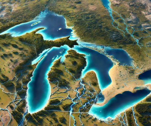
The Great Lakes Watershed is one of the most critical and expansive freshwater systems on Earth, encompassing five massive lakes—Superior, Michigan, Huron, Erie, and Ontario—and their surrounding basins. Spanning over 295,000 square miles across eight U.S. states and two Canadian provinces, the watershed holds about 20% of the world’s freshwater and serves as an essential resource for drinking water, transportation, agriculture, industry, and recreation. A Great Lakes Watershed map offers a window into this dynamic system, revealing its geography, ecological significance, and the challenges it faces in a rapidly changing world.
Mapping the Great Lakes Watershed: A Freshwater Giant
The Great Lakes Watershed is a marvel of interconnected waterways that drain into the St. Lawrence River and eventually the Atlantic Ocean. Each lake contributes to the system’s flow and plays a distinct role in its ecology and hydrology.
- Lake Superior: The largest and deepest of the Great Lakes, Lake Superior holds more water than the other four lakes combined and sets the system’s northern boundary.
- Lake Michigan: The only Great Lake entirely within the United States, Lake Michigan’s basin supports major cities like Chicago and Milwaukee.
- Lake Huron: Known for its expansive shoreline and Georgian Bay, Lake Huron connects to Lake Michigan via the Straits of Mackinac.
- Lake Erie: The shallowest of the lakes, Erie is prone to algae blooms but supports some of the region’s most fertile agricultural lands.
- Lake Ontario: The final lake in the system, Ontario channels water into the St. Lawrence River, acting as the gateway to the Atlantic.
Maps of the Great Lakes Watershed reveal the vast network of rivers, streams, and smaller lakes that feed into the system. Major tributaries include the St. Louis River, the Detroit River, the Niagara River, and the Maumee River, each playing a crucial role in transporting water, nutrients, and sediments. The watershed also encompasses diverse landscapes, from the dense forests of the Upper Peninsula to the bustling cities of the Midwest and the agricultural plains of Ontario.
Ecological Importance of the Great Lakes Watershed
The Great Lakes Watershed supports one of the most diverse and productive ecosystems in North America. Its freshwater habitats are home to over 3,500 species of plants and animals, including native fish like walleye, trout, and sturgeon, as well as migratory birds, amphibians, and mammals.
Wetlands within the watershed are particularly vital, providing breeding grounds for fish and birds and acting as natural filters that improve water quality by trapping pollutants. Coastal areas along the lakes support unique ecosystems like sand dunes, estuaries, and rocky shorelines, which host rare plant species and offer critical nesting sites for birds.
Watershed maps are indispensable tools for conservationists, helping identify areas of ecological importance, track changes in land use, and prioritize restoration efforts. For example, maps showing wetland distribution can guide projects to restore degraded areas, while those highlighting fish migration routes can inform efforts to remove barriers like dams and culverts.
The Great Lakes Watershed as an Economic Powerhouse
The Great Lakes Watershed is a cornerstone of the North American economy, supporting industries such as shipping, agriculture, manufacturing, and tourism. Its 94,000 square miles of surface water create a network of navigable waterways that facilitate the movement of goods between the United States, Canada, and international markets. The Great Lakes-St. Lawrence Seaway is one of the busiest trade routes in the world, transporting commodities like grain, iron ore, and petroleum.
The watershed’s fertile soils and abundant water supply make it a hub for agriculture, producing crops like corn, soybeans, apples, and grapes. Its freshwater resources also sustain major urban centers, providing drinking water for over 40 million people.
Watershed maps are critical for managing these economic activities sustainably. They help planners balance the needs of agriculture, industry, and conservation by providing a clear picture of water availability and usage. For instance, maps showing irrigation networks can highlight areas where water efficiency improvements are needed, while those depicting pollution hotspots can guide cleanup efforts.
The Challenges of Managing the Great Lakes Watershed
Despite its abundance, the Great Lakes Watershed faces significant challenges, including pollution, invasive species, and the impacts of climate change. Urban and agricultural runoff introduces nutrients like phosphorus and nitrogen into the lakes, leading to harmful algal blooms that threaten water quality and aquatic life. Industrial discharges and historical pollution have left legacy contaminants like PCBs and heavy metals in the sediments of some areas.
Invasive species such as zebra mussels, sea lampreys, and round gobies have disrupted the ecosystem, outcompeting native species and altering food webs. Climate change is exacerbating these issues by raising water temperatures, altering precipitation patterns, and causing more frequent extreme weather events.
Watershed maps are essential tools for addressing these challenges. They provide detailed information about water flow, land use, and environmental conditions, enabling stakeholders to develop strategies for mitigating pollution, controlling invasive species, and adapting to climate change. For example, maps showing nutrient runoff sources can guide efforts to reduce agricultural inputs, while those depicting vulnerable habitats can inform conservation priorities.
Fabricating Great Lakes Watershed 3D Maps: A Fusion of Science and Art
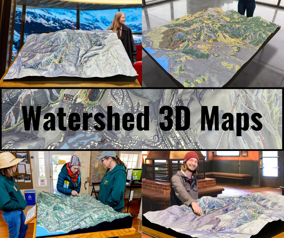
Creating a 3D map of the Great Lakes Watershed is a meticulous process that combines advanced technology, scientific data, and artistic expertise. These maps offer a tactile and visually engaging way to explore the watershed’s geography, helping viewers understand its scale, complexity, and importance.
The process begins with the collection of high-resolution topographical and hydrological data. Organizations like the U.S. Geological Survey (USGS) and Environment Canada provide datasets that include elevation, land cover, and water flow information. This data is processed using geographic information system (GIS) software to create a digital model of the watershed.
Once the digital model is complete, it is translated into a physical object using 3D printing technology. WhiteClouds, a leader in 3D mapping, employs state-of-the-art printers to construct the map layer by layer. Materials such as PLA (polylactic acid) or resin are used to build the structure, with each layer representing a specific elevation. This process ensures that the 3D map accurately replicates the contours of the watershed.
After the base structure is printed, the map undergoes a finishing process to enhance its realism. Artists hand-paint the map, using colors that correspond to the various features of the watershed. Shades of blue highlight the lakes and rivers, while green and brown tones depict forests, wetlands, and urban areas. Airbrushing techniques are often used to create smooth transitions between different terrain types, resulting in a lifelike and visually striking map.
The final step involves applying a protective coating, such as polyurea or polyurethane, to ensure the map’s durability. This coating protects the map from wear and tear, making it suitable for use in educational displays, public exhibitions, and planning meetings.
3D maps of the Great Lakes Watershed are more than just tools—they are works of art that inspire curiosity and understanding. They provide a hands-on way to explore the watershed, helping people appreciate its scale, significance, and challenges.
Educational and Planning Applications of Great Lakes Watershed Maps
Great Lakes Watershed maps are invaluable tools for education, research, and planning. In classrooms, they help students learn about geography, hydrology, and ecology by providing a visual and interactive way to explore the system. For researchers, these maps offer detailed information about the watershed’s features, supporting studies on topics such as water quality, invasive species, and climate change.
Planners and policymakers use watershed maps to make informed decisions about land use, infrastructure development, and resource management. By visualizing the watershed’s topography and water flow, they can identify areas at risk from pollution, flooding, or habitat loss and develop strategies to address these challenges.
The Future of the Great Lakes Watershed
As the Great Lakes Watershed continues to face pressures from pollution, invasive species, and climate change, the need for sustainable management and conservation has never been greater. Innovations in mapping technology, including 3D models, will play a crucial role in addressing these challenges. By providing detailed and accurate information about the watershed, these tools enable better planning and decision-making.
The Great Lakes Watershed is a vital part of North America, supporting ecosystems, communities, and economies. By continuing to study and protect this system, we can ensure that it remains a source of life and inspiration for generations to come. Whether through traditional maps, digital tools, or immersive 3D models, the Great Lakes Watershed will continue to captivate and educate, highlighting the importance of preserving one of the world’s most valuable natural resources.
Check out WhiteClouds’ 3D Maps for more information on Great Lakes River watershed maps.

