Top 10 Largest Sand Dunes in the World
Top 10 Largest Sand Dunes in the World
WhiteClouds builds 3D Raised Relief Maps
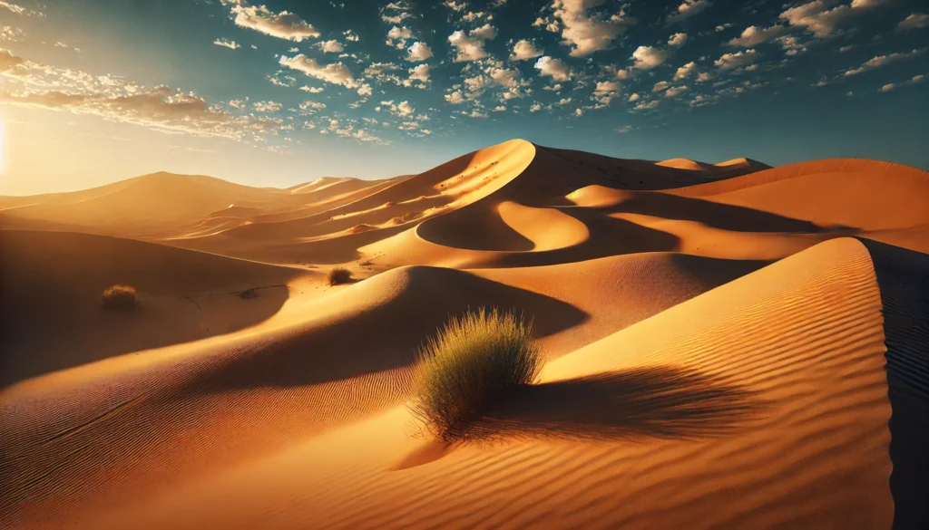
Sand dunes are among the most awe-inspiring natural formations on Earth, shaped over millennia by wind, weather, and the relentless forces of nature. These colossal mounds of sand dominate arid landscapes and tell stories of geological history, resilience, and beauty. From towering desert peaks to coastal giants, here’s a look at the top 10 largest sand dunes in the world, ranked by their height.
#1: Dune 7 – 1,256 feet
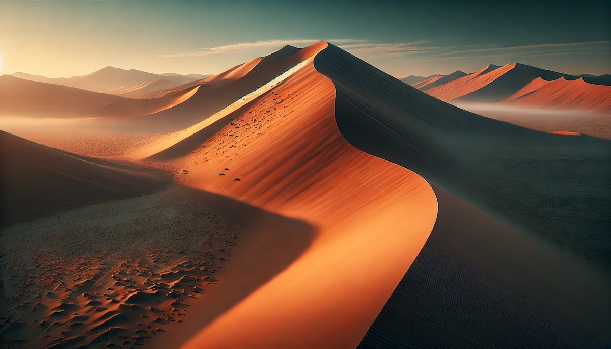
Dune 7, located in Namibia’s Namib Desert, holds the title of the world’s tallest sand dune, standing at an astonishing 1,256 feet. Situated near Walvis Bay, this iconic dune is named after its location as the seventh dune in the Tsauchab River valley. Its vibrant orange sands contrast sharply with the azure skies above, creating a stunning visual spectacle.
Adventurers flock to Dune 7 for its breathtaking views of the Namib Desert and the Atlantic Ocean. The climb to its summit is both challenging and rewarding, offering a panoramic perspective of one of the planet’s oldest deserts. Local tales and traditions celebrate the dune as a symbol of endurance and connection to the land.
#2: Big Daddy – 1,207 feet
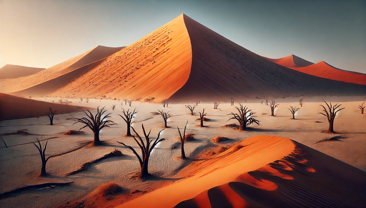
Big Daddy, another Namibian marvel, stands at 1,207 feet in Sossusvlei, within Namib-Naukluft National Park. This towering dune is set against the surreal backdrop of Dead Vlei, a white salt pan dotted with ancient, sun-scorched acacia trees. The dune’s fiery red hue is a result of iron oxidation over millions of years.
Climbing Big Daddy is a rite of passage for many visitors. At the top, climbers are greeted with breathtaking views of the surrounding desert and the chance to sprint or slide down the soft sands—a thrilling and memorable experience.
#3: Cerro Blanco – 6,824 feet above sea level
Cerro Blanco, located in Peru near the Nazca Desert, is often regarded as the tallest sand dune in the world when measured from base to summit. Though its height above sea level is 6,824 feet, the dune itself towers about 3,860 feet above its surroundings.
This massive dune attracts sandboarding enthusiasts and adventurous trekkers. Its proximity to the Nazca Lines, mysterious ancient geoglyphs, adds an extra layer of intrigue. Local lore describes the dune as a sacred site, tying it to the spiritual beliefs of the region’s indigenous peoples.
#4: Star Dune – 750 feet
Star Dune in Colorado’s Great Sand Dunes National Park rises 750 feet above the surrounding valley floor. This uniquely shaped dune, formed by multidirectional winds, is a geological wonder and the tallest dune in North America.
The climb to Star Dune’s peak is a challenge, but the 360-degree views of the Sangre de Cristo Mountains and the expansive dune field below make it worthwhile. The park is also a hotspot for stargazing, as its remote location offers some of the darkest skies in the U.S.
#5: Badain Jaran Dunes – 1,200 feet
The Badain Jaran Desert in China is home to some of the tallest sand dunes in the world, reaching up to 1,200 feet. These dunes are stabilized by underground water sources, creating hidden lakes that punctuate the arid landscape.
The interplay between towering sand dunes and shimmering lakes creates an otherworldly beauty. Stories of ancient caravans traversing these dunes add a sense of mystery and adventure to this remote region.
#6: Eureka Dunes – 680 feet
Eureka Dunes, located in California’s Death Valley National Park, rise to 680 feet, making them the tallest dunes in North America. Known for their “singing sands,” a phenomenon where the shifting grains produce a deep, humming sound, they are both a scientific curiosity and a natural wonder.
Visitors are encouraged to tread lightly on these fragile dunes, which are home to several endemic plant species. The unique blend of science, history, and natural beauty makes Eureka Dunes a fascinating destination.
#7: Mount Tempest – 935 feet above sea level
Mount Tempest, located on Moreton Island in Australia, is the tallest coastal sand dune in the world, rising 935 feet above sea level. Its stunning location near Brisbane makes it a popular destination for visitors seeking outdoor adventure and panoramic views of the surrounding ocean and island.
The dune is steeped in Aboriginal culture, with stories and traditions linking it to the island’s rich history. It remains a confirmation to the interplay between natural beauty and cultural significance.
#8: Rig-e Jenn – 1,000 feet
Located in Iran’s Dasht-e Kavir Desert, the Rig-e Jenn dunes rise up to 1,000 feet and are shrouded in mystery. Known as the “Dune of the Jinn,” local legends attribute supernatural occurrences to this remote and forbidding landscape.
While the dunes are challenging to navigate, their untouched beauty and cultural lore attract adventurers and researchers alike. They are a confirmation to the power of wind and time in shaping our planet’s surface.
#9: Khongoryn Els – 984 feet
Khongoryn Els, also known as the “Singing Dunes,” rise up to 984 feet in Mongolia’s Gobi Desert. These massive dunes stretch over 60 miles and produce a melodious sound when the sand shifts, creating an unforgettable experience for visitors.
Surrounded by stark desert and rugged mountains, Khongoryn Els offer a glimpse into the nomadic lifestyle of Mongolia’s herders. Camel treks and yurt stays make the journey to these dunes a cultural and natural adventure.
#10: Skeleton Dunes – 820 feet
Skeleton Dunes, located along Namibia’s Skeleton Coast, reach heights of 820 feet. These dunes are sculpted by powerful winds and sit alongside a coastline famous for shipwrecks and desolate beauty.
The juxtaposition of the Atlantic Ocean’s crashing waves and the towering dunes creates a hauntingly beautiful scene. The area’s name and history evoke tales of survival and exploration, drawing adventurous travelers to this remote part of the world.
The world’s largest sand dunes are breathtaking examples of nature’s artistry, each with its own unique features, history, and stories. From Namibia’s towering Dune 7 to the melodic Khongoryn Els in Mongolia, these natural monuments remind us of the timeless forces shaping our planet. Whether visited for adventure, research, or awe, sand dunes continue to inspire wonder and respect for Earth’s dynamic landscapes.
More Great Top 10’s
Sand Dunes and Maps
Sand dunes and maps are a mesmerizing blend of nature’s artistry and human exploration, where the shifting sands of time meet the precision of cartographic lines. On a map, sand dunes may appear as undulating contours or shaded expanses, but in reality, they are living landscapes, constantly molded by the whisper and roar of the wind. Each dune tells a story of resilience and change, shaped over centuries by the delicate balance of nature’s forces. Maps bring these vast deserts into focus, guiding adventurers to their towering peaks and revealing the hidden lakes, oases, and ecosystems that thrive against the odds. The ripples of the Sahara, the melodic sands of the Gobi, and the coastal giants of Namibia come alive on a map, inviting the imagination to wander across arid seas of golden grains. Maps also capture the history embedded in these dunes—ancient trade routes, tales of survival, and the mysteries of civilizations that once thrived in their shadow. Together, sand dunes and maps celebrate the harmony between the ephemeral beauty of nature and the enduring curiosity of humanity, urging us to explore, respect, and preserve these fragile wonders.
Learn more about Maps
- Topographical Maps: Representation of the physical features of a region or area.
- Contour Maps: Representation of the contours of the land surface or ocean floor.
- Raised Relief Maps: Representation of land elevations with raised features indicating landforms.
- Terrain Maps: Representation of the physical features of a terrain or landmass.
- USGS Topographic Maps: Representation of topographic features and land elevations based on USGS data.
- USGS Historical Topographic Maps: Representation of historical topographic maps created by the USGS.
- Watershed Maps: Representation of the areas where water flows into a particular river or lake.
- Elevation Maps: Representation of land and water elevations with high precision.
- Physical Maps: Representation of physical features of the Earth’s surface such as landforms, oceans, and plateaus.
- Bathymetric Maps: Representation of the topography and features of the ocean floor.
- NOAA Maps: Representation of atmospheric, oceanographic, and environmental data by NOAA.
- Nautical Maps: Representation of the underwater features and depth of an area for navigation purposes.
- Geologic Maps: Representation of the geologic features of an area such as rock types, faults, and folds.
- Satellite Maps: Representation of earth from high-definition satellite imagery.
Contact us today to learn more about our services and how we can help you achieve your goals.

