Top 10 Clearest Lakes in the United States
Top 10 Clearest Lakes in the United States
WhiteClouds builds 3D Raised Relief Maps
The United States is home to some of the clearest lakes in the world, their pristine waters offering a glimpse into natural beauty and tranquility. These lakes, with their sparkling clarity, reflect stunning landscapes, from snow-capped peaks to lush forests, making them ideal destinations for adventurers, photographers, and nature lovers. Here are the top 10 clearest lakes in the U.S., ranked by their size and celebrated for their breathtaking transparency and stories.
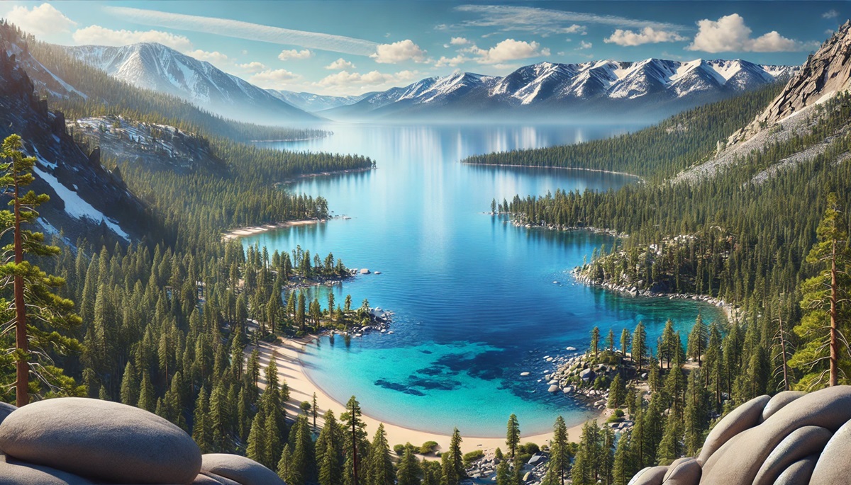
#1: Lake Tahoe – 6,225 feet above sea level
Lake Tahoe, straddling the California-Nevada border, is a jewel of the Sierra Nevada mountains. Known for its astonishing clarity and vibrant blue hues, Lake Tahoe is the largest alpine lake in North America. Its crystal-clear waters are the result of natural filtration and low levels of fine sediment, allowing visibility down to 70 feet.
Lake Tahoe is not only a paradise for outdoor enthusiasts but also steeped in cultural significance. The Washoe people regarded the lake as a sacred site long before it became a hub for tourism. Today, visitors flock to its shores for boating, hiking, and skiing in the surrounding mountains.
#2: Crater Lake – 6,178 feet above sea level
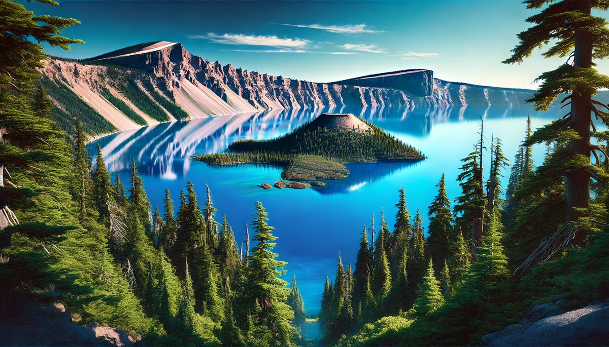
Crater Lake in Oregon is famed for its vivid blue color and extraordinary clarity, boasting visibility up to 100 feet deep. This lake, formed within the remnants of an ancient volcanic crater, is the deepest lake in the U.S. at 1,943 feet.
Crater Lake’s pristine waters are fed solely by rain and snow, making it one of the cleanest lakes in the world. Its dramatic setting, surrounded by cliffs and the iconic Wizard Island, offers a surreal experience. Visitors often recount the mystical beauty of the lake, describing it as a place of profound stillness and natural wonder.
#3: Flathead Lake – 2,893 feet above sea level
Flathead Lake in Montana is the largest natural freshwater lake west of the Mississippi River. Its exceptionally clear waters, surrounded by the scenic Mission Mountains, make it a popular destination for fishing, boating, and kayaking.
Flathead Lake’s clarity is attributed to the clean mountain streams that feed it and its gravelly shoreline. Anecdotes from locals often highlight the vibrant underwater views, where rocks and fish are visible from boats and docks. The lake’s islands, including Wild Horse Island, add to its allure with rich wildlife and hiking trails.
#4: Torch Lake – 600 feet above sea level
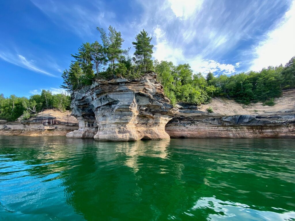
Torch Lake, located in Michigan, is famous for its Caribbean-like turquoise waters. As one of the deepest inland lakes in Michigan, Torch Lake offers exceptional clarity, with visibility up to 30 feet.
Known as a summer hotspot, Torch Lake attracts visitors for boating, swimming, and its famous sandbars. Its clarity and unique coloration have inspired many to call it one of the most beautiful lakes in the Midwest.
#5: Lake George – 320 feet above sea level
Lake George in New York is often called the “Queen of American Lakes” for its stunning beauty and clear waters. Nestled in the Adirondack Mountains, this lake offers a combination of natural splendor and rich history, including Revolutionary War landmarks.
Visitors to Lake George often share stories of its tranquil bays and underwater views. The lake’s clarity is maintained by strict environmental protections, making it a pristine retreat for nature lovers.
#6: Hanging Lake – 7,322 feet above sea level
Hanging Lake in Colorado is a small yet breathtakingly clear lake known for its vibrant aquamarine color. Located high in Glenwood Canyon, this lake is fed by waterfalls and surrounded by lush vegetation.
Accessible only by a steep hike, Hanging Lake offers a secluded, magical experience. Its clarity is due to the mineral-rich waters that sustain its unique ecosystem, including hanging plant gardens and rare trout.
#7: Newfound Lake – 589 feet above sea level
Newfound Lake in New Hampshire is celebrated for its crystal-clear waters, considered among the cleanest in the country. This glacial lake is a favorite for swimming, boating, and camping.
Local legends speak of the lake’s early settlers, who marveled at its pristine condition. Today, it remains a cherished natural treasure, surrounded by small towns and forested hills.
#8: Lake Chelan – 1,100 feet above sea level
Lake Chelan in Washington State is a 50-mile-long fjord-like lake renowned for its clear, deep waters. Surrounded by vineyards and mountains, Lake Chelan is both a recreational paradise and a serene retreat.
The lake’s unique geography, with steep, glacial-carved walls, contributes to its clarity and depth. Visitors often explore its waters by boat, marveling at the vibrant underwater views and scenic shoreline.
#9: Lake Coeur d’Alene – 2,128 feet above sea level
Located in Idaho, Lake Coeur d’Alene is a popular destination for its sparkling blue waters and surrounding forested hills. Its clarity and natural beauty draw visitors year-round for activities like boating, fishing, and hiking.
The lake’s history includes steamboat travel during the mining boom of the 19th century. Today, it is celebrated for its peaceful charm and vibrant local culture.
#10: Mono Lake – 6,381 feet above sea level
Mono Lake in California is a unique saline lake known for its otherworldly tufa formations and brilliant clarity. Its high salinity creates buoyant waters that teem with brine shrimp, attracting millions of migratory birds.
Mono Lake’s stark beauty and ecological importance have inspired efforts to preserve its fragile environment. Visitors are captivated by its serene waters and the dramatic backdrop of the Sierra Nevada.
The clearest lakes in the U.S. offer more than just transparent waters; they are windows into natural and cultural treasures. From the volcanic depths of Crater Lake to the vibrant blues of Torch Lake, these aquatic wonders invite exploration and appreciation for their pristine beauty. Whether you seek adventure or tranquility, these lakes promise unforgettable experiences that connect us to the profound purity of nature.
More Great Top 10’s
Lakes and Maps
Lakes and maps are like mirrors to the Earth’s soul, revealing hidden treasures of serenity and adventure. On a map, a lake is often a serene blue patch, outlined by lines that hint at its size and shape, but in reality, each lake is a living, breathing entity. These bodies of water are sanctuaries of biodiversity, cultural stories, and geological wonders. A lake on a map might represent glacial origins, volcanic craters, or meandering rivers brought to a halt, now cradling life in their depths. Maps lead explorers to these watery havens, guiding them through winding trails to the crystal-clear shores of Tahoe or the shimmering reflections of Michigan’s Torch Lake. Each contour and coordinate on the map invites us to imagine the cool ripples, the mountain reflections, or the echo of a loon’s call at dusk. Lakes are storytellers, holding ancient myths, local legends, and tales of settlers and adventurers who found solace or sustenance along their shores. Together, lakes and maps inspire journeys into nature’s peaceful embrace, offering us not just directions but also a sense of wonder and a call to protect these fragile gems.
Learn more about Maps
- Topographical Maps: Representation of the physical features of a region or area.
- Contour Maps: Representation of the contours of the land surface or ocean floor.
- Raised Relief Maps: Representation of land elevations with raised features indicating landforms.
- Terrain Maps: Representation of the physical features of a terrain or landmass.
- USGS Topographic Maps: Representation of topographic features and land elevations based on USGS data.
- USGS Historical Topographic Maps: Representation of historical topographic maps created by the USGS.
- Watershed Maps: Representation of the areas where water flows into a particular river or lake.
- Elevation Maps: Representation of land and water elevations with high precision.
- Physical Maps: Representation of physical features of the Earth’s surface such as landforms, oceans, and plateaus.
- Bathymetric Maps: Representation of the topography and features of the ocean floor.
- NOAA Maps: Representation of atmospheric, oceanographic, and environmental data by NOAA.
- Nautical Maps: Representation of the underwater features and depth of an area for navigation purposes.
- Geologic Maps: Representation of the geologic features of an area such as rock types, faults, and folds.
- Satellite Maps: Representation of earth from high-definition satellite imagery.
Contact us today to learn more about our services and how we can help you achieve your goals.

