Adirondak Mountains Raised Relief Mapc

Adirondack Mountains Raised Relief Map

We Build Custom 3D Raised Relief Maps

Did you know we make

Adirondack Mountains Raised Relief Maps?

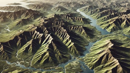
Aridondak Mountains Raised Relief Map 2

Adirondack Mountains Raised Relief Map: A Journey Through the Majestic Peaks of New York

The Adirondack Mountains, nestled in upstate New York, are a breathtaking expanse of natural beauty, home to dense forests, serene lakes, and over 46 towering peaks that exceed 4,000 feet in elevation.  Covering over six million acres, this region is not only one of the largest protected parks in the contiguous United States but also a testament to the grandeur of untouched wilderness.  Capturing this vast and varied landscape in a single map is no small feat, yet the Adirondack raised relief map does so with stunning precision and artistry.

Unlike traditional flat maps, raised relief maps bring the region’s topography to life, offering a three-dimensional view of its terrain.  These maps provide a tactile and visual exploration of the Adirondacks’ peaks, valleys, rivers, and lakes, making them an invaluable tool for hikers, educators, geographers, and nature enthusiasts.

Raised Relief 3D Maps


Why an Adirondack Raised Relief Map Is a Must-Have for Nature Lovers

The Adirondack region is a haven for adventurers and explorers.  Its mountains beckon climbers, its trails entice hikers, and its waterways invite kayakers and canoeists.  The raised relief map transforms this vast, complex landscape into an accessible format that allows enthusiasts to plan, explore, and reminisce about their adventures.

For a hiker, tracing the High Peaks on a raised relief map provides an immersive preview of the journey.  The ascent of Mount Marcy, the highest peak in New York, feels palpable as your fingers glide over the rugged contours.  Similarly, paddlers exploring Lake George or Saranac Lake can visualize their routes in vivid detail.  These maps are not just tools; they are invitations to connect with the land on a deeper level.

How Raised Relief Maps Are Crafted: The Art of Precision and Creativity

Creating an Adirondack raised relief map involves a fascinating blend of science, technology, and craftsmanship.  The process begins with the acquisition of accurate geographical data and culminates in a physical model that reflects the region’s topographical intricacies.

  • Topographical Data Collection:  The foundation of a raised relief map lies in precise topographical data.  This information, often sourced from organizations like the U.S. Geological Survey (USGS), includes detailed measurements of elevation, terrain, and natural features.  Advances in satellite imaging and LiDAR technology have significantly enhanced the accuracy and resolution of this data.
  • Digital Terrain Modeling:  The data is then translated into a Digital Elevation Model (DEM) using specialized software.  This 3D digital representation serves as the blueprint for the physical map.  The cartographer adjusts the vertical exaggeration to ensure that the Adirondack peaks and valleys are visually distinct, while still maintaining accuracy.
  • Material Selection and Mold Creation:  Once the digital model is complete, it is used to create a physical mold through CNC machining or 3D printing.  These molds are typically cast in materials like resin or thermoplastics, chosen for their durability and ability to capture fine details.
  • Adding Texture and Detailing:  After the initial cast, the map is refined and textured to simulate the ruggedness of the Adirondacks.  Artists use hand tools to enhance features like cliffs, ridges, and valleys, ensuring the map’s surface mirrors the real-world terrain.
  • Painting and Labeling:  The map is brought to life with carefully applied colors. Artists use greens for forests, blues for water bodies, and earth tones for rocky areas. Features like mountain peaks, rivers, and hiking trails are labeled using decals or precision engraving, making the map both visually appealing and highly functional.
  • Final Assembly and Quality Control:  The completed map is mounted onto a sturdy backing and may be framed or laminated for added durability.  Rigorous quality checks ensure that every detail is accurate and visually stunning before the map reaches its audience.


Discovering the High Peaks Region in Raised Relief

The Adirondack High Peaks are a central feature of any raised relief map of the region. These 46 peaks, each with an elevation above 4,000 feet, are the crown jewels of the park. A raised relief map allows adventurers to explore these peaks in a whole new way.

  • Mount Marcy:   The highest point in New York at 5,344 feet, Mount Marcy’s prominence is vividly depicted, showing the challenge that awaits climbers.
  • Algonquin Peak:  The second-highest peak, known for its sweeping views and challenging ascent, stands tall and unmistakable on the map.
  • Cascade and Porter Mountains:  These peaks are popular for beginner climbers, and their proximity to trails and roads is clearly illustrated.

The raised relief map captures the intricate connections between these peaks and the surrounding valleys, offering an invaluable perspective for planning expeditions.

A Celebration of the Adirondack Lakes and Rivers

The Adirondack region is dotted with over 3,000 lakes and 30,000 miles of rivers and streams. A raised relief map beautifully portrays these waterways, highlighting their role in shaping the region’s geography and ecology.

  • Lake George:  Known as the “Queen of American Lakes,” its long, narrow expanse is prominently featured on the map.
  • Saranac Lakes:  These interconnected lakes are shown in stunning detail, offering insight into their navigation routes.
  • Hudson River:   Its origin in the Adirondacks and subsequent journey south is a key feature that maps capture elegantly.

For paddlers and anglers, the map provides a detailed view of the waterways, revealing hidden coves, islands, and access points.

Educational Value: Teaching the Adirondacks Through Raised Relief Maps

In classrooms, an Adirondack raised relief map is a powerful educational tool.  Geography lessons come to life as students can see and feel the ruggedness of the region.  Concepts like watersheds, elevation changes, and glacial geology become tangible, helping students develop a deeper understanding of the natural world.

These maps also offer lessons in conservation.  The Adirondacks are a model of environmental protection, balancing recreation with preservation.  The visual and tactile nature of a raised relief map fosters an appreciation for the delicate ecosystems within the park.

An Artistic and Functional Addition to Any Space

Adirondack raised relief maps are not only functional but also visually stunning.  Their intricate textures and vibrant colors make them a perfect addition to homes, offices, and visitor centers.  Whether displayed as a centerpiece in a living room or used as a reference in a ranger station, these maps captivate anyone who views them.

For interior designers, they offer a unique blend of art and geography.  Framed and mounted, they become conversation starters, inspiring stories of adventures and sparking curiosity about the natural world.

For Collectors, an Adirondack Raised Relief Map Is a Treasured Piece

Map enthusiasts and collectors value raised relief maps for their craftsmanship and historical significance.  A detailed Adirondack map serves as both a work of art and a scientific artifact, showcasing the region’s geography in an unforgettable way.  Collectors often seek custom or vintage maps that highlight specific features or historical changes in the landscape.

A Tribute to the Adirondacks’ Timeless Beauty

The Adirondack raised relief map is more than a representation of geography—it’s a tribute to one of America’s most iconic natural regions.  It captures the awe-inspiring grandeur of the mountains, the serenity of the lakes, and the interconnectedness of the ecosystems in a format that is as educational as it is artistic.

Whether you’re a hiker, a geographer, an educator, or a nature lover, an Adirondack raised relief map invites you to connect with this rugged wilderness in a tangible and meaningful way. It’s a celebration of the land, its history, and the adventures it inspires, making it an essential addition to any collection.
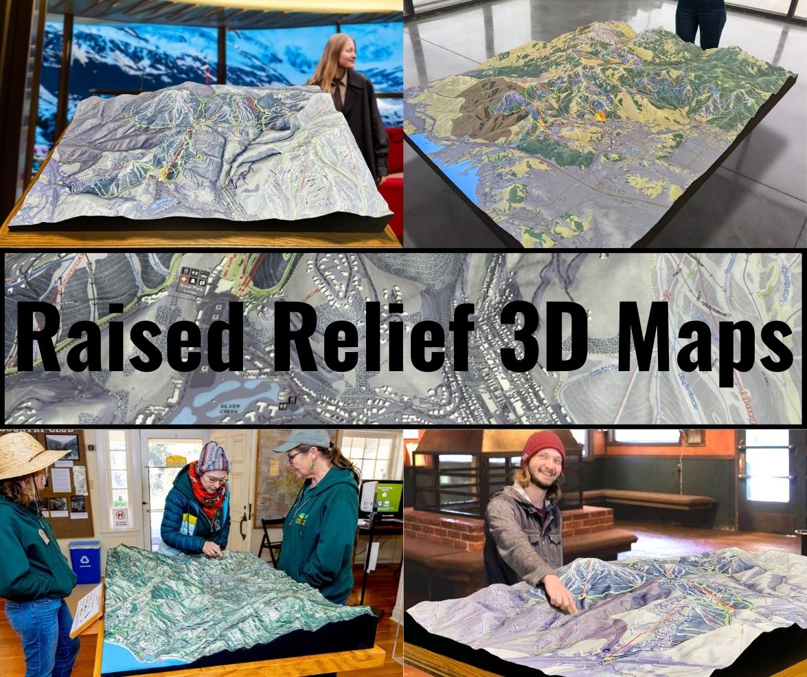
  

Check out WhiteClouds’ 3D Maps for more information on Adirondack Mountain raised relief maps.  

Contact us today to learn more about our 3D services and how we can help you achieve your goals.     

Get a free quote

Get a Free Quote on a Custom 3D Billboard

Get a Free Quote