Blue Ridge Mountains Raised Relief Map

Blue Ridge Mountains Raised Relief Map

We Build Custom 3D Raised Relief Maps

Did you know we make

Blue Ridge Mountains Raised Relief Maps?

BlueRidge Mountains Raised Relief Map

Blue Ridge Mountains Raised Relief Map: A Tactile Journey Through Appalachia’s Iconic Peaks

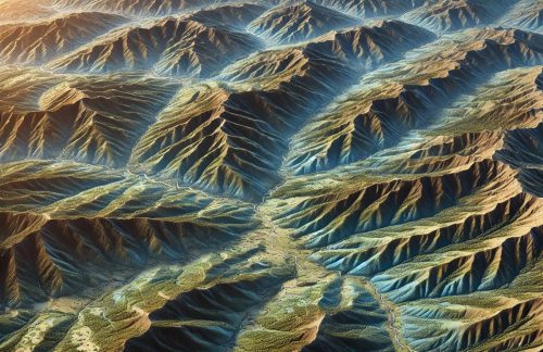
The Blue Ridge Mountains, an iconic part of the Appalachian chain, stretch from southern Pennsylvania to northern Georgia, offering a landscape of rolling peaks, verdant valleys, and dense forests.  Known for their misty blue haze and historic significance, these mountains are a treasure trove of natural beauty, biodiversity, and cultural heritage.  A raised relief map of the Blue Ridge Mountains transforms this stunning region into a tangible, three-dimensional representation, allowing enthusiasts to explore its geographic intricacies in vivid detail.

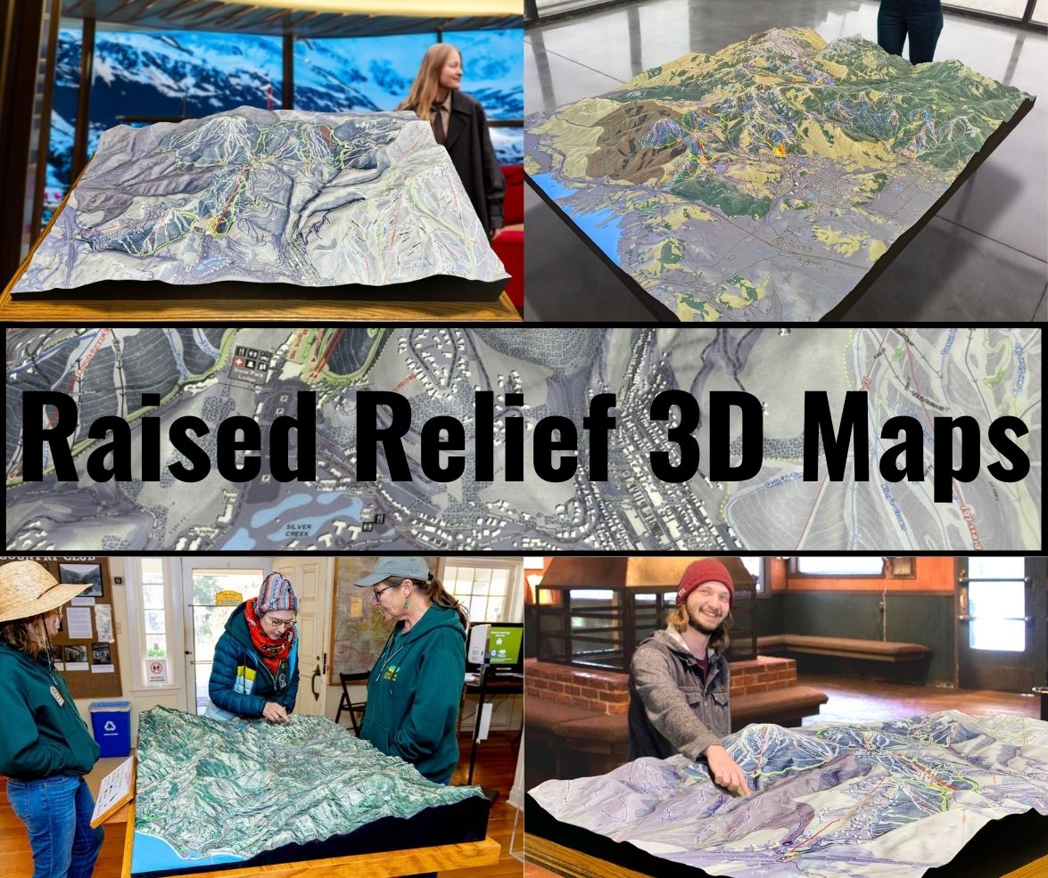
Unlike traditional flat maps, raised relief maps add a new dimension to the viewing experience.  From the undulating ridgelines of the Shenandoah Valley to the lofty heights of Mount Mitchell, the highest peak east of the Mississippi, these maps invite viewers to physically engage with the terrain, making them invaluable tools for education, adventure planning, and artistic display.

Raised Relief 3D Maps


Why a Blue Ridge Mountains Raised Relief Map Is a Must-Have

The Blue Ridge Mountains are more than just a geographic feature; they are a confirmation to the forces of nature and time.  The raised relief map brings this story to life by highlighting key aspects of the region, from its ancient geology to its role in shaping human history.

For educators, this map offers a hands-on tool to teach geography, geology, and environmental science.  Students can trace the paths of rivers, follow ridgelines, and identify key landmarks.  For adventurers and travelers, the map provides a practical guide to the region’s hiking trails, scenic drives, and recreational areas.  For history buffs, it offers a deeper understanding of how the terrain influenced events like migration and settlement patterns.

The Art and Science of Crafting a Raised Relief Map of the Blue Ridge Mountains

Creating a raised relief map of the Blue Ridge Mountains is an intricate process that blends cutting-edge technology with meticulous craftsmanship.  Every feature, from the smallest valley to the tallest peak, is rendered with precision to ensure an accurate and visually stunning result.

  • Data Collection and Terrain Modeling:  The process begins with gathering detailed topographical data from reliable sources like the U.S. Geological Survey (USGS).  This data includes elevation profiles, landforms, and hydrological features.  Using specialized software, cartographers create a Digital Elevation Model (DEM), which serves as the foundation for the map.
  • Adjusting Scale and Vertical Exaggeration:  To make the Blue Ridge Mountains’ features visually distinct, vertical exaggeration is often applied.  This technique enhances the prominence of ridgelines and valleys, ensuring that features like the Shenandoah River and the Great Smoky Mountains stand out.
  • Mold Creation and Material Casting:   The DEM is translated into a physical mold using CNC machining or 3D printing.  This mold is then used to cast the map in durable materials such as resin or thermoplastics, which capture fine details with remarkable accuracy.
  • Texturing and Detailing:  Artists refine the map by adding textures that mimic the natural features of the Blue Ridge Mountains. Rugged peaks, rolling foothills, and smooth river valleys are carefully sculpted to create a tactile and visually engaging surface.
  • Painting and Labeling:  The map is brought to life with vibrant colors.  Greens represent the forests that blanket much of the region, blues highlight rivers and lakes, and earth tones define rocky outcrops and open areas.  Key features such as peaks, trails, and cities are labeled for clarity and functionality.
  • Mounting and Quality Assurance:  The finished map is mounted onto a sturdy backing, framed, or laminated for durability.  Each piece undergoes rigorous quality checks to ensure accuracy and visual appeal before it reaches its audience.


Exploring the Geographic Highlights of the Blue Ridge Mountains in Raised Relief

The Blue Ridge Mountains raised relief map captures the region’s most iconic features, offering a detailed view of its diverse landscapes.

  • Mount Mitchell:  The highest point in the Blue Ridge and the eastern United States, Mount Mitchell’s prominence is vividly rendered, showcasing its majestic rise above the surrounding terrain.
  • Shenandoah National Park:  The ridgelines and valleys of this park are beautifully depicted, highlighting features like Skyline Drive and the Appalachian Trail.
  • Great Smoky Mountains:  Part of the Blue Ridge chain, this area’s dense forests and rolling peaks come to life, showcasing its status as a UNESCO World Heritage Site.
  • The Blue Ridge Parkway:  The map traces this famous scenic route, revealing its winding path through the mountains and its proximity to natural landmarks.
  • Rivers and Waterfalls:  Key waterways like the James River, New River, and the French Broad River are depicted in stunning detail, along with the region’s many waterfalls.

A Journey Through Time: The Geologic Story of the Blue Ridge Mountains

The Blue Ridge Mountains are among the oldest ranges on Earth, their origins dating back over a billion years.  A raised relief map captures not just the geography but also the geological history of the region, illustrating how time and natural forces have shaped the land.

  • Ancient Formations:  The folded and faulted terrain reflects the tectonic activity that created the Appalachians during the collision of ancient landmasses.
  • Erosion and Weathering: Over millions of years, wind and water have sculpted the Blue Ridge Mountains into their current form, creating rolling ridges and deep valleys.
  • Rivers as Sculptors:  Waterways like the Shenandoah and James Rivers have carved through the mountains, leaving behind dramatic gorges and fertile valleys.

Educational Value: Teaching Geography and Ecology

For educators, a Blue Ridge Mountains raised relief map is an invaluable teaching tool.  Its tactile design makes abstract concepts like elevation and watershed dynamics more accessible, while its detailed labeling provides context for lessons on geology, ecology, and conservation.

Students can trace the Appalachian Trail, study the region’s biodiversity, and explore how the geography influences climate and ecosystems.  This hands-on approach fosters a deeper understanding of the natural world.

A Stunning Addition to Any Space

Beyond its educational value, a raised relief map of the Blue Ridge Mountains is a work of art. Its intricate details and vibrant colors make it a striking addition to homes, offices, and visitor centers.  Whether displayed as a centerpiece in a study or used as a reference in a park headquarters, the map captures the beauty and complexity of the region.

For travelers, it serves as a way to relive past adventures or plan new ones.  For designers, it offers a unique blend of utility and aesthetic appeal, adding depth and character to any space.

A Collector’s Delight: The Timeless Appeal of Raised Relief Maps

Collectors of maps and geographic artifacts appreciate raised relief maps for their craftsmanship and ability to bring geography to life.  A raised relief map of the Blue Ridge Mountains, with its blend of scientific accuracy and artistic beauty, is a prized addition to any collection.  Custom maps that highlight specific regions, such as Shenandoah National Park or the Great Smoky Mountains, are particularly sought after.

Celebrating the Blue Ridge Mountains in Three Dimensions

A raised relief map of the Blue Ridge Mountains is more than a tool for understanding geography—it’s a celebration of the natural beauty and cultural significance of this iconic region. It captures the rolling ridges, deep valleys, and winding rivers in a way that inspires curiosity and appreciation.

Whether you’re an educator, adventurer, geographer, or nature enthusiast, a raised relief map of the Blue Ridge Mountains invites you to explore its landscapes in a tangible and meaningful way. It’s a reminder of the forces that have shaped the land and an invitation to connect with the timeless beauty of Appalachia.  In an era of digital screens, these tactile maps provide a refreshing and engaging way to experience the geography of the Blue Ridge Mountains.
  

Check out WhiteClouds’ 3D Maps for more information on Blue Ridge Mountains raised relief maps.  

Contact us today to learn more about our 3D services and how we can help you achieve your goals.     

Get a free quote

Get a Free Quote on a Custom 3D Billboard

Get a Free Quote