Bolton Valley Resort 3D Maps
Bolton Valley Resort 3D Maps
We Build Custom 3D Bolton Valley Resort Maps
Bolton Valley Resort 3D Maps: Enhancing the Experience of Vermont’s Hidden Ski Gem
Nestled in the scenic Green Mountains of Vermont, Bolton Valley Resort is a hidden gem for outdoor enthusiasts. Known for its expansive terrain, family-friendly atmosphere, and adventurous vibe, Bolton Valley attracts both casual skiers and expert riders looking for a challenge. However, to truly unlock all that Bolton Valley has to offer, you need more than just a traditional map. The introduction of 3D maps at Bolton Valley has revolutionized the way skiers interact with the mountain. These maps offer an immersive and comprehensive view of the terrain, capturing every twist, turn, and elevation change in stunning detail.
In this blog, we will explore how these cutting-edge 3D maps are created, their impact on skiers’ planning and safety, and we’ll dive into the major ski runs at Bolton Valley Resort. Get ready for a new perspective on one of Vermont’s best-kept secrets!

How Bolton Valley Resort 3D Maps Are Fabricated: From Data to Art
Creating a 3D map that accurately reflects the complexity of a mountain like Bolton Valley requires both advanced technology and creative artistry. The process of fabricating these maps involves precise data collection, digital design, and hands-on craftsmanship to ensure that the terrain is not only visually stunning but also functionally accurate.
Topographic Data Collection: The Heart of Precision Mapping
The foundation of any 3D map begins with capturing accurate topographic data. At Bolton Valley Resort, this is done using LiDAR (Light Detection and Ranging) technology. LiDAR works by sending laser pulses from an aircraft over the mountain terrain. These pulses bounce back from the surface of the mountain, providing precise measurements of elevation, slope, and even fine details like tree cover or rocky outcrops.
This data is collected across the entire mountain, capturing the various changes in elevation that define Bolton Valley’s unique ski terrain. The resulting measurements are processed into a highly detailed digital elevation model (DEM), which forms the blueprint for the 3D map.
LiDAR technology is incredibly effective for mountainous terrains because it can measure steep pitches, rolling slopes, and wooded areas that are difficult to map using traditional methods. This precision ensures that Bolton Valley’s 3D maps are accurate down to the smallest elevation shift, giving skiers a clear understanding of what to expect when they’re out on the slopes.
Building the Digital 3D Model: Bringing Data to Life
Once the topographic data has been collected, it’s time to create a 3D digital model using advanced computer-aided design (CAD) software. Designers work with the DEM to transform the raw elevation data into a detailed visual representation of the mountain. Every ridge, slope, and valley is modeled in 3D to reflect the true shape of the terrain.
But it’s not just the natural features that are important—Bolton Valley’s 3D maps also include key infrastructure, like ski lifts, lodges, and snowmaking systems. The trails themselves are meticulously represented and color-coded according to difficulty: green for beginners, blue for intermediates, black for advanced, and double black for expert trails.
Designers also adjust the proportions of the map to ensure it is easy to read, while maintaining the accuracy of the terrain’s features. The end result is a 3D digital model that looks and feels like Bolton Valley, offering a visual representation that helps skiers plan their day with precision.
Physical Fabrication: From Digital Models to Tangible Maps
While the digital version of Bolton Valley’s 3D map is perfect for online or app-based use, there’s something special about a physical, tangible map. To create these physical maps, the digital model is processed using 3D printing or CNC machining. These fabrication methods build the map layer by layer, with each layer representing a different elevation level on the mountain.
High-density foam or plastic materials are used to create durable, long-lasting physical 3D maps. Each slope, trail, and ridgeline is carefully recreated to match the digital model, allowing skiers to engage with the terrain before heading out onto the mountain. These physical maps are displayed at the resort’s lodges or available as souvenirs, making them functional works of art.
Painting and Detailing: Adding Color and Character to the Map
The final step in creating a Bolton Valley Resort 3D map is adding color and detail. Artists use airbrushing and painting techniques to recreate the natural elements of the mountain, from snow-covered peaks to dense tree lines and rocky sections. The ski trails are color-coded to indicate difficulty, allowing skiers to easily spot which runs suit their skill level.
Landmarks like base lodges, terrain parks, and chairlifts are also highlighted, making navigation even easier. This combination of artistic finesse and data-driven accuracy results in a map that is both visually stunning and highly functional.
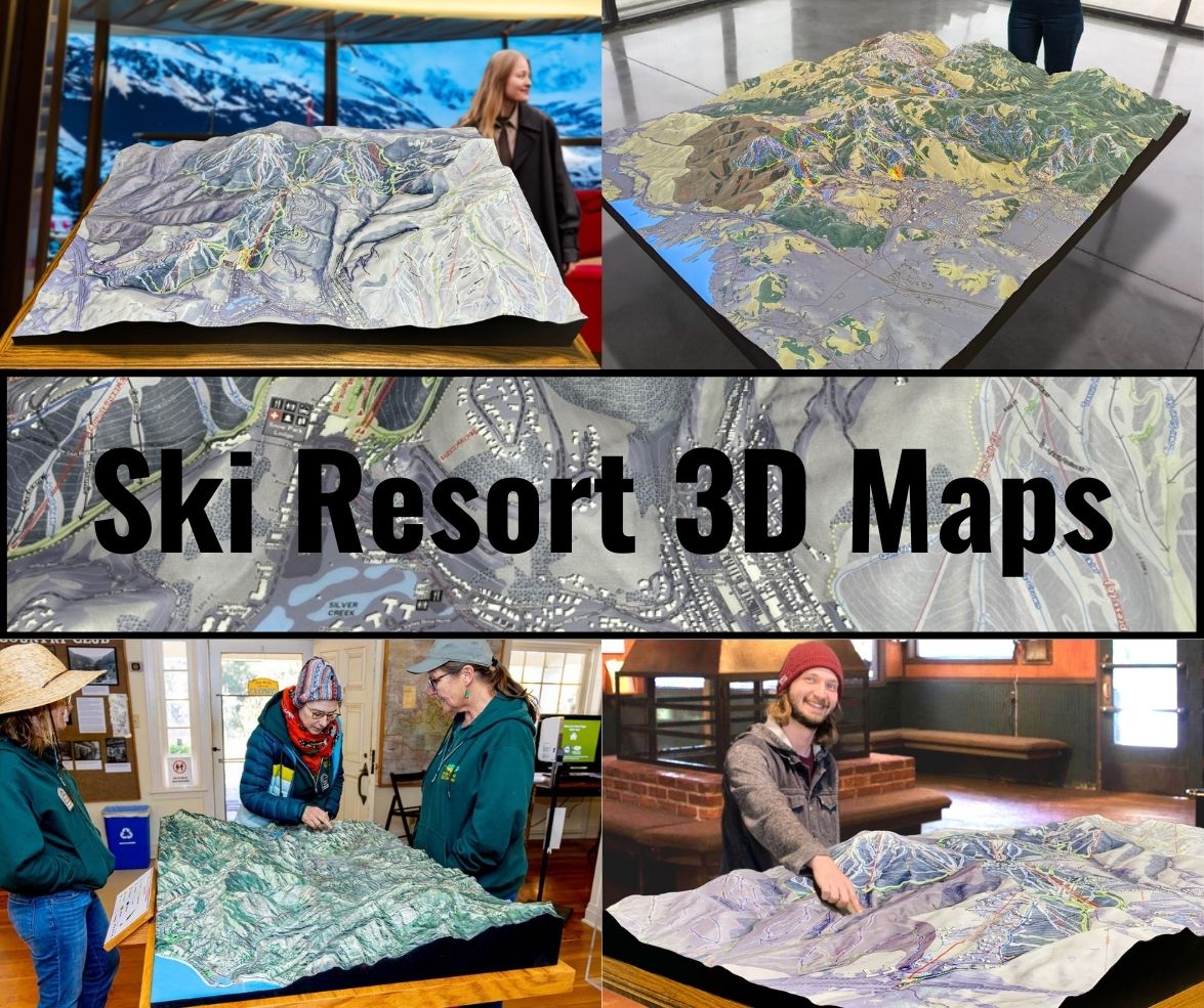
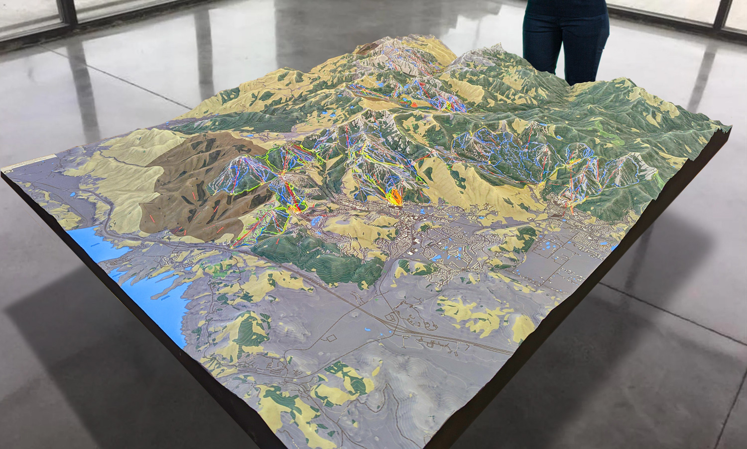
 Park City 3D Raised Relief Map
How 3D Maps Elevate the Bolton Valley Experience
For skiers, having access to a 3D map is more than just a cool visual—it’s a tool that enhances every aspect of the skiing experience. Bolton Valley’s 3D maps offer an immersive way to engage with the mountain, helping skiers make more informed decisions and navigate the terrain with confidence.
Better Route Planning
One of the biggest benefits of 3D maps is how they enable skiers to plan their day more effectively. Traditional flat maps can make it difficult to gauge the steepness of a slope or understand how trails flow together. In contrast, Bolton Valley’s 3D maps offer a lifelike representation of the terrain, allowing skiers to see exactly how steep a trail is and how it connects to other runs.
Whether you’re a beginner looking for wide, gentle slopes or an advanced skier seeking out steep black diamond runs, these 3D maps help you tailor your day to your skill level and preferences. The ability to visualize the mountain in three dimensions gives skiers confidence and ensures they don’t accidentally end up on a trail that’s too difficult for them.
Enhanced Safety and Awareness
Safety is a priority at any ski resort, and Bolton Valley’s 3D maps play a significant role in improving safety on the slopes. The detailed representation of the terrain helps skiers identify potential hazards, such as steep sections, tight turns, or tree-lined areas. By being able to anticipate the terrain before they hit the slopes, skiers can make better decisions and avoid risky situations.
In addition, the 3D maps clearly mark essential safety features like ski patrol stations, emergency access points, and rest areas. Having this information readily available on a map ensures that skiers always know where to go if they need assistance or a break.
A Deeper Connection to the Landscape
One of the most unique aspects of Bolton Valley Resort is its natural beauty. From the snowy ridgelines to the wooded glades, the landscape is stunning. Bolton Valley’s 3D maps allow skiers to appreciate this natural beauty in a new way. By providing a detailed look at the topography, these maps highlight the mountain’s unique features, from sweeping valleys to sharp peaks.
This connection to the landscape helps skiers feel more immersed in the experience. Whether you’re carving down a wide-open slope or exploring a narrow, tree-lined trail, the 3D map helps you appreciate the terrain on a deeper level.
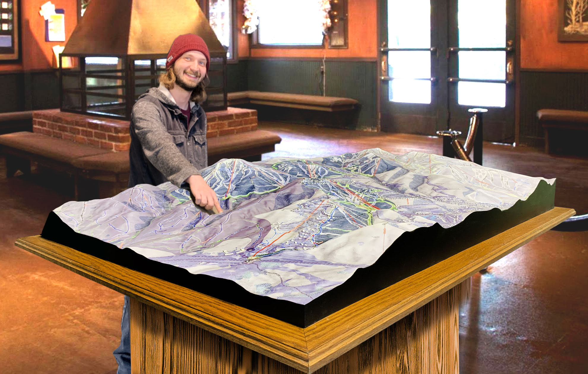
 Deer Valley 3D Raised Relief Map
Major Ski Runs at Bolton Valley Resort: A 3D Tour of the Trails
Bolton Valley Resort offers an exciting variety of ski runs that cater to every level of skier. Whether you’re just starting out or looking for expert-level challenges, Bolton Valley’s trails deliver. Here’s a look at some of the major ski runs, as seen through the lens of the 3D map.
Bear Run (Beginner): Bear Run is the perfect trail for beginners who are learning the ropes. This wide, gentle slope offers a forgiving gradient that’s ideal for practicing turns and building confidence. The 3D map highlights Bear Run’s gradual descent, showing how it winds down the lower part of the mountain, making it an excellent choice for families and new skiers.
Timberline Run (Intermediate): For intermediate skiers, Timberline Run offers a scenic and varied experience. This trail winds through wooded areas and offers stunning views of the surrounding mountains. The 3D map shows how Timberline flows seamlessly from wide, open sections to narrower tree-lined paths, giving skiers a chance to improve their skills while taking in the beauty of Bolton Valley.
Hard Luck (Advanced): Hard Luck is one of Bolton Valley’s black diamond trails, known for its steep, fast descent. This trail is designed for expert skiers who are looking for a thrilling challenge. The 3D map highlights the sharp vertical drop and technical turns, making it clear why Hard Luck is one of the most exciting runs on the mountain.
Devil’s Playground (Expert): For the most daring skiers, Devil’s Playground offers an intense ride down some of the steepest terrain at Bolton Valley. This double black diamond run features tight turns, narrow chutes, and fast drops. The 3D map captures Devil’s Playground’s intimidating landscape, giving expert skiers a preview of the adrenaline-pumping ride ahead.
Vista Glades (Intermediate/Advanced): Vista Glades offers a more natural, off-the-beaten-path experience. This trail runs through a wooded area, offering a mix of intermediate and advanced terrain. Skiers who love tree skiing will appreciate Vista Glades’ meandering path through the forest, and the 3D map shows how the trail transitions between tight tree-lined sections and more open clearings.
Conclusion: Bolton Valley Resort 3D Maps—A Game-Changer for Skiers
Bolton Valley Resort’s 3D maps are more than just a tool—they’re a transformative way to experience the mountain. These maps provide detailed, accurate depictions of the terrain, helping skiers of all levels plan their routes, improve their safety, and connect more deeply with the landscape. Whether you’re a first-time visitor or a Bolton Valley regular, the 3D maps offer an immersive, informative, and exciting way to explore one of Vermont’s best ski destinations.
Check out WhiteClouds’ 3D Maps for more information on 3D maps of Bolton Valley Ski Resort.
