Bristol Mountain 3D Maps
Bristol Mountain 3D Maps
We Build Custom 3D Bristol Mountain Maps
Discovering Bristol Mountain in 3D: A New Perspective on Skiing in the Finger Lakes
Bristol Mountain, located in the heart of New York’s Finger Lakes region, is a premier ski destination that draws winter enthusiasts from across the state. With the highest vertical rise between the Adirondacks and the Rocky Mountains—standing at 1,200 feet—Bristol Mountain boasts a variety of terrain suited for skiers and snowboarders of all skill levels. Its unique combination of natural beauty, varied trails, and modern facilities makes it an irresistible destination for winter sports lovers. Adding to the experience are Bristol Mountain’s innovative 3D maps, which provide a dynamic and immersive way to explore the mountain and its expansive ski runs.
Unlike traditional flat maps, Bristol Mountain’s 3D maps offer a detailed view of the mountain’s terrain, making it easier for skiers to visualize the slopes, plan their routes, and navigate the resort. These maps provide an accurate representation of the landscape, capturing the mountain’s elevation, trails, and natural features in a way that enhances the skiing and snowboarding experience. In this blog, we will dive deep into how these 3D maps are created, why they enhance the visitor experience, and explore the major ski runs that make Bristol Mountain a must-visit destination for winter sports.

Fabricating Bristol Mountain 3D Maps: The Blend of Technology and Artistry
Creating 3D maps for a ski resort like Bristol Mountain is no small task. It requires a perfect blend of advanced technology and artistic skill to bring the mountain’s terrain to life in a way that is both accurate and visually engaging. The process begins with the collection of topographical data using sophisticated tools like LiDAR (Light Detection and Ranging) and satellite imagery, which provide precise measurements of the landscape.
LiDAR technology is particularly effective for creating 3D maps of ski resorts because it uses laser pulses to capture detailed information about the mountain’s surface. The laser pulses are directed at the terrain, and the time it takes for the light to bounce back is measured, allowing cartographers to gather highly accurate elevation data. This method allows mapmakers to capture even the smallest details of Bristol Mountain’s terrain, from its steepest slopes to its gently rolling hills.
Once the raw data is collected, Geographic Information Systems (GIS) software is used to process the information and create a Digital Elevation Model (DEM). This DEM forms the foundation of the 3D map, offering a digital representation of the mountain’s contours, elevation changes, and slope angles. With this model in place, designers can then begin refining the map by adding the necessary details that make it usable and visually appealing.
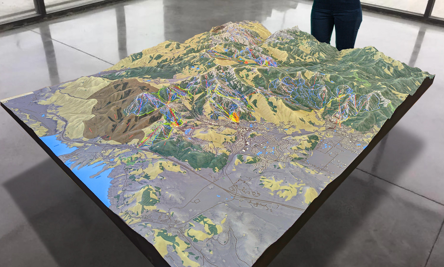
The next step in the fabrication process is to enhance the DEM with textures, colors, and shading to create a fully rendered 3D map. Designers use specialized software to add visual elements that reflect the natural beauty of the mountain. Snow-covered slopes are depicted in bright white, while wooded areas are shaded in shades of green and brown. These visual cues make it easy for skiers and snowboarders to identify different areas of the mountain and understand the layout of the terrain.
In addition to depicting the natural features of the mountain, the 3D map includes key elements such as ski trails, lift lines, and resort amenities. Each ski trail is color-coded to indicate its difficulty level—green for beginner, blue for intermediate, and black for advanced—making it easy for skiers to find the trails that suit their abilities. These details are essential for helping visitors plan their routes and navigate the mountain efficiently.
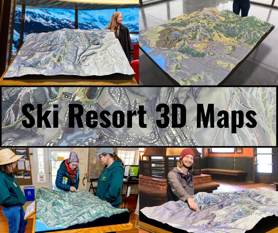
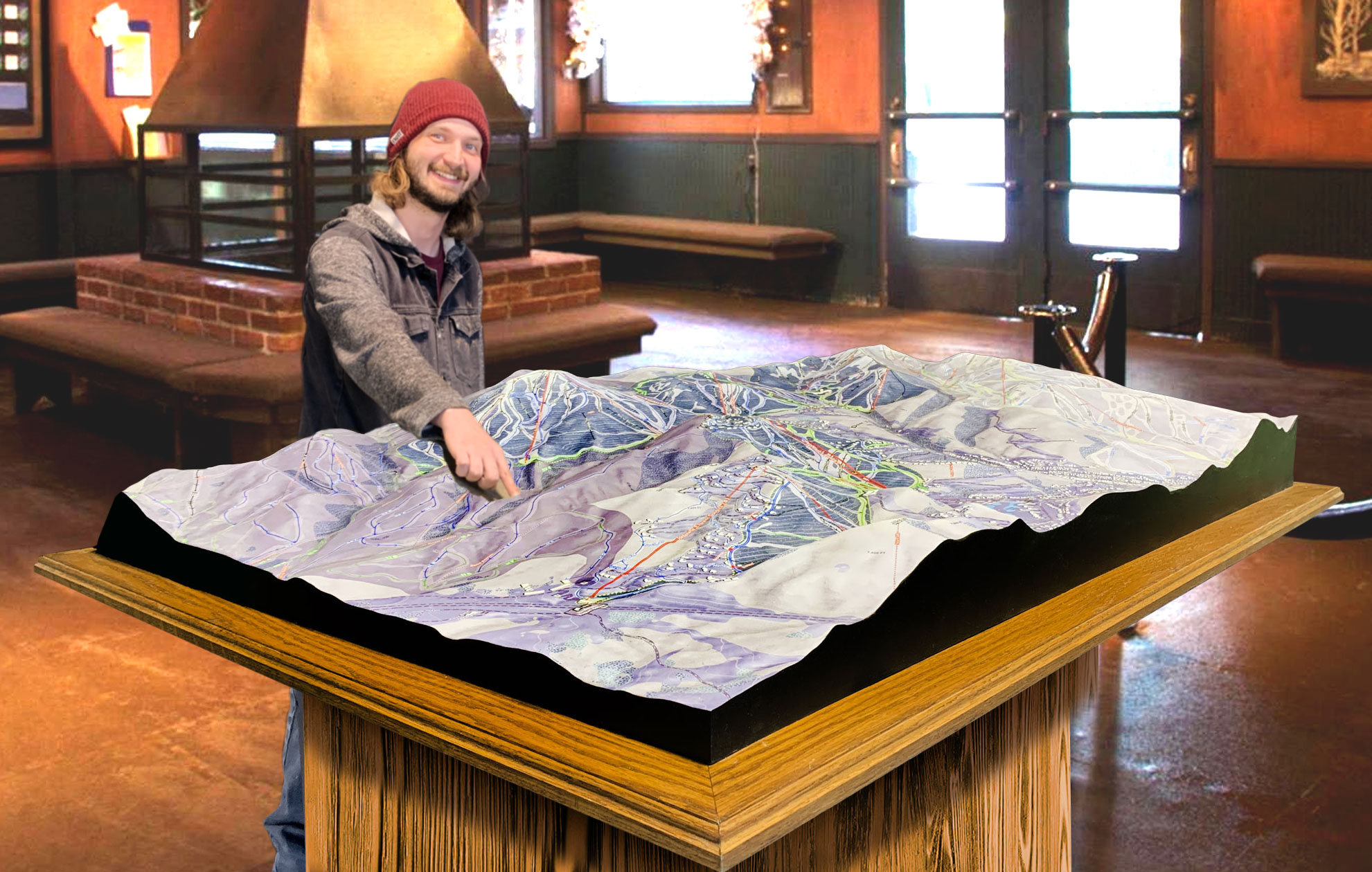
Some 3D maps are interactive, allowing users to zoom in on specific areas of the mountain, rotate the map for different perspectives, and explore the terrain in detail. This feature is particularly helpful for first-time visitors who may be unfamiliar with the layout of the resort. For physical models, 3D printing technology or foam carving techniques are used to create tangible representations of the mountain that can be displayed in the resort’s lodges or visitor centers. These physical models provide visitors with a hands-on way to explore the mountain before they hit the slopes.
 Park City 3D Raised Relief Map
How Bristol Mountain 3D Maps Enhance the Visitor Experience
Bristol Mountain’s 3D maps offer more than just a visual representation of the terrain—they are a valuable tool that enhances the overall visitor experience. By providing a detailed view of the mountain’s landscape, these maps make it easier for skiers and snowboarders to navigate the resort, plan their routes, and get the most out of their day on the slopes.
For beginners, 3D maps are particularly helpful because they offer a clear picture of the mountain’s elevation and trail difficulty. Skiers who are new to the sport often find it difficult to judge the steepness of a trail or its difficulty level from a flat map alone. With a 3D map, beginners can see how steep a trail is before they attempt it, helping them avoid runs that may be too challenging for their skill level. This reduces the risk of accidents and helps build confidence as they progress.
Intermediate and advanced skiers also benefit from 3D maps because they provide a more comprehensive view of the mountain’s terrain. Bristol Mountain is known for its long, scenic cruising runs and its more challenging black-diamond trails. The 3D map allows skiers to see how different trails connect, where elevation changes occur, and what to expect as they descend. This is particularly useful for those looking to explore new areas of the mountain or try more challenging runs.
For expert skiers, the 3D maps provide valuable insight into the most difficult terrain. Bristol Mountain has several advanced runs that feature steep drops, moguls, and narrow chutes. The 3D map highlights these areas in detail, giving expert skiers the information they need to plan their routes and tackle the most challenging parts of the mountain. By providing a clear view of the terrain, the map helps skiers navigate safely and confidently, ensuring they can make the most of their time on the mountain.
Families and groups benefit from 3D maps as well, as they make it easier to coordinate activities and stay together on the mountain. With a clear view of where different trails and amenities are located, families can plan their routes and find meeting points throughout the day. The map’s detailed depiction of the resort’s lodges, dining options, and parking areas ensures that everyone can find what they need quickly and easily.
 Deer Valley 3D Raised Relief Map
A Closer Look at the Major Ski Runs at Bristol Mountain
Bristol Mountain offers a wide variety of ski runs that cater to all skill levels, from beginner to expert. Whether you’re looking for gentle slopes to practice on or challenging black-diamond trails that test your abilities, Bristol Mountain has something for everyone. Let’s take a closer look at some of the major ski runs that are highlighted on the resort’s 3D maps.
Morning Star: Morning Star is one of Bristol Mountain’s most iconic intermediate runs. This long, blue-square trail offers a scenic ride down the mountain, with gentle curves and a consistent pitch that make it perfect for skiers looking to enjoy a smooth, relaxing run. Morning Star is a favorite among intermediate skiers because of its length and the stunning views it provides of the surrounding Finger Lakes region. The 3D map highlights Morning Star’s gentle slope and wide turns, making it easy for skiers to plan their descent.
Rocket: For advanced skiers looking for a challenge, Rocket is a black-diamond trail that offers a fast and technical descent. Known for its steep pitch and tight turns, Rocket is one of the most thrilling runs on the mountain. The 3D map clearly shows Rocket’s steep gradient, allowing expert skiers to prepare for the challenging terrain ahead. Rocket is perfect for those seeking an adrenaline-pumping ride and a true test of their skills.
Sunset: Sunset is a picturesque green-circle trail that provides beginners with a wide, gentle slope to practice their skills. This trail is ideal for first-time skiers and families with young children, as its gradual incline and wide-open layout make it easy to navigate. Sunset is well-marked on the 3D map, with its location near the base area making it an accessible option for those new to the mountain.
Infinity: Infinity is a blue-square cruiser that offers a long, smooth ride down the mountain. This intermediate trail is perfect for skiers who want to work on their carving technique while enjoying the mountain’s scenic views. Infinity’s consistent pitch and wide turns make it a favorite for those looking for a fun, relaxing run. The 3D map highlights Infinity’s path from top to bottom, making it easy for skiers to plan their route and enjoy a leisurely ride.
Lower Universe: Lower Universe is a black-diamond trail that offers expert skiers a steep, technical descent. This challenging run features tight turns, moguls, and a fast, thrilling ride down the mountain. The 3D map emphasizes Lower Universe’s steep gradient and technical aspects, giving expert skiers the information they need to tackle this demanding trail with confidence.
North Star: North Star is another intermediate favorite, offering a mix of wide-open spaces and tighter, more technical sections. This blue-square trail is perfect for skiers who want to challenge themselves while still enjoying the scenic beauty of Bristol Mountain. The 3D map shows North Star’s varying terrain, making it easy for skiers to plan their route and anticipate changes in pitch and difficulty.
Comet: Comet is one of the most challenging black-diamond runs at Bristol Mountain. This steep, narrow trail is known for its sharp drops and technical turns, making it a favorite among expert skiers. The 3D map highlights Comet’s steep pitch and narrow layout, giving advanced skiers a clear view of what to expect before they tackle this thrilling run.
Conclusion: The Power of Bristol Mountain 3D Maps
Bristol Mountain’s 3D maps are more than just guides—they are an essential tool that enhances the overall skiing and snowboarding experience. By providing a detailed, accurate view of the mountain’s terrain, these maps allow visitors to explore Bristol Mountain with confidence and ease. Whether you’re a beginner looking for gentle slopes or an expert seeking out the steepest and most technical runs, Bristol Mountain’s 3D maps help you make the most of your day on the mountain.
From the precision of LiDAR data collection to the artistry of map design, the fabrication of these maps is a confirmation to the resort’s commitment to providing visitors with the best possible experience. With a clear understanding of the terrain, skiers and snowboarders can navigate the mountain safely, efficiently, and with a sense of adventure that makes every trip to Bristol Mountain unforgettable.
Check out WhiteClouds’ 3D Maps for more information on 3D maps of Bristol Mountains Ski Resort.
