Campgaw Mountain 3D Maps
Campgaw Mountain 3D Maps
We Build Custom 3D Campgaw Mountain Maps
Discovering Campgaw Mountain Resort in 3D: A Fresh Perspective on New Jersey’s Ski Gem
Campgaw Mountain Resort, located in the picturesque Ramapo Mountains of northern New Jersey, is one of the closest ski destinations to the bustling New York metropolitan area. While it may not rival the larger ski resorts in the region in terms of size or vertical drop, Campgaw makes up for it with accessibility, affordability, and family-friendly offerings. From beginners hitting the slopes for the first time to seasoned skiers looking for a quick day trip, Campgaw Mountain offers something for everyone. One of the most exciting ways to explore and plan your time at the resort is through the use of 3D maps, which provide a dynamic and detailed view of the mountain.
Campgaw Mountain Resort 3D maps bring the mountain’s terrain to life, offering a topographical representation of the ski runs, terrain parks, and tubing areas that make the resort such a popular local destination. In this blog, we’ll explore the fascinating process of creating these 3D maps, discuss how they enhance the visitor experience, and take an in-depth look at the major ski runs that define Campgaw Mountain.

The Art and Science of Fabricating Campgaw Mountain Resort 3D Maps
The creation of 3D maps for any ski resort requires a unique blend of advanced technology, geospatial analysis, and artistic design. For a resort like Campgaw Mountain, which is smaller in scale compared to the large ski destinations in Vermont or Colorado, the precision of the map is crucial. These 3D maps allow visitors to see the resort in a new way, highlighting every hill, ridge, and valley.
The process begins with collecting detailed topographical data of the resort’s landscape using sophisticated methods such as LiDAR (Light Detection and Ranging) technology and high-resolution satellite imagery. LiDAR is particularly valuable in ski resort mapping because it uses laser pulses to create incredibly precise measurements of the mountain’s terrain, including elevation, slope steepness, and terrain features. This data collection phase is critical for ensuring that the final 3D map accurately reflects the mountain’s actual shape and topography.
Once the raw data is collected, it is processed using Geographic Information Systems (GIS) software. This software converts the raw elevation data into a 3D model, allowing designers to manipulate and refine the terrain into an accurate representation of Campgaw Mountain. Every aspect of the mountain—its ridgelines, valleys, ski trails, and tree cover—is meticulously modeled in this digital environment.
After the technical modeling is complete, the artistic phase begins. Designers use specialized software to enhance the 3D model with color, texture, and shading. The snow-covered slopes are rendered in bright white, while wooded areas are shaded in green. Ski trails are clearly marked with colors that indicate their difficulty level, following the universal ski resort color code: green for beginner trails, blue for intermediate, and black for advanced. The color-coded trails make it easy for skiers to quickly identify which runs are best suited to their skill level.
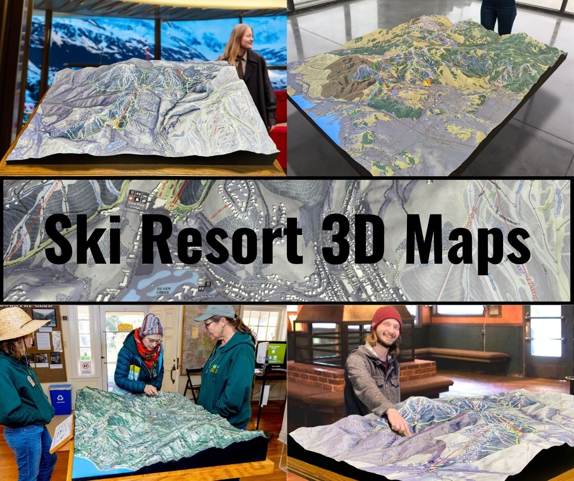
In some instances, 3D maps are made interactive, allowing users to zoom in and out, rotate the map, and explore the terrain from different angles. These digital versions are especially useful for visitors who want to familiarize themselves with the resort’s layout before their trip. For physical 3D maps, advanced printing technologies, such as 3D printing or carved foam models, are used to create tangible topographical representations of the mountain. These models are often displayed at the resort’s lodges or visitor centers, providing a hands-on way for guests to explore the mountain.
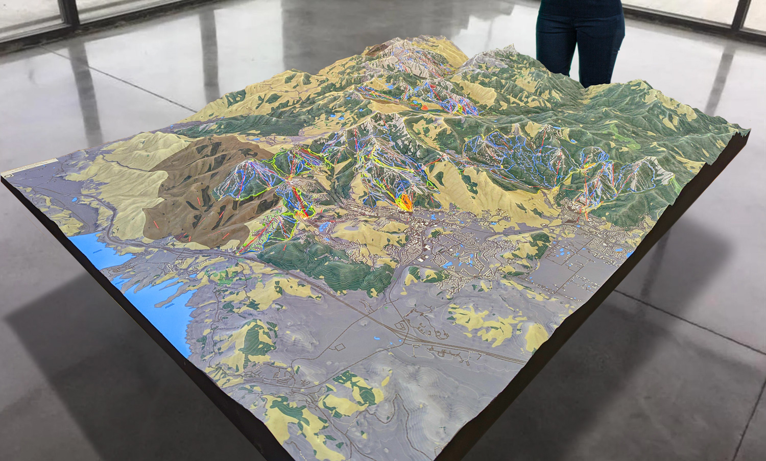
 Park City 3D Raised Relief Map
Enhancing the Ski Experience with Campgaw Mountain Resort 3D Maps
While traditional 2D maps have long been the standard for ski resorts, they often lack the depth and detail needed to fully capture the nuances of a mountain’s terrain. Campgaw Mountain’s 3D maps offer a much more engaging and informative experience, helping visitors to visualize the landscape in ways that a flat map simply cannot. By providing a three-dimensional perspective, these maps allow skiers and snowboarders to understand the elevation changes, trail difficulty, and the layout of the resort in greater detail.
One of the biggest advantages of 3D maps is their ability to show the verticality of the slopes. For example, a beginner looking at a 2D map might not be able to distinguish how steep a trail is just by looking at its layout. A 3D map, on the other hand, shows the slope’s incline in relation to the rest of the mountain, giving skiers a better understanding of how difficult the run will be. This is particularly important at Campgaw Mountain, where beginner and intermediate skiers make up a significant portion of the resort’s visitors. Being able to visualize the terrain in 3D helps beginners feel more confident as they plan their day on the mountain.
For more experienced skiers and snowboarders, the 3D map enhances route planning. With a clear view of the mountain’s layout, skiers can see how different trails connect, plan their runs efficiently, and even identify areas that they might want to explore further. Campgaw’s variety of trails, despite its smaller size, includes several more challenging runs, and the 3D map allows advanced skiers to pinpoint these more difficult sections of the mountain.
Families also benefit from the clarity of 3D maps, particularly when it comes to planning their day around Campgaw’s tubing park and beginner areas. Tubing is a major draw at Campgaw, and the 3D map provides a detailed look at how the tubing lanes are laid out, as well as how they connect to the base lodge and other amenities. This makes it easy for families to navigate the resort and ensure that everyone has a fun, safe experience.
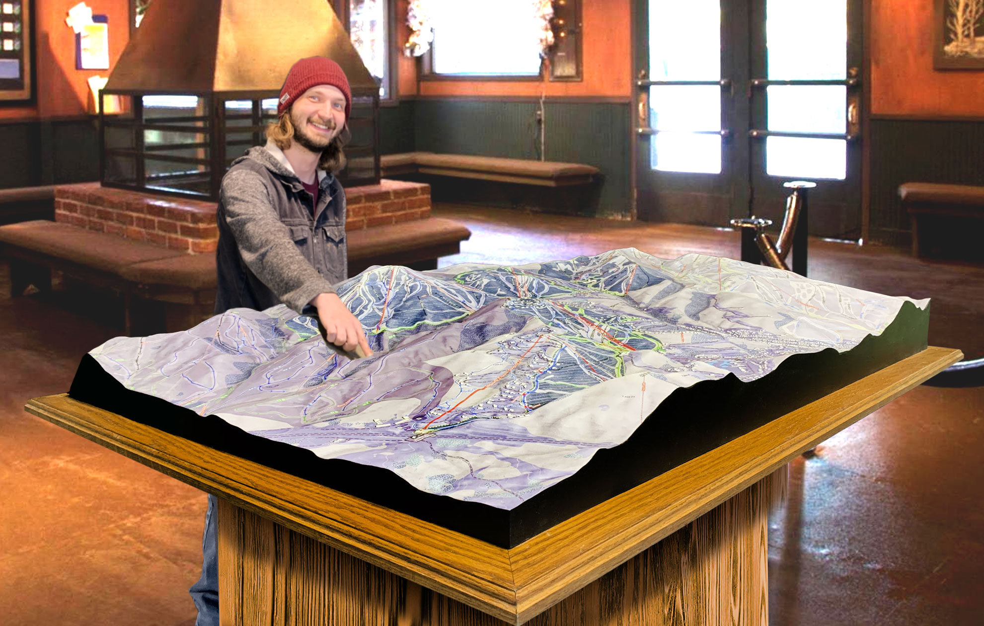
 Deer Valley 3D Raised Relief Map
A Deep Dive into the Major Ski Runs at Campgaw Mountain Resort
Despite being a smaller resort, Campgaw Mountain features a diverse array of trails that cater to all skill levels. From easy, wide beginner runs to more advanced slopes with steeper pitches, the mountain offers a little something for everyone. Let’s take a closer look at some of the major ski runs at Campgaw Mountain Resort, and how they are highlighted on the 3D maps.
Bunny Hill (Beginner): Bunny Hill is Campgaw’s most beginner-friendly area, offering a gentle slope that’s perfect for those who are just learning how to ski or snowboard. Located near the base of the mountain, Bunny Hill provides a wide, open space where new skiers can practice their turns and stops in a low-pressure environment. The 3D map highlights Bunny Hill’s location close to the ski school and rental shop, making it easy for newcomers to get started.
Snow Park (Intermediate): Snow Park is one of Campgaw’s popular blue-square trails, offering a fun and moderate descent for intermediate skiers. This wide trail is ideal for those who have graduated from the beginner slopes and are looking for a little more excitement. Snow Park is well-groomed and offers a consistent pitch, making it a favorite for families and casual skiers alike. The 3D map showcases the trail’s gradual elevation changes, allowing skiers to see how it compares to the steeper, more advanced runs nearby.
Giant Slalom (Intermediate): Another intermediate trail, Giant Slalom, offers a slightly more challenging experience than Snow Park, with a mix of wide turns and steeper sections. It’s a great trail for skiers who want to work on their technique without the intensity of black-diamond terrain. On the 3D map, Giant Slalom is clearly visible, with its rolling terrain and sweeping turns highlighted to show how it flows down the mountain.
Race Hill (Advanced): For advanced skiers looking for a challenge, Race Hill is one of Campgaw’s black-diamond trails. This run features a steeper pitch and narrower sections, making it a more demanding descent that requires good control and quick reflexes. The 3D map highlights the steep incline of Race Hill, giving skiers a sense of the vertical challenge they’ll face. It’s the perfect run for experienced skiers who want to push their skills.
The Terrain Park (Freestyle): Campgaw’s Terrain Park is a favorite among snowboarders and freestyle skiers, offering a variety of jumps, rails, and boxes for those who want to practice their tricks. The park is located near the base of the mountain, and the 3D map provides a detailed view of the layout, including the placement of the different features. Whether you’re a beginner just starting in freestyle or an experienced rider looking for a challenge, the Terrain Park offers plenty of opportunities for fun.
Tubing Area: One of the highlights of Campgaw Mountain, especially for families, is the tubing area. The 3D map clearly outlines the location and layout of the tubing lanes, showing how they are separated from the skiing and snowboarding trails. The tubing area is a major draw during the winter season, and the 3D map makes it easy for visitors to navigate between the tubing lanes, parking lot, and base lodge.
Conclusion: Campgaw Mountain Resort 3D Maps – A New Way to Experience Skiing in New Jersey
Campgaw Mountain Resort may not have the vast acreage of larger ski resorts, but it offers an excellent experience for local skiers, families, and beginners. The addition of 3D maps brings a new level of engagement and convenience to the experience, helping visitors navigate the resort’s terrain with confidence. Whether you’re a first-time skier on Bunny Hill, an intermediate skier exploring Snow Park, or an advanced rider tackling Race Hill, the 3D maps offer an immersive way to understand the mountain and plan your day.
The process of creating these maps, from the precision of LiDAR data collection to the artistic design of the final product, reflects the care and attention that goes into making sure every detail is accurately represented. For those who frequent Campgaw Mountain, these 3D maps are an indispensable tool for exploring everything the resort has to offer.
From the tubing park to the terrain park, from beginner slopes to advanced black diamonds, Campgaw Mountain Resort’s 3D maps offer skiers, snowboarders, and families the ultimate guide to a fun and memorable winter adventure.
Check out WhiteClouds’ 3D Maps for more information on 3D maps of Campgaw Mountain Ski Resort.

