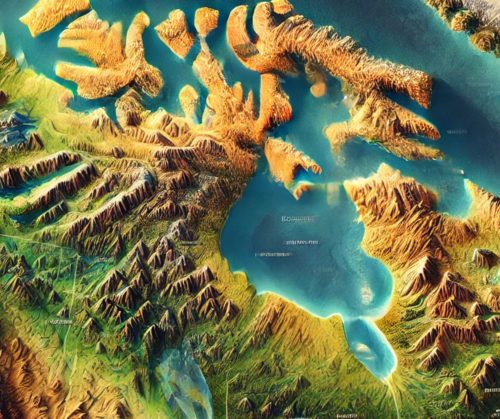
Canada Topo Map
Canada Topo Map
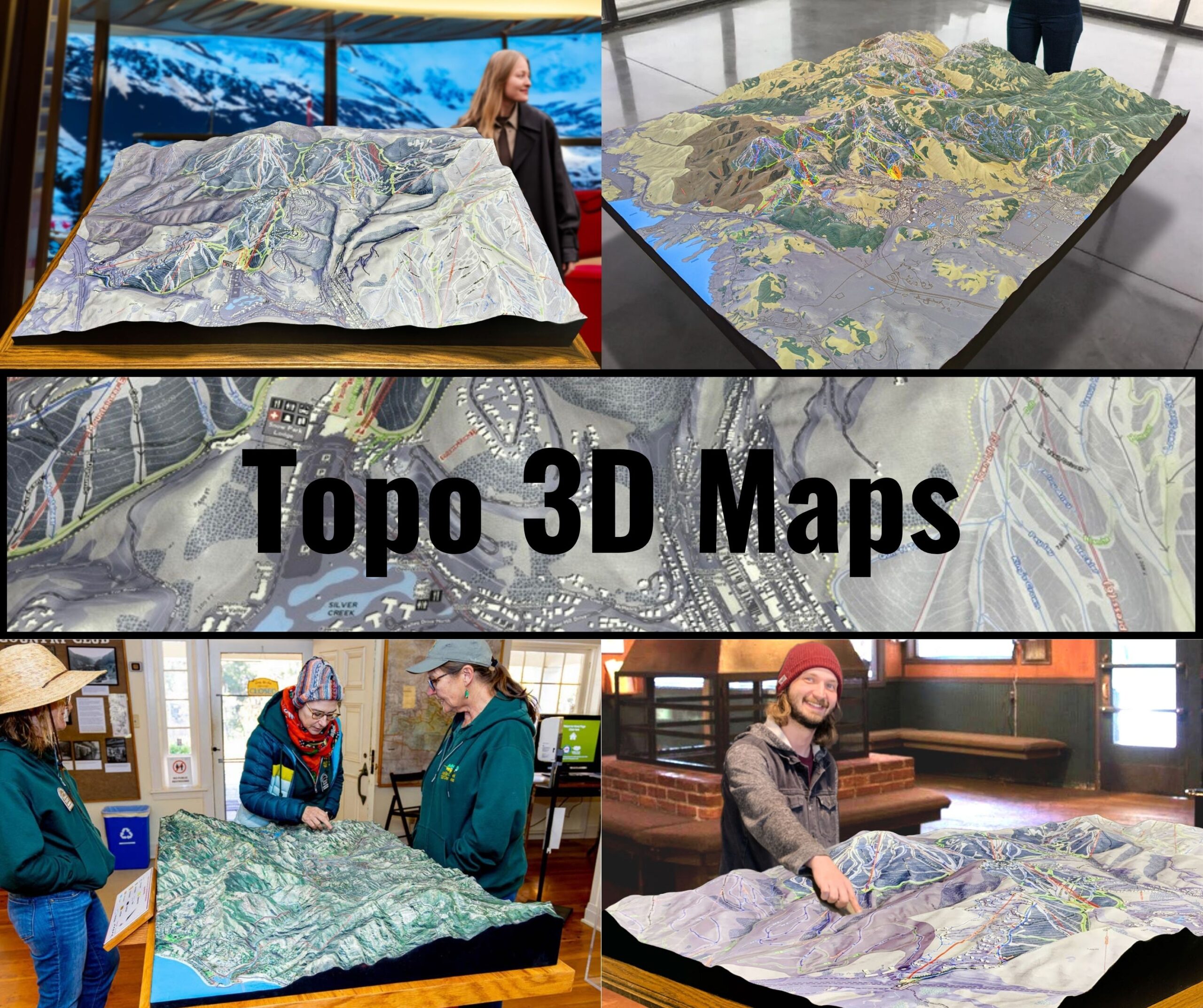
We Build Custom 3D Topo Maps
Canada Topo Maps: Unlocking the Secrets of a Vast and Diverse Land
Canada, the second-largest country in the world, boasts a landscape as diverse as it is expansive. From towering mountains and vast forests to glacial plains and rugged coastlines, Canada’s geography is a stunning blend of natural beauty and geographic extremes. Understanding this vast terrain requires more than just traditional maps; it demands the intricate detail and precision of topographical maps. Canada topo maps serve as indispensable tools for explorers, scientists, conservationists, and planners alike.
This blog dives into the fascinating world of Canada topo maps, exploring their importance, key features, and how they are meticulously crafted in both 2D and 3D formats.
Canada’s Geography: A Land of Infinite Variety and Complexity
Canada’s landmass spans 9.98 million square kilometers, encompassing ten provinces and three territories. Its geographical diversity is unparalleled, ranging from the Rocky Mountains in the west to the flat prairies of the central provinces, and from the Arctic tundra in the north to the dense forests of the Canadian Shield and the Atlantic coastline.
The Rocky Mountains and Western Cordillera: A paradise for hikers and climbers, these ranges feature jagged peaks, deep valleys, and glacial lakes. The Rockies stretch across Alberta and British Columbia, forming some of the most iconic Canadian landscapes.
The Great Plains and Prairies: These expansive flatlands, covering Manitoba, Saskatchewan, and Alberta, are vital for agriculture. Subtle topographical changes here require precise mapping for land use and water management.
The Canadian Shield: Spanning almost half of Canada’s landmass, the Canadian Shield is a rocky, forested region rich in minerals. Its unique topography, shaped by ancient glaciers, makes it a geological wonder.
The Arctic Archipelago and Tundra: The northern territories feature ice-covered islands, permafrost, and extreme conditions. These regions present unique challenges for mapping due to their remoteness and shifting ice sheets.
The Atlantic Coastline: From the rugged cliffs of Newfoundland to the maritime provinces’ rolling hills, the Atlantic coast is characterized by intricate shorelines and tidal systems.
Mapping such a vast and varied landscape requires topo maps that are not only detailed and accurate but also versatile enough to cater to different industries and activities.
The Art and Science of Creating Canada Topo Maps: From Data to Detailed Masterpieces
The fabrication of Canada topo maps is a process that marries cutting-edge technology with cartographic artistry. These maps, whether in 2D or 3D, must capture the nuances of Canada’s diverse terrain with precision and clarity.
How 2D Canada Topo Maps Are Made
Data Collection from Advanced Sources: The foundation of any topo map is its data. In Canada, data is gathered from a variety of sources, including satellite imagery, LiDAR scans, aerial photography, and ground surveys conducted by organizations like Natural Resources Canada (NRCan). These methods provide highly detailed elevation and land cover information.
Processing Geographic Data: Geographic data is processed using GIS (Geographic Information Systems) software such as ArcGIS or QGIS. These tools convert raw elevation data into contour lines, shading, and symbols that represent natural and man-made features.
Cartographic Design: Once processed, the data undergoes a design phase where colors, patterns, and labels are added. For example, the blue of Canada’s vast lakes and rivers contrasts with the green of its forests and the white of its glacial peaks. Designers use symbols and text to mark trails, roads, and landmarks.
Printing and Distribution: The final map is printed on durable, weather-resistant paper or plastic to withstand outdoor use. These maps are distributed digitally and physically, ensuring accessibility for all types of users.
How 3D Canada Topo Maps Are Made
Enhanced Data Acquisition: 3D topo maps require exceptionally high-resolution elevation data. This is obtained through technologies like LiDAR, which provides precise measurements of land features, and stereophotogrammetry, which uses overlapping images to create 3D models.
Digital 3D Modeling: Using specialized software like Blender, Rhino, or Autodesk, elevation data is transformed into digital 3D models. These models capture the intricate details of Canada’s varied terrain, from mountain ridges to river valleys.
Fabrication with 3D Printing or CNC Machines: The digital model is then brought to life using advanced fabrication techniques. 3D printers layer materials like resin or PLA to create detailed relief maps, while CNC machines carve topographical features into solid blocks of foam, wood, or metal.
Finishing Touches for Realism: Once fabricated, the 3D maps are painted and textured to mimic Canada’s natural features. Rivers are painted in vibrant blues, forests in deep greens, and mountains are shaded to highlight their ruggedness. Polyurethane coatings are often applied for durability.
The Key Features of Canada Topo Maps: A Detailed Look at the Essentials
Canada topo maps are masterpieces of detail and accuracy. They incorporate a range of features that make them invaluable tools for various users:
Contour Lines and Elevation Profiles: Contour lines show elevation changes, with close lines indicating steep terrain and wider spacing denoting flatter areas. These are crucial for understanding the Rockies’ dramatic peaks or the subtle gradients of the prairies.
Hydrography: Canada’s vast network of rivers, lakes, and wetlands is clearly depicted. The Great Lakes, Hudson Bay, and iconic rivers like the Mackenzie and St. Lawrence are central features.
Vegetation and Land Use: Forested areas, tundra, and agricultural lands are differentiated using color coding and symbols, providing insight into land use and conservation efforts.
Cultural and Urban Features: Cities, towns, roads, and railways are marked, offering a balance between natural and human-made features.
Natural Landmarks: Iconic sites like Banff, Jasper, and the Bay of Fundy are highlighted, blending geography with tourism and cultural significance.
How Canada Topo Maps Benefit Explorers, Researchers, and Industries
The applications of Canada topo maps are as diverse as the country’s terrain. These maps are indispensable for various users, from outdoor enthusiasts to professionals in multiple fields.
Outdoor Adventure and Tourism: Hikers, climbers, and kayakers use topo maps to navigate Canada’s national parks, mountain ranges, and waterways. Maps of the Rockies, for instance, are essential for planning treks to peaks like Mount Robson.
Scientific Research and Environmental Conservation: Biologists and ecologists rely on topo maps to study biodiversity, track wildlife migration, and plan conservation areas. In regions like the boreal forest, maps help monitor deforestation and habitat preservation.
Urban and Infrastructure Planning: Topo maps guide engineers and architects in designing cities, roads, and utilities. Understanding elevation and drainage patterns is critical for infrastructure projects in regions with challenging terrain.
Resource Management and Extraction: The mining, forestry, and energy sectors use topo maps to locate resources, plan extraction sites, and minimize environmental impact.
Disaster Management and Climate Monitoring: Topo maps help predict and manage natural disasters like floods, landslides, and wildfires. They are also used to monitor climate change effects, such as glacial retreat in the Rockies and rising sea levels along the coasts.
Technology’s Role in Transforming Canada Topo Maps: The Shift to Digital and 3D Platforms
Modern technology has revolutionized the way topo maps are created, accessed, and used in Canada. Digital platforms and 3D modeling have expanded the potential of these maps, making them more interactive and user-friendly.
Digital Topo Maps: Online resources like NRCan’s Toporama and apps like Gaia GPS provide interactive topo maps that allow users to zoom in on specific areas, measure distances, and overlay additional data.
Augmented and Virtual Reality: AR and VR technologies bring topo maps to life, enabling users to explore Canada’s terrain in 3D. These tools are particularly useful for educational purposes and virtual tourism.
Real-Time Data Integration: Advanced topo maps incorporate real-time data, such as weather conditions, water levels, and traffic patterns, making them dynamic tools for planning and decision-making.
Canada Topo Maps: A Cultural and Historical Perspective
Canada’s topo maps are more than practical tools; they are records of the country’s natural and cultural history. Early hand-drawn maps reflect the exploration of Canada by Indigenous peoples and European settlers. Modern maps, meanwhile, document the country’s evolving landscapes and urban growth.
The inclusion of Indigenous place names and landmarks in recent maps highlights efforts to honor Canada’s rich cultural heritage. Topo maps are thus not only technical achievements but also cultural artifacts that preserve the stories of the land and its people.
The Future of Canada Topo Maps: Innovations on the Horizon
The future of Canada topo maps lies in further technological advancements. AI and machine learning are set to improve the accuracy and efficiency of map creation. 3D printing technology will continue to make physical topo maps more accessible, while digital platforms will integrate more real-time data and interactive features.
In the educational and tourism sectors, topo maps are expected to play an increasingly important role in promoting Canada’s natural beauty and fostering a deeper understanding of its geography.
Discovering Canada Through Topo Maps: A Journey of Exploration and Appreciation
Canada topo maps are more than navigational tools; they are gateways to understanding the vast and varied landscapes of this incredible country. From the soaring peaks of the Rockies to the remote tundra of the Arctic, these maps capture the essence of Canada’s natural beauty and geographic complexity.
Whether used for adventure, research, or planning, topo maps of Canada are indispensable for exploring its diverse terrain. By combining technology, precision, and artistry, they bring Canada’s landscapes to life, inspiring awe and fostering a deeper connection to the land.
Check out WhiteClouds’ 3D Maps for more information on Canada topo maps.

