Catamount Ski Area 3D Maps
Catamount Ski Area 3D Maps
We Build Custom 3D Catamount Ski Area Maps
Discovering Catamount Ski Area with 3D Maps: A New Dimension of Skiing
Situated on the border between New York and Massachusetts, Catamount Ski Area is a beloved destination for skiers and snowboarders who crave a mix of challenging terrain and family-friendly slopes. With over 1,000 feet of vertical drop, Catamount offers something for everyone, from scenic cruisers to steep, adrenaline-pumping black-diamond runs. However, beyond the thrill of its diverse trails, Catamount offers something equally innovative: 3D maps. These 3D maps are changing the way visitors navigate and explore the resort, offering an immersive and detailed view of the mountain that enhances the entire skiing experience.
Whether you’re a first-time visitor or a seasoned Catamount enthusiast, the 3D maps provide a detailed understanding of the mountain’s terrain, helping skiers and snowboarders of all skill levels confidently plan their routes. In this blog, we’ll explore how Catamount’s 3D maps are created, the role they play in enhancing the skiing experience, and take a deep dive into some of the major ski runs that define this East Coast gem.
The Creation of Catamount Ski Area 3D Maps: Blending Advanced Technology and Design
The creation of 3D maps for a ski resort like Catamount Ski Area is an intricate process that blends cutting-edge technology with creative artistry. Accurate 3D maps require a deep understanding of the mountain’s natural terrain, capturing everything from its steep ridgelines to its gentle, rolling beginner slopes. The process starts with the collection of precise topographical data using advanced technologies such as LiDAR (Light Detection and Ranging) and high-resolution satellite imaging.
LiDAR is a crucial tool for ski resort mapping, as it uses laser pulses to measure the precise distance between the laser source and the ground. By measuring the time it takes for the light to bounce back, LiDAR technology can create a highly accurate 3D model of the terrain, down to the smallest changes in slope. At Catamount, this technology allows mapmakers to capture even the most subtle features of the mountain, from its steepest black-diamond runs to the smoother, more accessible green-circle trails.
Once the LiDAR and satellite data are gathered, it is processed using Geographic Information Systems (GIS) software. GIS software takes the raw elevation data and converts it into a Digital Elevation Model (DEM), which provides a detailed representation of the mountain’s terrain. This DEM forms the foundation of the 3D map, allowing designers to visualize the mountain’s natural contours and create an accurate topographical model.
However, the creation of a 3D map doesn’t stop with the collection of raw data. Designers take this information and begin the process of adding textures, colors, and visual elements that make the map engaging and easy to understand. Using specialized design software, the team enhances the map with details that include snow-covered trails, wooded areas, and rock outcroppings, creating a lifelike depiction of the mountain. Ski trails are color-coded by difficulty—green for beginner trails, blue for intermediate, and black for expert—allowing skiers to easily identify which runs suit their skill level.
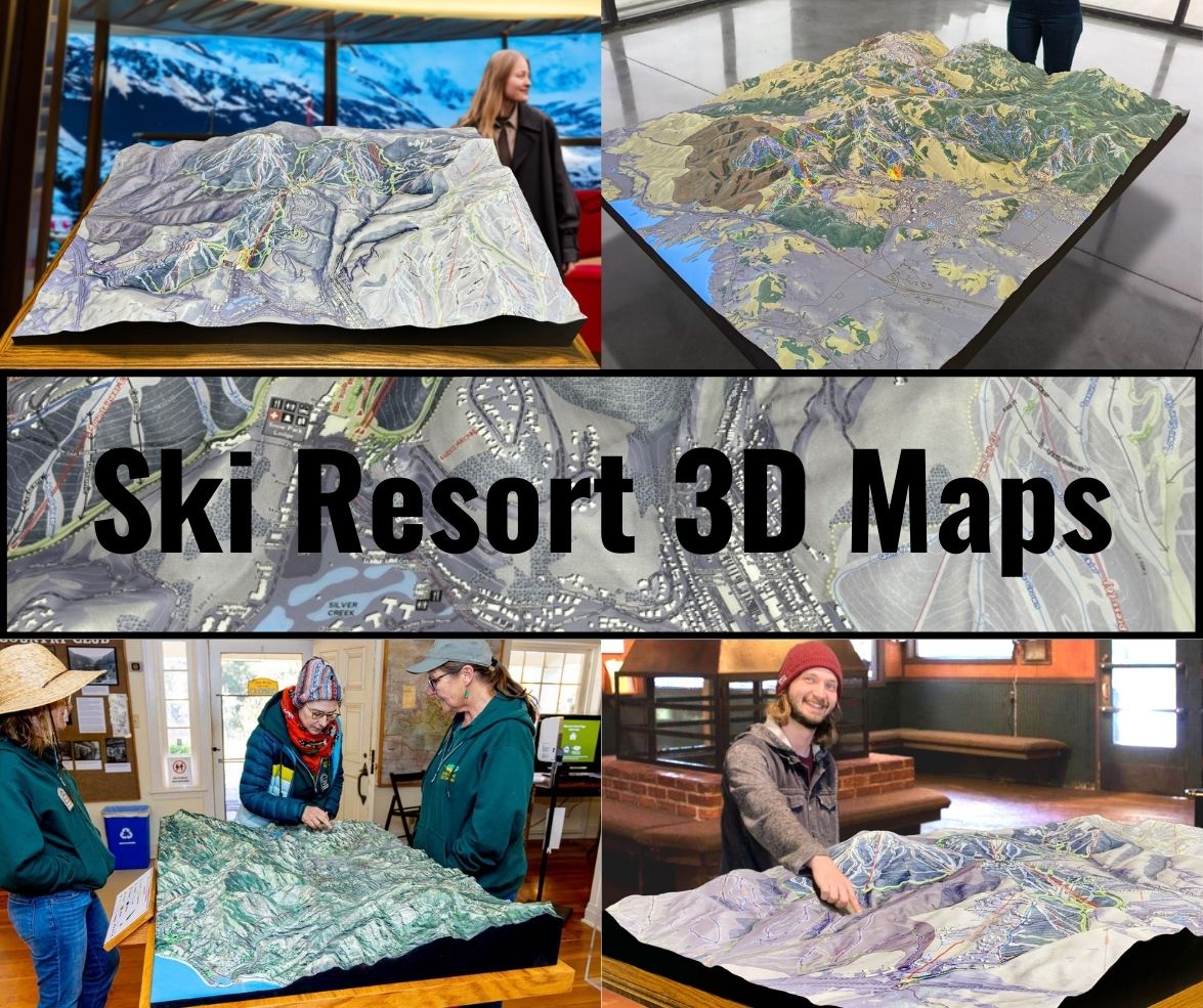
In addition to trails, Catamount’s 3D maps include other key elements, such as lift lines, base lodges, dining areas, and ski rental shops. These features are carefully placed to ensure that visitors can navigate the resort with ease, regardless of whether they’re new to skiing or seasoned experts. For many resorts, these maps are available in both digital and physical formats. The digital versions may include interactive features, allowing users to zoom in on specific trails, rotate the map for different perspectives, and explore the terrain in more detail. Physical versions of the map, often created using 3D printing technology or foam carving, are typically displayed in resort lodges or visitor centers, offering a tactile way to explore the mountain before hitting the slopes.
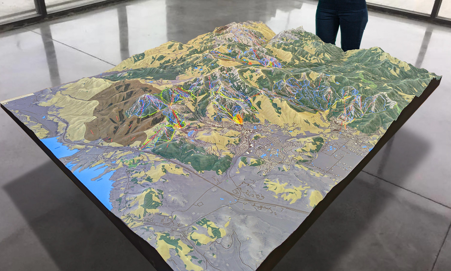
 Park City 3D Raised Relief Map
How Catamount Ski Area 3D Maps Elevate the Skiing Experience
Catamount’s 3D maps aren’t just for navigation—they provide a new way to experience and interact with the mountain, making skiing at the resort more enjoyable, safer, and more accessible for all levels of skiers and snowboarders. By offering a detailed, three-dimensional view of the terrain, these maps allow visitors to better understand the mountain’s elevation changes, trail connections, and natural features.
For beginners, 3D maps are an invaluable tool. One of the biggest challenges for novice skiers is understanding the difficulty of a trail before skiing it. While traditional 2D maps can indicate the trail’s length and difficulty level, they don’t convey the steepness or terrain complexity as effectively as 3D maps. At Catamount, beginners can use the 3D map to visualize the elevation of each trail, helping them select routes that match their skill level and avoid trails that may be too advanced. The clear depiction of green-circle runs makes it easy for new skiers to identify the best practice areas, giving them confidence before they head out.
Intermediate skiers benefit from the detailed representation of how the trails connect across the mountain. Catamount’s blue-square runs offer a variety of experiences, from long cruisers to more technical descents, and the 3D map highlights these trails’ flow and layout. By showing the elevation changes in relation to other trails and lifts, intermediate skiers can plan their routes more effectively, making sure they find the best terrain to match their interests.
For expert skiers and snowboarders, 3D maps offer insights into Catamount’s most challenging terrain. The mountain’s black-diamond runs feature steep drops, moguls, and tight, technical sections that demand skill and precision. The 3D map’s ability to show these runs in detail—highlighting the steepness of the slopes and the natural obstacles along the way—gives advanced skiers the information they need to confidently navigate the most difficult trails.
Families and groups also benefit from the clarity that 3D maps provide. The maps help parents find safe and fun trails for children, as well as identify suitable meeting points for groups of varying ability levels. This ensures that families can stick together while still enjoying trails that match their individual skills. The maps also show the location of essential amenities like restaurants, lodges, and parking areas, making it easier to plan the day and find services when needed.
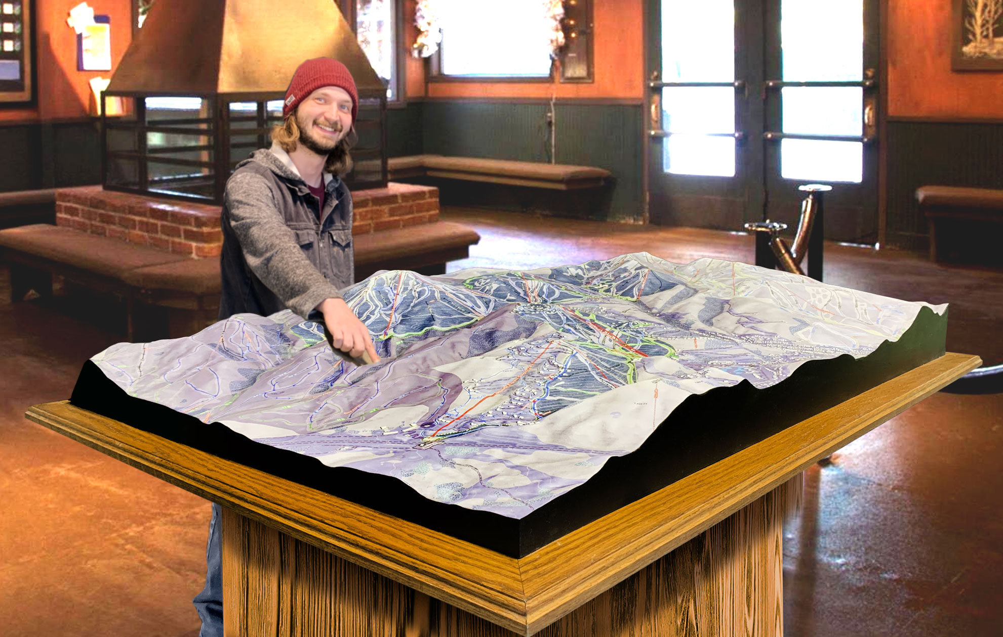
 Deer Valley 3D Raised Relief Map
Major Ski Runs at Catamount Ski Area: Exploring the Best of the Mountain
Catamount Ski Area offers a wide range of trails, each with its own character and challenges. Whether you’re looking for a relaxing cruise down a scenic trail or an exhilarating descent down a steep black-diamond run, Catamount’s diverse terrain has something to offer every skier and snowboarder. Let’s take a closer look at some of the major ski runs at Catamount, all of which are vividly highlighted on the resort’s 3D maps.
Ridge Run (Blue Square): Ridge Run is one of Catamount’s most iconic intermediate trails. This long, winding blue-square run offers a scenic descent along the ridge of the mountain, providing breathtaking views of the surrounding Berkshires. It’s a favorite among intermediate skiers who want to enjoy a relaxing, scenic ride while still experiencing the thrill of a long run. The 3D map highlights Ridge Run’s gentle curves and elevation changes, making it easy for skiers to navigate this popular trail.
Catamount (Black Diamond): Catamount is the resort’s namesake trail and one of its most challenging. This black-diamond run is steep and fast, featuring sharp turns, moguls, and technical terrain that requires expert-level skills. The 3D map clearly shows Catamount’s steep gradient and demanding features, allowing advanced skiers to plan their line before tackling the run. Catamount offers an adrenaline-pumping ride for those looking to push their limits.
Upper and Lower Glade (Black Diamond): For skiers who love tree skiing and off-piste challenges, Upper and Lower Glade provide an exhilarating experience. These black-diamond trails take skiers through densely wooded areas, offering a backcountry feel with natural obstacles and narrow tree-lined paths. The 3D map highlights the location of these glades, making it easier for expert skiers to navigate the trees and find the best lines.
Promenade (Green Circle): Promenade is a family favorite and one of the best green-circle trails for beginners at Catamount. This wide, gently sloping run is perfect for learning to ski or snowboard, offering a safe and easy descent with plenty of room to practice turns. The 3D map shows Promenade’s wide layout and gradual slope, making it a great choice for families and first-time skiers.
Upper Sidewinder (Blue Square): Upper Sidewinder is a popular blue-square run that offers intermediate skiers a more technical challenge. This trail features sharper turns and more varied terrain than some of the other intermediate runs at Catamount, providing a great opportunity to work on carving and controlling speed. The 3D map shows Upper Sidewinder’s layout and elevation changes, helping skiers anticipate the technical sections of the trail.
Sunset Strip (Green Circle): Sunset Strip is another great option for beginner skiers and snowboarders, offering a long, scenic descent with a consistent, gentle slope. This green-circle trail is perfect for families and those new to the sport who want to enjoy a relaxing ride while taking in the stunning views of the Berkshires. The 3D map highlights Sunset Strip’s smooth and predictable terrain, making it an ideal choice for anyone looking to build confidence on the slopes.
Wildcat (Black Diamond): Wildcat is one of Catamount’s most challenging black-diamond runs, featuring steep pitches and tight turns. This trail is designed for advanced skiers who are looking for a technical challenge, and the 3D map showcases the steep gradients and natural obstacles that make Wildcat such an exciting run. Expert skiers will appreciate the clear view of the trail’s terrain, helping them prepare for a thrilling descent.
Conclusion: Catamount Ski Area 3D Maps Transform the Experience
Catamount Ski Area’s 3D maps provide an enhanced and immersive way to experience the mountain. From helping beginners select the right trails to giving expert skiers a detailed look at the resort’s most challenging terrain, these maps are an invaluable tool for making the most of your time on the slopes. By blending advanced technology with thoughtful design, Catamount’s 3D maps offer a new perspective on skiing, allowing visitors to explore the mountain with confidence and ease.
Whether you’re navigating the gentle green-circle runs or taking on the steep black-diamond trails, Catamount’s 3D maps are your guide to an unforgettable skiing adventure in the Berkshires. With every elevation change, trail connection, and terrain feature clearly depicted, these maps make skiing at Catamount more enjoyable, safer, and more exciting for everyone.
Check out WhiteClouds’ 3D Maps for more information on 3D maps of Catamount Ski Resort.

