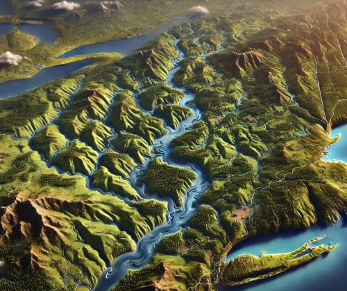
Connecticut River Watershed Map
Connecticut River Watershed Map
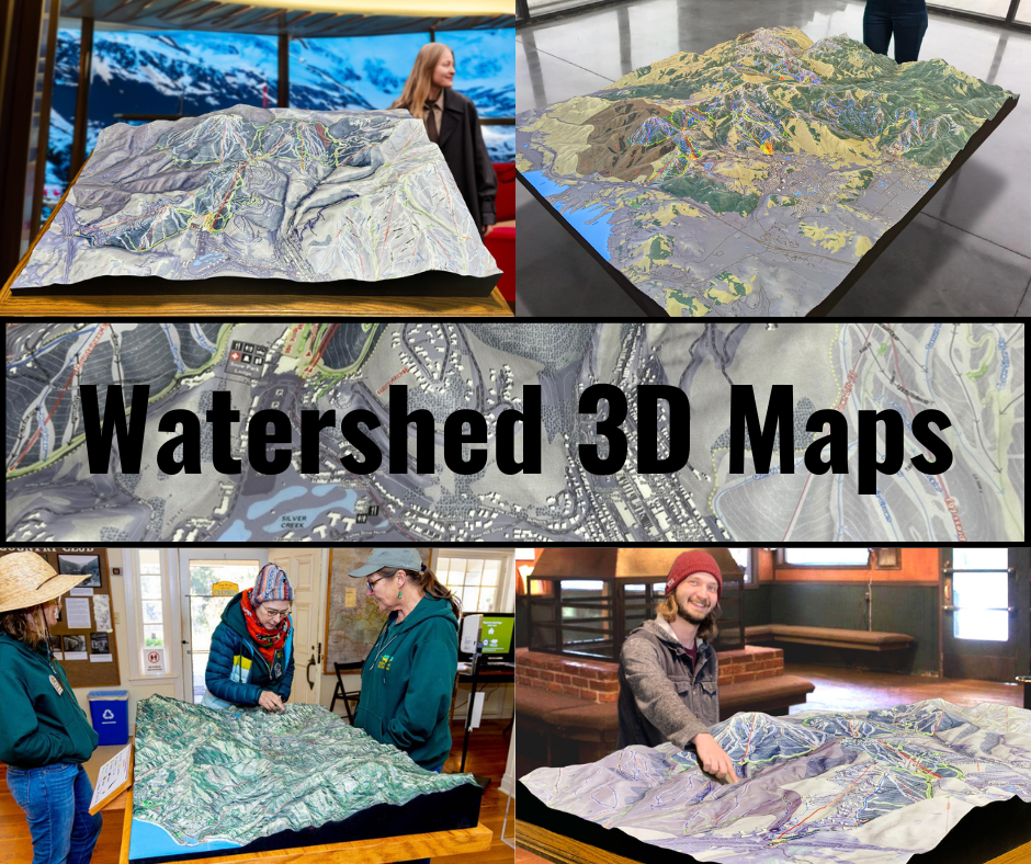
We Build Custom 3D Watershed Maps
Connecticut River Watershed Map: Navigating New England’s Largest River System
The Connecticut River Watershed is the lifeblood of New England, spanning over 11,000 square miles across four states: New Hampshire, Vermont, Massachusetts, and Connecticut. Anchored by the 410-mile-long Connecticut River, this watershed is the largest in the region, providing critical ecological, cultural, and economic benefits. A detailed Connecticut River Watershed map showcases the intricate network of tributaries, forests, wetlands, and communities that make this river system an invaluable resource for the Northeast.
Tracing the Connecticut River Watershed: From the Canadian Border to Long Island Sound
The Connecticut River begins its journey at Fourth Connecticut Lake in the Connecticut Lakes region of northern New Hampshire, near the Canadian border. Flowing southward, it serves as a natural boundary between New Hampshire and Vermont, winds through western Massachusetts, and meanders into Connecticut before emptying into Long Island Sound.
The watershed encompasses a vast network of tributaries, including the Deerfield, West, and Chicopee Rivers, as well as smaller streams and brooks that feed the main stem. These waterways connect high-elevation forests in the north to lowland valleys and coastal marshes in the south, creating a dynamic hydrological system.
Maps of the Connecticut River Watershed highlight the diverse geography of the region, from the mountainous headwaters of the White and Green Mountains to the fertile floodplains of the Connecticut River Valley. These maps provide crucial insights into the river’s flow, topography, and ecological connections.
Ecological Richness of the Connecticut River Watershed
The Connecticut River Watershed is an ecological treasure trove, supporting a wide range of habitats and species. Its forests, wetlands, and riparian zones are home to diverse wildlife, making the watershed a key corridor for biodiversity in the Northeast.
The river itself is a vital habitat for fish species such as American shad, Atlantic salmon, and striped bass. Efforts to restore fish passage through dam removal and fish ladders have revitalized migratory fish populations in the watershed. The wetlands and floodplains along the river serve as breeding grounds for amphibians, waterfowl, and wading birds, including great blue herons and wood ducks.
The Connecticut River estuary, where the river meets Long Island Sound, is a globally recognized ecosystem for its productivity and biodiversity. It supports marine life such as oysters, blue crabs, and various shellfish, as well as migratory birds that rely on its marshes for feeding and nesting.
Watershed maps are indispensable for conservation efforts, helping to identify critical habitats, track changes in land use, and guide restoration projects. For instance, maps that pinpoint areas of wetland loss or pollution can inform strategies to enhance biodiversity and ecosystem health.
The Connecticut River Watershed’s Role in Economy and Culture
The Connecticut River Watershed is a cornerstone of New England’s economy and cultural identity. Its fertile floodplains have long supported agriculture, with crops such as tobacco, corn, and vegetables thriving in the region. The river also sustains aquaculture, forestry, and hydroelectric power generation, contributing significantly to local economies.
Recreation and tourism are major economic drivers in the watershed. The river and its tributaries offer opportunities for fishing, kayaking, and hiking, attracting outdoor enthusiasts from across the region. Scenic byways along the river, such as the Connecticut River Scenic Byway, provide breathtaking views and connect visitors to historic towns and cultural landmarks.
Culturally, the Connecticut River has been central to the lives of Indigenous peoples, early settlers, and modern communities. It continues to inspire art, literature, and traditions that celebrate New England’s natural beauty and history.
Challenges Facing the Connecticut River Watershed
The Connecticut River Watershed faces numerous challenges, many of which are driven by human activity and climate change. Urbanization and agricultural runoff have led to water quality issues, habitat loss, and altered river flows. Runoff containing fertilizers, pesticides, and sediment impacts aquatic ecosystems and threatens the health of downstream communities.
Climate change exacerbates these issues, with rising temperatures, changing precipitation patterns, and increased flooding affecting the watershed’s health and resilience. Sea level rise poses additional risks to the estuarine areas, threatening habitats and increasing saltwater intrusion into freshwater systems.
Dams and other infrastructure, while critical for energy and water management, have fragmented the river system, impacting fish migration and sediment transport. Invasive species, such as water chestnut and zebra mussels, further disrupt the watershed’s ecosystems by outcompeting native species and altering habitats.
Maps of the watershed are essential for addressing these challenges, providing detailed information about pollution hotspots, areas at risk from flooding, and regions requiring habitat restoration.
Fabricating Connecticut River Watershed 3D Maps: A Fusion of Science and Art
Creating a 3D map of the Connecticut River Watershed is a meticulous process that combines advanced technology, scientific data, and artistic craftsmanship. These maps provide a visually compelling and interactive representation of the watershed, helping viewers understand its scale, complexity, and significance.
The process begins with the collection of high-resolution topographical and hydrological data. Organizations such as the U.S. Geological Survey (USGS) and regional environmental agencies provide datasets that include elevation, land cover, and water flow information. This data is processed using geographic information system (GIS) software to create a detailed digital model of the watershed.
Once the digital model is complete, it is translated into a physical object using 3D printing technology. WhiteClouds, a leader in 3D mapping, employs state-of-the-art printers to construct the map layer by layer. Materials such as PLA (polylactic acid) or resin are used to build the structure, with each layer representing a specific elevation. This precision ensures the 3D map accurately reflects the watershed’s contours and features.
After the base structure is printed, artists bring the map to life by hand-painting it. Colors are carefully chosen to represent various features: blues for rivers and estuaries, greens for forests and wetlands, and browns for agricultural and urban areas. Airbrushing techniques create smooth transitions between terrain types, enhancing the map’s realism.
A protective coating, such as polyurea or polyurethane, is applied to ensure the map’s durability. This final step makes the map suitable for use in educational exhibits, public presentations, and planning meetings, ensuring it remains a lasting resource.
3D maps of the Connecticut River Watershed are more than tools—they are masterpieces that inspire curiosity and deepen understanding of this vital ecosystem.
Educational and Planning Applications of Connecticut River Watershed Maps
Connecticut River Watershed maps are invaluable resources for education, research, and planning. In classrooms, they serve as interactive tools to teach students about geography, ecology, and water resource management. Researchers use these maps to analyze changes in land use, habitat distribution, and water quality, supporting studies on topics such as climate resilience and species conservation.
For planners and policymakers, watershed maps provide critical insights into the region’s hydrology and topography, helping guide decisions on land development, flood mitigation, and habitat restoration. By visualizing the interconnectedness of the watershed’s features, stakeholders can make informed choices that balance economic growth with environmental sustainability.
The Future of the Connecticut River Watershed
As the Connecticut River Watershed faces increasing pressures from climate change and human activities, the need for innovative management and conservation strategies has never been more urgent. Advances in mapping technology, such as 3D modeling, play a pivotal role in addressing these challenges by providing detailed and accurate information about the watershed.
The Connecticut River Watershed is not just a natural resource—it is a vital part of New England’s heritage and future. By studying and protecting this system, we ensure that it continues to sustain ecosystems, communities, and economies for generations to come. Through traditional maps, digital tools, and immersive 3D models, the Connecticut River Watershed will remain a source of inspiration, education, and stewardship.
Check out WhiteClouds’ 3D Maps for more information on Connecticut River watershed maps.

