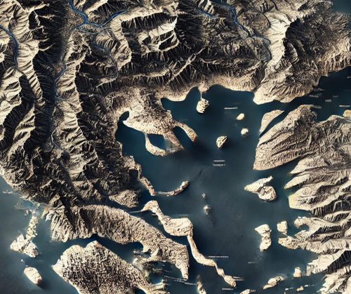
Greece Topo Map
Greece Topo Map
We Build Custom 3D Topo Maps
Exploring the Depths of Greece Topo Maps: A Journey Through History, Fabrication, and Modern Applications
Greece, a land steeped in myth, history, and natural splendor, offers a geographical richness that is as fascinating as its ancient ruins. From the iconic mountains of Olympus to the intricate coastlines of the Aegean Sea, Greece topo maps are invaluable tools for unraveling the intricacies of this remarkable nation. Whether you’re an explorer, urban planner, geologist, or history enthusiast, these maps serve as both guides and gateways to understanding Greece’s diverse terrains.
In this in-depth exploration, we dive into the significance, fabrication, and transformative power of Greece topo maps. These maps are more than practical tools—they’re artistic, scientific, and cultural artifacts that bridge ancient landscapes with modern technology.
The Significance of Greece Topo Maps in Unveiling Ancient and Modern Landscapes
Greece’s geography is a tapestry of islands, mountains, valleys, and seas, making topo maps essential for a wide range of applications. They are indispensable for hikers tracing the trails of Mount Parnassus, archaeologists uncovering ancient city-states, and environmentalists preserving fragile ecosystems.
Navigating Natural Wonders: Greece’s mountains and coastlines are famed for their rugged beauty. Topo maps provide detailed insights into these terrains, highlighting elevation changes, trails, and water sources that are vital for outdoor adventures.
Preserving Cultural Heritage: Greece is home to countless historical sites, many of which are intricately tied to their surrounding geography. Topo maps often include markers for archaeological locations, ensuring they are accessible and protected.
Sustainable Development: Urban and rural planning in Greece relies heavily on topo maps. These maps help balance modern development with the preservation of the country’s natural and historical resources.
Unpacking the Components of Greece Topo Maps: A Blend of Precision and Artistry
Greece topo maps are designed to convey a wealth of information with clarity and elegance. Their components are meticulously crafted to ensure accuracy and usability, even in the most complex landscapes.
Contours and Elevation Lines: Contour lines form the backbone of topo maps, illustrating the elevation and shape of the land. In Greece, where elevation changes can be steep and dramatic, these lines provide a critical visual representation of the terrain.
Geographic Features: From the rolling hills of the Peloponnese to the volcanic islands of the Cyclades, topo maps highlight rivers, forests, valleys, and geological formations unique to Greece.
Symbolism and Legend: Greek topo maps employ a comprehensive set of symbols to denote man-made and natural features. These include ruins, caves, monasteries, and historical paths.
Scales and Coordinates: Accurate scales and geographic coordinates make these maps indispensable for precise navigation, research, and exploration.
How Greece Topo Maps Are Fabricated: The Art and Science Behind Their Creation
The creation of Greece topo maps involves a fascinating interplay of advanced technology and meticulous craftsmanship. Whether 2D or 3D, each map is a labor of precision, ensuring it meets the needs of various users.
Data Collection and Integration: The process begins with gathering data from satellites, aerial imagery, and ground surveys. Advanced tools like LiDAR and photogrammetry provide highly detailed topographic data, capturing even subtle variations in the terrain.
2D Map Fabrication: For 2D maps, cartographers use Geographic Information Systems (GIS) to layer multiple data sets, including elevation, hydrology, and human settlements. These layers are harmonized to produce maps that are both detailed and easy to interpret. Printed versions are designed to be weather-resistant for field use.
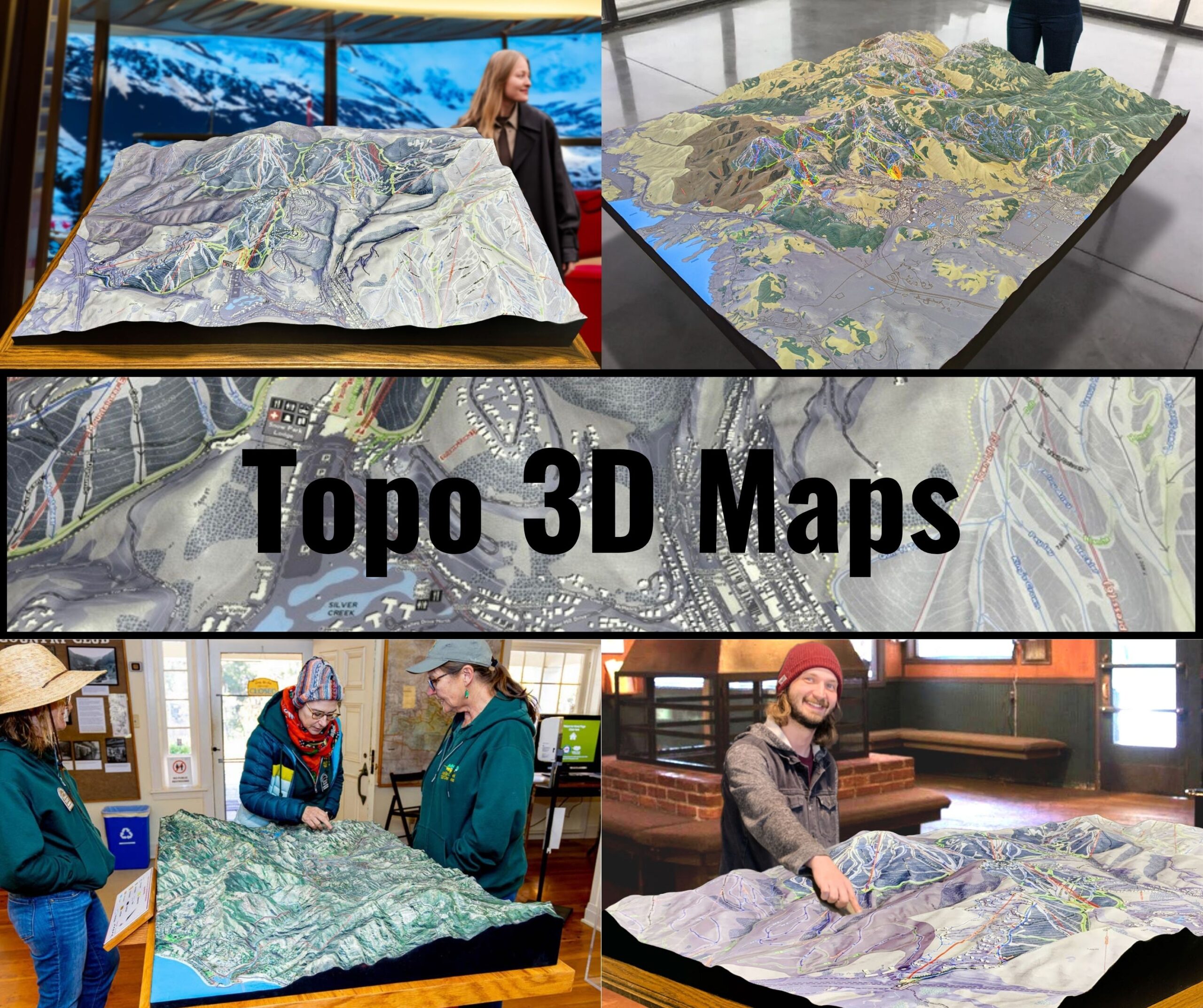
3D Map Fabrication: Creating 3D topo maps involves converting digital elevation models (DEMs) into physical or digital representations. Physical 3D maps are often fabricated using CNC milling machines or 3D printers, followed by hand-painting to add realistic details. Digital 3D maps are used in simulations and virtual explorations, offering dynamic perspectives of Greece’s geography.
Quality Control and Distribution: Each map undergoes thorough quality checks to ensure accuracy and reliability. Once approved, the maps are distributed in both digital and physical formats, catering to diverse user needs.
2D Greece Topo Maps: The Cornerstone of Exploration and Planning
2D topo maps are versatile tools that cater to a broad spectrum of applications, from recreational activities to professional research. In Greece, their uses are as diverse as the landscape itself.
Guiding Outdoor Adventures: Hikers, climbers, and sailors rely on 2D topo maps to navigate Greece’s mountains, valleys, and islands. These maps highlight trails, harbors, and elevation profiles, ensuring safe and enjoyable journeys.
Agriculture and Land Use: Greece’s agricultural heritage is deeply connected to its geography. Topo maps assist farmers and land managers in planning irrigation, managing soil resources, and maximizing crop yields.
Cultural Preservation: Many of Greece’s ancient sites are located in remote areas. 2D topo maps help archaeologists and historians locate and study these treasures, while also aiding in their preservation.
3D Greece Topo Maps: A New Dimension in Geographic Understanding
While 2D maps provide foundational knowledge, 3D topo maps bring Greece’s geography to life, offering immersive insights that are invaluable for certain applications.
Educational Tools: 3D maps are frequently used in classrooms and museums to teach about Greece’s geography, history, and geology. They provide a tactile and visual representation of the land, making complex concepts easier to understand.
Virtual and Augmented Reality: Digital 3D maps have found a place in modern technology, particularly in virtual reality (VR) and augmented reality (AR) applications. These allow users to explore locations like Meteora’s monasteries or the volcanic terrain of Santorini from anywhere in the world.
Disaster Management and Environmental Planning: 3D topo maps are critical in assessing natural hazards like earthquakes and floods, which are common in Greece. By visualizing terrain and risk zones, planners can implement effective mitigation strategies.
Adventure Tourism and Greece Topo Maps: A Perfect Partnership
Greece’s allure as a destination for adventure tourism is unmatched. Topo maps play a crucial role in enhancing the experiences of visitors, whether they are trekking ancient paths or exploring underwater caves.
Tracing the Footsteps of the Ancients: Greece’s ancient paths, such as those leading to Delphi or Mycenae, are brought to life through topo maps. These maps guide adventurers through history while ensuring safety.
Climbing and Hiking in Iconic Landscapes: For mountaineers tackling Mount Olympus or hikers exploring the Vikos Gorge, topo maps provide essential information about routes, elevation, and terrain challenges.
Exploring Maritime Wonders: With its extensive coastline and numerous islands, Greece is a paradise for sailors and divers. Topo maps include coastal and underwater features, aiding navigation and exploration.
Technological Advancements Transforming Greece Topo Maps
The field of cartography has evolved dramatically, and Greece topo maps have kept pace with these advancements, becoming more accessible, accurate, and versatile.
Mobile Applications and Digital Platforms: Apps like Geotracker and Gaia GPS offer digital topo maps of Greece, complete with GPS integration. These tools allow users to plan routes, mark waypoints, and share their journeys.
Drone Mapping: Drones are increasingly used to capture high-resolution imagery of Greece’s terrain. This technology enables the creation of detailed and up-to-date topo maps, especially in hard-to-reach areas.
AI Integration: Artificial intelligence is being used to analyze topographic data and predict environmental changes, leading to smarter, more adaptive mapping solutions.
Cultural and Historical Insights Through Greece Topo Maps
Greece topo maps are not just geographic tools—they are windows into the nation’s rich cultural and historical tapestry.
Mapping Ancient Civilizations: Many topo maps include details of ancient sites, helping historians and archaeologists trace the development of Greek civilization from the Minoans to the Byzantines.
Military and Strategic Importance: Throughout history, Greece’s strategic position has made topo maps vital for military planning. From the Persian Wars to modern conflicts, these maps have shaped strategies and outcomes.
Preserving Natural and Cultural Heritage: Topo maps are instrumental in identifying and protecting Greece’s UNESCO World Heritage Sites, such as the Acropolis and Meteora, ensuring they remain accessible for future generations.
Conclusion: Greece Topo Maps as Timeless Tools for Exploration and Preservation
Greece topo maps are remarkable tools that transcend their practical uses, offering insights into the country’s geography, history, and culture. Whether in 2D or 3D, these maps are crafted with precision and artistry, making them invaluable for adventurers, researchers, and planners alike.
From guiding hikers through the Pindus Mountains to aiding archaeologists in discovering ancient ruins, Greece topo maps serve as bridges between the past, present, and future. They are not just representations of the land but also reflections of the stories, myths, and realities that define Greece. In every contour and symbol, these maps reveal the soul of a nation, inviting us to explore and connect with its timeless beauty.
Check out WhiteClouds’ 3D Maps for more information on Greece topo maps.

