Idaho Topo Map

Idaho Topo Map

We Build Custom 3D Topo Maps

Did you know we make

Idaho Topo Maps?

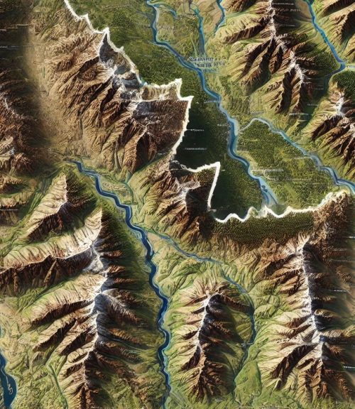
Idaho Topo Map 1

Idaho’s Breathtaking Landscapes Through Topographic Maps: A Deep Dive into Elevation and Terrain

Idaho, a state often overshadowed by its more famous neighbors, holds some of the most stunning and varied landscapes in the United States.  Known as the “Gem State” for its natural beauty, Idaho offers towering mountain ranges, deep valleys, winding rivers, expansive plains, and high desert regions.  From the craggy peaks of the Sawtooth Mountains to the desolate beauty of Craters of the Moon, Idaho is a state defined by its topography, making topographic maps an essential tool for exploring and understanding its diverse landscapes.

Topographic maps bring Idaho’s stunning natural features to life, offering a view of the elevation, contours, and natural landmarks that define the state’s geography.  Whether for adventurers seeking remote hiking trails, scientists conducting geological surveys, or casual explorers fascinated by the landscape, topographic maps are indispensable tools. With both 2D and 3D representations available, these maps provide unique insights into Idaho’s varied terrain, making it easier to navigate its rugged wilderness and appreciate its natural beauty.

Topo 3D Maps

The Sawtooth Mountains: Idaho’s Majestic Peaks Unveiled

When you think of Idaho’s topography, the Sawtooth Mountains often come to mind first. Located in central Idaho, the Sawtooth Range is part of the Rocky Mountains and boasts over 50 peaks that rise above 10,000 feet.  The range’s jagged, rocky peaks resemble the teeth of a saw, hence its name, and it offers some of the most spectacular mountain scenery in the state.  For outdoor enthusiasts, the Sawtooth Wilderness is a paradise, with countless trails, alpine lakes, and hidden valleys waiting to be explored.

Topographic maps of the Sawtooth Mountains offer an indispensable guide for navigating this rugged terrain.  In 2D topographic maps, contour lines help to visualize the dramatic elevation changes between the peaks and valleys.  The steep slopes of the mountains are shown by tightly packed contour lines, revealing the challenges of hiking through the region.  In contrast, flatter areas such as the meadows around Redfish Lake or the lowlands near Stanley are displayed with more widely spaced lines, providing a clear picture of where the landscape levels out.

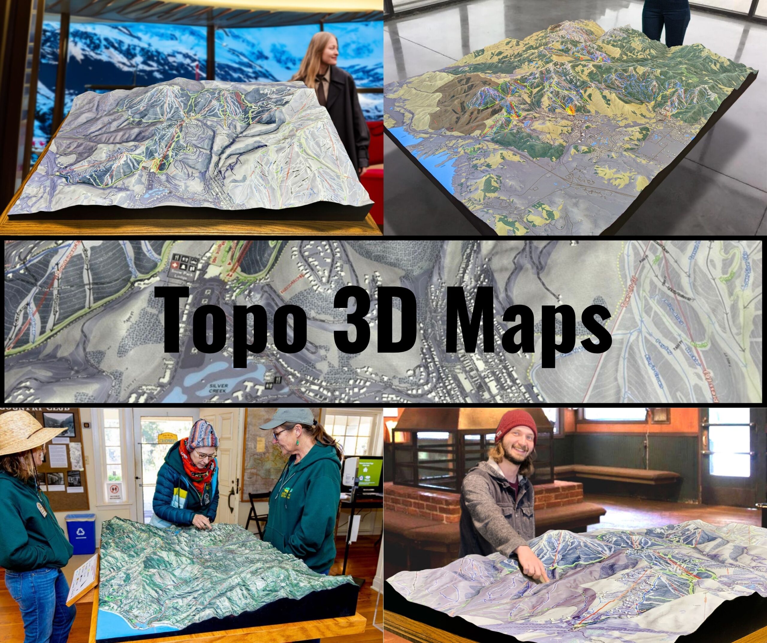
For those seeking an even more immersive experience, 3D topographic maps of the Sawtooths bring the dramatic elevation changes to life.  These maps allow users to trace the ridgelines, valleys, and canyons with their fingers, offering a tangible sense of the range’s topography.  In 3D, the jagged peaks stand out in sharp relief, and viewers can easily visualize the steepness of the terrain, making it easier to plan hikes, climbs, or camping trips in the area.

The Sawtooths are also home to a number of alpine lakes, many of which are nestled in deep basins carved by glaciers thousands of years ago.  Topographic maps highlight these lakes, showing how the surrounding mountains create natural barriers that limit access to these hidden gems.  Whether you’re planning a backcountry trip to Alice Lake or hiking up to Sawtooth Lake, topographic maps provide the critical information needed to navigate the rugged terrain.

Craters of the Moon: A Landscape of Lava and Elevation

Idaho is known for its volcanic history, and one of the most fascinating topographic features in the state is Craters of the Moon National Monument.  This otherworldly landscape of lava flows, cinder cones, and volcanic craters is unlike anything else in Idaho, and topographic maps of the area provide a unique view of its volcanic terrain.

In 2D topographic maps of Craters of the Moon, the region’s volcanic features are clearly delineated by contour lines that show the elevation changes between the lava fields and the surrounding landscape.  The cinder cones, which rise sharply from the flat lava plains, are represented by tightly packed lines that indicate their steep sides.  The lava tubes and cracks in the earth are also visible on these maps, giving viewers a sense of the fractured and chaotic landscape.

3D topographic maps of Craters of the Moon provide an even more dramatic representation of this alien landscape.  The volcanic cones rise up from the flat plains, and the twisted lava flows are more apparent in three dimensions.  For geologists, hikers, and explorers, these maps offer a valuable tool for understanding the volcanic history of the region and for navigating its treacherous terrain.

Craters of the Moon may seem desolate, but topographic maps reveal how the area’s topography creates microenvironments where plants and animals have managed to thrive. The slight elevation changes between the lava fields and the surrounding desert create pockets where moisture can collect, allowing hardy species to survive in an otherwise inhospitable environment.

The Salmon River: Idaho’s Wild River and its Topographic Importance

The Salmon River, also known as the “River of No Return,” cuts through some of the most remote and rugged landscapes in Idaho.  Flowing through the Frank Church–River of No Return Wilderness, the Salmon River offers a wild and untamed beauty that is unmatched in the lower 48 states.  Topographic maps of the Salmon River region are essential for anyone looking to explore this vast wilderness, whether by raft, kayak, or on foot.

In 2D topographic maps, the Salmon River is shown winding its way through steep canyons and deep valleys, with contour lines indicating the sharp elevation changes along its course.  The river’s rapids and waterfalls are evident on the map, as are the high ridges that rise above the river’s banks.  For whitewater rafters, these maps are essential for identifying the most challenging sections of the river and for planning safe routes through the rapids.

In 3D topographic maps, the Salmon River region’s dramatic elevation changes become even more apparent.  The deep canyons and towering ridges are brought to life in three dimensions, allowing users to visualize the scale of the landscape.  These maps are especially useful for hikers and backpackers who are planning trips in the Frank Church Wilderness, as they provide a clear picture of the terrain’s challenges and help adventurers find the best routes through the wilderness.

The Salmon River’s topography has also played a critical role in shaping the region’s history. Native American tribes, early settlers, and modern-day adventurers have all had to contend with the river’s wild terrain, and topographic maps offer a window into how the land has influenced human activity in the region.

The Snake River Plain: Idaho’s Wide-Open Spaces Mapped

While much of Idaho is known for its mountainous terrain, the southern part of the state is dominated by the Snake River Plain, a broad, flat valley that stretches across the state.  The Snake River Plain is one of the most important agricultural regions in Idaho, and topographic maps of the area provide valuable information for farmers, land managers, and conservationists.

In 2D topographic maps, the Snake River Plain is shown as a broad, flat area with gently sloping contours that indicate the gradual elevation changes across the plain.  The Snake River itself winds through the plain, creating a network of irrigation canals, reservoirs, and floodplains that are critical for the region’s agriculture.  These maps help land managers plan for irrigation, manage water resources, and understand how the river’s flow affects the surrounding land.

3D topographic maps of the Snake River Plain offer a more detailed view of the region’s subtle topography.  While the plain may appear flat at first glance, 3D maps reveal the slight elevation changes that define the landscape.  These maps are especially useful for understanding how the Snake River’s flow has shaped the plain over time, creating fertile farmland and influencing the region’s settlement patterns.

The Snake River Plain is also home to a number of geological features, such as volcanic craters, lava fields, and rift zones.  Topographic maps highlight these features, showing how the region’s volcanic history has shaped the land.  In 3D, these features stand out even more, allowing users to visualize the volcanic landscape that lies beneath the fertile soil of the plain.


How Idaho Topo Maps Are Fabricated: A Blend of Technology and Artistry

Creating topographic maps of Idaho’s diverse landscapes requires a combination of advanced technology, data collection, and artistic interpretation.  Whether it’s a 2D map filled with contour lines or a 3D model that brings the terrain to life, the fabrication process for topographic maps is a complex and fascinating blend of science and art.

For 2D topographic maps, the process begins with data collection from a variety of sources. This includes satellite imagery, aerial photography, and on-the-ground surveys.  Elevation data is gathered using tools like LiDAR (Light Detection and Ranging), which uses lasers to measure the distance between the ground and the aircraft or satellite.  This data is then processed using Geographic Information Systems (GIS) software, which converts the raw elevation data into contour lines that represent changes in elevation.

The contour lines on 2D topographic maps are carefully spaced to show the steepness of the terrain.  Closer lines indicate steeper slopes, while wider lines show flatter areas. Features such as rivers, lakes, and man-made structures are added to the map to create a more complete picture of the landscape.  The final map is a detailed representation of Idaho’s topography, providing users with a clear understanding of the state’s terrain.

Creating 3D topographic maps is a more involved process that builds on the same elevation data used for 2D maps.  Using advanced software, the elevation data is transformed into a three-dimensional model of the landscape.  This model can be printed using 3D printers, which layer materials such as PLA to create a physical representation of the terrain.  Once the 3D map is printed, it is often painted and finished to highlight different features of the landscape, such as forests, rivers, and mountains.

For Idaho’s topographic maps, special attention is given to capturing the state’s diverse landscapes, from the jagged peaks of the Sawtooth Mountains to the broad plains of the Snake River Valley and the rugged wilderness of the Salmon River.  The final 3D maps are not only precise but visually stunning, showcasing the unique geographical features that define Idaho’s topography.  These 3D maps offer a more tactile and immersive experience, allowing users to explore the state’s natural beauty in a tangible way.

In addition to physical 3D maps, digital 3D topographic models are increasingly popular, particularly for hikers, geologists, and outdoor enthusiasts.  Using specialized software, users can rotate, zoom, and manipulate digital versions of these maps, providing a detailed and flexible way to explore Idaho’s varied landscapes.  These digital maps are particularly useful for planning expeditions in remote areas, offering a comprehensive view of the terrain before setting foot on the ground.

Idaho Topo Maps in Environmental Conservation and Resource Management

Topographic maps play a crucial role in Idaho’s environmental conservation efforts and resource management.  The state’s natural resources, from its forests and rivers to its wildlife and ecosystems, are deeply connected to its topography.  Conservationists, scientists, and land managers rely on topographic maps to plan and execute initiatives aimed at preserving Idaho’s pristine wilderness and managing its natural resources sustainably.

In Idaho’s mountainous regions, where elevation plays a significant role in ecosystem diversity, topographic maps help scientists understand how changes in elevation affect plant and animal life.  For instance, the transition from low-elevation grasslands to high-elevation forests and alpine tundra is well-documented on topographic maps, making it easier to track changes in species distribution due to climate change or human activity.

Topographic maps are also used in fire management, particularly in the vast forests of central and northern Idaho.  The steep terrain of the Sawtooth and Bitterroot Mountains makes firefighting efforts challenging, and topographic maps are essential for planning containment strategies and safe evacuation routes.  By understanding the landscape’s elevation and slope, fire crews can better predict how wildfires will spread and where to establish firebreaks.

In Idaho’s river systems, topographic maps are invaluable for managing water resources. The Snake River, which irrigates much of southern Idaho’s farmland, is a vital part of the state’s agricultural economy.  Topographic maps help land managers plan irrigation systems, monitor water flow, and assess the impact of dams and reservoirs on the surrounding terrain.  These maps are also essential for flood management, particularly in the spring when snowmelt from Idaho’s mountains swells the state’s rivers.

Additionally, Idaho’s vast public lands, including national forests and wilderness areas, rely on topographic maps for responsible land management.  These maps help land managers balance the needs of recreation, conservation, and resource extraction, ensuring that Idaho’s natural beauty remains preserved for future generations.

Idaho Topo Maps for Outdoor Recreation: Enhancing the Adventure

Idaho is a haven for outdoor enthusiasts, offering some of the best hiking, camping, fishing, and whitewater rafting opportunities in the country.  For those seeking to explore Idaho’s backcountry, topographic maps are an essential tool for planning adventures and navigating remote terrain.

Hikers, in particular, benefit greatly from topographic maps. Whether exploring the craggy peaks of the Sawtooths, the remote wilderness of the Selway-Bitterroot, or the desert landscapes of southwestern Idaho, a topographic map provides critical information about elevation changes, trail routes, and water sources.  In areas with steep terrain, such as the Sawtooth Wilderness, topographic maps help hikers prepare for challenging ascents and descents, while also offering clues to the best viewpoints and campsites.

For backpackers and multi-day adventurers, topographic maps are essential for route planning and safety.  Knowing the elevation profile of a trail allows backpackers to anticipate the difficulty of different sections and allocate their time and energy accordingly. In addition, these maps help adventurers identify potential hazards, such as steep cliffs, river crossings, and areas prone to avalanches or rockfalls.

Whitewater rafters and kayakers also rely on topographic maps when navigating Idaho’s wild rivers, such as the Salmon and Snake Rivers.  These maps help identify rapids, waterfalls, and other obstacles, allowing paddlers to plan their route and assess the difficulty of different river sections.  Topographic maps also highlight take-out points, campsites, and other important landmarks along the river, ensuring a safe and enjoyable experience on the water.

Hunters and anglers use topographic maps to scout remote locations, identify water sources, and plan their trips.  In Idaho’s vast wilderness areas, these maps are invaluable for navigating unfamiliar terrain and finding the best spots for fishing or tracking game. By studying elevation changes and natural features, hunters and anglers can make informed decisions about where to set up camp, hunt, or fish.

In recent years, the advent of GPS and digital mapping tools has enhanced the way outdoor enthusiasts use topographic maps.  Many hikers, backpackers, and rafters now use GPS devices or smartphone apps that integrate digital topographic maps, providing real-time location data and terrain information.  These tools are especially useful in Idaho’s remote wilderness areas, where trails may be unmarked, and cell phone service is unavailable.  However, even in the age of GPS, physical topographic maps remain an essential backup, ensuring that adventurers can navigate safely, even when technology fails.

Educational and Scientific Uses of Idaho Topo Maps

Topographic maps of Idaho aren’t just for adventurers and land managers—they’re also powerful tools for education and scientific research.  From classrooms to laboratories, these maps provide valuable insights into Idaho’s geology, hydrology, and ecology, helping students and researchers better understand the state’s natural environment.

In classrooms, topographic maps are often used to teach students about geography, elevation, and landforms.  By studying Idaho’s varied landscapes, students can learn how mountains, rivers, and valleys are formed, how elevation affects climate and vegetation, and how human activity interacts with the natural world.  For instance, students can use topographic maps to explore the relationship between Idaho’s mountain ranges and its weather patterns, or to study how the Snake River has shaped the state’s agricultural economy.

For geologists, topographic maps are essential tools for studying Idaho’s unique geological history.  The state is home to a wide range of geological features, from ancient volcanic fields to glacially carved valleys, and topographic maps provide a detailed view of how these features are distributed across the landscape.  Geologists use these maps to study fault lines, identify areas prone to landslides or earthquakes, and track the effects of erosion and sedimentation over time.

Hydrologists also rely on topographic maps to study Idaho’s water systems.  The state’s rivers, lakes, and groundwater resources are deeply connected to its topography, and topographic maps provide the information needed to understand how water flows through the landscape.  In areas such as the Snake River Plain, where irrigation and water management are critical to agriculture, topographic maps are essential for managing water resources sustainably.

Ecologists use topographic maps to study the distribution of plant and animal species across Idaho’s varied ecosystems.  By understanding how elevation, slope, and aspect affect temperature, moisture, and sunlight, ecologists can predict where certain species are likely to thrive and monitor changes in species distribution due to climate change or habitat loss.

Conclusion: Idaho’s Landscapes Brought to Life Through Topo Maps

Idaho’s topographic maps are more than just tools—they are windows into the state’s breathtaking landscapes.  Whether you’re navigating the jagged peaks of the Sawtooths, rafting down the wild Salmon River, or studying the volcanic history of Craters of the Moon, topographic maps provide the critical information needed to explore, understand, and appreciate Idaho’s natural beauty.

From the traditional 2D maps that use contour lines to show elevation changes to the more immersive 3D maps that bring the landscape to life in stunning detail, Idaho’s topographic maps offer something for everyone.  Outdoor enthusiasts, scientists, educators, and conservationists all rely on these maps to navigate the state’s diverse terrain, study its natural features, and protect its wild spaces.

As technology continues to advance, the future of Idaho topographic maps looks even more exciting. With the use of LiDAR, GPS, and 3D printing, these maps are becoming more detailed, accurate, and accessible than ever before.  Whether in digital or physical form, topographic maps will continue to play a vital role in exploring Idaho’s landscapes, connecting us to the natural world in meaningful ways, and ensuring that Idaho’s beauty is preserved for generations to come.
  

Check out WhiteClouds’ 3D Maps for more information on Idaho topo maps.  

Contact us today to learn more about our 3D services and how we can help you achieve your goals.     

Get a free quote

Get a Free Quote on a Custom 3D Billboard

Get a Free Quote