Killington Ski Resort 3D Maps
Killington Ski Resort 3D Maps
We Build Custom 3D Killington Ski Resort Maps
Killington Ski Resort 3D Maps: Exploring the Beast of the East in Stunning Detail
Killington Ski Resort, fondly known as the “Beast of the East,” holds the crown as one of the largest and most exhilarating ski destinations on the East Coast. With over 1,500 acres of skiable terrain, six different mountain peaks, and an extensive trail network, it offers a thrilling experience for skiers and snowboarders of all levels. But to fully appreciate the vast and varied terrain, Killington Ski Resort 3D maps provide an essential, visually captivating guide. These intricate maps bring the mountain to life, allowing visitors to explore its layout with precision and understanding.
In this comprehensive blog, we’ll dive deep into the craftsmanship behind the creation of these stunning 3D maps, reveal how they’re fabricated using cutting-edge technology, and explore the major ski runs that define Killington as the ultimate winter destination. Whether you’re a seasoned skier looking to conquer expert terrain or a beginner exploring the slopes for the first time, the Killington Ski Resort 3D map serves as both a practical navigational tool and a beautiful representation of this iconic resort.
Crafting Killington Ski Resort 3D Maps: Blending Technology with Artistry
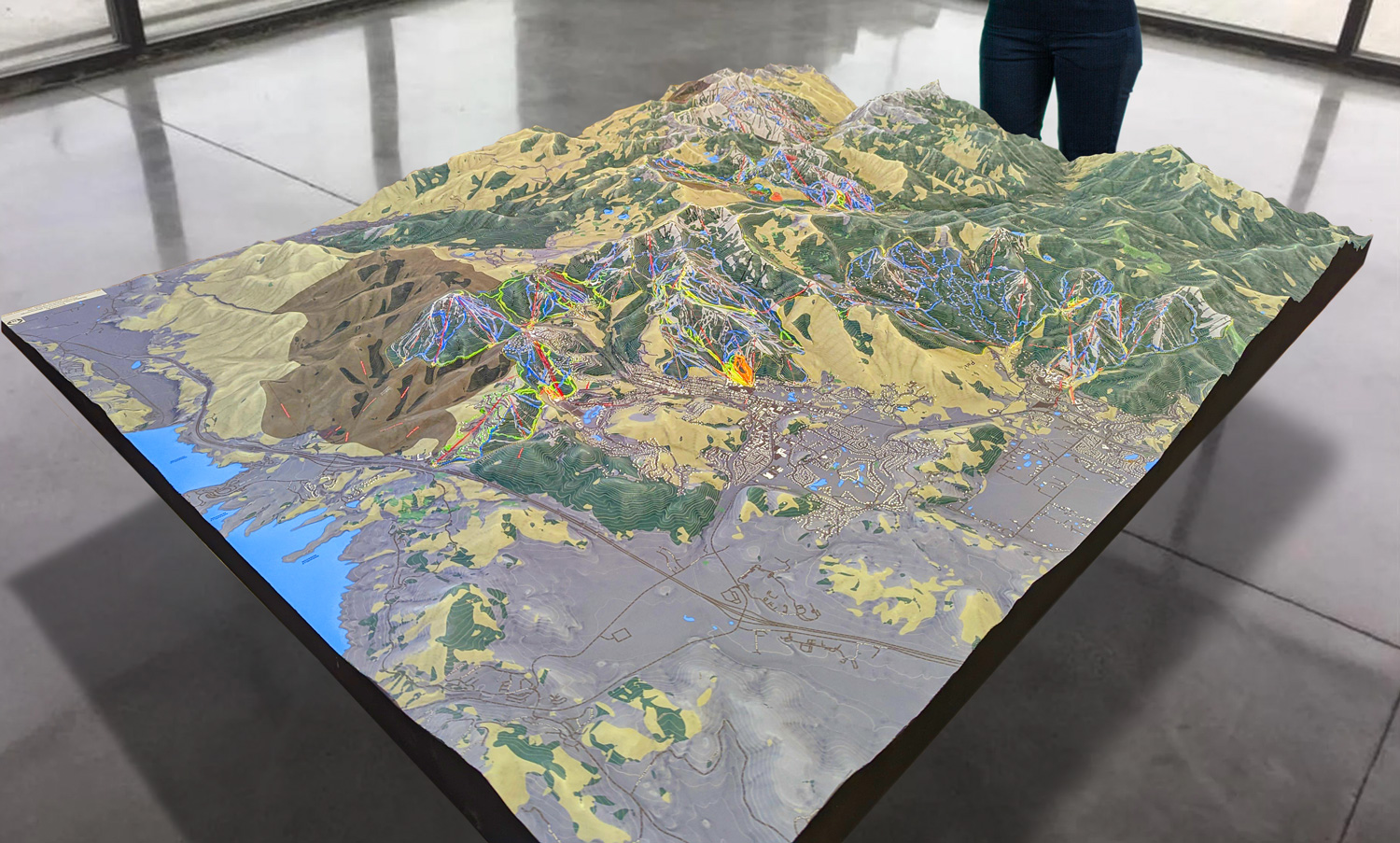
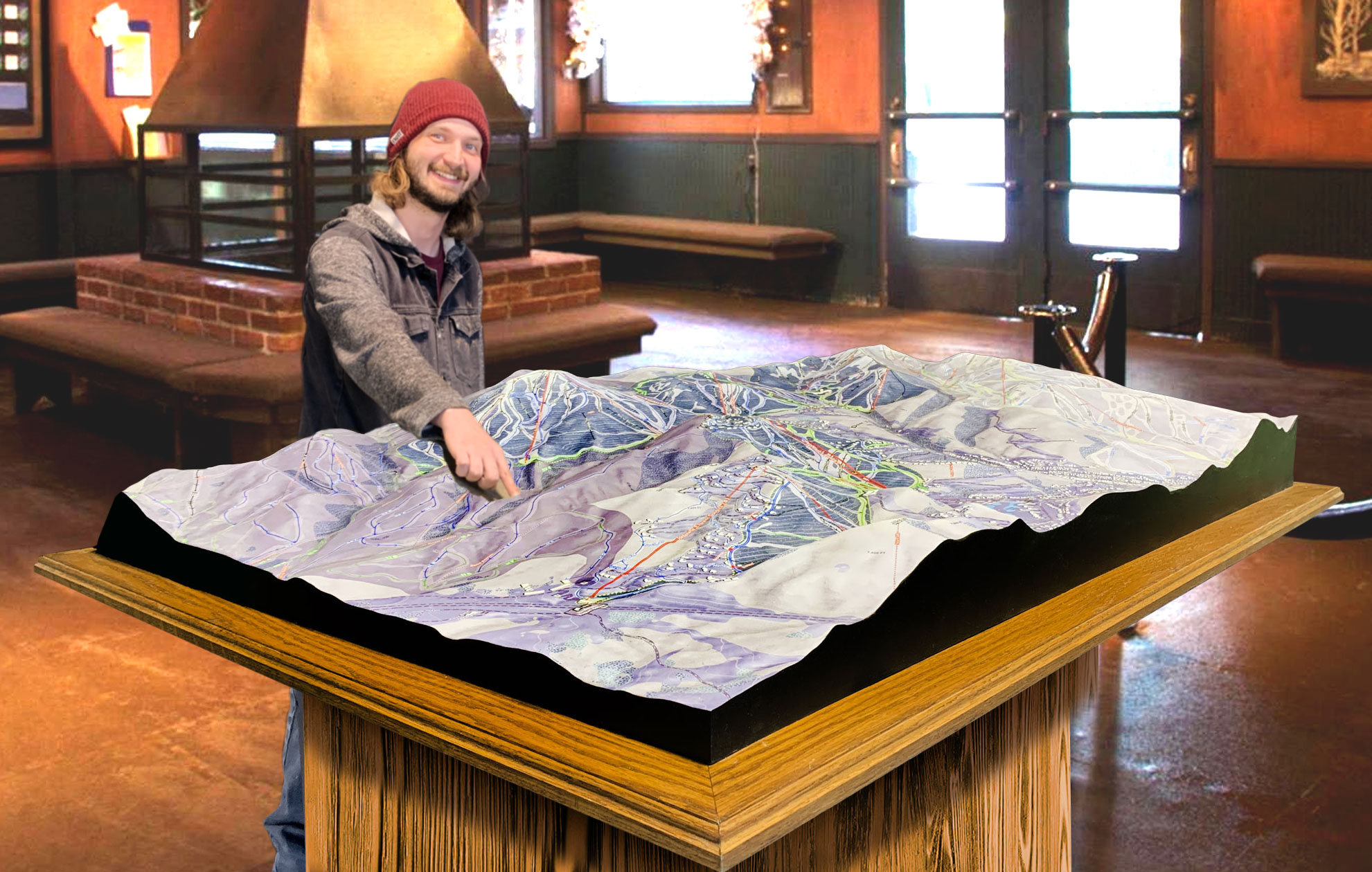
The process of creating Killington Ski Resort 3D maps is a blend of advanced technology and artistic craftsmanship, resulting in maps that are both accurate and visually stunning. These maps aren’t just functional tools for navigating the mountain; they’re also detailed works of art that capture the grandeur of Killington’s terrain.
The creation process begins with precise data collection, which is achieved using technologies like LiDAR (Light Detection and Ranging) and GPS mapping. LiDAR involves sending out laser pulses from an aerial platform (such as a drone or airplane) to measure the distance between the laser sensor and the surface of the mountain. This allows for the collection of highly detailed topographical data that captures even the smallest contours of the terrain. The steep ridges, gentle slopes, valleys, and rock formations of Killington are all recorded with incredible accuracy.
Once the LiDAR data has been gathered, it’s combined with GPS mapping to ensure the precise location of key features such as ski trails, lifts, base lodges, and other landmarks. This data is then transferred to a computer-aided design (CAD) system, where designers create a 3D digital model of the mountain. The CAD software allows for the manipulation of this data to generate a scaled-down, highly detailed representation of the resort.
The next phase in the process is the physical creation of the 3D map, which can be done through two primary methods: CNC (Computer Numerical Control) machining or 3D printing. CNC machines carve the topographical model out of foam or resin, precisely following the digital design to replicate the contours of Killington’s terrain. Alternatively, 3D printing technology can be used to build the map layer by layer, gradually creating a scaled model of the mountain. Both methods ensure that the physical map is a faithful representation of the actual landscape.
But the craftsmanship doesn’t stop there. Once the base map is complete, skilled artisans take over, adding color and texture to bring the mountain to life. The green forests, white snow-covered slopes, rocky cliffs, and open glades are all meticulously painted with natural hues. Artists use shading to depict elevation changes, with darker tones used in the valleys and lighter shades on the peaks. This attention to detail not only enhances the map’s visual appeal but also provides a more intuitive understanding of the terrain.
The final step is to add the key elements of the ski resort—such as trails, lifts, and important landmarks—ensuring that the map is not only a beautiful work of art but also a fully functional navigational tool. Each ski trail is clearly marked, with its difficulty level indicated, and lift lines are shown in their correct locations, helping visitors navigate the resort efficiently. The combination of technology, precision, and artistry results in a 3D map that perfectly captures the essence of Killington Ski Resort.
 Park City 3D Raised Relief Map
Killington’s Expansive Terrain: A 3D Map Brings the Mountain to Life
One of the key benefits of Killington’s 3D map is that it provides an immersive view of the resort’s vast and varied terrain. Killington is famous for its size and diversity, with trails and features spread across six different peaks—Killington Peak, Snowdon Mountain, Skye Peak, Bear Mountain, Ramshead Mountain, and Sunrise Mountain. Each of these areas offers a unique skiing experience, from gentle beginner slopes to steep, heart-pounding expert runs.
Killington Peak, standing tall at 4,241 feet, is the highest point in the resort and offers breathtaking views of Vermont’s Green Mountains. From the summit, skiers can choose from a range of trails that cater to all skill levels. On the 3D map, the steep, challenging runs like Cascade and Double Dipper are shown plunging down from the peak, while more intermediate-friendly options like Great Northern meander down the slopes, offering scenic views and easier terrain.
Bear Mountain is known for its advanced terrain, and the 3D map highlights its iconic trails like Outer Limits, one of the steepest mogul runs on the East Coast. The map shows how this black diamond trail carves its way down the mountain, with its steep pitch and massive moguls visible even in the 3D representation. For expert skiers, the map provides an invaluable tool for understanding the layout of Bear Mountain’s steep and technical terrain before they commit to a challenging descent.
For beginners, Ramshead Mountain offers wide, gentle slopes that are perfect for learning the basics. Trails like Easy Street and Caper are clearly marked on the 3D map, showing their gentle incline and wide, forgiving terrain. Families and first-time skiers can use the map to navigate these beginner zones, ensuring they stay on terrain that matches their skill level.
Snowdon Mountain is another favorite area, offering a mix of intermediate and advanced terrain. The 3D map shows how trails like Chute and Ridge Run weave their way through this area, providing thrilling yet manageable runs for those looking to challenge themselves without venturing onto expert-only terrain.
One of the most exciting features of Killington’s 3D map is how it brings the resort’s extensive glade terrain to life. Killington is known for its tree skiing, and the map highlights areas like Patsy’s, Squeeze Play, and Devil’s Fiddle where skiers can venture into the trees for a more adventurous experience. These glades are beloved for their powder-filled runs and natural beauty, and the 3D map helps skiers locate and explore these off-piste areas with confidence.
 Deer Valley 3D Raised Relief Map
Major Ski Runs at Killington Ski Resort: Exploring the Beast
Killington Ski Resort offers a wide variety of ski runs that cater to every skill level, and the 3D map provides an invaluable guide to these trails, helping visitors plan their day on the slopes. Let’s take a closer look at some of the most iconic ski runs at Killington, as depicted on the 3D map.
For beginner skiers, Ramshead Mountain is a haven of gentle, wide-open trails that are perfect for learning. Runs like Easy Street and Caper offer long, smooth descents with gradual slopes that allow beginners to practice their turns and build confidence. These trails are clearly marked on the 3D map, making it easy for newcomers to navigate the beginner areas and avoid more challenging terrain.
Intermediate skiers will find a wealth of options across the resort, but Skye Peak is particularly popular for its variety of blue square trails. Great Eastern, one of the longest trails on the East Coast, is a must-do for intermediates, offering a scenic, five-mile cruise from the summit of Skye Peak all the way down to the base. The 3D map shows how this trail winds its way through the resort, providing a clear view of its twists and turns. Other standout intermediate runs include Cruise Control and Bittersweet, both of which offer smooth, enjoyable descents with stunning views of the surrounding mountains.
For advanced skiers, Killington is a true playground. The 3D map showcases some of the resort’s most challenging trails, including the infamous Outer Limits on Bear Mountain. Known for its steep pitch and massive moguls, Outer Limits is one of the toughest mogul runs in the country, and the 3D map captures the steepness of the slope and the daunting size of the bumps. Another expert favorite is Devil’s Fiddle, a double black diamond trail with steep, rocky terrain and tree-filled sections that test even the most experienced skiers.
Killington Peak is home to some of the resort’s most iconic expert runs, including Cascade and Double Dipper. These trails offer steep descents and thrilling terrain, with the 3D map providing a detailed view of their narrow chutes and sharp drops. Expert skiers can use the map to plan their routes down these challenging trails and visualize the terrain before they begin their descent.
For those who prefer tree skiing, Killington offers some of the best glade runs on the East Coast. Patsy’s, Squeeze Play, and Devil’s Den are all featured on the 3D map, allowing adventurous skiers to plan their routes through the trees and explore the untouched powder within the glades. The map shows how these glades are integrated into the mountain’s trail network, making it easy to find and navigate the best tree-skiing areas.
Conclusion: Killington Ski Resort 3D Maps – A Gateway to Adventure
Killington Ski Resort’s 3D maps are more than just navigational tools—they are works of art that capture the essence of this iconic resort. Whether you’re a beginner learning the basics on Ramshead Mountain or an expert skier tackling the steep slopes of Bear Mountain, these maps provide an immersive and detailed view of the terrain. By blending advanced technology with artistic craftsmanship, Killington’s 3D maps offer a comprehensive guide to the resort, allowing visitors to explore the mountain with confidence and appreciation.
From the longest runs like Great Eastern to the steepest mogul fields on Outer Limits, the Killington 3D map serves as a gateway to adventure, ensuring that every skier can find their ideal terrain and make the most of their time at the Beast of the East.
Check out WhiteClouds’ 3D Maps for more information on 3D maps of Killington Ski Resort.

