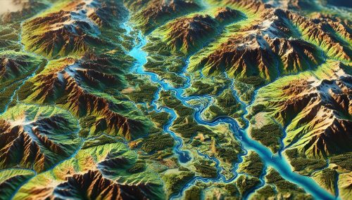
Matanuska River Watershed Map
Matanuska River Watershed Map
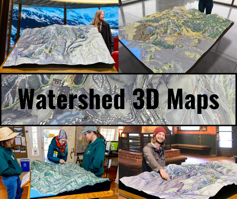
We Build Custom 3D Watershed Maps
The Matanuska River Watershed Map: An In-Depth Look at Alaska’s Dynamic Waterway
The Matanuska River, located in the south-central region of Alaska, is a powerful and vital waterway that flows for approximately 50 miles, draining the vast Matanuska Glacier. The river winds its way through a spectacular landscape of snow-capped mountains, glacial valleys, and lush forests, ultimately emptying into the Knik Arm of the Cook Inlet. The Matanuska River Watershed Map is an indispensable tool for understanding the hydrology, geography, and ecology of this unique region. From its headwaters in the glacier-fed streams of the Matanuska Glacier to the agricultural lands of the Matanuska-Susitna Valley, the map provides valuable insights into the river’s journey, the ecosystems it sustains, and the human communities that depend on it.
The Matanuska River Watershed is an integral part of the surrounding landscape, serving as a key water source for agriculture, hydroelectric power generation, and natural ecosystems. However, like many watersheds in the Arctic and sub-Arctic regions, the Matanuska River faces growing challenges from climate change, human activity, and land use changes. The map of this watershed is a critical resource for understanding the complexities of the river system, as well as the potential impacts of environmental changes.
Tracing the Path of the Matanuska River: Geography and Hydrology of the Watershed
The Matanuska River originates from the Matanuska Glacier, which sits at the base of the Chugach Mountains. As the glacier melts, the river is fed by a series of streams and meltwater channels that descend from the ice. From its source, the river flows through the Matanuska Valley, winding its way southward before emptying into the Knik Arm of the Cook Inlet.
Geographically, the Matanuska River Watershed encompasses a diverse range of terrains, from rugged, mountainous areas to expansive valleys. The river’s headwaters lie at the base of the Matanuska Glacier, where snowmelt and glacier runoff create an immense volume of water. As the river flows southward, it carves through glacial valleys, gradually transitioning into the lower, more fertile areas of the Matanuska-Susitna Valley. The riverbed in these lower sections is characterized by gravel bars, meandering channels, and oxbow lakes, which serve as important habitats for wildlife.
The Matanuska River is a glacial-fed river, meaning that its flow is highly dependent on the melting of the surrounding glaciers. During the summer months, as temperatures rise, the glaciers release large volumes of meltwater into the river, increasing its flow and nourishing the ecosystems along its banks. During the colder winter months, the river flow decreases significantly as snow accumulation slows the melting process. This seasonal variation is crucial for understanding the hydrology of the watershed and the ecosystems it supports. The map of the watershed offers a detailed view of these seasonal dynamics, providing essential information for water management, agriculture, and conservation efforts.
Ecosystems and Biodiversity in the Matanuska River Watershed
The Matanuska River Watershed is home to a wide variety of ecosystems, ranging from alpine meadows and riparian zones to wetlands and forests. These ecosystems support a diverse array of plant and animal species, many of which are uniquely adapted to the harsh, sub-Arctic environment. The Matanuska River Watershed Map provides a detailed overview of these ecosystems, illustrating how they are distributed across the landscape and how they interact with the river.
Riparian zones along the Matanuska River are vital for supporting biodiversity and maintaining water quality. These lush areas, characterized by dense vegetation and water-loving plants, serve as essential habitats for wildlife such as moose, beavers, and a variety of bird species, including the bald eagle. These riparian habitats also help stabilize riverbanks, reduce erosion, and filter pollutants from runoff. The map highlights the extent of these riparian zones, underscoring their importance for the overall health of the watershed.
The wetlands found in the lower sections of the Matanuska River Watershed are another critical feature of the ecosystem. These wetlands act as natural filters, removing excess nutrients and pollutants from the water before it enters the Knik Arm. They also provide essential breeding and feeding grounds for migratory birds, fish, and amphibians. The Matanuska River Watershed Map identifies key wetland areas, helping to guide conservation efforts and protect these important habitats.
Upland ecosystems, including the boreal forests and tundra of the surrounding mountains, also play an essential role in the watershed’s health. These ecosystems help regulate water flow by capturing snowmelt, reducing the risk of flooding, and preventing soil erosion. The map integrates these upland areas, demonstrating their interconnectedness with the river system and the broader watershed.
Fish populations in the Matanuska River are particularly significant, with species such as salmon, trout, and grayling relying on the river’s cold, clean waters for spawning and feeding. The map helps identify critical spawning habitats and migratory routes, providing essential information for fisheries management and conservation.
Human Influence and Land Use in the Matanuska River Watershed
Human activity has had a profound impact on the Matanuska River Watershed, with agriculture, urbanization, and hydropower generation all playing key roles in shaping the region. The Matanuska-Susitna Valley, located within the watershed, is a major agricultural area in Alaska, with farmers relying on the river for irrigation and water supplies. The map highlights these agricultural areas, offering a visual representation of how land use affects the river and surrounding ecosystems.
Agriculture in the Matanuska-Susitna Valley is vital for the local economy, with crops such as potatoes, vegetables, and hay being grown in the fertile soils of the valley. Irrigation from the Matanuska River is essential for sustaining these crops, particularly during the dry summer months when water levels in the river may fluctuate. The map provides valuable information on how agricultural water demands interact with the river’s natural flow, helping to identify potential conflicts between agricultural needs and environmental sustainability.
Hydropower generation is another significant human activity within the watershed, with the construction of dams and reservoirs playing a key role in providing electricity to the region. The map identifies these structures, illustrating how they regulate water flow and provide power while also creating challenges for fish migration and water quality. The Matanuska River Watershed Map provides a visual representation of how dams, reservoirs, and irrigation systems impact the river and surrounding ecosystems, helping to inform water management strategies that balance human needs with environmental protection.
Urban development within the watershed, particularly in the city of Palmer and the surrounding communities, has also contributed to changes in land use and river dynamics. As the population grows, so does the demand for water, infrastructure, and land. The map helps to visualize how urban sprawl affects the river and its surrounding landscapes, highlighting areas where urban development has altered natural water flow patterns, increased pollution, and reduced habitat quality.
The Impact of Climate Change on the Matanuska River Watershed
Climate change poses a significant threat to the Matanuska River Watershed, with rising temperatures, changing precipitation patterns, and increasing frequency of extreme weather events expected to have profound effects on the region’s hydrology, ecosystems, and human communities. The Matanuska River Watershed Map is an essential tool for understanding these changes and planning for the future.
One of the most significant impacts of climate change on the Matanuska River is the reduction in snowpack in the surrounding mountains. Snowmelt from the glaciers and snow-covered peaks of the Chugach Mountains is a critical source of water for the river during the spring and summer months. However, warmer temperatures are leading to earlier snowmelt and reduced snowfall, which could result in lower river flows during the growing season, impacting agriculture and ecosystems. The map helps to model how these changes in snowpack will affect the river’s flow and water availability.
Rising temperatures are also expected to increase evaporation rates, further reducing the amount of water available for agriculture and other uses. Additionally, the region may experience more frequent and intense wildfires, which could increase sedimentation in the river, degrade water quality, and further strain fish populations. The map integrates climate data, helping to visualize how these changes could impact the watershed and inform adaptation strategies.
Fabricating Matanuska River Watershed 3D Maps: The Technology Behind the Scenes
Creating 3D maps of the Matanuska River Watershed is a highly advanced process that requires the integration of topographical data, hydrological models, and ecological information. The 3D map offers a dynamic, interactive representation of the watershed, allowing users to explore the river’s path, ecosystems, and human impacts in great detail.
The process begins with the collection of high-resolution geographic data through technologies such as LiDAR (Light Detection and Ranging), satellite imagery, and ground-based surveys. This data is processed into a Digital Elevation Model (DEM), which serves as the foundation for the 3D map. Geographic Information Systems (GIS) software is used to overlay additional data layers, such as land use, vegetation, water quality, and infrastructure, onto the model.
Once the digital map is complete, it can be visualized on a computer screen, in virtual reality, or through augmented reality, allowing users to explore the watershed from different perspectives. This interactive mapping approach provides valuable insights into how the river system, ecosystems, and human activity interact with one another, offering a more comprehensive understanding of the watershed’s dynamics.
In addition to virtual maps, 3D printing technology can be used to create physical models of the Matanuska River Watershed. These models are created by printing layer by layer, using materials such as resin or plastic to replicate the terrain and river features. Hand-painted details enhance the model’s realism, allowing users to engage with the watershed in a tactile way.
3D maps offer numerous benefits for decision-makers, conservationists, and water managers. They can be used to simulate the impacts of climate change, assess flood risks, and plan for the restoration of damaged ecosystems. By providing a multi-dimensional view of the watershed, 3D maps empower stakeholders to make more informed decisions about the future of the Matanuska River Watershed.
The Future of the Matanuska River Watershed and Its Map
The future of the Matanuska River Watershed is shaped by numerous factors, including climate change, population growth, and evolving water demands. The Matanuska River Watershed Map will continue to play a critical role in guiding sustainable management practices, conservation efforts, and water resource planning.
As climate change continues to affect the region, the map will provide valuable insights into how changes in snowmelt, rainfall, and temperature will impact the river’s hydrology and ecosystems. Advances in mapping technology will make it even easier to integrate real-time data, providing a dynamic and up-to-date representation of the watershed that can be used to respond to emerging challenges.
The Matanuska River Watershed Map is more than just a tool—it is an essential resource for understanding the complex relationships between water, land, and people. By embracing this technology and continuing to innovate in watershed management, we can help ensure that the Matanuska River continues to provide vital resources for generations to come.
Check out WhiteClouds’ 3D Maps for more information on Matanuska River watershed maps.

