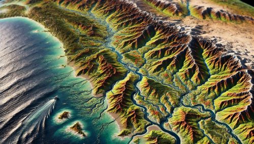
Pacific Coast Basin Watershed Maps
Pacific Coast Basin Watershed Maps
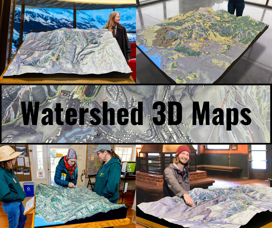
We Build Custom 3D Watershed Maps
The Pacific Coast Basin Watershed: A Vital Water System for the Western United States
The Pacific Coast Basin Watershed is one of the most dynamic and diverse ecosystems in the United States, encompassing a vast and intricate network of rivers, streams, wetlands, and coastal environments that flow into the Pacific Ocean. Stretching from the rainforests of the Pacific Northwest to the arid landscapes of Southern California, this watershed is an essential part of the western U.S., providing vital resources for both people and wildlife. Watershed maps of the Pacific Coast Basin are invaluable tools for understanding how water flows through this complex system, the environmental challenges it faces, and the impact of human activity on its ecosystems.
The Pacific Coast Basin Watershed is unique in many ways, most notably due to the range of climates and environments it spans. From temperate rainforests and mountainous terrain in the north to the more desert-like landscapes of California, the Pacific Coast is home to a stunning array of ecosystems, each playing a critical role in supporting biodiversity. The region also has a long history of human settlement, with cities like Seattle, Portland, San Francisco, and Los Angeles situated along its coast. This has led to the development of extensive infrastructure and land use practices that have altered the natural flow of water, making it even more important to map and manage the watershed effectively.
As the region experiences pressures from urbanization, industrialization, and climate change, understanding how water moves through the landscape has never been more crucial. Detailed watershed maps help researchers and policymakers track water flow, identify areas at risk of flooding or contamination, and design strategies for water conservation, habitat restoration, and sustainable development. In addition to providing a comprehensive overview of the physical terrain, these maps allow us to understand how various factors—from weather patterns to human activity—shape the region’s water systems.
The Geography and Topography of the Pacific Coast Basin: A Study in Diversity
The geography and topography of the Pacific Coast Basin are as varied as the ecosystems that inhabit it. This vast watershed spans a wide array of landscapes, from the towering peaks of the Cascade Range in Washington and Oregon to the low, flat coastal plains of California. The diverse terrain has a profound impact on how water moves across the landscape, influencing the behavior of rivers, streams, and estuaries.
In the Pacific Northwest, the land is characterized by steep mountain ranges, dense forests, and abundant rainfall. The region is home to major river systems such as the Columbia River, which is the largest river in the Pacific Northwest, draining a vast portion of the region. The Columbia River and its tributaries are vital for agriculture, transportation, and hydropower, but they also support a range of ecosystems, including wetlands, floodplains, and forested riparian zones. The complex topography of the area means that water flows quickly through the region’s steep valleys and gorges, creating powerful rivers that can experience rapid rises and falls in response to rainfall or snowmelt.
Further south, the terrain becomes more diverse, with the Sierra Nevada mountains to the east and the coastal mountain ranges running parallel to the ocean. This region, particularly California, is known for its Mediterranean climate, with hot, dry summers and mild, wet winters. Rivers like the Sacramento and San Joaquin Rivers drain vast agricultural regions in the Central Valley, providing essential water resources for crops, livestock, and the state’s economy. These rivers also feed into the San Francisco Bay-Delta, a crucial estuarine system that supports numerous species and serves as a critical hub for water distribution in California.
At the southernmost reaches of the Pacific Coast Basin, the landscape transitions into the more arid regions of Southern California, where the flow of water is significantly influenced by rainfall patterns, which are often sporadic and unpredictable. In this region, the development of water infrastructure, such as dams, aqueducts, and reservoirs, has been essential to meet the demands of urban areas like Los Angeles, San Diego, and other population centers. The watershed in this area is more fragmented, with a mix of smaller rivers and streams that flow through desert landscapes, but the importance of these waterways is no less significant in supporting the region’s diverse ecosystems and human populations.
The Role of Watershed Maps in Understanding the Pacific Coast Basin
Watershed maps are invaluable tools for understanding the flow of water across the Pacific Coast Basin, offering a visual representation of the basin’s rivers, streams, and other water systems. These maps help to delineate the boundaries of the watershed, identify major rivers and tributaries, and illustrate how water flows through the region’s diverse topography. They are essential for managing water resources, preventing flooding, and protecting ecosystems, especially in a region as environmentally and climatically diverse as the Pacific Coast.
By analyzing these maps, researchers can identify key areas where water is most vulnerable to contamination, erosion, or overuse. For example, urban areas along the coast often experience heavy runoff from rainfall, which can wash pollutants such as oil, chemicals, and debris into rivers and oceans. Watershed maps help to pinpoint these areas, allowing environmental agencies to implement measures to mitigate pollution and protect water quality.
In addition to providing insights into water flow and contamination risks, watershed maps also help identify areas that are most vulnerable to flooding, particularly in regions with steep terrain or significant rainfall. These maps can help guide flood management strategies, such as the construction of levees, dams, and retention basins, and ensure that infrastructure development does not exacerbate flood risks in vulnerable areas.
Furthermore, these maps are crucial for understanding the relationships between water systems and ecosystems. The Pacific Coast Basin is home to a range of habitats, including wetlands, estuaries, and riparian zones, all of which rely on a stable water flow to maintain ecological balance. Watershed maps help track the health of these ecosystems, providing critical data for conservationists and wildlife managers who work to protect biodiversity and restore habitats that have been impacted by human activity.
The Ecological Importance of the Pacific Coast Basin: A Hub for Biodiversity
The Pacific Coast Basin is home to some of the most diverse ecosystems in North America. From temperate rainforests in the Pacific Northwest to the dry, desert landscapes of Southern California, the region supports a variety of plant and animal species that are adapted to its unique climates and environments. These ecosystems are interconnected, with rivers and streams acting as corridors for species migration and providing the water necessary to sustain both aquatic and terrestrial life.
In the Pacific Northwest, the region’s rainforests and river systems provide critical habitat for species such as the Chinook salmon, which depends on the clean, cold waters of the Columbia River and its tributaries for spawning. The region is also home to diverse bird species, including bald eagles, osprey, and a variety of migratory waterfowl. The wetlands and floodplains that surround these rivers are home to a variety of plant species, as well as amphibians, reptiles, and mammals, all of which contribute to the region’s rich biodiversity.
Moving southward, the ecosystems of the Pacific Coast Basin become more diverse, with coastal marshes, saltwater estuaries, and coastal dunes providing habitats for species like the California sea otter, the western snowy plover, and the endangered southern sea otter. The wetlands of the Bay Area and the coastal marshes of Southern California are essential for filtering water, preventing coastal erosion, and providing breeding grounds for marine species. The interconnectedness of these habitats and the role they play in maintaining water quality make the Pacific Coast Basin an essential area for conservation efforts.
The diverse ecosystems of the Pacific Coast Basin rely heavily on the health of its water systems, with many species dependent on the steady flow of clean water to survive and thrive. Understanding how water flows through these landscapes, and how human activity has impacted these systems, is essential for protecting biodiversity and maintaining ecological balance.
The Impact of Human Activity on the Pacific Coast Basin
Human activity has had a significant impact on the Pacific Coast Basin, particularly in terms of urbanization, agriculture, and industrialization. The region’s population has grown rapidly over the past century, with major metropolitan areas such as Seattle, Portland, San Francisco, Los Angeles, and San Diego all situated along the coast. This rapid urbanization has resulted in increased demand for water resources, as well as the development of extensive infrastructure to manage the flow of water.
The construction of dams, reservoirs, and aqueducts has been essential for providing water to the region’s growing population, but it has also altered the natural flow of rivers and streams. In some areas, the construction of dams has led to the loss of critical wetland habitats, the disruption of fish migration, and the deterioration of water quality. In addition, urbanization along the coast has led to increased runoff and water pollution, with stormwater carrying pollutants such as chemicals, plastics, and heavy metals into rivers and oceans.
Agriculture, particularly in California, has also contributed to the alteration of natural water systems. The demand for water for irrigation in the state’s Central Valley has led to the depletion of groundwater resources and the alteration of river flows. The use of fertilizers and pesticides in farming has resulted in nutrient pollution and the creation of harmful algal blooms, which threaten aquatic ecosystems and water quality.
How 3D Maps of the Pacific Coast Basin Watershed Are Fabricated
The development of 3D maps of the Pacific Coast Basin Watershed represents a major technological advancement in understanding the region’s water systems. These maps provide a more detailed and interactive representation of the basin, allowing researchers, policymakers, and conservationists to analyze the landscape and water flow in three dimensions. The process of creating these maps begins with the collection of data from a variety of sources, including satellite imagery, LiDAR (Light Detection and Ranging) technology, and hydrological data.
LiDAR technology is particularly important for creating accurate 3D maps, as it uses laser pulses to measure the distance between the sensor and the Earth’s surface. This data is used to create a detailed digital elevation model (DEM) of the land, capturing even the smallest variations in topography, such as the slopes of mountains, the contours of rivers, and the elevations of valleys. Once the DEM is created, other data layers, such as satellite imagery, vegetation data, and water quality information, are integrated into the map.
Geographic Information Systems (GIS) software is used to combine all of this data into a cohesive 3D model that can be visualized from different angles. These 3D maps allow researchers to analyze how water moves across the landscape, simulate different environmental scenarios, and explore the impact of human activity on the watershed.
The Future of Pacific Coast Basin Watershed Mapping
As technology continues to evolve, the future of Pacific Coast Basin watershed mapping looks incredibly promising. The integration of real-time data from sensors, drones, and other monitoring tools will allow for continuous updates to the maps, providing an up-to-date view of the health of the watershed. This will enable researchers to track changes in water quality, monitor the effects of climate change, and implement more effective conservation strategies.
In conclusion, the Pacific Coast Basin Watershed is one of the most critical and complex ecosystems in North America. With its diverse landscapes, rich biodiversity, and vital water resources, understanding how water moves through this region is crucial for maintaining ecological balance and supporting sustainable development. Through the use of advanced 3D mapping technologies, we can gain deeper insights into the watershed and ensure its long-term health for future generations.
Check out WhiteClouds’ 3D Maps for more information on Pacific Coast Basin watershed maps.

