Quoggy Jo 3D Maps
Quoggy Jo 3D Maps
We Build Custom 3D Quoggy Jo Maps
Exploring the Fascinating World of Quoggy Jo 3D Maps: From Fabrication to the Thrills of the Ski Runs
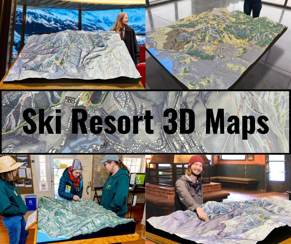
Quoggy Jo Ski Area, nestled in the stunning landscapes of Aroostook County, Maine, may not be the largest or most famous ski area, but it holds a charm that captivates outdoor enthusiasts of all ages. Whether you’re a local resident or a visitor seeking a peaceful and exciting winter retreat, Quoggy Jo offers a unique experience that is enhanced by the intricate and detailed 3D maps created specifically for the ski area. These maps are more than just navigational tools—they are artistic representations of the mountain’s topography and ski runs, helping both beginners and seasoned skiers explore the area with ease.
In this blog, we’ll dive deep into the fabrication process behind Quoggy Jo 3D maps, as well as explore the major ski runs at this beautiful destination. These maps not only provide a practical guide to the slopes but also serve as a visual celebration of the mountain’s contours, trails, and natural beauty.

How Quoggy Jo 3D Maps Are Meticulously Fabricated to Capture Every Detail
Creating a 3D map of a ski area is an intricate process that combines technology, craftsmanship, and creativity to accurately represent the landscape. At Quoggy Jo, the 3D maps are more than just practical tools for navigating the slopes—they’re also works of art that showcase the unique terrain of the mountain. The fabrication process involves several stages, each critical to ensuring the map reflects the true essence of Quoggy Jo.
Gathering Topographical Data
The foundation of any 3D map begins with topographical data. This data is typically sourced from Geographic Information Systems (GIS), satellite imagery, or lidar scans. At Quoggy Jo, the map designers rely on a combination of these technologies to capture the precise elevation changes, contours, and natural features of the mountain. Lidar, in particular, is a laser-based technology that creates highly accurate representations of the terrain, ensuring that every dip, rise, and slope is mapped with precision.
For Quoggy Jo, this data is essential in illustrating the ski area’s gentle slopes, forested areas, and trails. The topographical information is then converted into a 3D model, which becomes the blueprint for the fabrication of the final map.
3D Modeling the Terrain
Once the topographical data has been gathered, it’s time to translate that data into a 3D model. Using advanced software like CAD (Computer-Aided Design) or 3D modeling platforms, the designers create a virtual version of Quoggy Jo. This stage is crucial for accuracy—every feature of the terrain must be represented in the model, from the subtle slopes to the ski runs that wind through the mountain.
At this stage, the 3D model isn’t just about elevation. Designers consider various elements such as vegetation, snow cover, and man-made features like ski lifts or signage. The result is a fully fleshed-out 3D model that serves as the blueprint for the physical 3D map.
Printing and Material Choices
After the digital model is perfected, it’s time to bring the 3D map into the physical world. Most 3D maps are created using a process called 3D printing, which allows designers to print layers of material that gradually build up the contours and features of the terrain.
For Quoggy Jo 3D maps, durable materials like PLA (Polylactic Acid) or polyurethane foam are often used. These materials are not only eco-friendly but also provide the durability needed to withstand both indoor and outdoor display conditions. Once printed, the maps go through a finishing process, where they are sanded, polished, and prepped for painting and detailing.
Detailing and Painting
This stage is where the artistry of the 3D map comes to life. After the initial printing, skilled artisans meticulously hand-paint each map to reflect the natural beauty of Quoggy Jo. The snow-covered slopes, tree-lined trails, and distinct landmarks are carefully painted to create a vivid and realistic representation of the mountain. Special airbrushing techniques are often used to blend colors seamlessly, adding depth and texture to the final product.
At Quoggy Jo, the trails are highlighted in different colors to make it easy for skiers to distinguish between various runs. Beginner slopes may be marked in green, intermediate runs in blue, and expert trails in black. This color-coding system is essential for skiers, helping them easily identify the difficulty level of each trail at a glance.
Sealing and Final Touches
To ensure the longevity of the 3D map, it is coated with a protective sealant. This sealant protects the map from UV rays, moisture, and general wear and tear, ensuring it stays vibrant and intact for years to come. The final touches, such as labels for trail names and ski lifts, are then added to complete the map.
The finished 3D map of Quoggy Jo is not just a functional tool—it’s a stunning piece of art that enhances the experience for skiers, giving them a detailed and visually appealing guide to the mountain.
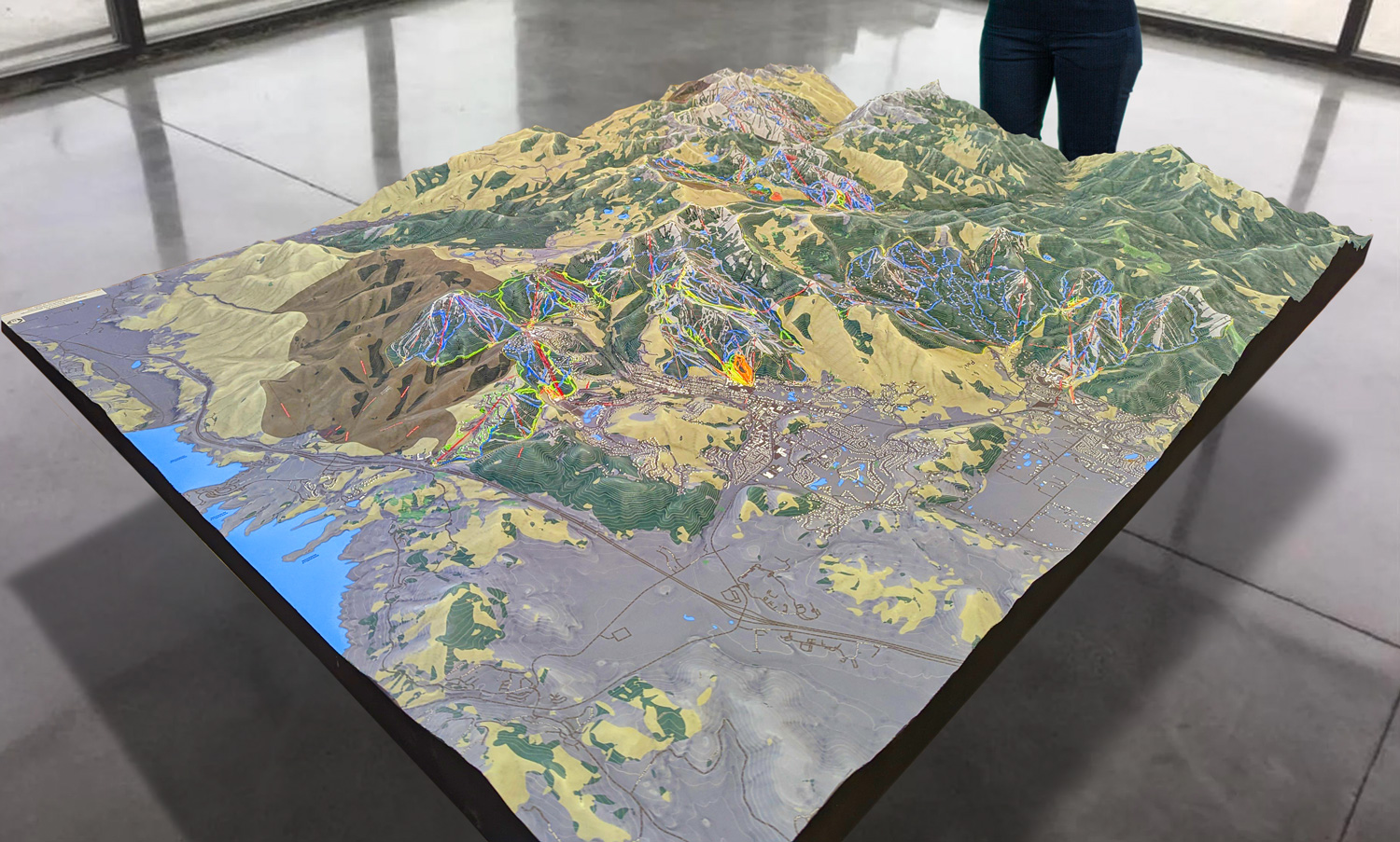
 Park City 3D Raised Relief Map
Navigating the Major Ski Runs at Quoggy Jo: A Guide to the Best Trails
Now that we’ve explored the intricate process behind the fabrication of Quoggy Jo’s 3D maps, let’s turn our attention to the main attraction: the ski runs themselves. Quoggy Jo may not have the vast expanse of larger ski resorts, but what it lacks in size, it makes up for in charm, diversity, and excitement. Whether you’re a first-time skier or a seasoned expert, Quoggy Jo has something for everyone.
The Perfect Beginner Slopes: Learning the Ropes at Quoggy Jo
One of the reasons Quoggy Jo is a beloved ski area is its accessibility for beginners. The gentle slopes and well-groomed trails make it the perfect place for first-time skiers to gain confidence on the snow. The 3D maps at Quoggy Jo prominently feature the beginner-friendly runs, ensuring that newcomers can easily navigate the area.
One of the most popular beginner slopes at Quoggy Jo is Bunny Hill. This short, gentle slope is ideal for those just getting the hang of their skis. The wide-open space gives learners plenty of room to practice turns, stops, and basic maneuvers without the pressure of more advanced skiers.
Another great spot for beginners is Easy Street, which, true to its name, offers a smooth and gradual slope with a consistent pitch, perfect for practicing techniques. For families with young children, this is often the go-to run for introducing the little ones to the joys of skiing.
Intermediate Runs: Thrills for the Confident Skier
As you progress in your skiing abilities, Quoggy Jo has several intermediate runs that offer a little more excitement without being too intimidating. These runs are marked clearly on the 3D maps, with blue-coded trails indicating their intermediate level.
One of the standout intermediate runs is The Glider. This trail offers a longer descent with some gentle turns and slight elevation changes, giving skiers the chance to enjoy a more dynamic experience while still feeling in control. It’s the perfect run for those who have moved beyond the beginner stage and are ready to tackle something more challenging.
Another popular intermediate run is Timberline, which winds its way through the trees, offering a scenic and slightly more technical ride. The trail is lined with evergreen trees, giving it a tranquil and almost magical atmosphere, especially on snowy days when the branches are dusted with fresh powder.
Expert Terrain: Tackling the Black Diamonds
For advanced skiers looking for a thrill, Quoggy Jo has a few black diamond runs that will put your skills to the test. While the mountain’s overall size means there aren’t as many expert runs as larger resorts, the ones that are available are sure to satisfy the need for speed and challenge.
The crown jewel of Quoggy Jo’s expert terrain is The Chute, a narrow, steep run that demands precision and control. The Chute is not for the faint of heart—it requires expert skiing ability to navigate its sharp turns and steep pitch. For those who conquer it, however, the sense of accomplishment is immense, and the adrenaline rush is unforgettable.
Another challenging run is Wild Wind, which, true to its name, offers a fast and exhilarating descent. This run is steep with quick changes in direction, making it ideal for expert skiers who enjoy a high-speed, technical challenge. The 3D maps of Quoggy Jo highlight these black diamond runs, ensuring that only those ready for the challenge venture onto these slopes.
Family-Friendly Fun: The Tubing Hill
While skiing is the main attraction at Quoggy Jo, the ski area also offers a tubing hill for families and non-skiers to enjoy. The 3D maps include this fun feature, marking it clearly for those looking to try something different. Tubing is a great way to enjoy the winter wonderland of Quoggy Jo without the need for skis or snowboards, making it a popular option for families with young children or anyone looking for some light-hearted fun.
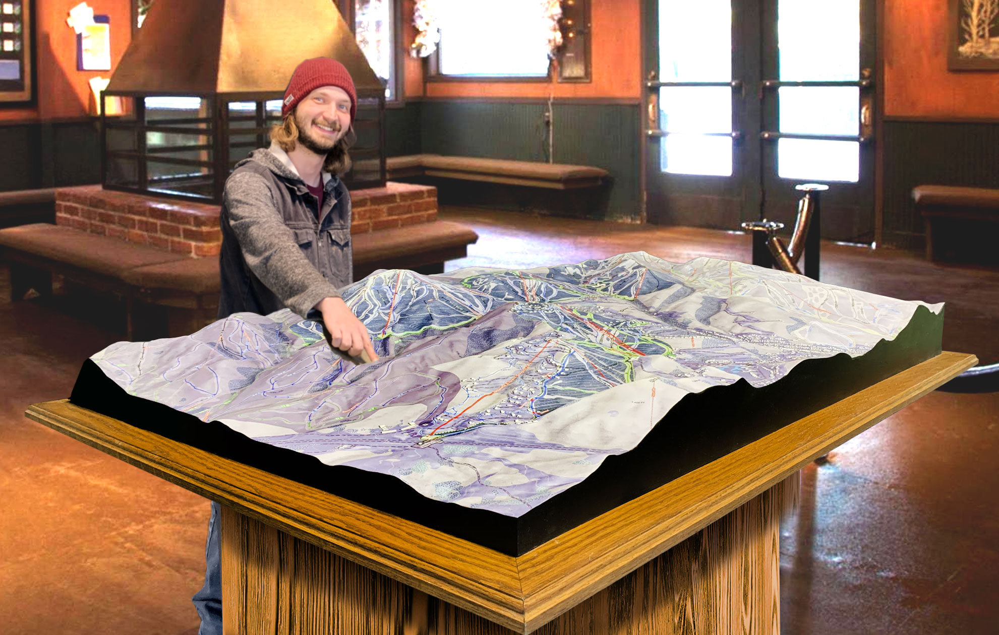
 Deer Valley 3D Raised Relief Map
The Importance of 3D Maps in Enhancing the Skiing Experience
The detailed and expertly crafted 3D maps of Quoggy Jo are more than just tools for getting around—they are essential components of the skiing experience. These maps provide a clear and easy-to-understand guide to the mountain’s terrain, allowing skiers to plan their routes and enjoy the slopes with confidence.
Whether you’re a beginner exploring the gentle slopes, an intermediate skier cruising down the tree-lined trails, or an expert tackling the black diamonds, the 3D maps of Quoggy Jo enhance your ability to navigate the mountain. Additionally, their vibrant colors, detailed topography, and artistic representation of the ski area make them beautiful to look at, serving as both practical tools and artistic souvenirs of a memorable trip to the mountain.
In conclusion, the 3D maps of Quoggy Jo are a crucial part of the ski area’s charm and functionality. From their intricate fabrication process to their practical use on the slopes, these maps provide a visual and navigational guide that helps skiers of all levels explore the mountain with ease. Whether you’re a first-timer or a seasoned pro, Quoggy Jo’s 3D maps ensure that your skiing adventure is as enjoyable and seamless as possible.
Check out WhiteClouds’ 3D Maps for more information on 3D maps of Quoggy Jo Ski Resort.
