Red Hill Ski Club 3D Maps
Red Hill Ski Club 3D Maps
We Build Custom 3D Red Hill Ski Club Maps
Exploring Red Hill Ski Club 3D Maps: Craftsmanship Behind the Terrain and Navigating the Ski Runs
Red Hill Ski Club, nestled in the Lakes Region of New Hampshire, is a charming community ski area that offers a unique and intimate skiing experience for families and enthusiasts. Known for its scenic beauty and manageable slopes, the ski club is a hidden gem for locals who want to enjoy a day on the mountain without the crowds of larger resorts. While the natural beauty of the club attracts visitors, it’s the detailed 3D maps that truly enhance the skiing experience, giving skiers a comprehensive and visually engaging tool for navigating the slopes.
In this blog, we will explore the intricate process behind the creation of Red Hill Ski Club 3D maps and highlight how these maps bring the mountain to life. Additionally, we’ll take a deep dive into the major ski runs at the club, from beginner-friendly slopes to more advanced challenges. These maps not only help skiers plan their routes but also enrich the overall skiing experience by capturing the essence of the mountain.

The Fabrication of Red Hill Ski Club 3D Maps: From Data to Masterpiece
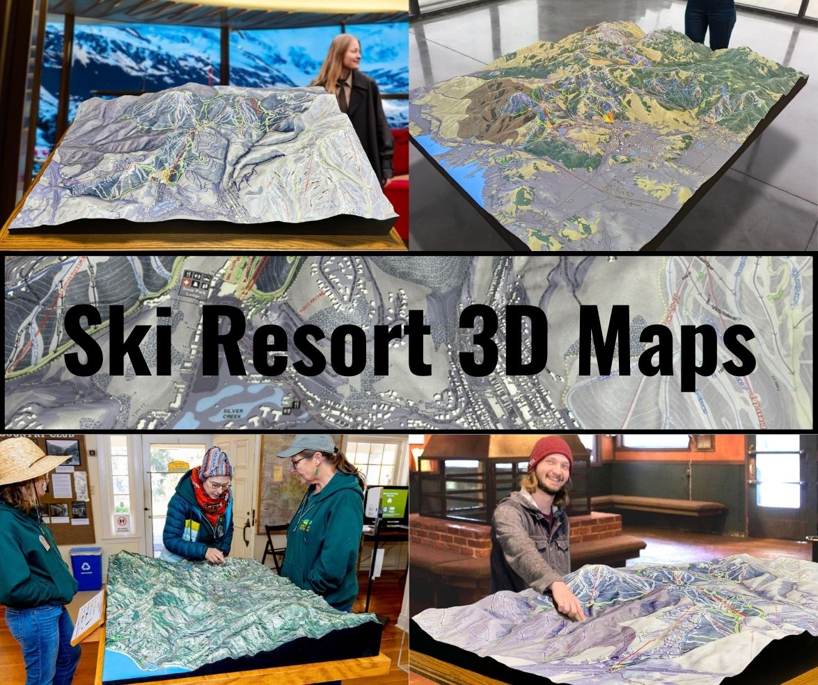
Creating 3D maps of a ski area is a meticulous process that involves advanced technology and expert craftsmanship. These maps are more than just navigational aids—they are works of art that showcase the terrain while offering practical value to skiers of all skill levels. Below, we will walk through the various steps involved in fabricating Red Hill Ski Club’s 3D maps.
Collecting Precise Topographical Data
The first and most crucial step in creating a 3D map of Red Hill Ski Club is gathering accurate topographical data. This is typically done using lidar (Light Detection and Ranging) technology, a laser-based system that scans the landscape and provides precise elevation data. Lidar technology allows for a detailed representation of the ski club’s terrain, capturing even the smallest variations in slope, ridges, and contours.
In addition to lidar, satellite imagery and drone mapping are used to supplement the data collection. This combination ensures that every feature of Red Hill’s landscape is mapped out, from the gentle inclines of beginner slopes to the steeper drops of the more advanced trails. The topographical data is then processed and serves as the foundation for building the 3D model of the mountain.
Creating the Digital 3D Model
Once the topographical data has been collected, the next step is to translate it into a digital 3D model. Specialized software like CAD (Computer-Aided Design) and GIS (Geographic Information Systems) are used to recreate the terrain in virtual form. This digital model includes every aspect of Red Hill’s landscape, from the elevation of each ski run to the tree lines, ski lifts, and base lodge.
During this stage, designers fine-tune the model to ensure that every detail is accurate. This digital blueprint not only serves as the basis for the physical 3D map but also provides skiers with a virtual representation of the mountain that can be used for planning routes. The digital model is an essential part of the fabrication process, ensuring that the final product will be both functional and visually stunning.
3D Printing the Physical Map
Once the digital model is complete, it’s time to bring the map into the physical world using 3D printing technology. The 3D printing process involves building the map layer by layer, with each layer representing a different elevation point on the mountain. This technique allows for the creation of a highly detailed map that accurately reflects the topography of Red Hill Ski Club.
For these maps, materials like PLA (Polylactic Acid) or high-density foam are commonly used. These materials are chosen for their durability and environmental friendliness, ensuring that the map is both sturdy and sustainable. The printed map forms the basic structure of the terrain, but it’s the finishing touches that truly bring the landscape to life.
Hand-Painting and Adding Texture
Once the 3D map has been printed, the next step is to add color and texture to the terrain. This is where the artistry of the process shines. Skilled artisans hand-paint the map, carefully applying colors that represent the natural features of the mountain. Ski trails are color-coded based on their difficulty level—green for beginner slopes, blue for intermediate runs, and black for advanced trails.
The paint not only adds visual appeal but also makes the map functional, allowing skiers to easily identify the different types of terrain. In addition to painting, textures are added to represent various elements of the landscape, such as the roughness of tree-lined sections or the smoothness of open slopes. The combination of color and texture makes the map a realistic and detailed representation of Red Hill Ski Club.
Protective Coating and Finishing Touches
The final step in the fabrication process is to apply a protective coating to the 3D map. This coating helps protect the map from UV rays, moisture, and general wear and tear, ensuring that it remains vibrant and durable over time. Once the coating is applied, the map is ready to be displayed, whether in the ski lodge or used as a reference tool for skiers on the mountain.
The finished product is not only a practical guide for navigating the slopes but also a beautiful representation of Red Hill Ski Club’s terrain. The combination of advanced technology and hand-crafted artistry ensures that these 3D maps are both functional and visually engaging.
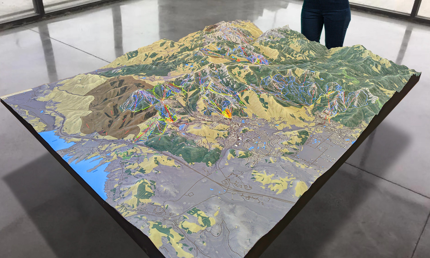
 Park City 3D Raised Relief Map
The Major Ski Runs at Red Hill Ski Club: A Trail for Every Skier
Red Hill Ski Club may be smaller than some of the larger ski resorts in New Hampshire, but it offers a variety of trails that cater to skiers of all skill levels. From gentle beginner slopes to more challenging advanced runs, Red Hill has something for everyone. The 3D maps are an invaluable resource for skiers looking to explore the terrain, providing a clear and accurate guide to the mountain’s various trails.
Beginner Slopes: A Perfect Introduction to Skiing
One of the reasons Red Hill Ski Club is so popular with families and first-time skiers is its beginner-friendly terrain. The gentle slopes provide a welcoming environment for learning, with wide, open spaces that allow new skiers to practice their turns and gain confidence. The 3D maps highlight these beginner trails in green, making them easy to identify for those just starting out.
Maple Slope is one of the most popular beginner trails at Red Hill. This gentle, well-groomed slope offers a smooth ride with a gradual incline, making it the perfect place for first-time skiers to get comfortable on the snow. The 3D map of Maple Slope clearly shows the trail’s layout, allowing beginners to visualize the terrain before they begin their descent.
Another great option for beginners is Spruce Meadow, a longer trail that features a gradual descent and scenic views of the surrounding landscape. This trail is ideal for skiers who want to practice controlling their speed and making wider turns. The 3D map of Spruce Meadow provides a detailed view of the trail’s path, ensuring that beginners have all the information they need for a successful and enjoyable ride.
Intermediate Trails: Fun for the Developing Skier
For those who have mastered the basics and are ready for more of a challenge, Red Hill offers several intermediate trails that provide a fun and engaging experience. These trails are marked in blue on the 3D maps, making them easy to identify for skiers who are looking to take their skills to the next level.
Pine Ridge is a favorite among intermediate skiers. This trail offers a mix of open sections and gentle turns, allowing skiers to practice their carving technique while enjoying the scenic beauty of Red Hill. The 3D map of Pine Ridge highlights the smooth flow of the trail, helping skiers visualize the route before they hit the slopes.
Birch Run is another excellent intermediate trail, offering a longer descent with a few steeper sections to keep things exciting. This trail is perfect for skiers who want to improve their skills while still enjoying a relaxed and scenic ride. The 3D map of Birch Run provides a detailed representation of the trail’s varied terrain, making it easy for skiers to plan their route.
Advanced Runs: A Challenge for the Experienced Skier
While Red Hill Ski Club is known for its family-friendly atmosphere, it also offers a few advanced runs that will challenge even the most experienced skiers. These black diamond trails are clearly marked on the 3D maps, ensuring that only those ready for the challenge take on these steep and technical slopes.
Eagle’s Descent is one of the most thrilling advanced trails at Red Hill. With its steep pitch and sharp turns, this run demands expert control and quick reflexes. The 3D map of Eagle’s Descent highlights its steep incline and tight curves, giving advanced skiers a clear sense of what to expect before they tackle the trail.
For those looking for a fast and exciting ride, Black Bear Ridge offers a high-speed descent with plenty of opportunities to pick up speed. This trail is ideal for advanced skiers who enjoy navigating steep terrain while maintaining control. The 3D map of Black Bear Ridge shows its steep drops and rapid elevation changes, helping skiers prepare for the challenge ahead.
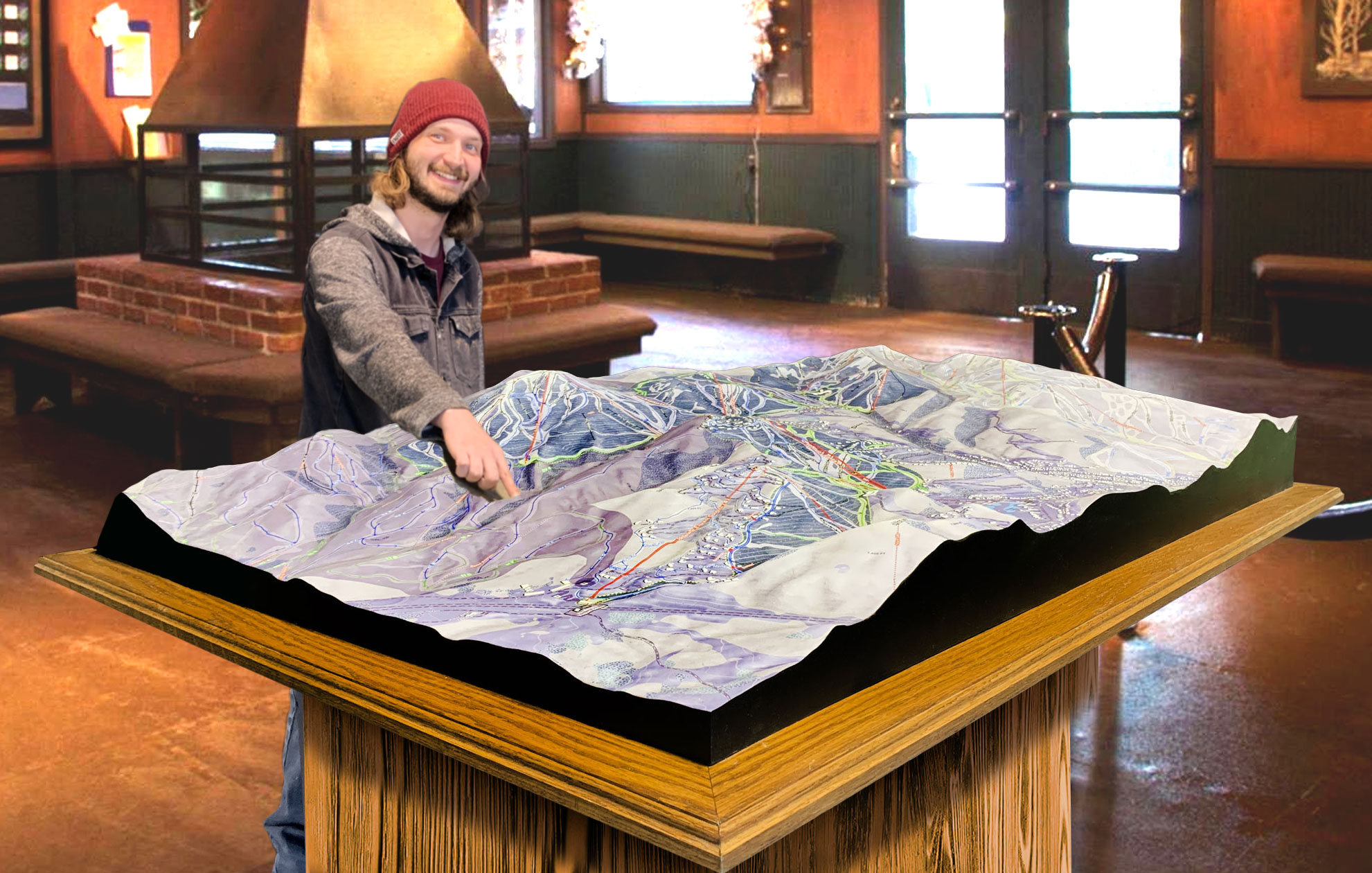
 Deer Valley 3D Raised Relief Map
Enhancing the Skiing Experience with 3D Maps
The 3D maps at Red Hill Ski Club do more than just provide a navigational tool—they enhance the overall skiing experience. By offering a detailed and accurate representation of the terrain, these maps give skiers a clear understanding of the mountain before they even set foot on the slopes. Whether you’re a beginner exploring the gentle trails or an expert looking for the most thrilling runs, the 3D maps help you plan your routes and make the most of your time on the mountain.
For beginners, the 3D maps provide confidence by clearly showing the easiest routes and helping them avoid more challenging terrain until they’re ready. Beginners can explore the trails with peace of mind, knowing that the 3D maps provide clear guidance on where to ski safely as they build their skills. Intermediate and advanced skiers benefit from the detailed representation of the mountain’s varied terrain, allowing them to seek out trails that match their abilities and preferences. The color-coded difficulty markers on the maps make it easy to navigate between runs and plan routes that offer the right level of challenge.
Additionally, the artistic craftsmanship that goes into each map creates a visually engaging experience. The hand-painted details and textured terrain offer more than just a navigational guide—they bring the mountain to life in a way that traditional 2D maps simply cannot. Whether displayed in the lodge or used as a practical tool on the slopes, the 3D maps of Red Hill Ski Club are both functional and beautiful.
Conclusion: Red Hill Ski Club 3D Maps – A Crucial Part of the Skiing Experience
In conclusion, the 3D maps of Red Hill Ski Club are an essential part of what makes skiing at this charming mountain a memorable experience. From the advanced technology used to capture precise topographical data to the hand-crafted artistry that makes the maps visually stunning, these maps are more than just tools—they are an integral part of the skier’s journey.
For beginners, intermediates, and advanced skiers alike, the maps offer a detailed and accurate representation of the mountain, helping everyone find the perfect run for their skill level. Whether you’re enjoying the gentle slopes of Maple Slope, carving down Pine Ridge, or taking on the thrills of Eagle’s Descent, the 3D maps of Red Hill Ski Club ensure that every skier can navigate the terrain with confidence, safety, and excitement.
With their combination of precision, artistry, and functionality, Red Hill Ski Club’s 3D maps play a vital role in enhancing the skiing experience for all who visit, making every adventure on the mountain a thrilling and unforgettable one.
Check out WhiteClouds’ 3D Maps for more information on 3D maps of Red Hill Ski Club.
