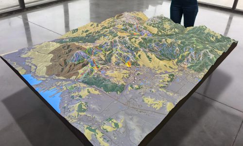
Satellite Map of Iowa
Satellite Map of Iowa
We Build Custom Large 2D & 3D Satellite Maps of Iowa
Iowa from Orbit: Satellite Unveils the Heartland’s Splendor
Amid the bustle of coastal cities and the grandeur of mountainous terrains, the American heartland holds a unique charm of its own. Iowa, often dubbed the ‘Food Capital of the World’, is a central figure in this narrative. But have you considered how this agricultural powerhouse looks from above? Let’s journey through satellite images, as they lift the veil on Iowa’s stunning landscapes and vibrant communities.
Unmasking the Skies: Understanding Satellite Imagery
Before our space-bound tour, it’s essential to grasp the marvel that is satellite imagery. These aren’t traditional maps, but dynamic, high-resolution photographs captured by satellites orbiting our planet. Tools like Google Earth have democratized access to these images, letting us virtually traverse Earth from pole to pole.

Highlights of Iowa: Satellite’s Picks
Quilted Farmlands: Iowa’s topographic hallmark is its patchwork of farms. From space, the state looks like a grand quilt, stitched together by patches of corn, soybean, and other crops. The geometric perfection of these fields reflects Iowa’s agricultural mastery.
The Mississippi’s Silvery Stretch: To the east, the Mississippi River forms a natural boundary. This majestic river, vital for trade and transportation, looks like a shimmering silver ribbon, cradling Iowa’s eastern edge. From space, its meanders, islands, and tributaries create an intricate watercolor.
Des Moines: The Capital’s Footprint: Central Iowa reveals the urban sprawl of Des Moines. The organized layout, crisscrossed by roads and the Des Moines River, is a testament to thoughtful urban planning. The city’s green spaces, like the Water Works Park, stand out as verdant patches amid the urban gray.
Loess Hills: Nature’s Wonders: Western Iowa introduces a captivating spectacle – the Loess Hills. These unique formations, made of wind-deposited silt, present a series of ridges and valleys. Satellite imagery accentuates their wavy patterns, contrasting the otherwise flat Iowan terrains.
The Lakes Region: In northern Iowa, a collection of blue jewels stands out. The Iowa Great Lakes, including Spirit Lake and West Okoboji Lake, offer serene visuals. Their icy blue hues contrast beautifully with the surrounding green and amber lands.
Satellite’s Gift to Iowa: Beyond the Aesthetic
Satellite imagery isn’t just about spectacular views. It holds practical significance:
Crop Monitoring: For a state deeply rooted in agriculture, satellites provide insights into crop health, irrigation needs, and potential pest infestations.
Water Resource Management: Satellite data helps in tracking river water levels, crucial for flood predictions, and managing the state’s water reservoirs.
Environmental Conservation: Areas like the Loess Hills and wetlands are monitored for ecological health and potential threats.
Urban Development: As cities like Cedar Rapids grow, planners can harness satellite data to envision sustainable urban expansion.
Future Gazing: The Next Era of Satellite Tech in Iowa
Satellite technology is evolving, with innovations like drones and AI-enhanced imagery paving the way. For Iowa, this means:
Precision Agriculture: With finer, more frequent satellite data, Iowa’s farmers can pioneer next-gen farming techniques, optimizing yields and resource use.
Environmental Initiatives: As climate change impacts become more palpable, Iowa can employ satellite insights to safeguard its natural habitats and resources.
Wrapping Up: Iowa’s Satellite Symphony
While Iowa may not boast towering peaks or sprawling coastlines, its beauty lies in its subtleties – the rhythmic patterns of farmlands, the gentle flow of rivers, and the warm hues of its towns and cities.
Through satellite eyes, Iowa emerges not just as the heartland of America, but as the heartbeat. Each pixel, each image, pulses with stories of the land and its people. So, whether you’re an Iowan at heart or a curious traveler, remember that above us, satellites are painting a daily portrait of this magnificent state, capturing its essence from dawn to dusk.

