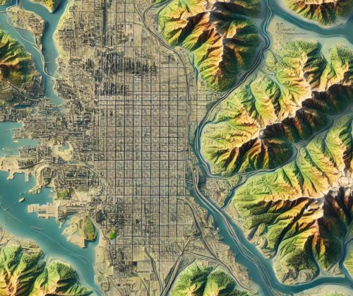
Seattle Topo Map
Seattle Topo Map
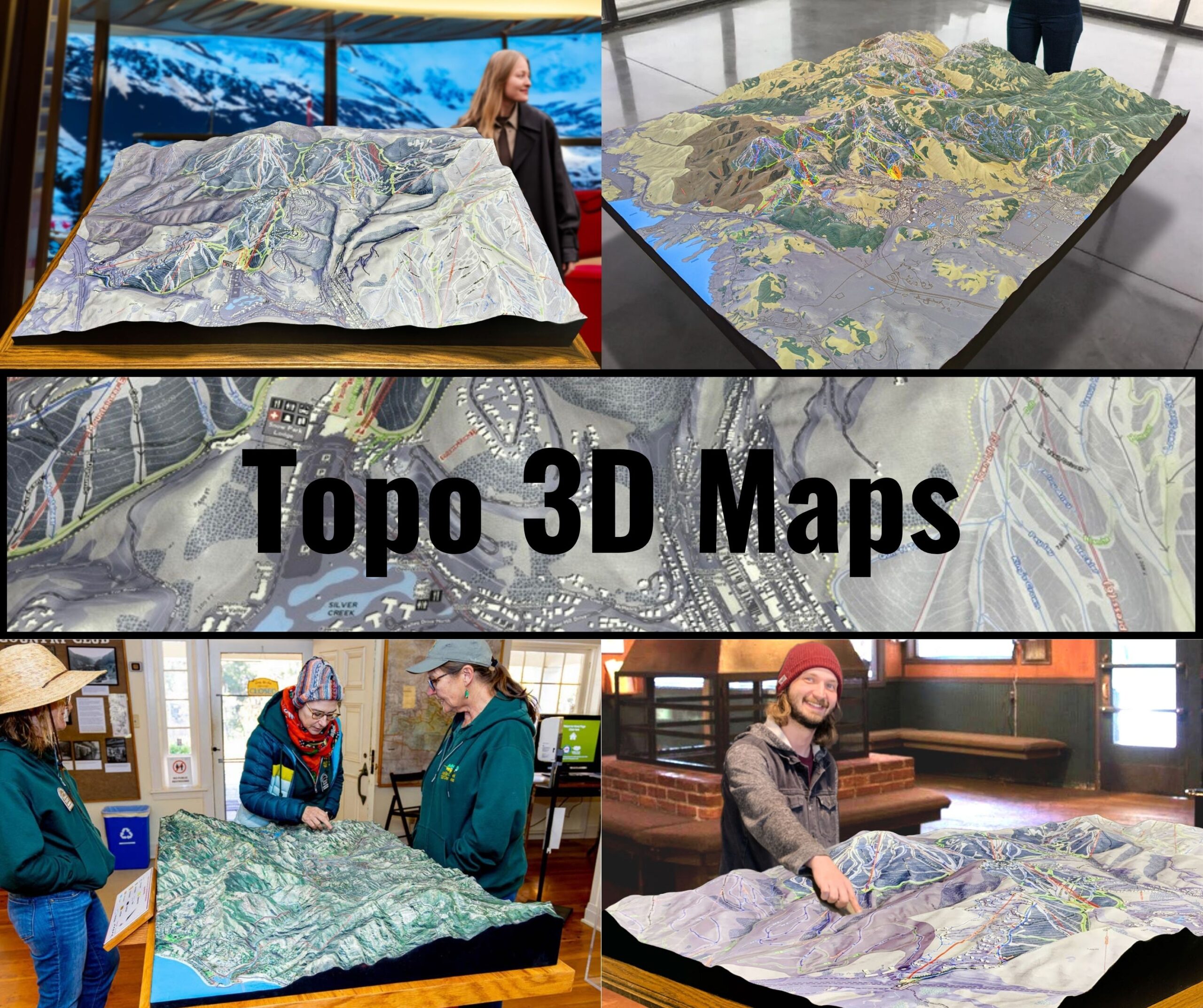
We Build Custom 3D Topo Maps
Seattle Topo Maps: Mapping the Stunning Terrain of the Emerald City
Seattle, nestled between the Puget Sound and the Cascade Mountain Range, boasts one of the most breathtaking and diverse landscapes in the United States. Known as the “Emerald City,” Seattle is characterized by rolling hills, deep waterways, and a striking urban skyline. Its complex topography makes topo maps of Seattle invaluable for navigating and understanding the city’s terrain. These maps provide a detailed view of Seattle’s natural features, from its iconic waterfront to the lush green spaces that dot the cityscape.
This blog dives into Seattle topo maps, exploring their unique features, practical applications, and the intricate processes used to create them in both 2D and 3D formats.
Seattle’s Unique Geography: A City of Water, Hills, and Mountains
Seattle’s geography is a dynamic blend of urban development and natural beauty. Its landscape is shaped by glaciers, tectonic activity, and centuries of human influence, creating a rich tapestry of features.
Waterways and Waterfronts: The city is surrounded by water, with Puget Sound to the west, Lake Washington to the east, and Lake Union in the heart of the city. These waterways are critical to Seattle’s economy, recreation, and identity.
Rolling Hills and Elevated Neighborhoods: Seattle’s hills, such as Capitol Hill, Queen Anne, and Beacon Hill, define its urban layout. These elevation changes make for dramatic views and are central features on topo maps.
Mount Rainier and the Cascade Range: The majestic Mount Rainier, visible from the city on clear days, serves as a striking backdrop. While not directly within Seattle, the Cascade Range’s proximity influences the city’s weather and outdoor culture.
Green Spaces and Urban Parks: Parks like Discovery Park, Gas Works Park, and the Washington Park Arboretum highlight Seattle’s commitment to preserving natural spaces amid urban development.
Seattle’s topography, with its mix of water, hills, and green spaces, demands topo maps that capture its complexity with precision and clarity.
How Seattle Topo Maps Are Fabricated: Precision and Creativity Combined
Creating topo maps for a city as geographically diverse as Seattle involves a sophisticated process that blends advanced data collection techniques with artistic cartography. Both 2D and 3D maps are designed to provide accurate and visually engaging representations of the city’s terrain.
The Fabrication Process for 2D Seattle Topo Maps
Data Collection from Advanced Sources: High-resolution geographic data is collected using LiDAR (Light Detection and Ranging), satellite imagery, and aerial photography. Ground surveys conducted by local and state agencies refine the details of Seattle’s intricate terrain.
GIS Processing and Analysis: Geographic Information Systems (GIS) software like ArcGIS and QGIS process the data, generating contour lines, elevation profiles, and thematic layers. These tools capture Seattle’s rolling hills, waterways, and urban infrastructure.
Cartographic Design and Styling: Cartographers enhance the maps with color gradients to depict elevation, shading to highlight slopes, and symbols for landmarks and green spaces. Features like the Space Needle, Pike Place Market, and Elliott Bay are prominently marked.
Printing and Digital Distribution: Finalized 2D maps are printed on durable materials for outdoor use or shared digitally for integration into apps and online platforms.
The Fabrication Process for 3D Seattle Topo Maps
High-Resolution Data Acquisition: Detailed elevation data is gathered using LiDAR and stereophotogrammetry. These methods capture Seattle’s steep hills, waterfronts, and surrounding mountains with millimeter precision.
3D Modeling and Digital Rendering: The elevation data is imported into 3D modeling software like Blender, Rhino, or Autodesk. Designers build a digital model that emphasizes Seattle’s elevation changes, natural features, and urban layout.
Fabrication Using Advanced Techniques: Physical 3D maps are created using 3D printing or CNC machining. Printers build layers of material, such as resin or PLA, while CNC machines carve the terrain into foam, wood, or metal.
Artistic Detailing and Finishing: After fabrication, the maps are painted and textured to reflect Seattle’s natural and urban features. Blue tones highlight waterways, green represents parks, and gray or white shades depict urban areas. Protective coatings ensure durability.
Key Features of Seattle Topo Maps: Capturing the City’s Essence
Seattle topo maps are crafted to showcase the city’s unique topography, balancing natural beauty with urban complexity. Key features include:
Contour Lines and Elevation Profiles: These lines depict Seattle’s steep hills and valleys, providing a detailed view of elevation changes across neighborhoods like Queen Anne and Capitol Hill.
Waterways and Shorelines: Puget Sound, Lake Washington, and Lake Union are prominently featured, reflecting their importance to Seattle’s geography and culture.
Parks and Green Spaces: Maps highlight major parks such as Discovery Park, Volunteer Park, and Gas Works Park, emphasizing Seattle’s commitment to preserving its natural environment.
Urban Infrastructure: Roads, bridges, and landmarks, including the Space Needle, University of Washington campus, and Seattle-Tacoma International Airport, are integrated into the maps.
Iconic Landmarks and Natural Wonders: Features like Mount Rainier and the Cascade Range are depicted, providing geographic context and visual interest.
How Seattle Topo Maps Are Used Across Industries and Activities
Seattle topo maps are versatile tools, serving a wide range of applications from urban planning to outdoor recreation.
Urban Planning and Development: City planners and architects use topo maps to design infrastructure that accommodates Seattle’s hills, waterways, and growing population.
Environmental Conservation: Conservationists rely on topo maps to monitor green spaces, assess the impact of urbanization, and plan restoration projects.
Disaster Preparedness and Management: With its location in an earthquake-prone region, Seattle uses topo maps to identify vulnerable areas, plan evacuation routes, and guide disaster mitigation efforts.
Tourism and Exploration: Visitors and locals use topo maps to navigate Seattle’s parks, trails, and waterfronts, from Alki Beach to the Burke-Gilman Trail.
Scientific Research and Education: Geologists, hydrologists, and educators use topo maps to study Seattle’s terrain, water systems, and tectonic activity.
The Role of Technology in Advancing Seattle Topo Maps
Modern technology has revolutionized the creation and use of Seattle topo maps, making them more interactive and accessible.
Digital Mapping Platforms: Tools like Google Earth and GIS applications allow users to explore Seattle’s terrain in detail, offering features like zoomable maps and interactive overlays.
Augmented Reality (AR) and Virtual Reality (VR): AR and VR technologies enable users to experience Seattle’s topography in immersive 3D environments, enhancing education, tourism, and urban planning.
Real-Time Data Integration: Advanced topo maps incorporate real-time data, such as weather patterns, traffic conditions, and water levels, enhancing their utility for navigation and risk management.
The Historical and Cultural Importance of Seattle Topo Maps
Seattle topo maps are more than just practical tools—they are records of the city’s evolution. Early maps document Seattle’s growth from a logging town to a tech hub, while modern maps reflect its transformation into a global city.
Efforts to include Indigenous place names and cultural landmarks on contemporary maps honor Seattle’s rich heritage, fostering a deeper understanding of its history.
The Future of Seattle Topo Maps: Innovations and Opportunities
The future of Seattle topo maps lies in leveraging emerging technologies to create even more detailed and versatile tools. High-resolution satellite imagery, AI-driven data analysis, and advancements in 3D printing will make maps more accurate and accessible.
Interactive maps that integrate historical, cultural, and environmental data will become essential for education, tourism, and conservation. Imagine exploring Discovery Park through a VR topo map or using an AR app to navigate the Seattle waterfront with real-time elevation data.
Discovering Seattle Through Topo Maps: A Gateway to the Emerald City
Seattle topo maps are more than just representations of its terrain—they are keys to understanding the city’s unique blend of natural beauty, urban innovation, and cultural vibrancy. From the iconic Space Needle to the serene shores of Lake Washington, these maps capture the essence of Seattle’s geography and community.
Whether you’re a city planner designing sustainable infrastructure, a conservationist preserving natural spaces, or a visitor exploring the city’s landmarks, Seattle topo maps provide the detail and precision you need. By blending technology, artistry, and functionality, these maps celebrate the Emerald City and inspire deeper connections to its land and legacy.
Check out WhiteClouds’ 3D Maps for more information on Seattle topo maps.

