Ski Sundown 3D Maps
Ski Sundown 3D Maps
We Build Custom 3D Ski Sundown Maps
Exploring Ski Sundown Through 3D Maps: A New Way to Experience Connecticut’s Premier Ski Resort
In the scenic hills of New Hartford, Connecticut, Ski Sundown has become a winter destination for skiers and snowboarders alike. With well-groomed trails, modern amenities, and a variety of terrain for all skill levels, Ski Sundown has built a reputation for providing an unforgettable mountain experience. But as ski technology evolves, so does the way visitors can engage with the slopes. One of the most exciting innovations at Ski Sundown in recent years is the development and use of 3D maps.
A 3D map provides an incredibly immersive experience for skiers, snowboarders, and outdoor enthusiasts, allowing them to visualize the entire mountain in stunning detail. Unlike traditional flat maps, these three-dimensional renderings capture the slopes, valleys, trails, and elevations, making it easier for visitors to understand the lay of the land. Whether you’re a beginner looking to plan your day or an advanced skier seeking out the most challenging runs, Ski Sundown’s 3D maps offer a comprehensive view that enhances both enjoyment and safety.
In this blog, we’ll take an in-depth look at the world of Ski Sundown’s 3D maps, exploring how they are created, how they transform the skiing experience, and what major ski runs come to life in three dimensions.
The Role of 3D Maps at Ski Sundown: More Than Just a Guide
The primary purpose of a 3D map is to provide skiers and snowboarders with a detailed understanding of the terrain. Ski resorts like Ski Sundown cover a large and often complex landscape, where trails crisscross each other, elevation changes drastically, and a variety of terrain features need to be navigated. A flat map can give a general idea of where to go, but it often falls short in terms of conveying the depth, slope, and challenge of the mountain.
Ski Sundown’s 3D maps go beyond just showing the layout. They offer a full perspective of the mountain, including the exact contours of each trail, the height of the slopes, and the surrounding features. These maps are especially useful for skiers who want to plan their routes before heading out, helping them to choose the trails that match their skill level and interests.
Additionally, the maps offer real-time functionality in digital formats, making them more than just static representations. Skiers can access the 3D maps through the resort’s website, mobile apps, or interactive screens in the lodge, and they can see up-to-date information about trail conditions, weather patterns, and lift status. This real-time integration means that visitors have access to the latest information, enhancing both convenience and safety.
But Ski Sundown’s 3D maps aren’t just for logistical purposes. They also contribute to the overall visual experience of the resort. The maps bring the mountain to life, giving skiers a unique perspective that highlights the beauty of the landscape. Seeing the hills and valleys in such fine detail creates an emotional connection to the place, fostering a deeper appreciation for the environment and the sport.

The Fabrication of Ski Sundown 3D Maps: Bringing the Mountain to Life
The creation of a 3D map is a meticulous and highly technical process. It involves a combination of cutting-edge technology and artistic craftsmanship, all working together to ensure that the final product is both accurate and visually engaging. At Ski Sundown, the fabrication of the 3D maps is a fascinating blend of data collection, terrain modeling, and detailed rendering.
Data Collection: The Foundation of the Map
The first step in creating a 3D map is gathering data about the terrain. This involves using LiDAR technology (Light Detection and Ranging), which employs laser pulses to measure distances and capture detailed information about the landscape. At Ski Sundown, this data is collected via aerial surveys, often using drones or helicopters equipped with LiDAR sensors.
As the laser beams bounce off the mountain’s surface, they create a dense cloud of data points, each representing an exact location on the ground. These data points are then used to create a topographical map of the entire resort. LiDAR is particularly useful because it can capture even the most subtle features of the landscape, such as small dips, ridges, and contours that might be missed with traditional surveying methods.
Along with LiDAR, aerial imagery is collected to provide detailed visual information about the mountain. High-resolution photographs from drones or satellites are combined with the LiDAR data, giving the model not just a structural framework but also realistic textures and colors. This ensures that the 3D map doesn’t just capture the shape of the mountain but also its visual beauty—snow-covered slopes, tree lines, and even the shadows cast by the hills.
Terrain Modeling: Crafting a 3D Representation
Once the data has been collected, the next step is to build a digital terrain model (DTM) or digital elevation model (DEM) using specialized 3D modeling software. The data points collected by LiDAR are fed into the software, which then generates a 3D mesh of the landscape. This mesh consists of thousands (sometimes millions) of tiny polygons, each one representing a small section of the terrain.
The result is a highly detailed model that accurately captures every hill, valley, and slope on the mountain. At this stage, the terrain model is checked for accuracy, ensuring that the elevation data matches the real-world topography of Ski Sundown.
The model is then refined by adding visual textures and details, such as snow, trees, rocks, and buildings. This is where the aerial imagery comes into play, providing realistic color and texture to the terrain. The snow-covered trails, forested areas, and even the surface of the ski lifts are meticulously recreated to give the map a lifelike appearance.
Adding Functional Elements: Trails, Lifts, and Signage
One of the most important aspects of Ski Sundown’s 3D maps is the inclusion of functional elements like ski trails, lifts, and signage. These features are crucial for helping visitors navigate the resort and plan their skiing or snowboarding day.
Each ski trail is color-coded according to difficulty (green for beginners, blue for intermediates, and black for experts), and the exact width and length of each trail are carefully measured and incorporated into the map. Ski lifts are also added, with their paths clearly shown, allowing visitors to see how different trails connect to the lift system.
Signage plays a critical role in making the 3D maps useful and intuitive. Trail names, lift designations, and important markers (such as ski patrol stations and rest areas) are labeled directly on the map, giving visitors all the information they need at a glance.
Producing Physical and Digital Maps
Once the 3D model is complete, it can be produced in a variety of formats. Digital maps are the most common, offering interactive features that allow users to zoom in on specific areas, rotate the map for different perspectives, and view real-time updates on trail conditions. These digital maps can be accessed via Ski Sundown’s website, mobile apps, or interactive screens located around the resort.
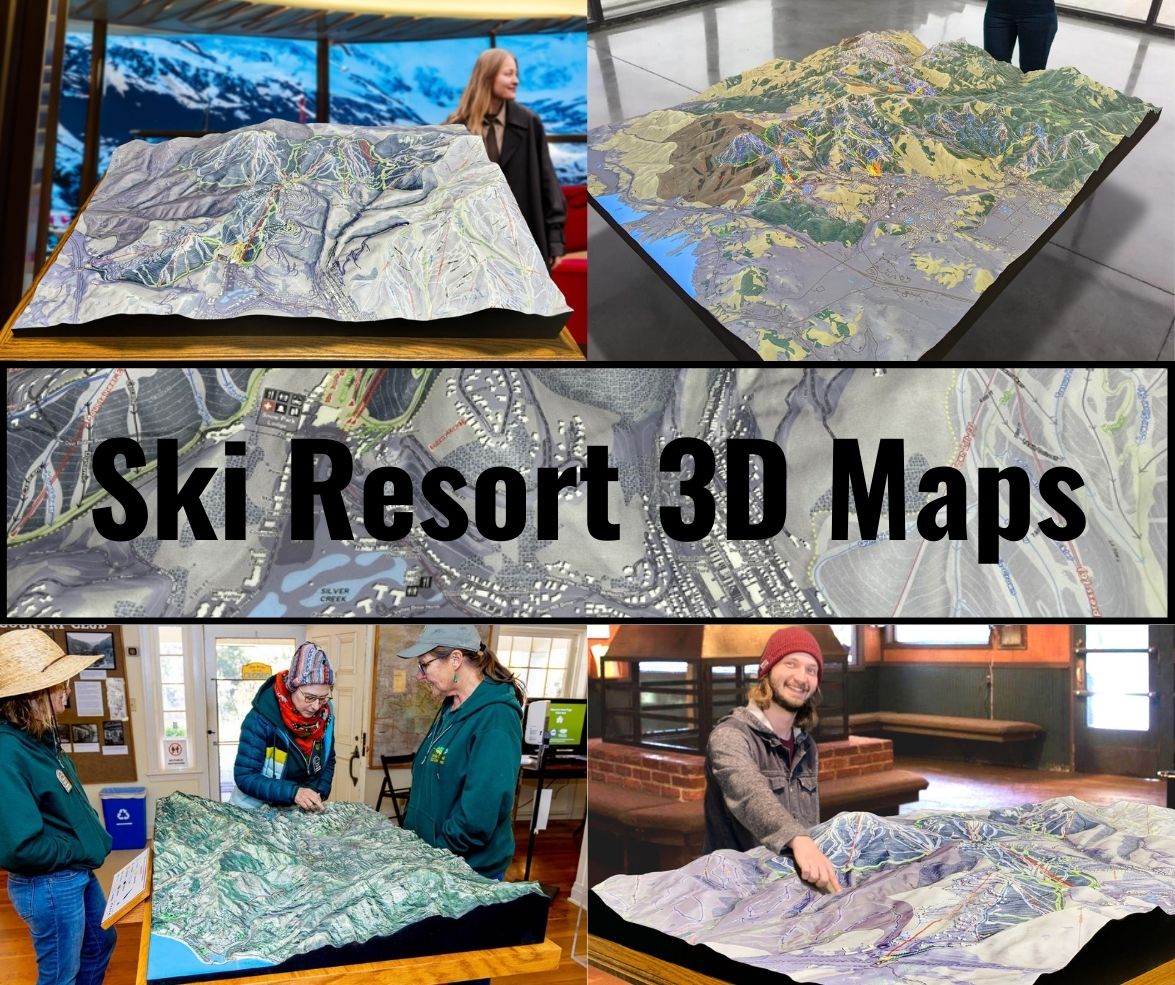
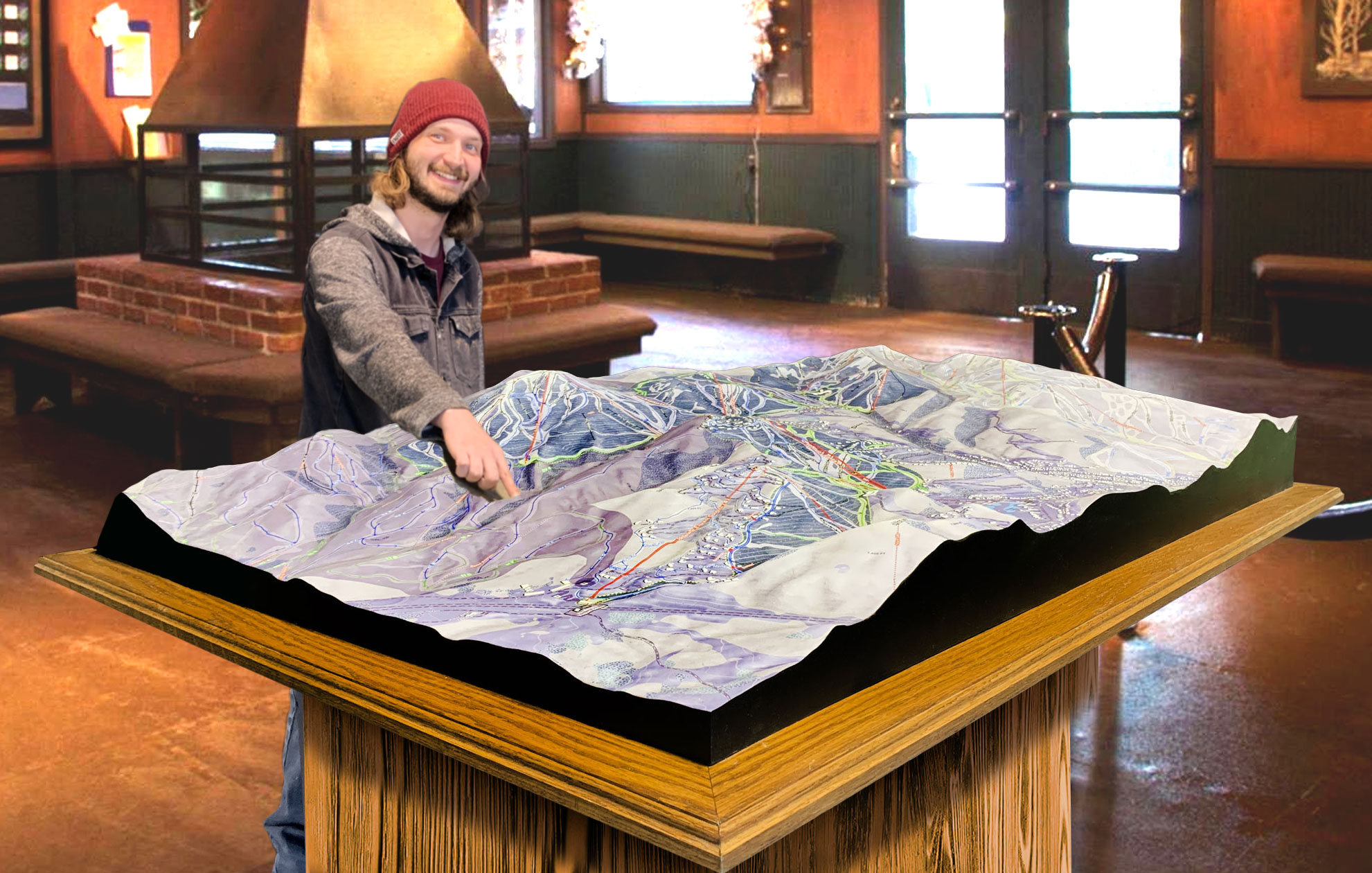
For visitors who prefer a more traditional experience, physical 3D maps can also be created using 3D printing technology. These maps are often displayed in the resort’s lodge or used as promotional tools at events. Physical 3D maps provide a tactile, hands-on experience, allowing visitors to explore the mountain’s terrain in a tangible way.
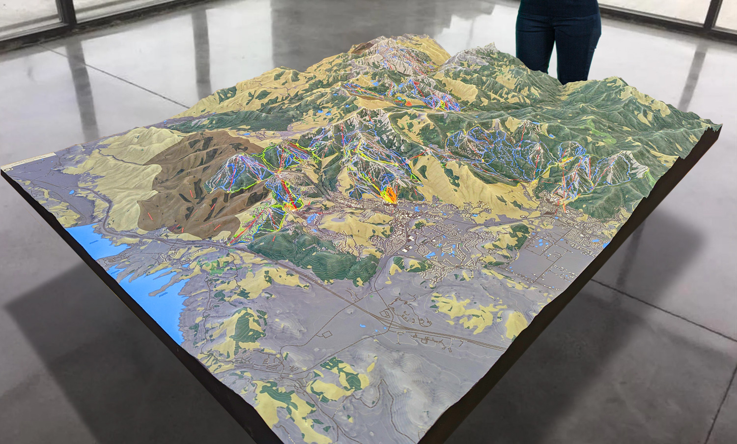
 Park City 3D Raised Relief Map
Exploring the Major Ski Runs at Ski Sundown with 3D Maps
Ski Sundown offers a wide range of ski runs, catering to beginners, intermediates, and experts alike. Each of these runs comes to life through the resort’s 3D maps, offering skiers a chance to explore the terrain before they even hit the slopes. Let’s take a closer look at some of the major ski runs at Ski Sundown, as seen through the lens of 3D mapping technology.
Canyon Run: A Classic for Beginners
For those new to skiing, Canyon Run is a perfect introduction to the sport. This wide, gentle green circle run is designed with beginners in mind, offering a smooth, gradual slope that allows for easy turns and minimal stress. On the 3D map, Canyon Run is immediately recognizable for its wide, open layout and gentle incline. The map clearly shows where the terrain is the flattest, making it easy for new skiers to plan their descent and avoid any surprises.
The 3D map is particularly useful for beginners, as it allows them to study the trail in detail before heading out, giving them the confidence to tackle the mountain without feeling overwhelmed.
Temptor: The Perfect Intermediate Challenge
For intermediate skiers looking to test their skills, Temptor offers the perfect challenge. This blue square run features steeper slopes and tighter turns than Canyon Run, but it’s still manageable for those with a bit of experience. The 3D map shows the full layout of Temptor, highlighting the points where the trail narrows and the incline increases.
By studying the 3D map before hitting the trail, intermediate skiers can plan their route, identifying the sections where they can pick up speed and the areas where they’ll need to maintain control. This makes Temptor a more strategic and exciting experience.
Gunbarrel: The Ultimate Test for Experts
For advanced skiers, Gunbarrel is the crown jewel of Ski Sundown. This black diamond run is steep, fast, and filled with moguls, offering a true test of skill and endurance. On the 3D map, Gunbarrel stands out for its sharp vertical drop and narrow, challenging terrain.
The map allows expert skiers to study the layout of the moguls, helping them plan the best line through the bumps. The steep incline is also clearly visible, giving skiers a sense of just how intense the run will be before they commit. By using the 3D map as a guide, skiers can approach Gunbarrel with a clear strategy, maximizing both safety and enjoyment.
Night Skiing and Terrain Parks
Ski Sundown is also known for its night skiing and terrain parks, both of which are highlighted on the 3D maps. The night skiing trails are clearly marked with lighting paths, ensuring that visitors can navigate the mountain safely even after the sun goes down.
The terrain park is also a major feature of Ski Sundown, offering skiers and snowboarders the chance to practice jumps, tricks, and rails. The 3D map shows the exact layout of the terrain park, including the locations of each feature and the best lines for approaching them.
 Deer Valley 3D Raised Relief Map
The Future of Skiing: How 3D Maps are Changing the Game
While 3D maps are already an incredible tool for navigation and planning, they represent just the beginning of a larger trend toward immersive, data-driven skiing experiences. As technology continues to advance, 3D maps could soon incorporate even more real-time data, such as live snow conditions, weather updates, and even personalized recommendations based on a skier’s preferences and skill level.
At Ski Sundown, the use of 3D maps has already enhanced the overall experience for visitors, making it easier than ever to explore the mountain, plan routes, and stay safe on the slopes. But as these maps continue to evolve, they will likely play an even more central role in shaping the future of skiing.
Conclusion: Ski Sundown’s 3D Maps as a Game-Changer
Ski Sundown’s 3D maps are more than just a navigation tool—they’re an immersive, educational, and safety-enhancing feature that brings the mountain to life in ways that traditional maps simply can’t. Whether you’re a beginner studying Canyon Run, an intermediate skier ready to take on Temptor, or an expert braving the steep slopes of Gunbarrel, these maps provide the insight and information you need to maximize your experience.
As technology continues to push the boundaries of what’s possible, Ski Sundown’s 3D maps stand at the forefront of a new era in skiing. They offer an exciting glimpse into the future of outdoor recreation, where skiers can interact with the terrain in ways we could only dream of a few years ago. For visitors to Ski Sundown, these 3D maps are not just a tool—they’re a gateway to discovering the mountain in vivid, thrilling detail.
Check out WhiteClouds’ 3D Maps for more information on 3D maps of Ski Down Ski Area.
