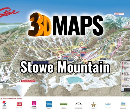
Stowe Mountain 3D Maps
Stowe Mountain 3D Maps
We Build Custom 3D Stowe Mountain Maps
Exploring Stowe Mountain Resort Through 3D Maps: A New Dimension of Skiing Adventure
Stowe Mountain Resort, nestled in the picturesque Green Mountains of Vermont, is one of the premier skiing destinations in the United States. Known for its legendary terrain, luxury accommodations, and year-round appeal, Stowe attracts skiers, snowboarders, and adventurers from all over the world. While the mountain itself offers unforgettable experiences, an innovative way to explore its features is through 3D maps of the resort. These intricately designed maps provide a unique perspective of the mountain’s topography, ski runs, and surrounding environment. Whether you’re a first-time visitor or a seasoned expert, 3D maps are an essential tool for navigating Stowe’s vast terrain.
In this blog, we will take a deep dive into the world of Stowe Mountain Resort 3D maps, exploring how they are crafted, the technology behind their precision, and how they enhance the skier’s experience. We will also look at the major ski runs at Stowe, examining their unique characteristics and the thrills they offer.

The Craftsmanship Behind Stowe Mountain Resort 3D Maps: A Blend of Art and Technology
Creating a 3D map of a resort as expansive and dynamic as Stowe Mountain Resort is no small feat. These maps require a blend of advanced technology, craftsmanship, and detailed geographical knowledge. The goal is to represent the mountain’s intricate terrain in a way that is both accurate and visually engaging. The process begins with gathering highly accurate data of the landscape, including elevation, terrain features, and ski trails, and ends with a meticulously designed physical or digital 3D model that showcases the mountain’s most important features.
The first step in fabricating a Stowe Mountain Resort 3D map is the use of digital elevation models (DEMs). These models are created through advanced geospatial technologies such as LiDAR (Light Detection and Ranging) or satellite imaging. These technologies capture the precise elevations and contours of the mountain, allowing for a highly detailed and accurate digital representation. LiDAR, in particular, is ideal for mountain resorts as it uses laser pulses to create topographical maps that include even the smallest changes in the landscape. This high level of precision ensures that the 3D maps reflect every slope, ridge, and valley of Stowe Mountain Resort.
Once the raw data is gathered, the next phase involves converting this information into a 3D format using specialized software. Programs like GIS (Geographic Information Systems) are commonly used to process and analyze the terrain data. These systems allow cartographers and designers to manipulate the elevation points, slopes, and other topographical features, turning the raw data into a 3D rendering of the resort. This step is critical in ensuring that the final product is accurate and easy to read.
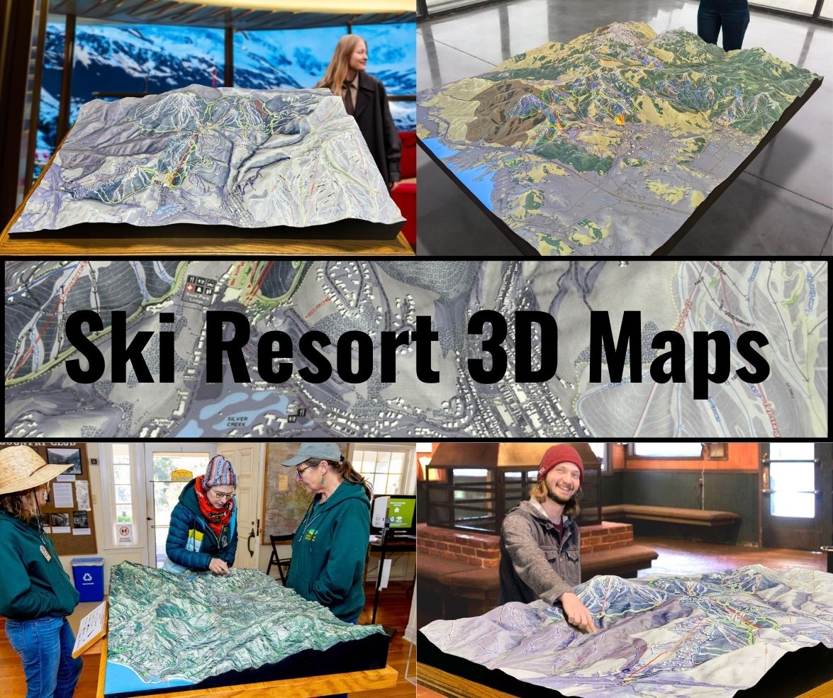
The most captivating part of the 3D map creation process is the artistic design. Designers use specialized software to bring the digital map to life, adding colors, textures, and details that represent snow conditions, trees, trails, and other environmental features. In some cases, these maps are printed as high-quality physical models, while others are interactive digital versions that allow users to zoom in and out, rotate the map, and explore the mountain from multiple perspectives. Physical 3D maps often use materials like layered foam, resin, or 3D-printed plastics to create tangible topographical elements that reflect the actual contours of the mountain.
For a place like Stowe, where both the aesthetic and practical details of the mountain are integral to the skier’s experience, the result is more than just a map—it’s a tool that transforms how skiers interact with the mountain. It gives them a deeper understanding of the terrain, the layout of ski runs, and even the best routes for navigating from one area to another.
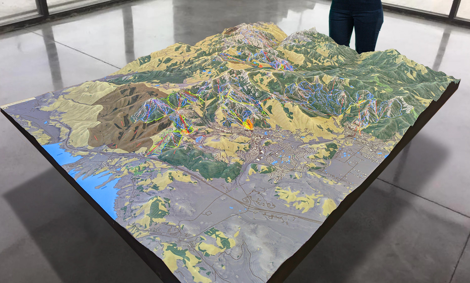
 Park City 3D Raised Relief Map
Why 3D Maps Enhance the Skiing Experience at Stowe Mountain Resort
One of the key reasons that 3D maps are such an invaluable resource for skiers is their ability to visualize the mountain in a way that 2D maps simply cannot. Traditional maps, though useful, flatten the experience of the mountain, offering only basic information about the slopes and trails. A 3D map, on the other hand, immerses the viewer in the actual contours of the terrain, highlighting the verticality, steepness, and natural flow of the runs.
For a ski resort like Stowe, which is renowned for its challenging terrain, understanding the mountain’s topography is critical. Stowe features a wide variety of trails, ranging from easy beginner slopes to advanced, expert-level runs. A 3D map can visually differentiate these types of terrain, making it easier for skiers to plan their day. Beginners, for instance, can easily identify the gentler green slopes and avoid areas that may be too difficult, while expert skiers can seek out the most thrilling and challenging black diamond runs.
Additionally, 3D maps help skiers identify important landmarks such as lifts, lodges, and amenities. Stowe’s resort area includes two distinct peaks: Mount Mansfield, Vermont’s highest mountain, and Spruce Peak, known for its well-groomed terrain and family-friendly atmosphere. A 3D map can clearly show the relationships between these areas, helping skiers determine the best routes between them, as well as how to efficiently move across the mountain.
Interactive digital 3D maps offer even more features, allowing users to zoom in on specific areas of the mountain, get detailed information about individual trails, and even check out real-time snow conditions. This level of interactivity not only improves the practical experience of skiing at Stowe but also makes the planning process more engaging and enjoyable.
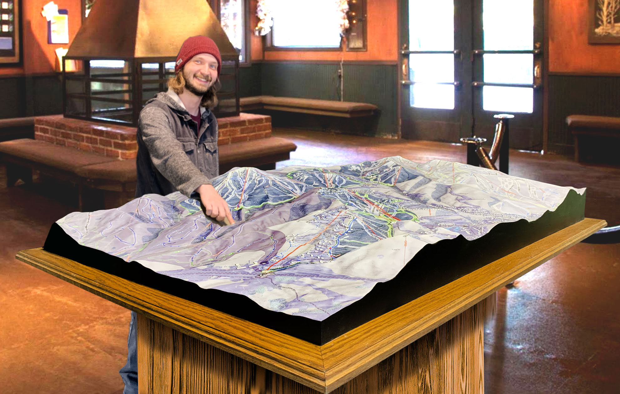
 Deer Valley 3D Raised Relief Map
The Major Ski Runs at Stowe Mountain Resort: A Tour of Stowe’s Best Terrain
Now that we’ve explored how Stowe Mountain Resort 3D maps are crafted and how they enhance the skier’s experience, let’s take a closer look at some of the most iconic and thrilling ski runs that the resort has to offer. Stowe’s diverse terrain ensures that there’s something for everyone—from beginners looking for wide, forgiving slopes to seasoned skiers seeking steep, technical challenges.
Nosedive: One of the most famous runs on Mount Mansfield, Nosedive is a long, winding intermediate trail that offers a blend of steep and moderate sections. Nosedive’s unique feature is its ability to cater to a range of skill levels, with easier routes that can bypass more difficult pitches. This trail offers stunning views of the surrounding mountains and is an excellent introduction to Stowe’s varied terrain.
Goat: For expert skiers looking for a serious challenge, Goat is one of Stowe’s most legendary black diamond runs. Located on the front face of Mount Mansfield, Goat is known for its steep, narrow, and bumpy terrain. The run is not groomed, so skiers must navigate through natural snow conditions, making it a test of skill and technique. The steep drop-offs and tight turns make this a favorite among advanced skiers looking to push their limits.
Starr: Another black diamond run on Mount Mansfield, Starr is considered one of the most difficult trails in the Eastern United States. Like Goat, Starr is not groomed and is full of natural moguls, steep pitches, and challenging terrain features. It’s a trail that demands both technical skill and physical endurance, rewarding those who can conquer it with a true sense of accomplishment.
Toll Road: For those looking for a more relaxed experience, Toll Road is an iconic beginner trail that winds down from the top of Mount Mansfield all the way to the base. This green-circle run is perfect for families or those new to skiing. Toll Road’s gentle gradient and wide turns make it a great spot to practice and enjoy the beautiful Vermont scenery without the pressure of challenging terrain.
Liftline: Liftline is a classic black diamond run that takes skiers directly under the Fourrunner Quad lift, offering a steep, direct descent that is a crowd favorite among advanced skiers. The run features tight turns, moguls, and some sections with significant pitch, making it a thrilling ride for those with the skills to handle it. Because it runs parallel to the lift, skiers also enjoy a bit of an audience, adding to the excitement of the descent.
Spruce Peak’s Meadows: Over on Spruce Peak, Meadows is a popular beginner and intermediate area offering wide, perfectly groomed runs. This area is particularly family-friendly, with gentle slopes that are ideal for children and new skiers to practice and build confidence. The terrain is forgiving, yet interesting enough to keep even more experienced skiers entertained.
Upper National and Lower National: The National trail, split into Upper and Lower sections, is one of the most exciting advanced runs at Stowe. Upper National begins with steep pitches and tight turns, while Lower National offers a slightly less technical but still thrilling ride down to the base. Both sections offer skiers the chance to experience the thrill of steep, fast descents, combined with excellent snow conditions and well-maintained runs.
Conclusion: How Stowe Mountain Resort 3D Maps Elevate the Ski Experience
Stowe Mountain Resort, with its dramatic terrain, diverse trails, and stunning natural beauty, is already a must-visit destination for winter sports enthusiasts. But when combined with the power of 3D maps, the experience of exploring Stowe reaches a new level. These detailed, immersive maps not only provide accurate representations of the mountain’s topography but also enhance the skier’s ability to plan, navigate, and fully enjoy their time on the slopes.
Whether you’re exploring Stowe’s challenging black diamond runs like Goat and Starr, or taking in the scenic beauty of a more relaxed trail like Toll Road, 3D maps bring the mountain to life in a way that transforms how you experience the resort. The craftsmanship behind these maps—melding cutting-edge technology with artistic design—ensures that every contour and feature of the mountain is captured with precision. This powerful combination of utility and artistry makes Stowe Mountain Resort 3D maps an essential tool for skiers, snowboarders, and adventurers alike.
Check out WhiteClouds’ 3D Maps for more information on 3D maps of Stowe Mountian Ski Resort.
