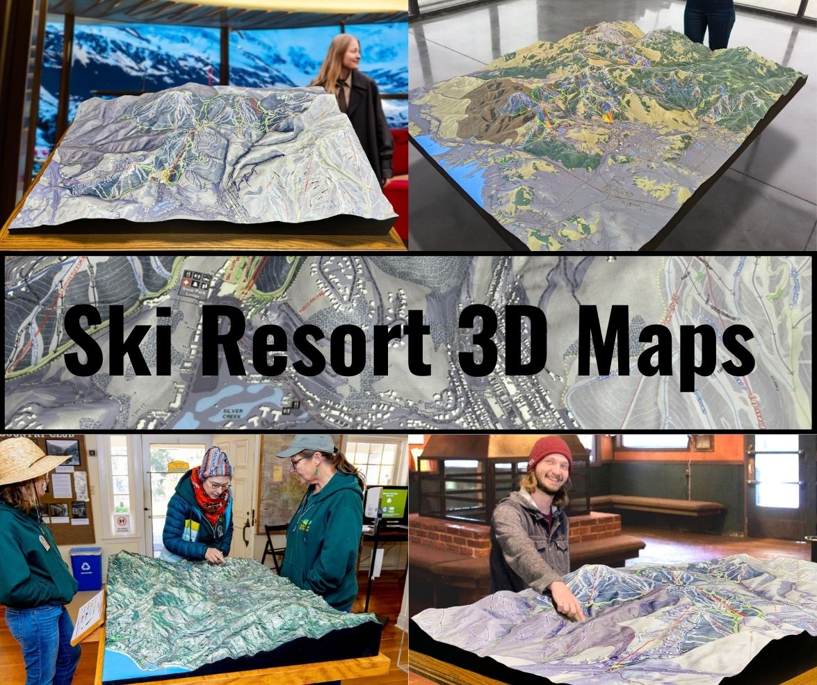
Whaleback 3D Maps
Whaleback 3D Maps
We Build Custom 3D Whaleback Maps
Whaleback Mountain 3D Maps: Exploring a Hidden Gem with Cutting-Edge Precision
Whaleback Mountain, located in Enfield, New Hampshire, is a beloved small-scale ski resort with a deep sense of community. Though it may not be the largest resort in the region, its welcoming atmosphere, diverse terrain, and challenging slopes attract skiers of all abilities. One of the most innovative ways skiers can now engage with the mountain is through detailed 3D maps, which offer an immersive and precise representation of the terrain. These maps are not just tools for navigation—they’re works of art that enhance the skiing experience and connect skiers more deeply with Whaleback’s topography.
In this blog, we’ll dive into the process of how Whaleback 3D maps are made, the significance of these maps for skiers, and explore the major ski runs that define this New England treasure.

The Fabrication of Whaleback 3D Maps: From Data to Art
The creation of a 3D map for a mountain like Whaleback requires a blend of advanced technology and artistic craftsmanship. These maps aren’t merely representations of the mountain’s trails—they provide a tactile and visual experience that brings the landscape to life. The process begins with high-tech data collection and evolves into a beautifully painted model that captures the essence of Whaleback’s terrain.
Topographic Data Collection: Precision from the Sky
The first step in creating a 3D map of Whaleback Mountain is gathering accurate topographic data. This is achieved using LiDAR (Light Detection and Ranging) technology, a remote sensing method that uses laser pulses to capture the terrain in stunning detail. LiDAR scans the mountain’s surface, providing precise data on the elevation, slopes, trees, and natural features of Whaleback.
LiDAR is particularly effective in capturing the subtleties of the landscape that can significantly impact a skier’s experience. Every ridge, drop, and contour is recorded, ensuring that the final 3D model reflects the mountain as accurately as possible. The data collected from these scans is used to create a digital elevation model (DEM), which serves as the foundation for the 3D map.
Building the Digital Model: From Elevation to Visualization
Once the LiDAR data is processed, the next step is creating a digital 3D model of the mountain using computer-aided design (CAD) software. This model translates the topographic data into a visual representation of Whaleback’s terrain, showing every twist, turn, and elevation change of the trails. The digital model is designed to be both accurate and aesthetically pleasing, providing a balance between functionality and artistic representation.
In the digital model, designers carefully adjust the scale and proportions to ensure that the map will be useful for skiers of all levels. Every ski run, chairlift, and natural feature is modeled in detail, giving users a clear understanding of how the mountain is laid out. This model also includes various annotations and markers, such as trail difficulty levels, ski lifts, terrain parks, and key landmarks.
Physical Fabrication: Bringing the Mountain to Life
For those looking for a physical 3D map of Whaleback, the digital model is then brought into the real world through 3D printing technology or CNC machining. These methods use high-density foam or plastic materials to build up the layers of the map, creating a tangible representation of the mountain. Each layer corresponds to a different elevation level, creating an accurate, three-dimensional representation of Whaleback’s unique landscape.
The fabrication process ensures that every detail, from the gentle slopes of the beginner runs to the steep pitches of the expert trails, is captured in the model. These physical 3D maps are not only functional, helping skiers plan their day on the slopes, but also beautiful pieces of art that can be displayed in lodges or homes.
Painting and Detailing: Adding Realism and Functionality
Once the physical model is complete, the final step is the painting and detailing process. Artists use airbrushes and fine-tuned painting techniques to recreate the natural beauty of Whaleback Mountain. Snow-covered peaks, forested areas, and rocky outcrops are all painted to reflect the real-world appearance of the mountain.
Trails are highlighted in distinct colors to indicate their difficulty level, with green for beginner runs, blue for intermediate, and black for advanced and expert trails. Chairlifts and other essential features, such as base lodges and ski patrol stations, are also clearly marked. This attention to detail ensures that the 3D maps are not only visually stunning but also practical tools for skiers to navigate the mountain with ease.
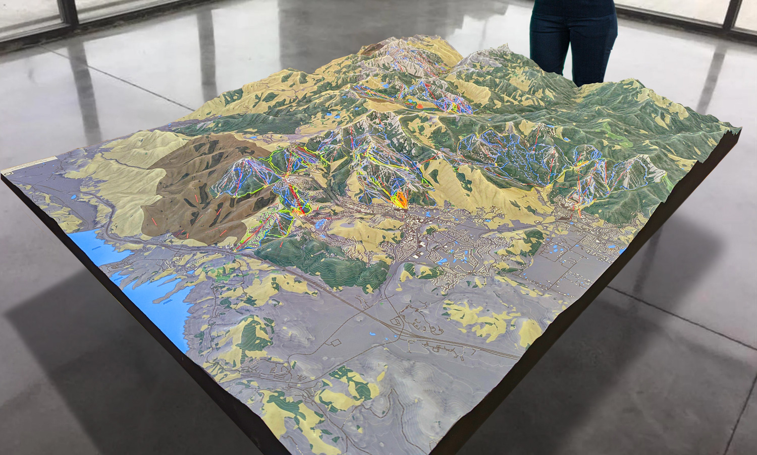
 Park City 3D Raised Relief Map
How Whaleback 3D Maps Enhance the Skiing Experience
For skiers, having a detailed 3D map of Whaleback Mountain is more than just a novelty—it’s a game-changer. These maps provide a deeper understanding of the mountain’s terrain, helping skiers of all skill levels plan their routes, avoid hazards, and maximize their enjoyment on the slopes.
Enhanced Route Planning and Exploration
Flat, traditional maps can be difficult to interpret, especially when it comes to understanding the steepness of a slope or the complexity of a trail. Whaleback’s 3D maps solve this problem by offering a three-dimensional view of the mountain’s contours, allowing skiers to see exactly how the trails twist, turn, and descend. This level of detail makes it easier for skiers to plan their day, choosing runs that match their skill level and preferences.
For beginners, the 3D maps make it easy to spot the gentle, wide-open slopes that offer plenty of space for practicing turns. Intermediate and advanced skiers can use the maps to identify more challenging runs and even explore hidden gems they might have overlooked on a traditional map. By visualizing the terrain, skiers can make more informed decisions and explore the mountain more confidently.
Improving Safety on the Slopes
Skiing can be unpredictable, especially for those unfamiliar with the mountain’s terrain. Whaleback’s 3D maps help improve safety by giving skiers a clearer understanding of the mountain’s layout. Steep drops, sharp turns, and tree-lined sections are all visible on the map, allowing skiers to avoid routes that may be too difficult or dangerous for their skill level.
In addition to providing clear markers for ski patrol locations, emergency stations, and other important safety features, the maps also highlight potential hazards, such as steep pitches or narrow trails, so that skiers can plan accordingly.
Building a Connection to the Mountain
Whaleback Mountain is known for its natural beauty, and the 3D maps help skiers connect more deeply with the landscape. By seeing the mountain in three dimensions, skiers gain a better appreciation for the terrain and the environment. Every ridge, gully, and tree line becomes part of the experience, adding a layer of depth and enjoyment to the day’s adventures.
This connection to the landscape enhances the overall skiing experience, making each run more meaningful. Whether you’re enjoying the wide, beginner-friendly slopes or tackling a challenging expert trail, the 3D map helps you appreciate the unique features of Whaleback Mountain.
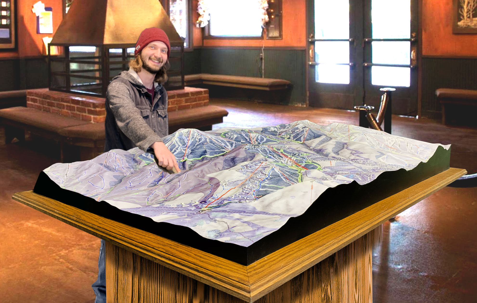
 Deer Valley 3D Raised Relief Map
Major Ski Runs at Whaleback: Highlights from the 3D Maps
Whaleback Mountain may not be the largest resort in New England, but it offers a diverse range of ski runs that cater to all abilities. Whether you’re a beginner looking for easy slopes or an expert seeking out steep, challenging terrain, Whaleback has something for everyone. Here are some of the major ski runs that are beautifully represented on the 3D maps:
The Face (Expert): The Face is one of Whaleback’s signature expert trails, offering a steep and challenging descent that thrills advanced skiers. This black diamond run features tight turns, a significant vertical drop, and narrow sections that require precision and skill. The 3D maps clearly depict The Face’s intimidating slope, giving skiers a chance to mentally prepare before taking on this exciting challenge.
Spout (Intermediate): For intermediate skiers, Spout is a fantastic option. This trail offers a smooth, flowing descent with plenty of room to carve wide turns. Spout is a great run for skiers who want to push their skills without venturing into expert territory. The 3D maps showcase Spout’s gentle curves and scenic route, making it a favorite for those who enjoy a more relaxed ride with a touch of adventure.
Practice Slope (Beginner): The Practice Slope is the perfect place for beginners to get comfortable on their skis. This wide, open run offers a gentle gradient that’s ideal for practicing turns and building confidence. The 3D map shows how the Practice Slope is conveniently located near the base lodge, making it easily accessible for families and first-time skiers.
Scrimshaw (Advanced): Advanced skiers looking for a thrilling ride will love Scrimshaw, a black diamond run that features steep pitches and challenging technical sections. This trail winds through tree-lined areas and offers a mix of open slopes and tight turns, providing an exciting challenge for seasoned skiers. The 3D maps highlight Scrimshaw’s steep drops and narrow passages, making it clear why this run is a favorite among experienced skiers.
Whale’s Tail (Intermediate): Tail is a scenic intermediate trail that offers a long, meandering descent through both wooded and open areas. The trail provides a mix of gentle slopes and more challenging sections, making it a great choice for intermediate skiers looking to enjoy a leisurely ride with a few exciting moments. The 3D maps capture the beauty of Whale’s Tail, highlighting its winding path and the stunning views it offers.
Conclusion: Whaleback 3D Maps—A New Way to Experience the Mountain
Whaleback Mountain’s 3D maps are transforming the way skiers interact with the terrain. These detailed, immersive maps enhance the skiing experience by providing a clear and accurate representation of the mountain’s topography. From helping skiers plan their routes and navigate safely to fostering a deeper connection with the natural landscape, Whaleback’s 3D maps are a game-changer for skiers of all levels. Whether you’re a beginner or an expert, these maps will help you make the most of your time on the mountain and ensure that every run is an unforgettable adventure.
Check out WhiteClouds’ 3D Maps for more information on 3D maps of Whaleback Ski Resort.
