Yukon River Watershed Map
Yukon River Watershed Map
We Build Custom 3D Watershed Maps
Yukon River Watershed Map: Exploring North America’s Arctic Lifeline
The Yukon River Watershed is one of the largest and most remote river systems in North America, covering more than 330,000 square miles across Alaska and Canada’s Yukon and British Columbia territories. The Yukon River, stretching over 1,980 miles, is a critical waterway that supports Indigenous communities, wildlife, and ecosystems in one of the harshest and most pristine environments on the planet. Yukon River Watershed maps offer a glimpse into this vast and untamed region, showcasing its geography, ecological significance, and the unique challenges it faces in an era of climate change.
Mapping the Expansive Yukon River Watershed
The Yukon River originates in the Llewellyn Glacier in British Columbia and flows through the Yukon Territory before crossing into Alaska, where it eventually empties into the Bering Sea. The watershed is vast, encompassing a network of tributaries that includes the Porcupine, Tanana, Koyukuk, and Pelly rivers. Together, these waterways create a hydrological system that drains one of the largest and most diverse regions in the Arctic.
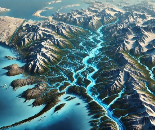
Watershed maps capture the intricate web of rivers and streams that define the Yukon River system, highlighting how water flows through forests, tundra, and wetlands. They also reveal the dramatic topography of the region, from the towering peaks of the Coast Mountains to the flat expanses of the Yukon Flats. This diversity shapes not only the movement of water but also the ecosystems and human activities that depend on it.
One of the most compelling features of the Yukon River Watershed is its seasonal variability. During the spring and summer, melting snow and ice swell the rivers, flooding vast areas and depositing nutrient-rich sediments that support plant and animal life. In winter, much of the watershed is locked in ice, creating a stark yet beautiful frozen landscape.
Ecological Importance of the Yukon River Watershed
The Yukon River Watershed is a haven for biodiversity, supporting an array of species adapted to its unique Arctic and sub-Arctic conditions. Its rivers and wetlands provide critical habitats for salmon, which undertake some of the longest migrations of any fish species, traveling thousands of miles from the Bering Sea to spawn in the watershed’s tributaries. These salmon runs are vital not only for wildlife but also for the Indigenous communities that rely on them for food, culture, and tradition.
The watershed’s forests and tundra are home to iconic species such as moose, caribou, wolves, and grizzly bears. Migratory birds, including sandhill cranes and waterfowl, depend on the region’s wetlands and riparian zones for nesting and feeding. The Yukon Flats, in particular, are recognized as one of the most important breeding grounds for ducks in North America.
Watershed maps are essential tools for understanding and protecting these ecosystems. They help conservationists identify critical habitats, monitor changes in land use and climate, and guide efforts to preserve the region’s biodiversity. For example, maps that show the distribution of salmon spawning areas can inform policies to protect these vital habitats from overfishing or development.
Human Connections to the Yukon River Watershed
The Yukon River Watershed has been home to Indigenous peoples for thousands of years, including the Gwich’in, Koyukon, and Tlingit communities. These groups have developed deep cultural and spiritual connections to the land and water, relying on the river system for subsistence hunting, fishing, and gathering.
During the late 19th and early 20th centuries, the Yukon River gained international attention as a key route during the Klondike Gold Rush. Paddlewheelers carried miners and supplies along the river, leaving a lasting legacy in the region’s history. Today, the watershed remains a vital resource for transportation, recreation, and tourism.
Watershed maps are invaluable for balancing these human uses with conservation goals. They provide insights into how the river system supports Indigenous communities and economic activities while highlighting areas that require protection or sustainable management.
Challenges Facing the Yukon River Watershed
The Yukon River Watershed faces significant challenges, many of which are driven by climate change. Rising temperatures are causing glaciers and permafrost to melt, altering water flow patterns and impacting ecosystems. Changes in precipitation and snowpack are affecting the timing and volume of river discharge, with implications for salmon migration and wetland habitats.
Pollution is another concern, particularly from mining and other industrial activities. Legacy contaminants from past mining operations, such as mercury and heavy metals, continue to affect water quality in parts of the watershed.
Watershed maps play a crucial role in addressing these challenges. They provide detailed information about water flow, land use, and environmental conditions, enabling stakeholders to develop strategies for mitigating the impacts of climate change, protecting water quality, and conserving biodiversity.
Fabricating Yukon River Watershed 3D Maps: Bringing the Arctic to Life
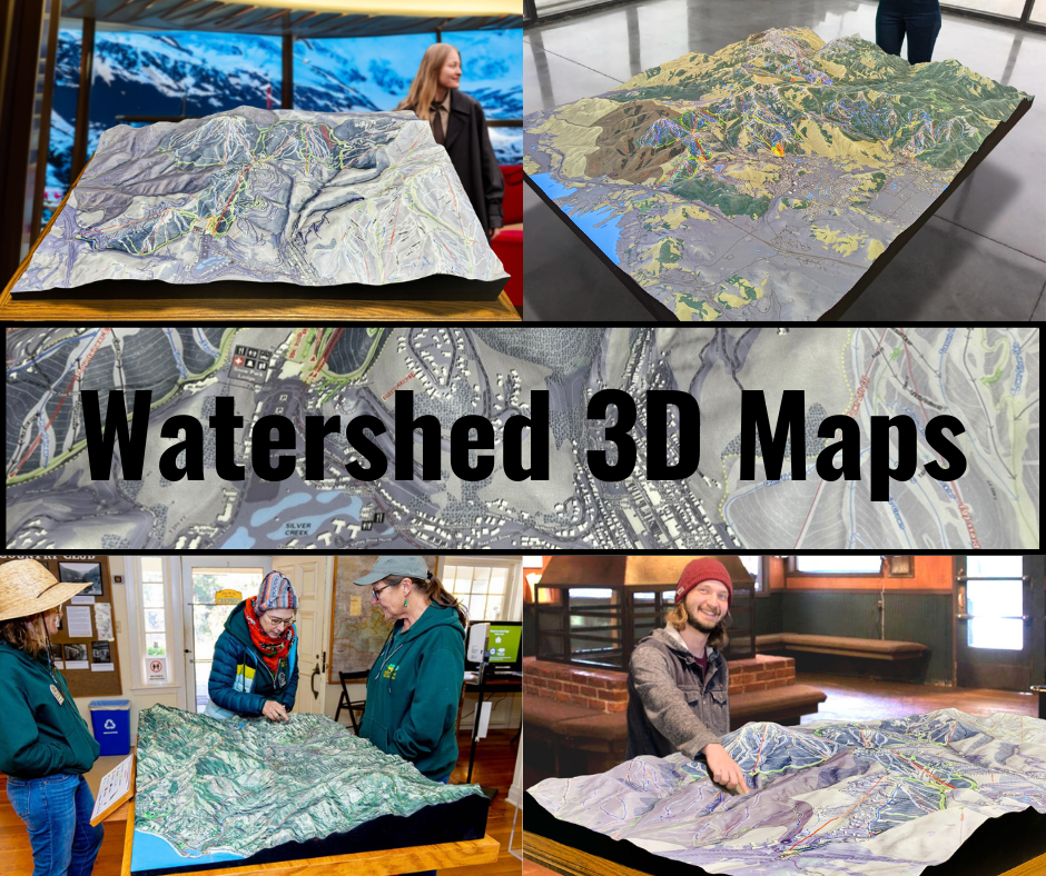
Creating a 3D map of the Yukon River Watershed is a complex process that combines scientific data, advanced technology, and artistic craftsmanship. These maps offer a tactile and visually engaging way to explore the watershed’s geography, helping viewers appreciate its scale, complexity, and importance.
The process begins with the collection of high-resolution topographical and hydrological data. Organizations such as the U.S. Geological Survey (USGS) and Natural Resources Canada provide datasets that include elevation, land cover, and water flow information. This data is processed using geographic information system (GIS) software to create a digital model of the watershed.
Once the digital model is complete, it is translated into a physical object using 3D printing technology. WhiteClouds, a leader in 3D mapping, employs state-of-the-art printers to construct the map layer by layer. Materials such as PLA (polylactic acid) or resin are used to build the structure, with each layer representing a specific elevation. This process ensures that the 3D map accurately replicates the contours and features of the watershed.
After the base structure is printed, the map undergoes a meticulous finishing process to enhance its realism. Artists hand-paint the map, using colors that correspond to the various features of the watershed. Shades of blue highlight rivers and lakes, while greens and browns depict forests, tundra, and mountains. Airbrushing techniques are often used to create smooth transitions between different terrain types, resulting in a lifelike and visually striking map.
The final step involves applying a protective coating, such as polyurea or polyurethane, to ensure the map’s durability. This coating protects the map from wear and tear, making it suitable for use in educational displays, public exhibitions, and planning meetings.
3D maps of the Yukon River Watershed are more than just tools—they are works of art that inspire curiosity and understanding. They provide a hands-on way to explore the watershed, helping people appreciate its beauty, challenges, and ecological significance.
Educational and Planning Applications of Yukon River Watershed Maps
Yukon River Watershed maps are invaluable resources for education, research, and planning. In classrooms, they provide students with a hands-on way to explore geography, hydrology, and ecology. By visualizing the watershed’s topography and water flow, students can better understand the challenges of managing water resources in a remote and dynamic environment.
For researchers, these maps offer detailed information about the watershed’s features, supporting studies on topics such as climate change, water quality, and biodiversity. Planners and policymakers use the maps to make informed decisions about land use, infrastructure development, and resource management. For example, maps showing areas of permafrost melt can guide efforts to mitigate its impacts on ecosystems and communities.
The Future of the Yukon River Watershed
As the Yukon River Watershed faces pressures from climate change, industrial development, and resource demands, the need for sustainable management and conservation has never been more urgent. Innovations in mapping technology, including 3D models, will play a critical role in addressing these challenges. By providing detailed and accurate information about the watershed, these tools enable better planning and decision-making.
The Yukon River Watershed is a vital part of North America’s natural and cultural heritage, supporting ecosystems, communities, and economies. By continuing to study and protect this system, we can ensure that it remains a source of life and inspiration for generations to come. Whether through traditional maps, digital tools, or immersive 3D models, the Yukon River Watershed will continue to captivate and educate, highlighting the importance of preserving one of the world’s most remote and extraordinary river systems.
Check out WhiteClouds’ 3D Maps for more information on Yukon River watershed maps.

