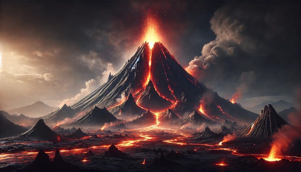
Volcanoes and maps share an intimate connection, as maps provide a way to chart the unpredictable and often violent nature of these natural wonders. Throughout history, the eruption of volcanoes has shaped both the landscape and the stories of those living in their shadows. Ancient civilizations used rudimentary maps to mark areas of volcanic activity, passing down warnings to future generations. Today, sophisticated satellite images and topographic maps allow scientists to study volcanoes in intricate detail, predicting eruptions and studying lava flows. These maps are not just tools of scientific discovery, but also artistic representations of Earth’s power and beauty, where every contour line represents the forces beneath the surface. The idea of volcanoes and maps brings to life the vivid contrast between the calmness of exploration and the sheer force of nature—how one can trace the flow of lava, track seismic shifts, and chart the aftermath of eruptions, all while appreciating the wild, untamed landscapes that volcanoes create. Maps of volcanic regions, whether ancient or modern, tell stories of devastation and rebirth, offering glimpses into the heart of our planet where fire and stone come together in a dance of creation and destruction.
Top 10 Deadliest Volcanic Eruptions in History
Top 10 Deadliest Volcanic Eruptions in History
WhiteClouds builds 3D Raised Relief Maps
Volcanic eruptions are one of the most catastrophic natural events in the world, with the potential to destroy entire cities, kill thousands, and alter the climate for years. Over the centuries, there have been numerous deadly volcanic eruptions that have left a significant impact on both the people and the environment. This list explores the top 10 deadliest volcanic eruptions in history, focusing on their size, locations, fascinating facts, and their lasting legacy.
#1: Mount Tambora, Indonesia – 12,280 feet
Mount Tambora, located on the island of Sumbawa in Indonesia, is the site of one of the most deadly and powerful volcanic eruptions in recorded history. The eruption occurred in April 1815 and is considered the most powerful eruption of the past 10,000 years. The explosion of Mount Tambora was so massive that it ejected an estimated 10 cubic miles of volcanic material into the atmosphere, significantly altering the climate and resulting in what is known as the “Year Without a Summer” in 1816. This eruption is believed to have killed up to 71,000 people directly, but the global effects of the eruption, including crop failures and food shortages, led to the deaths of tens of thousands more.
The eruption of Tambora was not only catastrophic in terms of loss of life but also had far-reaching environmental and social consequences. The ash and sulfur dioxide that were released into the atmosphere caused a dramatic cooling of the Earth’s climate, leading to widespread famine, particularly in Europe and North America. The eruption also created a significant global impact by leading to a series of climate anomalies and creating a volcanic winter that affected the weather patterns across the world for several years.
Tambora is also a fascinating volcano due to its geological history. Before the eruption, the volcano was a large and tall stratovolcano, standing at 13,000 feet, but after the eruption, its height was reduced to 12,280 feet, and a massive caldera formed in its place. The eruption’s violent explosion and the resulting lava flows and pyroclastic surges were some of the most destructive forces in volcanic history.
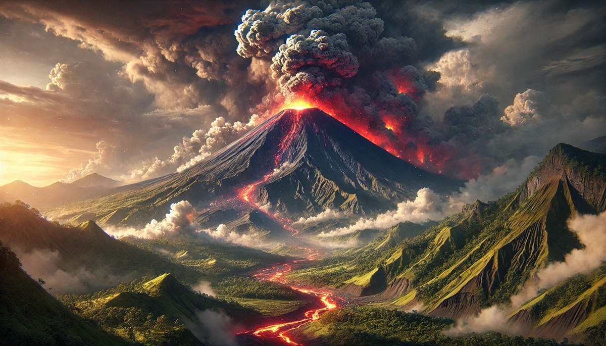
#2: Mount Krakatoa, Indonesia – 2,667 feet
Krakatoa, also located in Indonesia, is infamous for its catastrophic eruption in 1883, which led to the deaths of over 36,000 people. The eruption was preceded by several smaller explosions before the final, massive detonation that was heard as far away as Australia and the island of Rodrigues, nearly 3,000 miles away. Krakatoa’s eruption is considered one of the most violent volcanic events ever recorded. The eruption caused the island of Krakatoa to collapse, forming a caldera, and the explosion triggered massive tsunamis that devastated coastal towns and villages.
The event was one of the deadliest and most destructive volcanic eruptions in modern history. The eruption’s effects were global, with ash clouds that circled the globe, causing temperatures to drop and affecting weather patterns for years. The eruption also produced spectacular sunsets, which were observed across the world due to the ash particles in the atmosphere. The eruption has become a symbol of the power and unpredictability of volcanic activity.
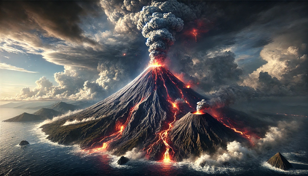
The volcanic island of Krakatoa is located between the islands of Java and Sumatra. Today, the island remains a fascinating study for volcanologists, and the small island of Anak Krakatau (“Child of Krakatoa”) has formed in the caldera of the previous eruption. Anak Krakatau itself is an active volcano that continues to erupt periodically.
#3: Mount Vesuvius, Italy – 4,203 feet
Mount Vesuvius is perhaps the most famous volcano in the world due to its eruption in 79 AD that destroyed the Roman cities of Pompeii and Herculaneum. The eruption was sudden and violent, burying both cities under a thick blanket of ash and pumice, killing thousands of people who were unable to escape. The eruption of Vesuvius is one of the deadliest in European history, with an estimated 16,000 people perishing during the event.
Vesuvius is located near Naples, Italy, and has erupted many times throughout history, with the most famous eruption in 79 AD being only one of its many violent outbursts. The eruption buried the cities of Pompeii and Herculaneum, preserving the ruins in a remarkably detailed way that allows modern archaeologists and visitors to understand what life was like in the Roman Empire.
Today, Mount Vesuvius remains one of the most dangerous volcanoes in the world due to the large population living nearby. The last eruption occurred in 1944, and the volcano continues to be closely monitored by volcanologists to predict any future activity. Vesuvius is part of the Campanian volcanic arc and is considered a stratovolcano, with a history of explosive eruptions.
#4: Mount St. Helens, USA – 8,363 feet
Mount St. Helens, located in Washington State, USA, erupted in 1980, resulting in the deadliest volcanic event in U.S. history. The eruption caused a massive debris avalanche, a lateral blast, and pyroclastic flows that destroyed vast areas of forest and killed 57 people. The eruption also left behind a massive crater and caused a significant environmental impact, with ash clouds that affected air travel and agricultural production.
Before the eruption, Mount St. Helens had been an active volcano, but it had been dormant for over 100 years. The 1980 eruption was preceded by a series of earthquakes and volcanic tremors that alerted scientists to the possibility of an eruption. The eruption caused the largest landslide in recorded history, and the resulting ash plume reached 15 miles into the atmosphere.
The eruption of Mount St. Helens is notable for the research that followed, as scientists were able to study the effects of a large volcanic eruption on ecosystems and wildlife. The region around the volcano has since recovered, but the eruption remains a powerful reminder of the destructive power of nature.
#5: Mount Pinatubo, Philippines – 5,863 feet
Mount Pinatubo erupted in June 1991 in the Philippines, and its eruption was one of the largest in the 20th century. The eruption released a massive volume of ash and sulfur dioxide into the atmosphere, which caused global temperatures to drop by approximately 1.5°F (0.8°C) over the following year. The eruption of Pinatubo caused over 800 deaths, but the indirect effects of the eruption, such as the resulting lahar flows and the disruption of local communities, contributed to even more loss of life.
The eruption of Pinatubo was preceded by a series of warnings, including a large number of small earthquakes and an increase in volcanic activity. The eruption produced pyroclastic flows and a large ash cloud that traveled thousands of miles, affecting air travel and creating health problems for millions of people. The eruption’s effects were not only felt locally but also globally, as the ash and gases released into the atmosphere caused atmospheric cooling.
Pinatubo is located on the island of Luzon and is part of the larger volcanic arc known as the Sunda Arc. The eruption left behind a massive caldera, and the area around the volcano remains a popular site for scientific research. The eruption serves as a reminder of the unpredictable and powerful nature of volcanic activity.
#6: Mount Fuji, Japan – 12,389 feet
Mount Fuji, Japan’s most iconic and highest volcano, stands at 12,389 feet and has had a long and storied history of eruptions. The most famous eruption of Mount Fuji occurred in 1707, known as the Hōei Eruption, which covered the surrounding area in ash and affected the nearby cities of Edo (now Tokyo). The eruption, though not as catastrophic in terms of casualties as some others, had a significant impact on the surrounding environment and the lives of people living nearby.
Mount Fuji is an active stratovolcano and is located on Honshu, the largest island in Japan. It has become a cultural and spiritual symbol for the Japanese people and has been a popular subject in art, literature, and religious practices for centuries. Today, Mount Fuji is an active volcano, though it has not erupted since the 18th century, and its slopes are visited by thousands of tourists each year.
Despite its serene appearance and cultural significance, Mount Fuji remains a potential threat, and it is closely monitored by scientists for any signs of future volcanic activity. The eruption of Mount Fuji in 1707 is an example of how even seemingly quiet volcanoes can erupt unexpectedly, reminding us of the ever-present dangers of volcanic activity.
#7: Mount Etna, Italy – 10,922 feet
Mount Etna is one of the most active volcanoes in the world and is located on the island of Sicily, Italy. With a height of 10,922 feet, it is Europe’s highest active volcano. Etna has been erupting for thousands of years and has had numerous eruptions throughout history, many of which have caused significant damage to surrounding areas. Its eruptions are often explosive and accompanied by lava flows, ash clouds, and pyroclastic surges.
One of the most destructive eruptions of Mount Etna occurred in 1669, when a series of eruptions destroyed parts of the city of Catania and caused widespread damage to the surrounding agricultural areas. The eruption created large lava flows that buried villages and forced thousands of people to flee their homes.
Mount Etna is famous for its constant activity, with eruptions occurring frequently, sometimes several times a year. Despite its frequent eruptions, Mount Etna has not caused a major loss of life in modern times, thanks to its predictable activity and the preparedness of local authorities.
#8: Mount Mauna Loa, Hawaii – 13,681 feet
Mount Mauna Loa, located on the Big Island of Hawaii, is the largest volcano on Earth by volume and area. Standing at 13,681 feet, it is one of the most massive volcanoes on the planet. Although it is not known for catastrophic eruptions, its eruptions have been significant enough to cause destruction and loss of life. The most recent eruption occurred in 2022, and its lava flows covered vast areas of land, affecting local communities and infrastructure.
Mauna Loa’s eruptions are primarily effusive, meaning they produce lava flows rather than explosive eruptions. However, the size of the eruptions and the extent of the lava flows can still cause significant damage to nearby properties, roads, and agricultural areas. Mauna Loa’s eruptions have shaped the landscape of the Big Island, creating large lava fields and new terrain.
Mauna Loa is an active shield volcano, and its eruptions are closely monitored by the Hawaiian Volcano Observatory to provide early warning of any future activity. The volcano is a key part of Hawaii’s volcanic history and has contributed to the formation of the Hawaiian Islands.
#9: Mount Pelee, Martinique – 4,583 feet
Mount Pelee, located on the Caribbean island of Martinique, is famous for its eruption in 1902, which destroyed the city of St. Pierre and killed nearly 30,000 people. The eruption of Mount Pelee is considered one of the deadliest in the Caribbean, and the eruption’s pyroclastic flows, which descended on the city of St. Pierre, are infamous for their speed and destructive force.
The eruption of Mount Pelee is particularly memorable due to the lack of warning signs before the disaster. Scientists at the time had little understanding of volcanic activity and failed to predict the eruption. As a result, many people were caught off guard and perished in the eruption.
Today, Mount Pelee remains an active volcano and continues to be a site of interest for volcanic research. The 1902 eruption serves as a reminder of the dangers of living near active volcanoes and the need for scientific research to predict eruptions.
#10: Mount Nevado del Ruiz, Colombia – 17,457 feet
Mount Nevado del Ruiz, located in Colombia, is famous for its eruption in 1985, which triggered a series of deadly lahars (volcanic mudflows) that buried the town of Armero, killing more than 23,000 people. The eruption was preceded by weeks of seismic activity and ash emissions, but the townspeople were unaware of the danger posed by the lahars. The eruption of Nevado del Ruiz is a tragic reminder of the devastation that volcanic eruptions can cause, even when the eruption itself is not immediately explosive.
Nevado del Ruiz is an active stratovolcano and is located in the Andes mountains. The eruption in 1985 was not the first time the volcano had erupted, and it has continued to show signs of activity in the decades since. The event led to significant changes in how volcanic eruptions are monitored and predicted in Colombia.
The deadliest volcanic eruptions in history showcase the immense power of nature and the vulnerability of human populations living near active volcanoes. From the cataclysmic eruption of Mount Tambora in 1815 to the tragic eruption of Nevado del Ruiz in 1985, these volcanoes have shaped not only the landscapes but also the lives of those who lived in their shadows. The study of these eruptions continues to provide valuable insights into volcanic activity and the risks associated with living near these natural giants. As we continue to monitor volcanoes around the world, these past eruptions remind us of the unpredictable forces that govern our planet.
More Great Top 10’s
Volcanoes and Maps
- Topographical Maps: Representation of the physical features of a region or area.
- Contour Maps: Representation of the contours of the land surface or ocean floor.
- Raised Relief Maps: Representation of land elevations with raised features indicating landforms.
- Terrain Maps: Representation of the physical features of a terrain or landmass.
- USGS Topographic Maps: Representation of topographic features and land elevations based on USGS data.
- USGS Historical Topographic Maps: Representation of historical topographic maps created by the USGS.
- Watershed Maps: Representation of the areas where water flows into a particular river or lake.
- Elevation Maps: Representation of land and water elevations with high precision.
- Physical Maps: Representation of physical features of the Earth’s surface such as landforms, oceans, and plateaus.
- Bathymetric Maps: Representation of the topography and features of the ocean floor.
- NOAA Maps: Representation of atmospheric, oceanographic, and environmental data by NOAA.
- Nautical Maps: Representation of the underwater features and depth of an area for navigation purposes.
- Geologic Maps: Representation of the geologic features of an area such as rock types, faults, and folds.
- Satellite Maps: Representation of earth from high-definition satellite imagery.
Contact us today to learn more about our services and how we can help you achieve your goals.


