Top 10 Largest Arches in the World
Top 10 Largest Arches in the World
WhiteClouds builds 3D Raised Relief Maps
Natural arches are some of the most extraordinary geological features on Earth, showcasing the artistry of erosion over millions of years. These breathtaking formations, found across deserts, mountains, and coastlines, are monumental in scale and beauty. From rugged wilderness to remote landscapes, each arch carries with it stories of its formation, cultural significance, and human fascination. Below is a list of the top 10 largest natural arches in the world, ranked by their span and height, offering a closer look at their majesty and history.
#1: Shipton’s Arch, China – 1,200 Feet Tall
While its span is smaller, Shipton’s Arch in China’s Xinjiang province is the tallest natural arch in the world, standing at a staggering 1,200 feet. Also known as Heaven’s Gate, the arch is a remote and awe-inspiring geological feature.
Discovered by British mountaineer Eric Shipton in the 1940s, the arch has become a symbol of perseverance for those willing to traverse its rugged surroundings.
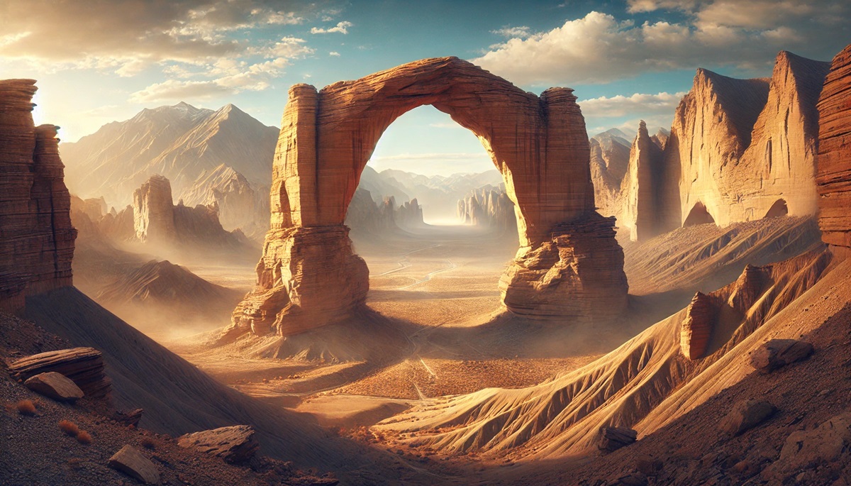
#2: Xianren Bridge, China – 400 Feet
Xianren Bridge, also known as Fairy Bridge, is the largest natural arch in the world, located in Guangxi, China. This limestone karst formation spans a remarkable 400 feet across the Buliu River. Its striking appearance, surrounded by lush greenery and serene waters, gives it an ethereal charm.
Discovered relatively recently by the Western world, Xianren Bridge has been a cultural and natural landmark for locals for centuries. Its name, Fairy Bridge, originates from Chinese folklore, where it’s said that fairies once danced across its span. The arch is a confirmation to the power of water erosion, which sculpted this masterpiece over millennia.

#3: Tushuk Tash, China – 330 Feet
Tushuk Tash, or “Hole Mountain,” is a massive arch in China’s western region, spanning an incredible 330 feet. Its formation is part of a karst landscape shaped by water erosion, creating a breathtaking natural wonder.
The arch has cultural and geological significance, with its remote location preserving its pristine beauty for those who journey to see it.
#4: Landscape Arch, USA – 290 Feet
Nestled within Utah’s Arches National Park, Landscape Arch is one of the most famous natural arches globally, with a slender span of 290 feet. Its delicate structure and improbable design make it a visual marvel, drawing thousands of visitors annually.
The arch is so fragile that sections have fallen in recent decades, underscoring its transient nature. Its iconic silhouette against the Utah desert has made it one of the most photographed landmarks in the world.
#5: Kolob Arch, USA – 287 Feet
Kolob Arch in Zion National Park, Utah, boasts an impressive span of 287 feet, making it one of the longest natural arches in the world. Surrounded by Zion’s rugged landscape, Kolob Arch is a secluded gem accessible only by a challenging hike.
Its reddish hues and dramatic surroundings make it a favorite among adventurers and photographers. Its formation reflects the geological processes unique to the region, with water and wind carving through Navajo Sandstone over millions of years.
#6: Rainbow Bridge, USA – 275 Feet
Rainbow Bridge in Utah is not only one of the largest natural arches, with a span of 275 feet, but also a site of immense cultural significance. Sacred to the Navajo people, it is considered a bridge to the spiritual world.
Located near Lake Powell, Rainbow Bridge is accessible by boat or hike, offering visitors a sense of adventure. Its sandstone arch stands as a confirmation to the region’s geological history and Indigenous culture.
#7: Aloba Arch, Chad – 250 Feet
Aloba Arch, located in the Ennedi Plateau of Chad, is one of the most dramatic natural arches in the world, towering over 250 feet in height. Its remote location in the Sahara Desert makes it a hidden treasure, often described as a gateway to another world.
The arch’s sheer size and isolation have made it a symbol of the untamed beauty of Africa’s desert landscapes. Local tribes have woven legends around it, adding an air of mystique to its grandeur.
#8: Paria Arch, USA – 248 Feet
Paria Arch, located in Arizona’s desert landscape, spans 248 feet and is a lesser-known yet equally impressive natural feature. Its secluded location provides a tranquil experience for those seeking solitude and natural beauty.
The arch’s rugged textures and surrounding red rocks create a captivating contrast against the blue skies, making it a favorite among photographers.
#9: Snake Bridge, USA – 240 Feet
Snake Bridge in Wyoming is a unique natural formation with a span of 240 feet. Named for its winding shape, the bridge offers a surreal experience to visitors exploring its surrounding desert terrain.
The bridge is a result of millions of years of wind erosion, creating its signature curves and shape that captivate geologists and adventurers alike.
#10: Darvaza Arch, Turkmenistan – 230 Feet
The Darvaza Arch in Turkmenistan is a stunning natural feature in the Karakum Desert, with a span of 230 feet. Its isolated location and stark surroundings give it an otherworldly feel.
The arch’s rugged beauty and the tales of nomadic tribes that speak of it as a gateway to the heavens add to its allure. It stands as a reminder of nature’s ability to create breathtaking sculptures.
The largest natural arches in the world are monumental confirms to the power of erosion and the passage of time. From the ethereal beauty of China’s Xianren Bridge to the iconic Landscape Arch in the USA, these formations connect us to Earth’s dynamic history and inspire a sense of wonder. They stand as enduring symbols of nature’s artistry, offering a glimpse into the geological forces that shape our world.
More Great Top 10’s
Arches and Maps
Learn more about Maps
- Topographical Maps: Representation of the physical features of a region or area.
- Contour Maps: Representation of the contours of the land surface or ocean floor.
- Raised Relief Maps: Representation of land elevations with raised features indicating landforms.
- Terrain Maps: Representation of the physical features of a terrain or landmass.
- USGS Topographic Maps: Representation of topographic features and land elevations based on USGS data.
- USGS Historical Topographic Maps: Representation of historical topographic maps created by the USGS.
- Watershed Maps: Representation of the areas where water flows into a particular river or lake.
- Elevation Maps: Representation of land and water elevations with high precision.
- Physical Maps: Representation of physical features of the Earth’s surface such as landforms, oceans, and plateaus.
- Bathymetric Maps: Representation of the topography and features of the ocean floor.
- NOAA Maps: Representation of atmospheric, oceanographic, and environmental data by NOAA.
- Nautical Maps: Representation of the underwater features and depth of an area for navigation purposes.
- Geologic Maps: Representation of the geologic features of an area such as rock types, faults, and folds.
- Satellite Maps: Representation of earth from high-definition satellite imagery.
Contact us today to learn more about our services and how we can help you achieve your goals.


