Top 10 Largest Forests in the World
Top 10 Largest Forests in the World
WhiteClouds builds 3D Raised Relief Maps
Forests are the backbone of Earth’s ecosystems, providing essential resources, habitats, and climate stability. Unlike the dense, humid rainforests, the world’s largest forests are diverse landscapes that range from expansive coniferous woodlands to temperate stretches of towering hardwoods. These vast forests are home to countless species, historical landmarks, and fascinating cultural narratives. From the Arctic’s boreal expanse to the ancient groves of North America, these forests are treasures of ecological, historical, and cultural importance. Here’s a look at the ten largest forests in the world, ranked by size.
#1: Taiga (Boreal Forest) – Canopy Height: Up to 100 Feet
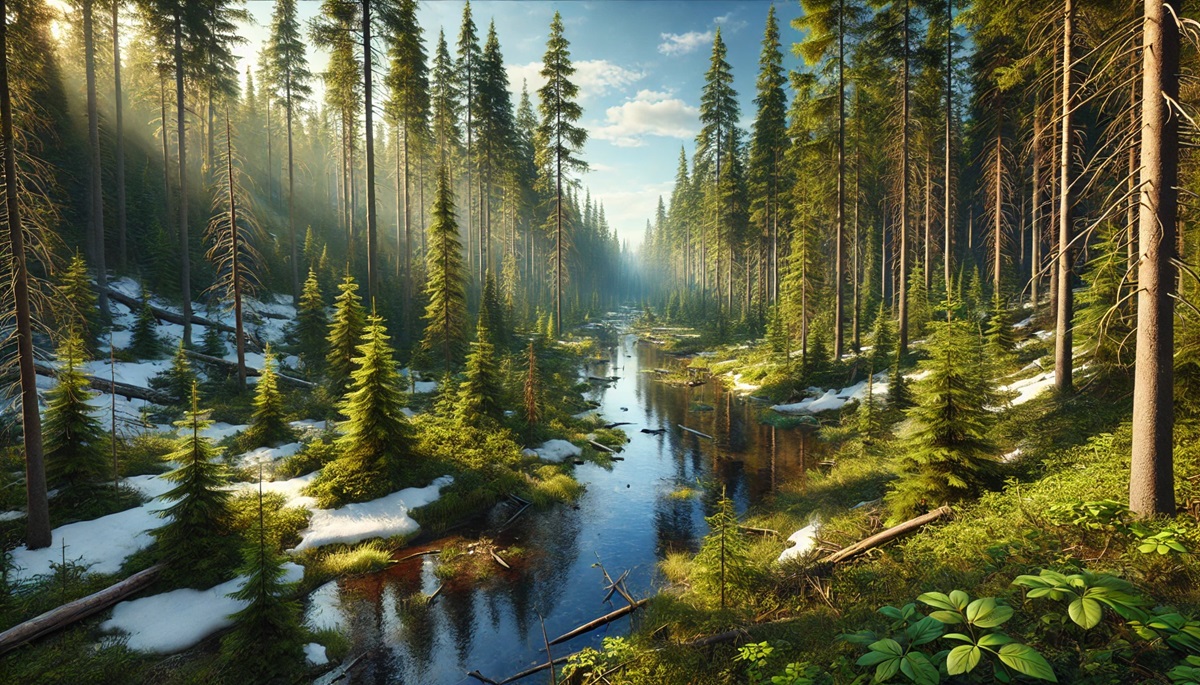
The Taiga, also known as the Boreal Forest, is the largest forest in the world, spanning over 6.6 million square miles across Canada, Alaska, Russia, and Scandinavia. This immense biome is dominated by towering conifers such as spruce, pine, and fir. These trees create a serene and somewhat stark landscape, particularly in the winter when the forest is blanketed in snow.
The Taiga plays a critical role in regulating the Earth’s climate by storing vast amounts of carbon in its soil and trees. Historically, indigenous peoples such as the Sami in Scandinavia and various First Nations in Canada have thrived in this forest, relying on its resources for food, shelter, and cultural practices. Explorers and settlers have long been awed by the Taiga’s vastness, often struggling to traverse its cold and rugged terrain. Its importance as a global carbon sink underscores its critical role in combating climate change, although wildfires and warming temperatures threaten its delicate balance.
#2: Amazon Basin Forests – Canopy Height: Up to 200 Feet
While known for its rainforests, the Amazon Basin also includes vast stretches of drier forests that span over 2.1 million square miles. These forests are characterized by diverse hardwood species and seasonal ecosystems. They host numerous species that thrive in transitional zones between rainforests and open grasslands.
The Amazon Basin forests have long been integral to indigenous cultures, with oral histories and myths linking human existence to the towering trees and expansive canopy. Beyond their ecological importance, these forests are a source of rare hardwoods and medicinal plants. Conservation efforts focus on protecting these vital habitats from deforestation and agricultural expansion.

#3: Siberian Forest – Canopy Height: Up to 150 Feet
The Siberian Forest is part of Russia’s vast Taiga and stretches across 5.2 million square miles. This coniferous forest is dominated by larch, pine, and spruce trees and is often considered one of the most remote and untamed regions on Earth. The Siberian Forest has extreme climates, with frigid winters and mild summers.
Anecdotal tales from Russian explorers describe encounters with bears, wolves, and the haunting stillness of the Siberian wilderness. The forest’s sheer size makes it a critical habitat for countless species and a significant carbon storage area. Its remote nature has preserved its pristine beauty, though logging and climate change pose challenges.
#4: Eastern European Forest – Canopy Height: Up to 120 Feet
Stretching across parts of Poland, Belarus, and Ukraine, the Eastern European Forest spans approximately 400,000 square miles. This forest is a mix of deciduous and coniferous trees, including oak, beech, and pine. Its diverse ecosystem supports a range of wildlife, including bison, lynxes, and wolves.
The Białowieża Forest, a UNESCO World Heritage site within this larger expanse, is one of Europe’s last and largest remaining primeval forests. Anecdotes of early kings hunting within these woods speak to their long-standing importance. Today, the forest is a symbol of conservation success, though it still faces challenges from illegal logging.
#5: North American Boreal Forest – Canopy Height: Up to 100 Feet
The North American Boreal Forest stretches across Canada and parts of Alaska, covering over 1.5 million square miles. This forest is dominated by conifers like spruce, fir, and tamarack and supports a wide range of wildlife, including moose, bears, and caribou.
Indigenous communities have relied on this forest for thousands of years, using its resources sustainably for food, medicine, and shelter. Anecdotes from early European settlers describe the overwhelming vastness and harsh beauty of this northern expanse. Today, the Boreal Forest is critical for global carbon storage and biodiversity conservation.
#6: Great Northern Forest (Scandinavia) – Canopy Height: Up to 80 Feet
The Great Northern Forest of Scandinavia spans Sweden, Norway, and Finland, covering approximately 600,000 square miles. It is characterized by its dense pine, spruce, and birch trees, as well as its serene lakes and rivers. The forest thrives under long summer days and enduring winter darkness.
Historically, this forest has been a resource hub for the timber and paper industries while also being a spiritual haven for indigenous Sami people. Anecdotes of Nordic folklore often involve these forests, painting them as enchanted and mysterious places.
#7: Appalachian Forest – Canopy Height: Up to 120 Feet
The Appalachian Forest in the eastern United States spans over 185,000 square miles and is a mix of deciduous and evergreen trees. Towering oaks, maples, and hickories dominate its canopy, which bursts into vivid colors during the autumn.
The forest’s history includes tales of early settlers using its resources for sustenance and stories of mountain folk who lived isolated lives amidst its dense greenery. Its trails, including the famous Appalachian Trail, draw hikers from across the globe. Conservation efforts have ensured much of the forest remains protected.
#8: Rocky Mountain Forest – Canopy Height: Up to 150 Feet
Stretching across the western United States and Canada, the Rocky Mountain Forest covers approximately 300,000 square miles. Its towering pines, firs, and aspens provide a backdrop to dramatic mountain peaks and alpine meadows.
Early settlers relied on this forest for timber and hunting, while indigenous tribes viewed it as a sacred landscape. Anecdotal stories of prospectors and adventurers traversing its rugged terrain are woven into the history of the American West. Today, the forest is a haven for outdoor enthusiasts and wildlife alike.
#9: Black Forest – Canopy Height: Up to 130 Feet
Germany’s Black Forest covers approximately 2,300 square miles and is famed for its dense canopy of fir and spruce trees. Its dark, shadowy atmosphere has inspired countless fairy tales, including those of the Brothers Grimm.
The forest’s history includes Roman settlements and medieval timber trade routes. Anecdotes of mythical creatures like werewolves and witches add to its allure, making it a cultural as well as a natural treasure.
#10: Ardennes Forest – Canopy Height: Up to 115 Feet
The Ardennes Forest, spanning Belgium, Luxembourg, and France, covers approximately 4,300 square miles. This forest is a mix of broadleaf and coniferous trees and is known for its rolling hills and historical significance.
The Ardennes has been the site of major historical events, including battles during both World Wars. Tales of soldiers seeking refuge in its dense woods add to its mystique. Today, it is a popular destination for hiking and exploring its rich heritage.
Forests are more than just trees—they are living, breathing ecosystems that support life, preserve history, and inspire awe. From the vast Taiga to the enchanted Black Forest, these wooded giants remind us of the beauty and importance of nature. Preserving these forests is essential for future generations, ensuring their stories and ecosystems endure for centuries to come.
More Great Top 10’s
Forests and Maps
Learn more about Maps
- Topographical Maps: Representation of the physical features of a region or area.
- Contour Maps: Representation of the contours of the land surface or ocean floor.
- Raised Relief Maps: Representation of land elevations with raised features indicating landforms.
- Terrain Maps: Representation of the physical features of a terrain or landmass.
- USGS Topographic Maps: Representation of topographic features and land elevations based on USGS data.
- USGS Historical Topographic Maps: Representation of historical topographic maps created by the USGS.
- Watershed Maps: Representation of the areas where water flows into a particular river or lake.
- Elevation Maps: Representation of land and water elevations with high precision.
- Physical Maps: Representation of physical features of the Earth’s surface such as landforms, oceans, and plateaus.
- Bathymetric Maps: Representation of the topography and features of the ocean floor.
- NOAA Maps: Representation of atmospheric, oceanographic, and environmental data by NOAA.
- Nautical Maps: Representation of the underwater features and depth of an area for navigation purposes.
- Geologic Maps: Representation of the geologic features of an area such as rock types, faults, and folds.
- Satellite Maps: Representation of earth from high-definition satellite imagery.
Contact us today to learn more about our services and how we can help you achieve your goals.


