Top 10 Largest Icebergs in the World
Top 10 Largest Icebergs in the World
WhiteClouds builds 3D Raised Relief Maps
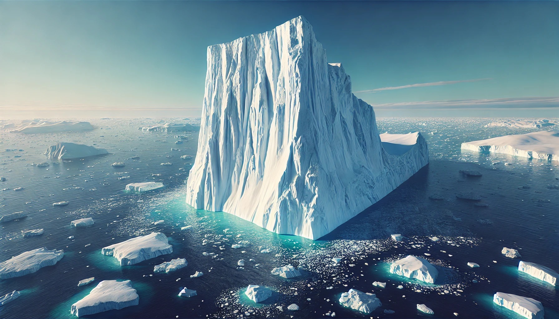
The frozen giants of the sea, icebergs are mesmerizing symbols of the power and beauty of nature. These vast floating ice masses, formed from calved glaciers, drift through the oceans, carrying with them stories of ancient climates, geological shifts, and awe-inspiring resilience. While the visible portion of an iceberg is impressive enough, up to 90% of their mass lies hidden beneath the surface, making them both a marvel and a mystery. Here’s a look at the top 10 largest icebergs in the world, ranked by size and steeped in fascinating history and facts.
#1: Iceberg B-15 – 656 Feet Tall
Iceberg B-15, the largest iceberg ever recorded, calved from the Ross Ice Shelf in Antarctica in March 2000. Initially measuring an astounding 4,250 square miles, B-15 was larger than the state of Connecticut. Its height reached an impressive 656 feet above the waterline, and its subsurface mass extended far deeper. For years, B-15 wandered the Southern Ocean, gradually breaking into smaller fragments that spread across the globe.
The journey of B-15 became an international fascination, with researchers tracking its movements and studying its impact on marine ecosystems. One fragment drifted into the waters near New Zealand, disrupting shipping lanes and endangering vessels. Anecdotal accounts tell of sailors gazing at the towering, glittering walls of ice with a mix of awe and trepidation. Today, remnants of B-15 continue to float, a confirmation to its colossal origin.

#2: Iceberg A-76 – 656 Feet Tall
Iceberg A-76 broke away from the Ronne Ice Shelf in Antarctica in May 2021, covering an area of 1,667 square miles. Slightly smaller than B-15, A-76 remains the largest iceberg currently in existence. Its massive, flat-topped surface and steep walls make it a textbook tabular iceberg, a structure resembling an icy plateau adrift in the ocean.
The sheer size of A-76 prompted immediate interest from scientists and satellite observers. Its movement through the Weddell Sea sparked concerns about its potential to impact shipping and marine habitats. Anecdotes from researchers describe the surreal experience of flying over A-76, marveling at its perfectly geometric edges stretching endlessly into the horizon.

#3: Iceberg B-17B – 492 Feet Tall
Iceberg B-17B was a fragment of another giant iceberg, originally calved from Antarctica’s Ross Ice Shelf in the late 1990s. B-17B gained notoriety when it drifted perilously close to Australia in 2009, sparking widespread media coverage and drawing attention to the far-reaching effects of Antarctic icebergs.
At its peak, B-17B covered an area of 545 square miles, and its towering height of 492 feet made it a formidable sight. Local anecdotes recall tourists and fishermen marveling at the iceberg’s unexpected arrival in Australian waters, where such phenomena are rare. Scientists used its journey to study ocean currents and climate patterns, adding to its legacy.
#4: Iceberg A-68A – 656 Feet Tall
Iceberg A-68A calved from Antarctica’s Larsen C Ice Shelf in July 2017, measuring 2,240 square miles at the time of its breakaway. A-68A’s journey became one of the most closely monitored events in iceberg history, as it drifted northward, eventually threatening the sub-Antarctic island of South Georgia.
Anecdotal stories highlight the dramatic concern for South Georgia’s wildlife, particularly its vast penguin and seal populations, which could have been starved of food if A-68A blocked their access to the ocean. Ultimately, the iceberg disintegrated before causing major harm, but its massive size and journey left an indelible mark on the scientific community.
#5: Iceberg C-19 – 492 Feet Tall
Iceberg C-19 calved from the Ross Ice Shelf in May 2002, covering approximately 2,154 square miles. While its size was impressive, its relatively slow and steady drift across the Southern Ocean earned it the nickname “the gentle giant” among researchers.
The iceberg’s history is marked by its influence on ocean circulation and ecosystems. Stories from researchers who observed C-19 up close describe a tranquil yet humbling experience, standing in the shadow of a towering wall of ancient ice that seemed almost otherworldly.
#6: Iceberg B-9 – 492 Feet Tall
Iceberg B-9 broke away from the Ross Ice Shelf in 1987, covering an area of over 1,385 square miles. Despite its age, remnants of B-9 continued to influence Antarctic waters for decades, making it one of the longest-lasting icebergs on record.
Anecdotal accounts from researchers aboard icebreaker ships describe the eerie silence and ethereal glow of B-9’s icy walls under the midnight sun. Its longevity provided invaluable insights into the behavior of large icebergs and their interactions with ocean currents.
#7: Iceberg A-38 – 492 Feet Tall
Calving from the Ronne Ice Shelf in 1998, Iceberg A-38 covered an area of over 2,200 square miles. The iceberg eventually split into two massive pieces, A-38A and A-38B, both of which remained enormous in their own right.
Anecdotes from nearby scientific expeditions recall how the iceberg’s towering presence was visible from miles away, a striking reminder of the power of nature. Its fragments influenced marine ecosystems and ocean circulation for years after their separation.
#8: Iceberg B-22 – 492 Feet Tall
Iceberg B-22 calved from the Thwaites Glacier in 2002, covering approximately 2,000 square miles. Nicknamed the “Doomsday Glacier,” Thwaites has been a focal point of climate research, and B-22’s breakaway underscored the glacier’s vulnerability.
Stories from research expeditions detail the challenges of studying B-22, with its remote location and harsh weather conditions. Despite these obstacles, the iceberg provided critical data on ice sheet dynamics and climate change.
#9: Iceberg C-38 – 492 Feet Tall
Iceberg C-38 calved from the Wilkins Ice Shelf in 2008, spanning over 1,000 square miles. Its calving was a significant event, marking the rapid disintegration of the Wilkins Ice Shelf due to warming temperatures.
Researchers recount how observing C-38’s journey was both awe-inspiring and sobering, as it highlighted the tangible effects of climate change. Its movement through Antarctic waters was meticulously documented, offering valuable insights for future studies.
#10: Iceberg A-43 – 492 Feet Tall
Iceberg A-43 calved from the Ronne Ice Shelf in 2000, covering an area of 1,500 square miles. Its tabular structure and immense size made it a striking feature of the Southern Ocean for years.
Anecdotal stories from sailors who encountered A-43 describe the surreal experience of navigating near its towering ice cliffs. Its journey added to the understanding of iceberg behavior and the dynamics of polar ice shelves.
The largest icebergs in the world are not just frozen behemoths drifting through the ocean; they are dynamic, ever-changing entities that hold the key to understanding our planet’s past, present, and future. Each iceberg on this list tells a unique story of natural wonder, human curiosity, and the delicate balance of Earth’s ecosystems. From the massive B-15 to the ethereal A-43, these icy giants remind us of the enduring power and beauty of nature.
More Great Top 10’s
Icebergs and Maps
Learn more about Maps
- Topographical Maps: Representation of the physical features of a region or area.
- Contour Maps: Representation of the contours of the land surface or ocean floor.
- Raised Relief Maps: Representation of land elevations with raised features indicating landforms.
- Terrain Maps: Representation of the physical features of a terrain or landmass.
- USGS Topographic Maps: Representation of topographic features and land elevations based on USGS data.
- USGS Historical Topographic Maps: Representation of historical topographic maps created by the USGS.
- Watershed Maps: Representation of the areas where water flows into a particular river or lake.
- Elevation Maps: Representation of land and water elevations with high precision.
- Physical Maps: Representation of physical features of the Earth’s surface such as landforms, oceans, and plateaus.
- Bathymetric Maps: Representation of the topography and features of the ocean floor.
- NOAA Maps: Representation of atmospheric, oceanographic, and environmental data by NOAA.
- Nautical Maps: Representation of the underwater features and depth of an area for navigation purposes.
- Geologic Maps: Representation of the geologic features of an area such as rock types, faults, and folds.
- Satellite Maps: Representation of earth from high-definition satellite imagery.
Contact us today to learn more about our services and how we can help you achieve your goals.


