Top 10 Largest Mountains in the World
Top 10 Largest Mountains in the World
WhiteClouds builds 3D Raised Relief Maps
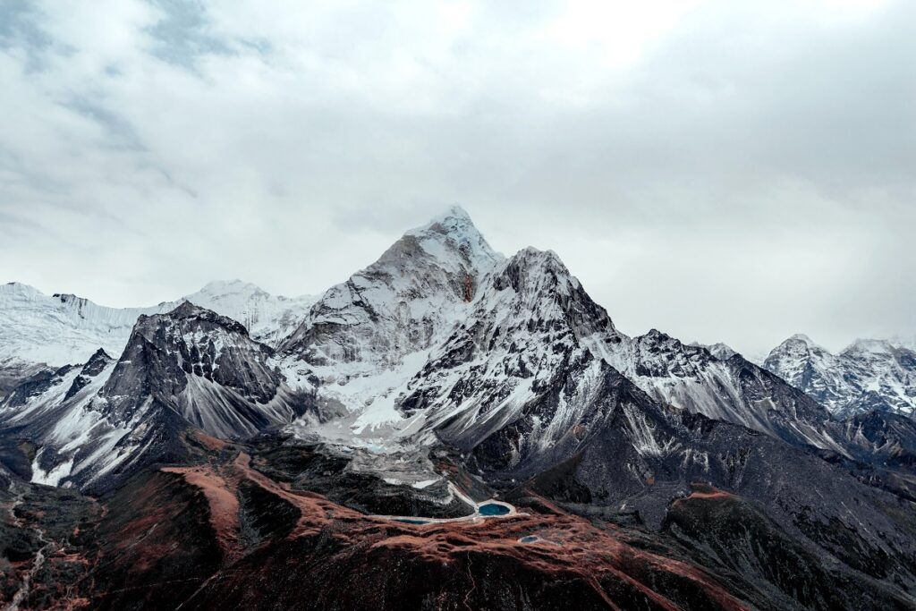
Mountains are the planet’s most magnificent natural monuments, shaped over millions of years by tectonic forces, erosion, and glacial activity. These towering peaks represent the ultimate frontier for climbers, explorers, and scientists, offering breathtaking landscapes and fascinating geological insights. The highest mountains in the world, primarily concentrated in the Himalayas, are not only geological wonders but also cultural and spiritual icons. In this list, we dive into the top 10 largest mountains in the world, exploring their incredible heights, awe-inspiring beauty, and the human stories that surround them.
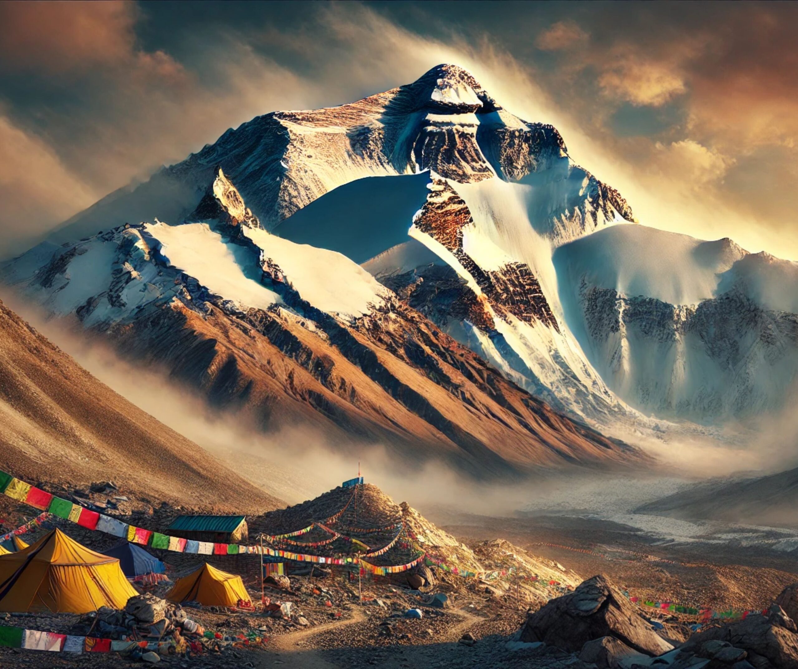
#1: Mount Everest – 29,032 feet
Mount Everest, towering at 29,032 feet, is the highest mountain on Earth and one of the most iconic landmarks of human achievement. Located on the border of Nepal and Tibet in the Himalayas, Everest is called Sagarmatha in Nepal and Chomolungma in Tibet, reflecting its significance in local cultures. The mountain was first successfully climbed in 1953 by Sir Edmund Hillary of New Zealand and Tenzing Norgay, a Sherpa guide. Since then, Everest has attracted climbers from around the globe, some seeking fame and others testing their physical and mental limits.
Everest is notorious for its extreme weather conditions, including hurricane-force winds and sub-zero temperatures. The thin atmosphere above 26,000 feet is known as the “death zone,” where oxygen levels are insufficient to sustain human life for prolonged periods. Tales of survival and tragedy are abundant, such as the 1996 disaster when eight climbers lost their lives in a single storm. Despite its dangers, Everest is a beacon for adventurers, its allure rooted in the unparalleled views from its summit and the sheer challenge of standing on top of the world.

#2: K2 – 28,251 feet
K2, also known as Mount Godwin-Austen, is the second-highest peak on Earth, reaching 28,251 feet in the Karakoram Range along the Pakistan-China border. Dubbed the “Savage Mountain,” it is widely regarded as one of the most difficult and dangerous climbs in the world. K2’s steep, icy slopes and unpredictable weather patterns have earned it a reputation for claiming lives, with one of the highest fatality rates among the 8,000-meter peaks.
First climbed in 1954 by an Italian expedition led by Achille Compagnoni and Lino Lacedelli, K2 has become a symbol of mountaineering prowess. The mountain’s legendary “bottleneck,” a perilous section just below the summit with overhanging ice seracs, has been the site of numerous tragedies. Despite its challenges, K2 continues to inspire climbers with its pristine beauty and the unrelenting test it poses to even the most experienced adventurers.
#3: Kangchenjunga – 28,169 feet
Kangchenjunga, standing at 28,169 feet, is the third-highest mountain in the world. Straddling the border between Nepal and India, this mountain holds deep spiritual significance and is revered as the “Five Treasures of Snow,” symbolizing prosperity in local traditions. First summited in 1955 by Joe Brown and George Band of a British expedition, climbers have long respected local customs by stopping short of the summit as a gesture of reverence.
Kangchenjunga’s remoteness and the difficulty of its terrain make it less frequented than Everest, adding to its mystique. The mountain’s snowfields, glaciers, and rugged cliffs create a landscape of unparalleled beauty, and its ecosystems support rare species such as the red panda and the snow leopard.
#4: Lhotse – 27,940 feet
Lhotse, the fourth-highest mountain in the world, stands at 27,940 feet and is located just south of Mount Everest. Sharing much of its climbing route with Everest, Lhotse offers similar challenges, including the notorious Khumbu Icefall. Its name, which means “South Peak” in Tibetan, reflects its proximity to Everest.
First climbed in 1956 by a Swiss expedition, Lhotse’s South Face is one of the most dramatic and technically demanding climbs in the Himalayas. Climbers who tackle Lhotse are rewarded with spectacular views and a sense of solitude often missing on the more crowded Everest.
#5: Makalu – 27,838 feet
Makalu, at 27,838 feet, is known for its striking pyramid shape and steep ridges. Located southeast of Everest, this fifth-highest mountain was first summited in 1955 by a French expedition. The climb requires exceptional technical skills, as its knife-edged ridges and icy walls offer little margin for error.
Makalu’s name derives from the Sanskrit word for “Great Black,” reflecting its dark granite faces. Despite its difficulties, Makalu remains a favorite for experienced climbers seeking an unspoiled and challenging ascent.
#6: Cho Oyu – 26,864 feet
Cho Oyu, meaning “Turquoise Goddess” in Tibetan, rises to 26,864 feet near the Nepal-Tibet border. It is often considered the easiest 8,000-meter peak to climb due to its relatively straightforward routes and fewer technical challenges. First summited in 1954 by an Austrian expedition, Cho Oyu has since become a popular destination for mountaineers preparing for Everest.
The mountain’s accessibility does not diminish its grandeur. With stunning glaciers, rolling snowfields, and panoramic views of the Himalayas, Cho Oyu offers a breathtaking introduction to high-altitude climbing.
#7: Dhaulagiri – 26,795 feet
Dhaulagiri, whose name means “White Mountain,” rises to 26,795 feet in western Nepal. Its sheer mass and dramatic profile make it a standout peak in the Himalayas. First climbed in 1960 by a Swiss-Austrian-Nepali team, Dhaulagiri is known for its treacherous icefalls and avalanche-prone slopes.
This mountain holds a special place in mountaineering history, as its discovery in the early 19th century reshaped perceptions of Himalayan geography. Today, it remains a challenging and awe-inspiring destination.
#8: Manaslu – 26,781 feet
Manaslu, meaning “Mountain of the Spirit,” rises to 26,781 feet in central Nepal. First summited in 1956 by a Japanese team, it is surrounded by pristine landscapes and traditional Tibetan villages. Manaslu’s remote location and crevasse-laden glaciers make it a formidable climb, but those who reach its summit are rewarded with unparalleled views of the Himalayas.
#9: Nanga Parbat – 26,660 feet
Nanga Parbat, the “Killer Mountain,” stands at 26,660 feet in Pakistan’s Gilgit-Baltistan region. Its towering Rupal Face is the tallest mountain face in the world, drawing climbers who crave extreme challenges. First summited in 1953 by Hermann Buhl, Nanga Parbat is both a test of skill and a symbol of the untamed beauty of the Karakoram Range.
#10: Annapurna I – 26,545 feet
Annapurna I, at 26,545 feet, is the tenth-highest mountain in the world but one of the most dangerous to climb. First summited in 1950 by Maurice Herzog and Louis Lachenal, its fatality rate is among the highest of any major peak. Despite its risks, Annapurna’s spiritual significance and breathtaking beauty continue to draw climbers and adventurers alike.
The tallest mountains in the world are more than geological marvels; they are the pinnacle of human exploration, resilience, and reverence for nature. These giants inspire us to push boundaries, preserve their ecosystems, and celebrate the timeless allure of the high places on Earth. Each peak tells a story of triumph, hardship, and the enduring connection between humanity and the natural world.
More Great Top 10’s
Mountains and Maps
Mountains and maps are intertwined symbols of adventure, discovery, and the human quest to understand and conquer nature’s grandest creations. A mountain, with its towering presence, is a natural masterpiece that beckons explorers to ascend its heights, navigate its slopes, and uncover its secrets. Maps, on the other hand, serve as the guides to these enigmatic giants, translating their rugged terrain, hidden valleys, and snow-capped peaks into an intricate tapestry of contours and lines. Together, they represent the intersection of imagination and precision, art and science. A map of a mountain range is more than just a tool; it’s a storyteller, capturing the undulating ridges, plunging gorges, and meandering streams that make each mountain unique. It recounts the legacy of those who have charted these lands—pioneers who etched their paths into history and climbers who tested their limits against the raw power of the elements. Mountains inspire awe with their untamed beauty, and maps reveal the paths to explore them, from well-trodden trails to uncharted wilderness. They document not just geography but also humanity’s relationship with the land—where spiritual reverence meets scientific curiosity. Whether it’s a weathered map used on a daring expedition or a modern digital chart plotted for precision, each representation of a mountain tells a story of courage, discovery, and the enduring allure of Earth’s towering monuments. Maps remind us that while a mountain may stand silent and still, its terrain pulses with life and mystery, waiting to be understood, respected, and cherished.
Learn more about Maps
- Topographical Maps: Representation of the physical features of a region or area.
- Contour Maps: Representation of the contours of the land surface or ocean floor.
- Raised Relief Maps: Representation of land elevations with raised features indicating landforms.
- Terrain Maps: Representation of the physical features of a terrain or landmass.
- USGS Topographic Maps: Representation of topographic features and land elevations based on USGS data.
- USGS Historical Topographic Maps: Representation of historical topographic maps created by the USGS.
- Watershed Maps: Representation of the areas where water flows into a particular river or lake.
- Elevation Maps: Representation of land and water elevations with high precision.
- Physical Maps: Representation of physical features of the Earth’s surface such as landforms, oceans, and plateaus.
- Bathymetric Maps: Representation of the topography and features of the ocean floor.
- NOAA Maps: Representation of atmospheric, oceanographic, and environmental data by NOAA.
- Nautical Maps: Representation of the underwater features and depth of an area for navigation purposes.
- Geologic Maps: Representation of the geologic features of an area such as rock types, faults, and folds.
- Satellite Maps: Representation of earth from high-definition satellite imagery.
Contact us today to learn more about our services and how we can help you achieve your goals.

