Top 10 Longest Hills in the World
Top 10 Longest Hills in the World
WhiteClouds builds 3D Raised Relief Maps
Hills, often overshadowed by towering mountains, possess a quiet majesty of their own. Stretching for miles across continents, the longest hills in the world are geological marvels that tell stories of Earth’s ancient past. These landforms, with their rolling terrains and gentle gradients, hold unique beauty and significance, whether they serve as natural landmarks, cultural icons, or recreational hotspots. In this list, we explore the top 10 longest hills globally, diving into their vast sizes, intriguing histories, and the stories that have shaped their existence.
#1: The Chocolate Hills – 31 Miles
The Chocolate Hills in the Philippines stretch across the island of Bohol, covering an area of approximately 31 miles. This unique geological formation consists of over 1,200 conical hills that turn brown during the dry season, giving them their chocolate-like appearance. These hills are not only a tourist attraction but also a source of folklore. According to legend, they were formed by the tears of a giant mourning a lost love. Scientifically, they are believed to be ancient coral deposits shaped by erosion. Visitors can climb observation decks to marvel at the symmetrical beauty of the hills, particularly at sunrise or sunset.

#2: The Black Hills – 120 Miles
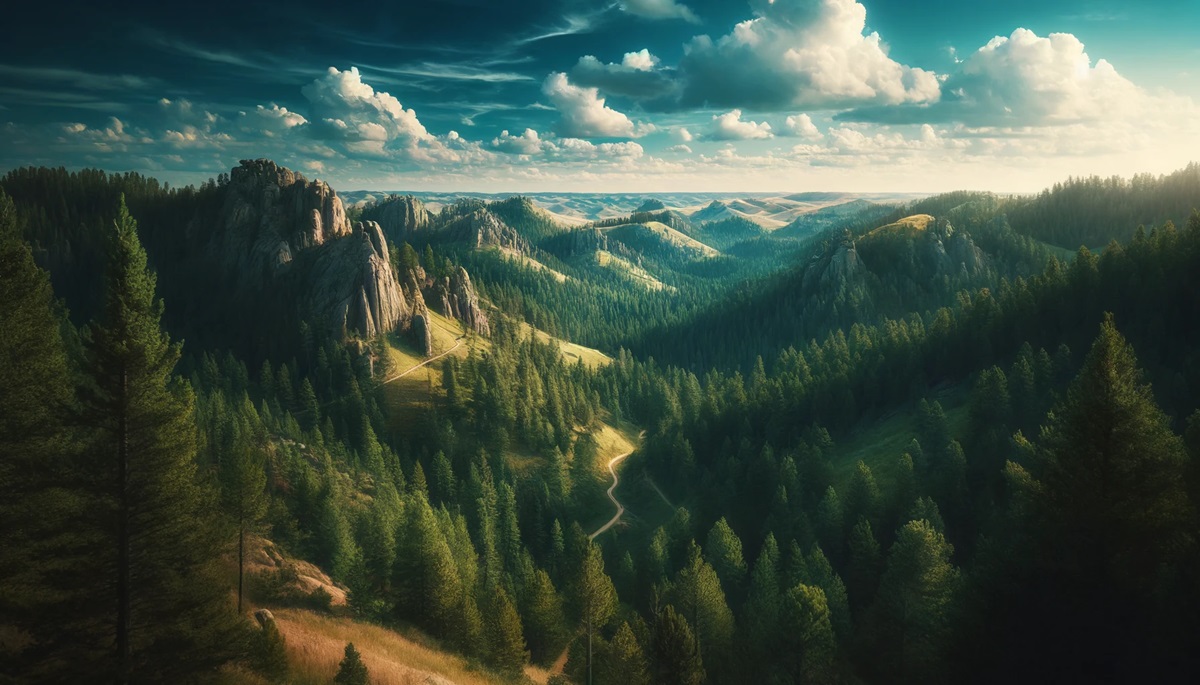
Located in South Dakota and Wyoming, the Black Hills span approximately 120 miles. Despite their name, these hills are lush and green, with pine trees creating a dark appearance from a distance. Rich in history, the Black Hills were sacred to the Lakota Sioux and later became a focal point of the Gold Rush. Today, they are home to Mount Rushmore and Crazy Horse Memorial, blending natural beauty with cultural significance. The hills are also a haven for outdoor enthusiasts, offering hiking, rock climbing, and wildlife spotting.
#3: The Mendip Hills – 18 Miles
The Mendip Hills in England, stretching about 18 miles, are a designated Area of Outstanding Natural Beauty. Known for their limestone ridges and ancient caves, these hills have been a hub of human activity since prehistoric times. Cheddar Gorge, a key feature of the Mendips, is where Britain’s oldest complete skeleton, Cheddar Man, was discovered. The hills are dotted with quaint villages, and their trails attract walkers and cyclists year-round. Anecdotes of smugglers using the caves add a layer of intrigue to these serene landscapes.
#4: The Pennines – 160 Miles
Often referred to as the “Backbone of England,” the Pennines stretch for 160 miles from Derbyshire to Northumberland. These rolling hills are characterized by moorlands, valleys, and striking escarpments. They have been the setting for numerous literary works, including the Brontë sisters’ novels. Historically, the Pennines were vital for coal mining and sheep grazing. Today, they are a paradise for hikers, with the Pennine Way offering one of the most iconic long-distance trails in the UK.
#5: The Blue Hills – 22 Miles
Located near Boston, Massachusetts, the Blue Hills Reservation spans 22 miles. These hills, named for their bluish appearance when viewed from a distance, are a natural retreat in a bustling urban area. Rich in history, the area was once inhabited by Native American tribes. Today, it features hiking trails, skiing in the winter, and the historic Blue Hill Meteorological Observatory. Anecdotes of early colonial settlers navigating these hills give them a touch of historical charm.
#6: The Malvern Hills – 13 Miles
The Malvern Hills, running for 13 miles through Worcestershire and Herefordshire in England, are famous for their panoramic views and spring water. These hills have inspired poets like W.H. Auden and Edward Elgar, whose music evokes the serene beauty of the area. The springs, believed to have healing properties, were central to the Victorian spa culture. Visitors can explore trails that meander through ancient woodlands and hilltops, offering a peaceful escape.
#7: The Sierra Madre Hills – 620 Miles
The Sierra Madre Hills in Mexico stretch an impressive 620 miles, forming the longest hill range in the Americas. These hills are rich in biodiversity, home to numerous endemic species. The region’s indigenous communities have lived in harmony with this landscape for centuries, relying on its resources for sustenance and cultural practices. The hills are also significant for their archaeological sites, with ancient pyramids nestled within their expanse.
#8: The Ozark Hills – 47,000 Square Miles
The Ozark Hills cover parts of Missouri, Arkansas, and Oklahoma, encompassing over 47,000 square miles. These ancient landforms are geologically distinct, featuring karst topography with caves, sinkholes, and springs. The Ozarks are steeped in folklore, with tales of moonshiners and hidden treasures. Today, the region is known for its vibrant arts scene, outdoor recreation, and charming small towns like Eureka Springs.
#9: The Appalachian Hills – 1,500 Miles
The Appalachian Hills, stretching 1,500 miles from Alabama to Canada, are among the oldest landforms in North America. These hills are rich in history, playing a significant role in the culture and folklore of the Appalachian region. The hills are home to the famous Appalachian Trail, drawing hikers from around the world. Stories of early settlers, moonshiners, and folk music add a layer of cultural depth to these rolling landscapes.
#10: The Cairngorms – 22 Miles
The Cairngorms in Scotland cover about 22 miles and are part of the largest national park in the UK. Known for their rugged beauty, these hills are a hub for outdoor activities, including skiing, climbing, and wildlife watching. The area’s history is tied to the Highland clans and their battles for survival. The Cairngorms’ unique climate and ecosystems make them a fascinating destination for nature lovers.
The world’s longest hills are more than just stretches of land; they are stories carved into the Earth, each with its own blend of natural beauty, cultural significance, and historical intrigue. From the mystical Chocolate Hills of the Philippines to the sprawling Appalachians of North America, these landforms remind us of the diverse and awe-inspiring landscapes our planet has to offer. Whether inspiring legends, offering adventure, or simply standing as silent witnesses to time, these hills hold a special place in the hearts of those who explore them.
More Great Top 10’s
Hills and Maps
Learn more about Maps
- Topographical Maps: Representation of the physical features of a region or area.
- Contour Maps: Representation of the contours of the land surface or ocean floor.
- Raised Relief Maps: Representation of land elevations with raised features indicating landforms.
- Terrain Maps: Representation of the physical features of a terrain or landmass.
- USGS Topographic Maps: Representation of topographic features and land elevations based on USGS data.
- USGS Historical Topographic Maps: Representation of historical topographic maps created by the USGS.
- Watershed Maps: Representation of the areas where water flows into a particular river or lake.
- Elevation Maps: Representation of land and water elevations with high precision.
- Physical Maps: Representation of physical features of the Earth’s surface such as landforms, oceans, and plateaus.
- Bathymetric Maps: Representation of the topography and features of the ocean floor.
- NOAA Maps: Representation of atmospheric, oceanographic, and environmental data by NOAA.
- Nautical Maps: Representation of the underwater features and depth of an area for navigation purposes.
- Geologic Maps: Representation of the geologic features of an area such as rock types, faults, and folds.
- Satellite Maps: Representation of earth from high-definition satellite imagery.
Contact us today to learn more about our services and how we can help you achieve your goals.


