Top 10 Rivers in Europe
Top 10 Rivers in Europe
WhiteClouds builds 3D Raised Relief Maps
Europe is home to some of the most iconic and historically significant rivers in the world. These waterways have shaped the continent’s history, culture, and geography for millennia. From the longest rivers that traverse multiple countries to those steeped in local folklore, European rivers are lifelines for trade, transportation, and biodiversity. In this list, we explore the top 10 rivers in Europe, highlighting their size, fascinating characteristics, and the stories they carry. These rivers, ranked by length, are not just waterways but integral threads in the fabric of European life.
#1: Volga River – 2,194 Miles
The Volga River is the longest river in Europe, flowing 2,194 miles across western Russia before emptying into the Caspian Sea. Often referred to as “Mother Volga,” it holds deep cultural and historical significance for the Russian people. The river has served as a vital transportation route since ancient times, enabling trade and communication between disparate regions. The Volga Basin supports a rich array of wildlife, including sturgeons that produce the famed Russian caviar. Along its banks are some of Russia’s most prominent cities, including Volgograd and Kazan, each bearing historical landmarks and vibrant local traditions. During World War II, the Battle of Stalingrad took place near the river, marking one of the most pivotal moments in modern history. Today, the Volga remains a vital economic and cultural artery for Russia, embodying both the challenges and triumphs of the region it sustains.

#2: Danube River – 1,770 Miles
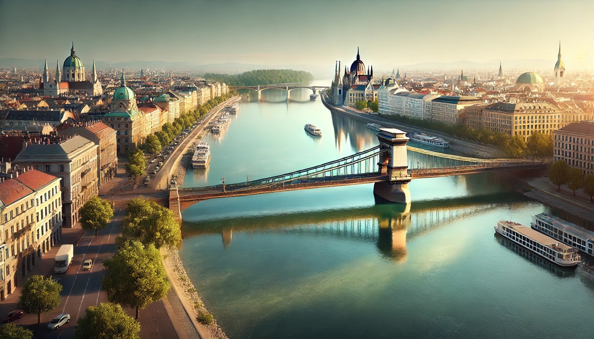
Stretching 1,770 miles, the Danube River flows through ten countries, more than any other river in the world, earning it the nickname “The River of Europe.” Its journey begins in Germany’s Black Forest and ends in the Black Sea, passing through major cities like Vienna, Budapest, and Belgrade. The Danube has inspired countless works of art, including Johann Strauss’s famous waltz, “The Blue Danube.” Its historical significance dates back to the Roman Empire, when it marked a northern boundary. The river’s basin is a UNESCO-protected biosphere reserve, home to diverse flora and fauna. The Iron Gates, a spectacular gorge on the Serbia-Romania border, is one of the river’s most striking features. Today, the Danube is a hub for river cruises, offering breathtaking views and a glimpse into the cultures of Central and Eastern Europe.
#3: Ural River – 1,509 Miles
The Ural River, spanning 1,509 miles, forms a natural boundary between Europe and Asia. Originating in Russia’s Ural Mountains, it flows southward into Kazakhstan before reaching the Caspian Sea. The river is an essential water source for both nations and a hotspot for biodiversity, including rare fish species like beluga sturgeon. Historically, the Ural was a critical trade route, connecting the vast steppe regions with the more developed western territories. Its name is derived from a Tatar word meaning “belt,” symbolizing its role in uniting diverse regions. The Ural’s serene landscapes have inspired poets and artists, while its waters sustain both agricultural and industrial activities in the region.
#4: Dnieper River – 1,423 Miles
The Dnieper River flows for 1,423 miles through Russia, Belarus, and Ukraine, eventually emptying into the Black Sea. It has been a critical lifeline for Eastern Europe since ancient times, with the Greeks and Vikings using it for trade and exploration. The river’s banks are dotted with historical landmarks, including Kyiv, one of Europe’s oldest cities. The Dnieper also played a vital role in the Cossack uprisings and the cultural identity of Ukraine. In modern times, it has become a hub for hydroelectric power, with massive dams harnessing its flow for energy. Despite industrialization, the river’s tranquil beauty and rich history continue to captivate those who visit.
#5: Don River – 1,162 Miles
The Don River, at 1,162 miles long, flows through southwestern Russia into the Sea of Azov. It has been a vital waterway since antiquity, serving as a conduit for trade between the Black Sea and interior Russia. The river’s delta is a biodiverse haven, supporting a range of bird and fish species. The Don is closely tied to the Cossack culture, with songs and legends celebrating its role in their history. During World War II, the river was the site of key battles, including the struggle for Stalingrad. Today, the Don remains a symbol of resilience and a lifeline for agriculture and industry.
#6: Pechora River – 1,124 Miles
Flowing 1,124 miles through northern Russia, the Pechora River is one of the least industrialized major rivers in Europe, preserving its pristine natural beauty. It originates in the Ural Mountains and empties into the Barents Sea. The Pechora’s basin is rich in biodiversity and resources, including vast forests and oil reserves. Its remote location has shielded it from heavy development, making it a haven for wildlife and a paradise for eco-tourism.
#7: Kama River – 1,122 Miles
A tributary of the Volga, the Kama River runs for 1,122 miles through Russia, offering a picturesque journey through forests, plains, and towns. It has been a crucial transportation route since ancient times, facilitating trade and communication across the region. The Kama is a cultural icon, inspiring local folklore and literature. Its waters also support agriculture, hydroelectric power, and fishing, making it an essential resource for the communities along its banks.
#8: Loire River – 629 Miles
France’s Loire River is the longest in the country, flowing 629 miles from the Massif Central to the Atlantic Ocean. Known as the “Garden of France,” the Loire Valley is a UNESCO World Heritage Site, famed for its stunning châteaux, vineyards, and historical towns. The river has been central to French history, serving as a strategic boundary and a source of inspiration for artists and writers. Its meandering course offers a scenic journey through one of Europe’s most charming regions.
#9: Rhine River – 764 Miles
The Rhine River flows 764 miles through six countries, starting in Switzerland and ending in the Netherlands. It has been a symbol of European unity and conflict, with its waters carrying centuries of history. The Rhine is lined with medieval castles, picturesque villages, and lush vineyards, making it one of the continent’s most romantic rivers. It is also a vital trade route, connecting major industrial regions to global markets.
#10: Elbe River – 678 Miles
The Elbe River, stretching 678 miles, flows from the Czech Republic to Germany, eventually reaching the North Sea. It has been a lifeline for the regions it traverses, supporting trade, agriculture, and transportation. The Elbe played a significant role in European history, from medieval times to the Cold War, when it served as a boundary between East and West Germany. Its scenic beauty and historical landmarks make it a favorite among travelers and historians alike.
Europe’s rivers are more than just natural waterways; they are lifelines of history, culture, and biodiversity. From the majestic Volga to the charming Loire, each river has shaped the regions it touches, inspiring art, facilitating trade, and sustaining life. Exploring these rivers offers a window into Europe’s past and present, revealing the profound connection between water and civilization. These top ten rivers are a confirmation to the enduring power and beauty of nature in shaping human history.


